Tucker Trail
(scroll to bottom for photo gallery)
Location:
Tucker Trail and Tucker Cutoff Trail are located near Greebrae, Kentfield, and Ross, CA, and cover an area in the Marin/Mt. Tamalpais Watershed south of Phoenix Lake and east of Lake Lagunitas.
Starting Point:
Tucker Trail does not constitute a simple loop trail on its own. Its offshoot, the Tucker Cutoff Trail starts from a very short road called Phoenix Road extending from Crown Road (the northern Crown Road trailhead on the map, rather than the southern Crown Road trailhead). The north end of Tucker Trail connects with the Harry Allen Trail which runs between the Bill Williams Fire Road and Crown Road. The other end of Tucker Trail connects with Eldridge Grade, east of Lake Lagunitas.
!!!Note: Phoenix Road shows up on Google Maps, but is only marked as Crown Road on the detailed Watershed map (scroll down for “The Lakes Area” enlarged map of this section, link below), the Pease Press Ramblers’ Guide Trails of Mt. Tamalpais map, and on the Tom Harrison Mt. Tam paper map.
Tucker Cutoff Trail is marked and labeled on the Watershed map, is marked as a trail without a name on the Pease Press Ramblers’ Guide Trails of Mt. Tamalpais map, and the Tom Harrison Mt. Tam paper map, and is marked by name without the trail showing on Google Maps.
Sometimes you need more than one map to get a clear picture of trails and junctions.
Info links:
For all web links, if a link doesn’t jump directly, copy and paste into browser.
Mt. Tam Watershed information (Marin Water):
https://www.marinwater.org/mt-tam-watershed
Mt. Tam project and road status info (CA State Parks):
https://www.parks.ca.gov/?page_id=471
Mt. Tam Watershed map (Marin Water):
https://www.marinwater.org/sites/default/files/2020-09/Watershed%20Visitor%20Map.pdf
Under Google Maps, key names to input include: Eldridge Grade, Indian Fire Road, Windy Ridge, Tucker (Cutoff) Trail (towns in this area include Ross, Greenbrae, Kentfield)
Distance:
There are many trail combinations hikers can choose from to include Tucker Trail. Best to have good maps!
Crown/Phoenix Road Tucker Cutoff Trail to Tucker Trail junction 0.3 miles, Tucker Trail from Bill Williams Trail junction to Eldridge Grade 1 mile (Tucker Trail south, NOT north toward Phoenix Lake), Tucker Trail from Bill Williams Trail junction to Harry Allen Trail junction (leading back to Phoenix Lake), 0.7 miles. So the main Tucker Trail end to end is 1.7 miles, with a little side addition of the Tucker Cutoff Trail extending 0.3 miles. This is not a loop trail. See maps and refer to related Hiking Autism posts to formulate a hike starting at the trailhead of your choice (see Bill Williams – Tucker Trail Waterfall Hike and Eldridge Grade – Windy Ridge Hike Notes).
Considerations:
• Bring a map or multiple maps. These trails get a little fuzzy in a couple of places. The maps don’t always match exactly, either. There are multiple map options for navigating Mt. Tam and the Marin Watershed.
• There is limited roadside parking near the Phoenix Road trailhead. Maps make it appear as if the drivable road ends on Crown Road, but it is possible to drive to the trailhead on Phoenix Road. Roadside parking on Crown and a short walk along Phoenix Road to the trailhead is the option we took.
• There were no toilet facilities/port-a-potties at this trailhead at the time of our visit.
• Pay attention to trail signs regarding plant and animal life, including any cautions regarding mountain lion sightings.
• Always watch for poison oak. A poison oak scrub like Technu is handy to have along.
• Opening/closing of trails and facilities subject to change due to health and safety status.
The trail:
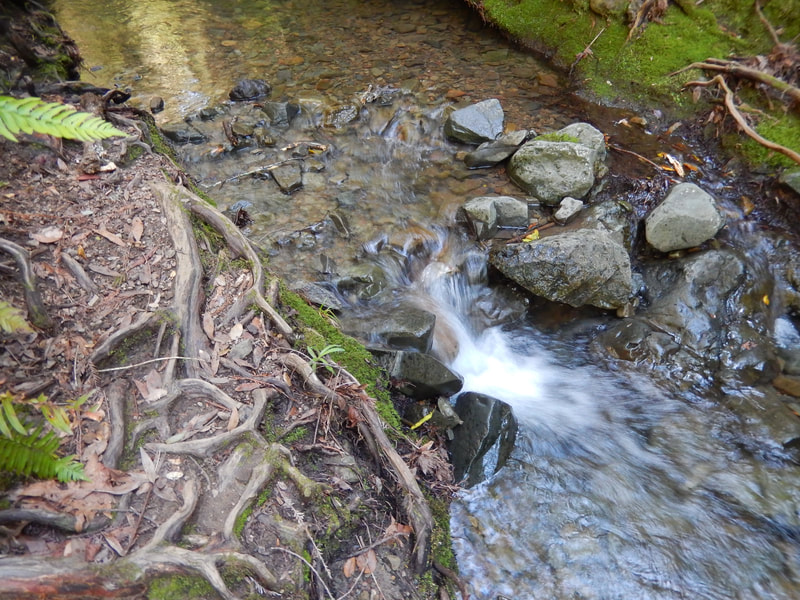
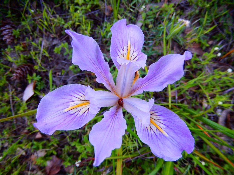
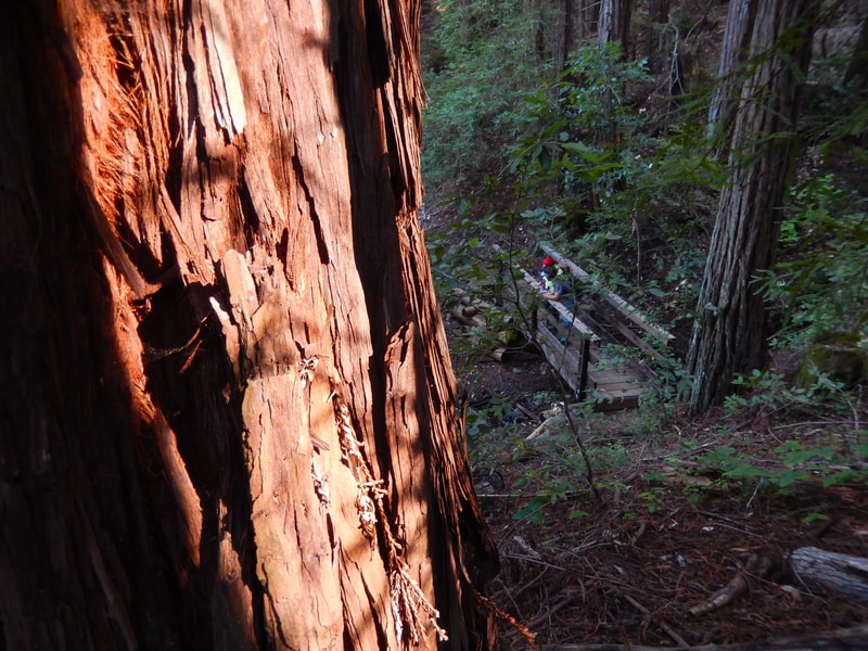
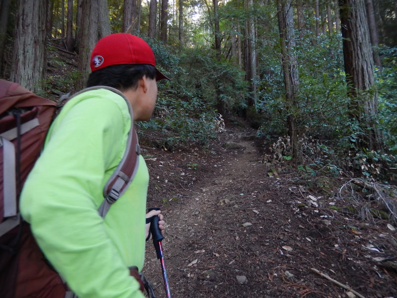
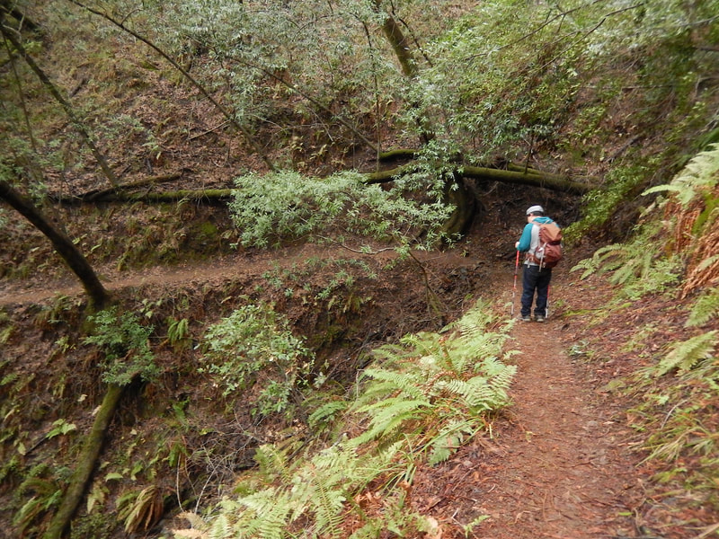
As noted in the Eldridge Grade – Windy Ridge Hike Notes, Tucker Trail features many of my favorite things about Mt. Tam hikes all in one: narrow paths above steep ravines, waterfalls, wooden footbridges, mossy fern trails, redwoods, and lovely wild irises in various colors.
The Tucker Trail and its short offshoot, the Tucker Cutoff Trail, do not constitute a loop trail. They are lovely in their own right, though, so the description here is to encourage hikers to try these stretches of trail in some combination of their own choice, two examples of which are described in the Bill Williams – Tucker Trail Waterfall Hike and Eldridge Grade – Windy Ridge Hike Notes.
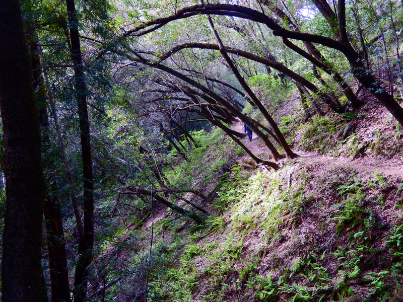
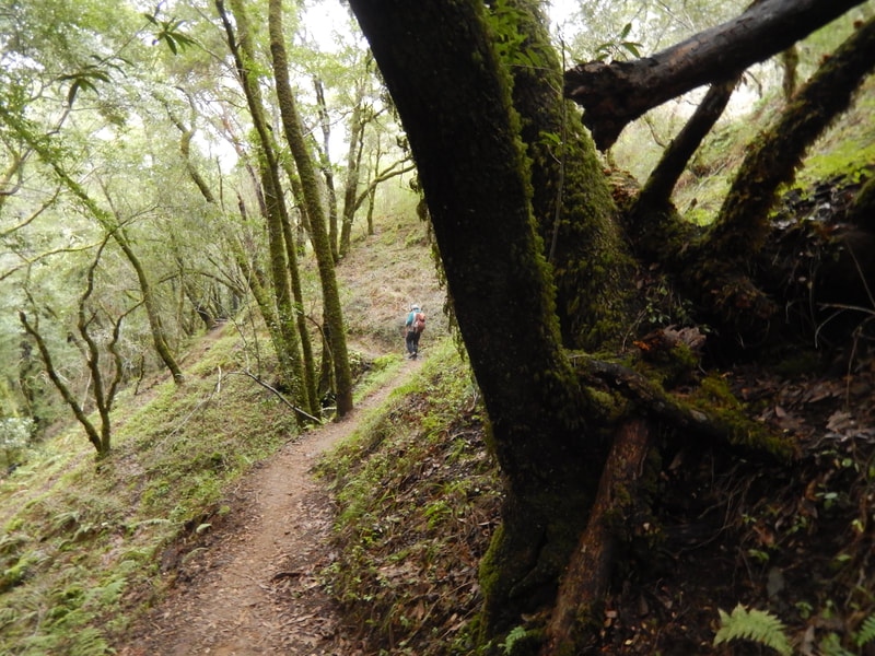
The Tucker Cutoff Trail is a brief 0.3 mile stretch from a hard to find trailhead (see “Starting Point” and “Considerations” above), but this short distance includes narrow grassy paths, sharply leaning trees over woodsy hillside paths, redwoods, and wild irises.
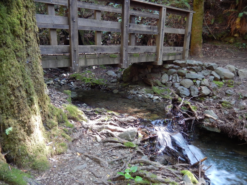
The Tucker Cutoff Trail joins with the Tucker Trail proper near another important junction with the Bill Williams Trail. This is one of my all time favorite areas on Mt. Tam. Just down a stunning set of stairs from the Tucker Trail is the creekbed with a wooden bridge where the Bill Williams Trail makes its U turn from southward to northward, the rising stairs leading to the Tucker Trail and back toward Phoenix Lake if going that direction. Spend some time by the creek and bridge at the bottom of these stairs. It really is a stunning, wonderful place.
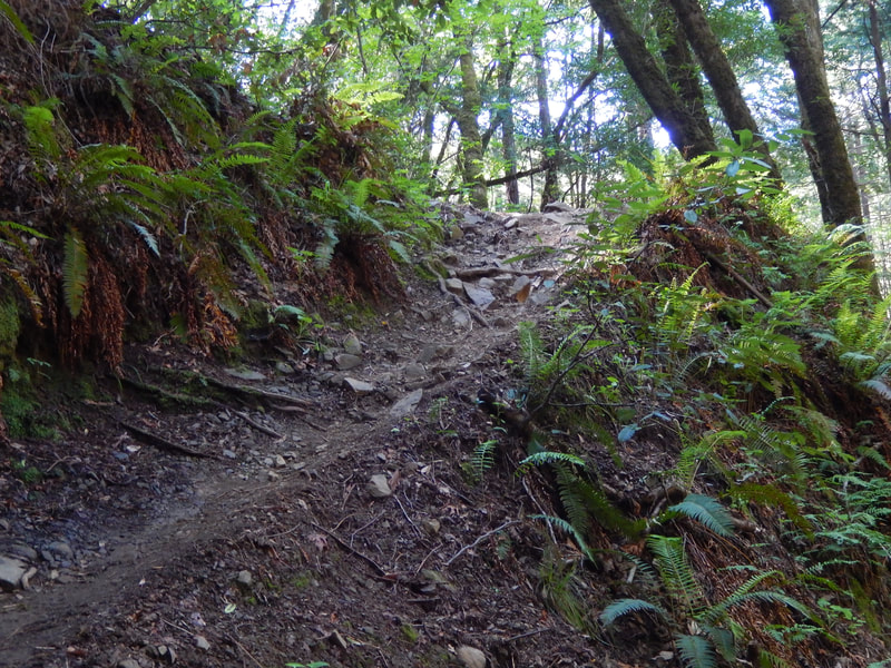
For those who have wandered to the bottom of the stairs to the Bill Williams Trail junction, there is about another mile of Tucker Trail to enjoy heading generally west toward Eldridge Grade. This stretch includes wonderful narrow woodsy stretches of trail, some of which have a fairly steep incline, more creeks and waterfalls, more wooden bridges, more redwoods. There are many visual treasures along this one mile stretch, which eventually ascends to connect with the wider Eldridge Grade, opening more choices of hiking directions. (Your choice, see map link above!)
The other direction from the Tucker Cutoff Trail to Tucker Trail junction is north, paralleling the Bill Williams Trail and Bill Williams Creek. This section of Tucker Trail has hikers walking a narrow trail high above the ravine, at the bottom of which the Bill Williams Creek and Trail are in view. Tucker Trail has a wonderful sharp turn that always looks like it will make a great photo, none of which ever do it justice. The narrow path with tunnels of leaning trees above a high ridge is the hallmark feature of this stretch of trail, which eventually connects with the Harry Allen Trail that leads back toward Phoenix Lake after connecting with a fire road heading west, or leads back to Crown road heading east.
I have loved the Tucker Trail as segments of a number of favorite hikes, and wanted to share it with readers. Enjoy choosing how to include it by checking out a good Mt. Tam map.
(Tucker Trail Hike Notes were originally paired with the “Quiet Treasures” Insights post.)
Click Insights/Hike Update News for inspiring reflections. Browse hikes on the main Hikes page or on the Hike Search by Area page. Check out Click Insights/Hike Update News for inspiring reflections. Browse hikes on the main Hikes page or on the Hike Search by Area page. Check out selected articles and interviews under Media. Click World Walks to see or share favorite family-friendly walks! Stay in touch with Lisa Louis and HikingAutism via Contact. See products with inspiring designs that support the efforts of HikingAutism under Support/Shop. The Links page lists a loose collection of helpful information links.
Check the Home page for the broader background story. If you’re not able to take one of these Northern California hikes, hopefully you can enjoy the photo galleries at the bottom of each hike page! Feel free to share and follow on Facebook at HikingAutism, follow on Twitter at @HikingAutism and Instagram at lisalouis777
