Bay Bridge Walk
(scroll to bottom for photo gallery)
Location:East span of the Bay Bridge, Bay Bridge Trail Parking Lot to Yerba Buena Island Vista Point
Starting Point: Bay Bridge Trail Parking Lot, 345 Burma Rd., Oakland, CA 94607
Info links:
For all web links, if a link doesn’t jump directly, copy and paste into browser.
Bay Bridge info link:
http://baybridgeinfo.org
Bay Bridge Bicycle and Pedestrian Path info link:
http://baybridgeinfo.org/path
Maps & Trails, Bay Bridge Trail, access/transportation options link:
https://511.org/biking/maps/baybridge
Bay Bridge Bicycle/Pedestrian Path and Yerba Buena Island Vista Point info link:
https://sftreasureisland.org/bicycle
Distance:
The path, one way, from the Bay Bridge Trail parking lot at the east end of the bridge to the Vista Point rest stop is listed as 2.2 miles.
Considerations:
• Parking is available on Burma Road for easy access to the Bay Bridge pedestrian trail. See links above for instructions.
• Bicycle and public transportation access are also noted in info links above.
• The historic Bridge Yard Building by the parking lot is worth taking a peek at.
• Pay attention to wind advisories and warnings.
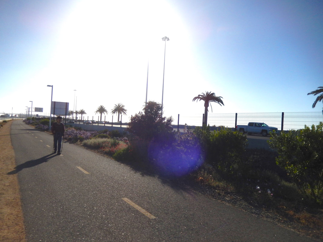
• Bring a hat or sunglasses. The light is extra intense on the bridge.
• Bathroom facilities are listed as being available both near the parking area and at Vista Point.
• Note separate lanes for pedestrians and bicycles.
• The path is in close vicinity to multiple lanes of fast moving traffic. Heads up for those with sensory issues.
The trail:
Check out the historic Bridge Yard Building by the parking area on Burma Road.
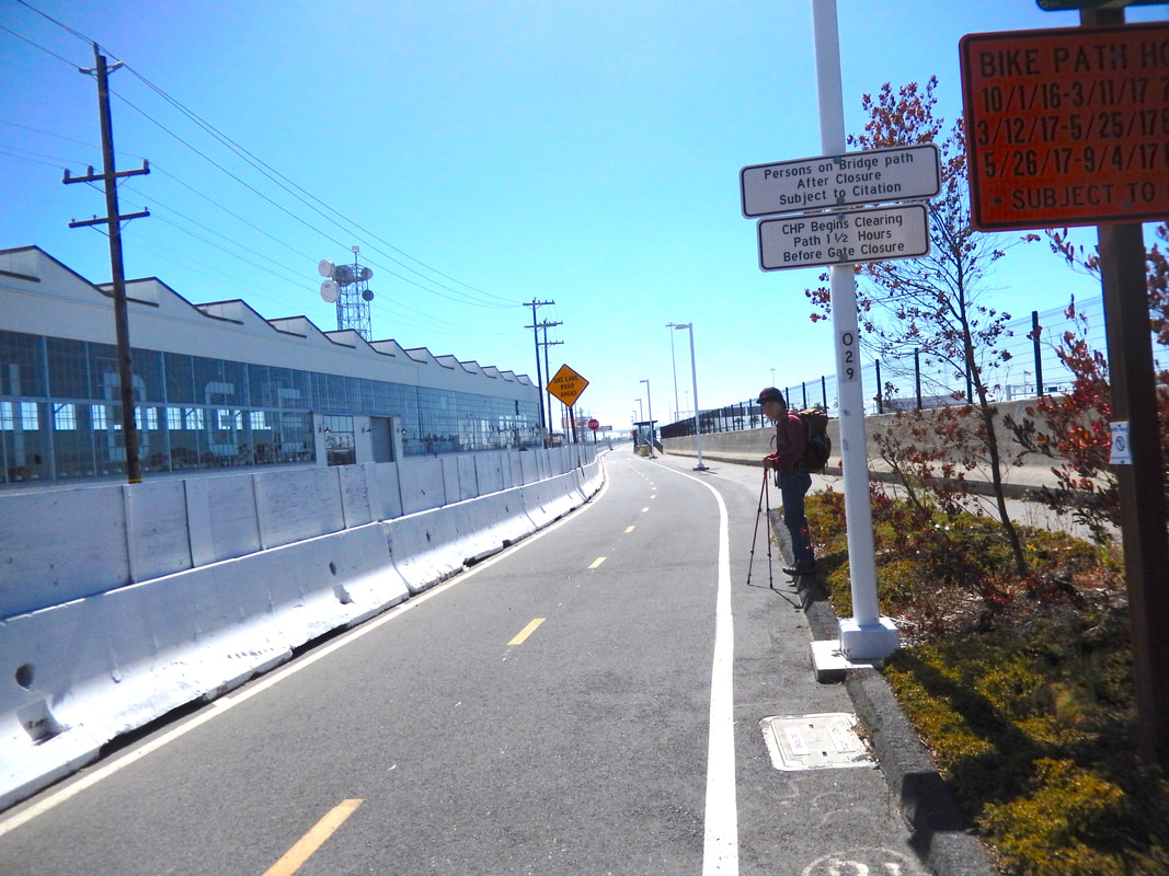
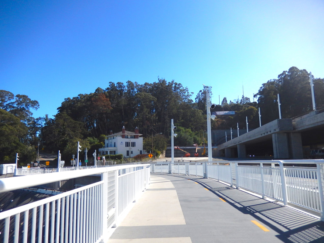
This is a paved, urban freeway type walkway. There is a fair bit of walking from the parking area to get onto the bridge proper.
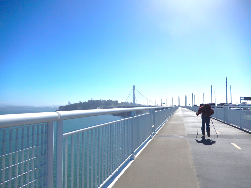
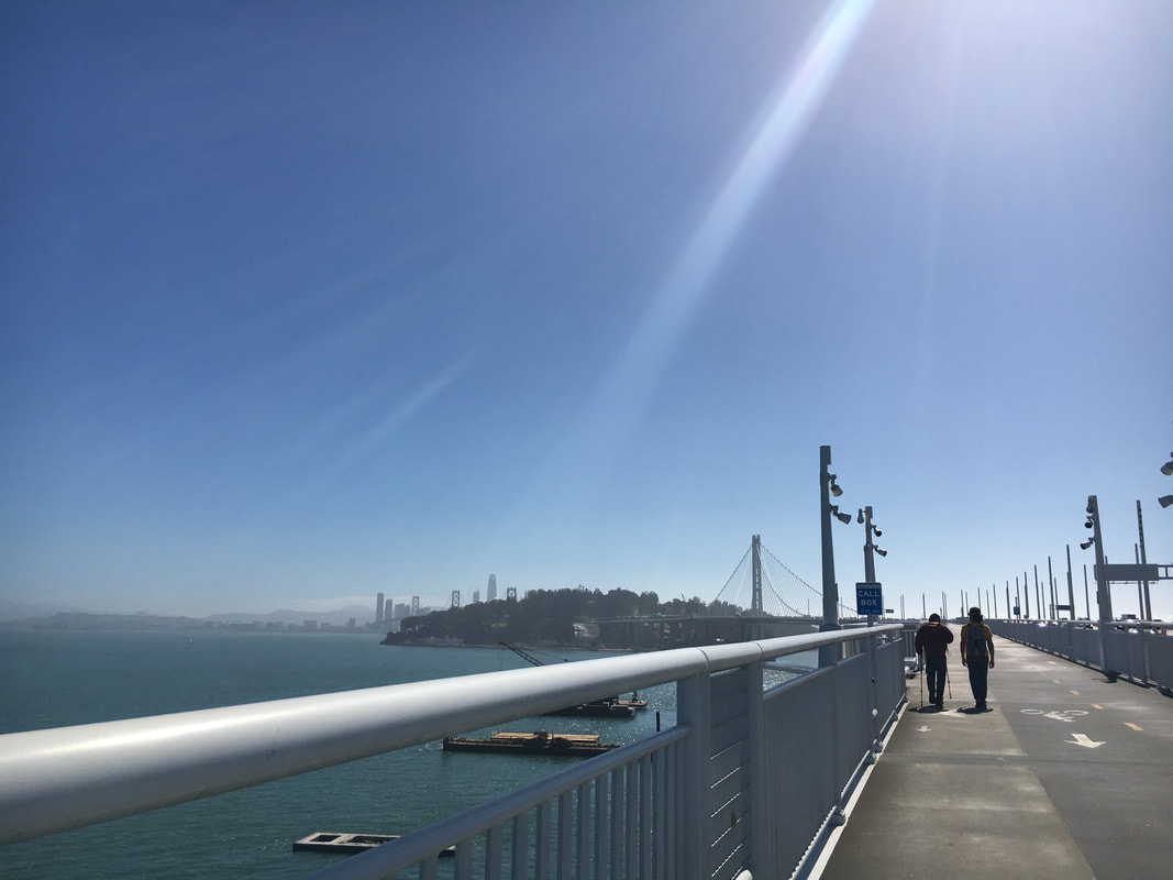
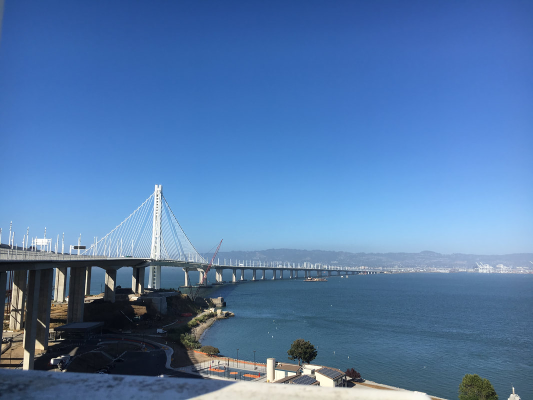
Once on the bridge, there are great views of the San Francisco cityscape beyond Treasure Island as you make your way forward.
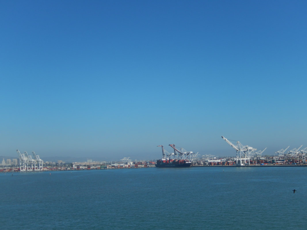
To the east are the Oakland Hills. Along the water are the iconic Port of Oakland container cranes that look suspiciously similar to the Star Wars Imperial walkers.
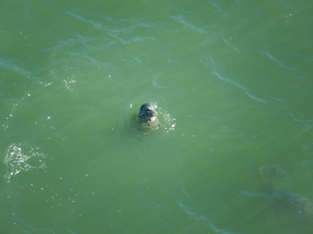
Views in any direction offer something interesting to see.
That includes looking downward. Harbor seals were playing happily in the water just below the walkway.
Check ahead for possible closures. At the time of our walk, there was residual demolition work that brought intermittent trail closures.
The Vista Point stop on Yerba Buena Island offers a pleasant view from a bench, perfect for a little rest before heading back.
(Bay Bridge Walk Hike Notes were originally paired with the “All That Glitters” Insights post.)
Click Insights/Hike Update News for inspiring reflections. Browse hikes on the main Hikes page or on the Hike Search by Area page. Check out selected articles and interviews under Media. Click World Walks to see or share favorite family-friendly walks! Stay in touch with Lisa Louis and HikingAutism via Contact. See products with inspiring designs that support the efforts of HikingAutism under Support/Shop. The Links page lists a loose collection of helpful information links.
Check the Home page for the broader background story. If you’re not able to take one of these Northern California hikes, hopefully you can enjoy the photo galleries at the bottom of each hike page! Feel free to share and follow on Facebook at HikingAutism, follow on Twitter at @HikingAutism and Instagram at lisalouis777
(scroll to bottom for photo gallery)
Location:East span of the Bay Bridge, Bay Bridge Trail Parking Lot to Yerba Buena Island Vista Point
Starting Point: Bay Bridge Trail Parking Lot, 345 Burma Rd., Oakland, CA 94607
Info links:
For all web links, if a link doesn’t jump directly, copy and paste into browser.
Bay Bridge info link:
http://baybridgeinfo.org
Bay Bridge Bicycle and Pedestrian Path info link:
http://baybridgeinfo.org/path
Maps & Trails, Bay Bridge Trail, access/transportation options link:
https://511.org/biking/maps/baybridge
Bay Bridge Bicycle/Pedestrian Path and Yerba Buena Island Vista Point info link:
https://sftreasureisland.org/bicycle
Distance:
The path, one way, from the Bay Bridge Trail parking lot at the east end of the bridge to the Vista Point rest stop is listed as 2.2 miles.
Considerations:
• Parking is available on Burma Road for easy access to the Bay Bridge pedestrian trail. See links above for instructions.
• Bicycle and public transportation access are also noted in info links above.
• The historic Bridge Yard Building by the parking lot is worth taking a peek at.
• Pay attention to wind advisories and warnings.
• Bring a hat or sunglasses. The light is extra intense on the bridge.
• Bathroom facilities are listed as being available both near the parking area and at Vista Point.
• Note separate lanes for pedestrians and bicycles.
• The path is in close vicinity to multiple lanes of fast moving traffic. Heads up for those with sensory issues.
The trail:
Check out the historic Bridge Yard Building by the parking area on Burma Road.
This is a paved, urban freeway type walkway. There is a fair bit of walking from the parking area to get onto the bridge proper.
Once on the bridge, there are great views of the San Francisco cityscape beyond Treasure Island as you make your way forward.
To the east are the Oakland Hills. Along the water are the iconic Port of Oakland container cranes that look suspiciously similar to the Star Wars Imperial walkers.
Views in any direction offer something interesting to see.
That includes looking downward. Harbor seals were playing happily in the water just below the walkway.
Check ahead for possible closures. At the time of our walk, there was residual demolition work that brought intermittent trail closures.
The Vista Point stop on Yerba Buena Island offers a pleasant view from a bench, perfect for a little rest before heading back.
(Bay Bridge Walk Hike Notes were originally paired with the “All That Glitters” Insights post.)
Click Insights/Hike Update News for inspiring reflections. Browse hikes on the main Hikes page or on the Hike Search by Area page. Check out selected articles and interviews under Media. Click World Walks to see or share favorite family-friendly walks! Stay in touch with Lisa Louis and HikingAutism via Contact. See products with inspiring designs that support the efforts of HikingAutism under Support/Shop. The Links page lists a loose collection of helpful information links.
Check the Home page for the broader background story. If you’re not able to take one of these Northern California hikes, hopefully you can enjoy the photo galleries at the bottom of each hike page! Feel free to share and follow on Facebook at HikingAutism, follow on Twitter at @HikingAutism and Instagram at lisalouis777