Laurel Dell and Cataract Creek
(scroll to bottom for photo gallery)
Location: Laurel Dell Trailhead, West Ridgecrest Blvd., Stinson Beach, CA
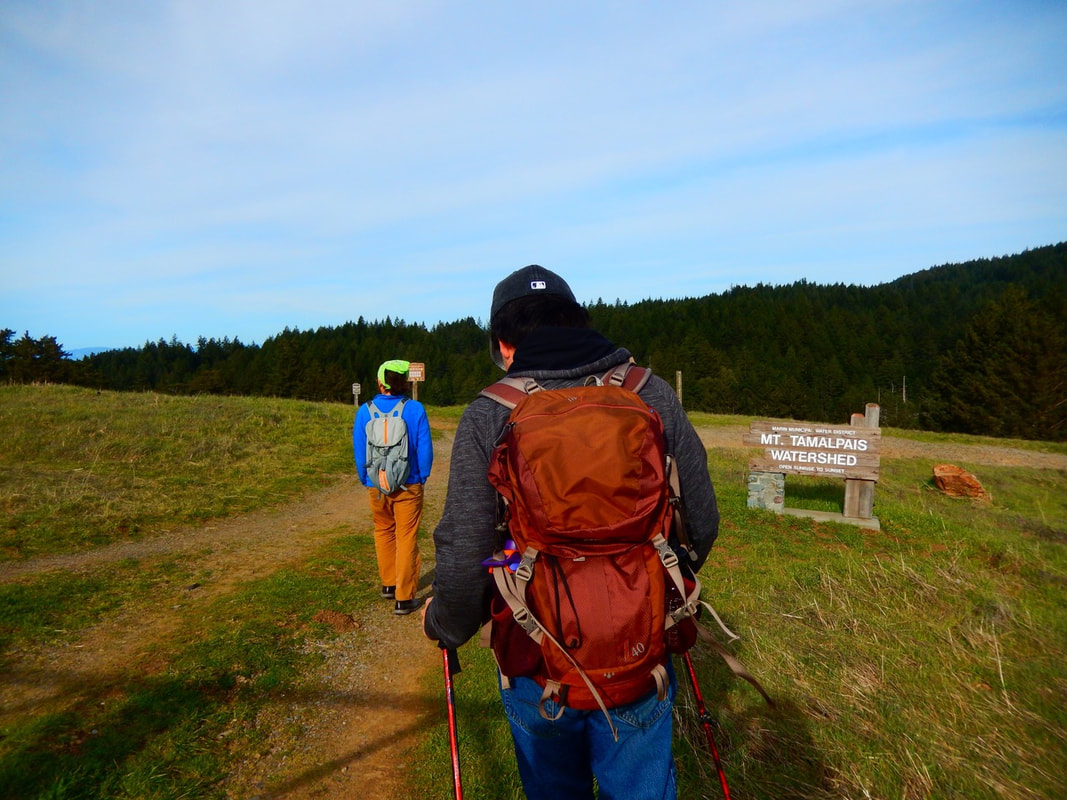
Starting Point: Laurel Dell Trailhead is located on W. Ridgecrest Blvd., about 3 miles northwest of Pantoll Campground (via Pantoll Road and W. Ridgecrest Blvd.) There is a parking pull-off area with a gate and a Mt. Tamalpais Watershed sign at a curve in the road. There’s a glorious view of the ocean across the road from the parking area, and the Laurel Dell trail starts downhill facing inland.
Info links:
For all web links, if a link doesn’t jump directly, copy and paste into browser.
Mt. Tam State Park brochure link (California State Parks):
https://www.parks.ca.gov/pages/471/files/MountTamalpaisSPFinalWebLayout110816.pdf
Mt. Tam Watershed information (Marin Water):
https://www.marinwater.org/mt-tam-watershed
Mt. Tam project and road status info (CA State Parks):
https://www.parks.ca.gov/?page_id=471
Mt. Tam Watershed map (Marin Water):
https://www.marinwater.org/sites/default/files/2020-09/Watershed%20Visitor%20Map.pdf
Distance:
There are multiple hike options starting from Laurel Dell trailhead. This set of notes and photo gallery covers a very short walk on Laurel Dell “Road” (it’s a trail/fire road) (approximately 0.3 miles) down to a short connector trail, the Ray Murphy Trail (which does not show up on many maps) that connects to Cataract Creek and the Cataract Trail. From this junction it’s about 0.5 miles from there to Cataract Falls heading northwest. We, however walked southeast on the Cataract Trail toward Rock Spring for about half a mile and realized we were going in the wrong direction to get to Cataract Falls, so we retraced our steps and then continued on Cataract Trail northwest to Cataract Falls. That added an extra mile to what would otherwise have been a relatively short 1.6 miles round trip to the falls and back.
Considerations:
• The drive is part of the Mt. Tam experience. Our route was Panoramic Highway, Pantoll Road, and W. Ridgecrest Blvd., all of which are scenic but also somewhat narrow and curvy in places. Drive with caution in case of animals, hikers, etc., on the road.
• There is space for several cars at the Laurel Dell Trailhead parking area.
• As is always the case, trailheads are easier to park at on weekdays and earlier in the day rather than on a weekend afternoon.
• There is a pit toilet near the Laurel Dell picnic area, but not at the trailhead (0.7 miles away from the trailhead if taking Laurel Dell Road/trail, a bit longer if taking Cataract Trail). Bathroom options include making an earlier stop at Pantoll Campground.
• Dressing in layers, using sun protection, and having water are advised for any hike.
• Be aware of poison oak along any trail. Scrubs like Technu are good to have in case of contact.
• Pay attention to health, safety and wildlife notices.
The trail:
The Laurel Dell Trailhead on W. Ridgecrest Blvd. makes for a lovely vista stop even if you’re not hiking. Parking is on the inland side, recognizable by the gate and Mt. Tamalpais Watershed sign. Across the road on the ocean side, the gently rolling hills frame the ocean, with the tip of Bolinas jutting out in the distance.
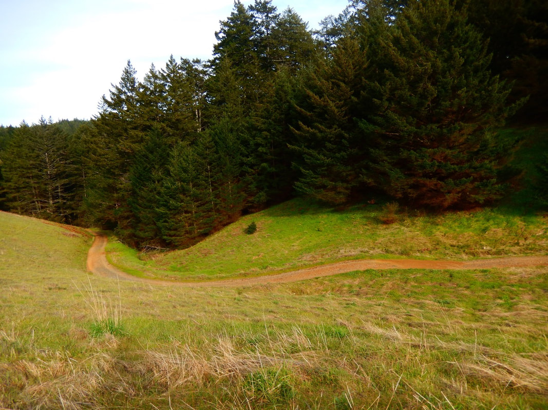
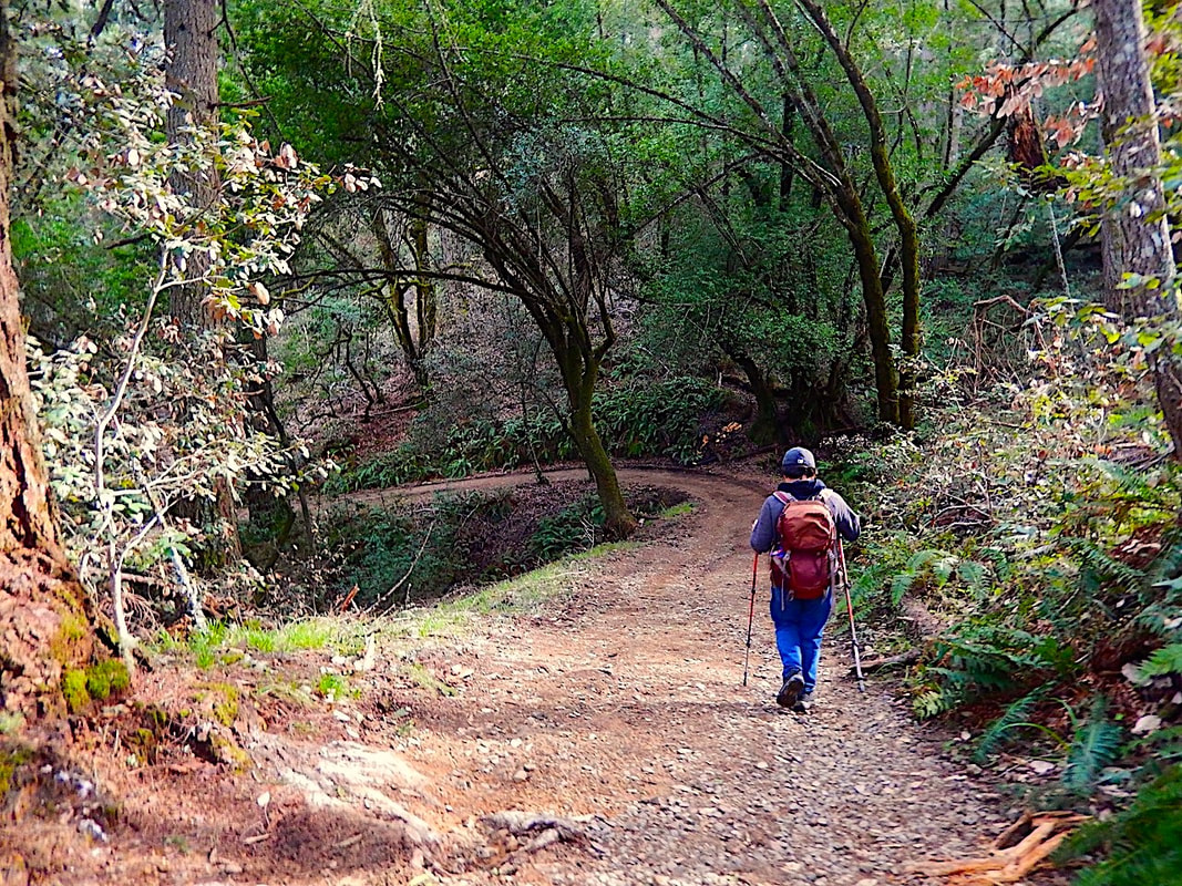
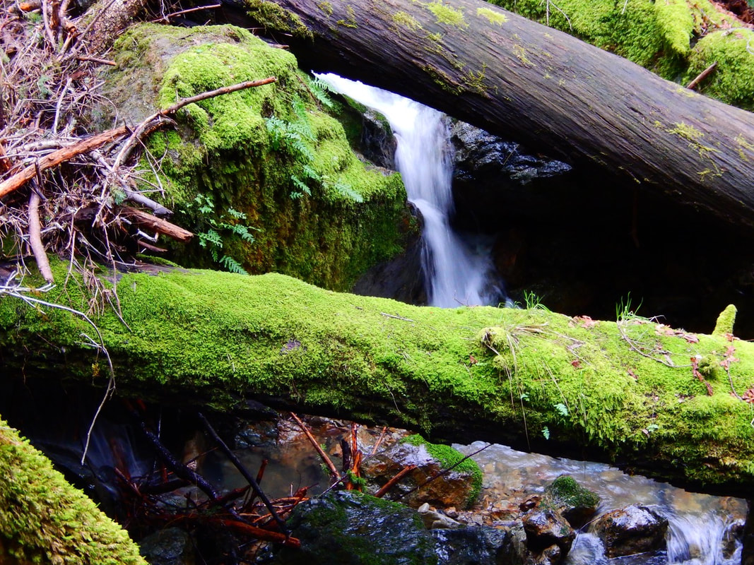
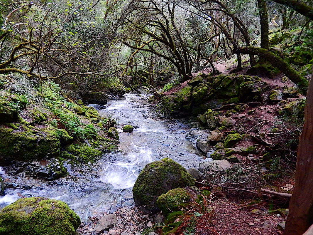
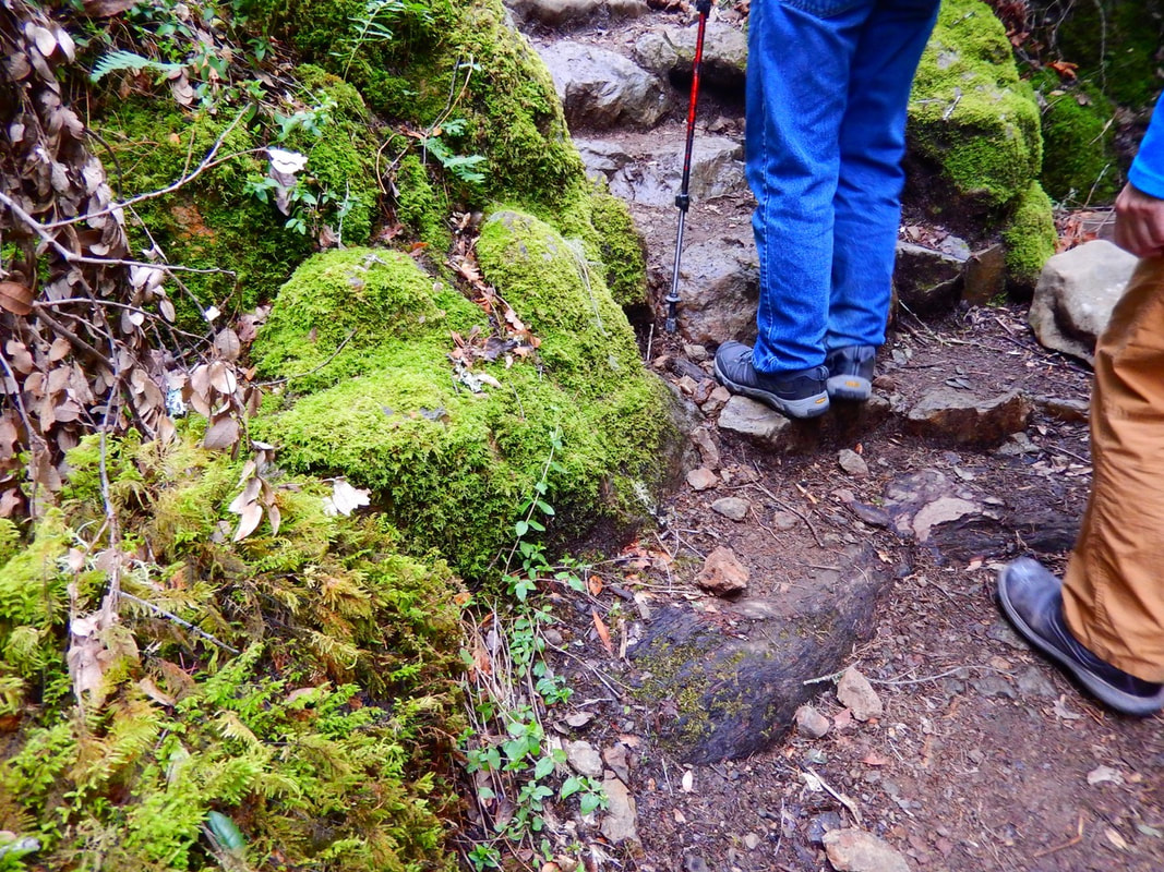
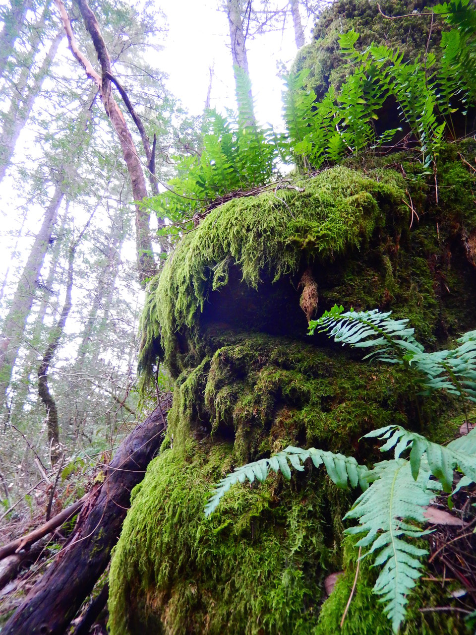
Laurel Dell fire road itself is a smooth, welcoming path that winds gently down from the open hills into wet, woodsy creek terrain. Instead of continuing northwest on Laurel Dell fire road, we left that and took the short connector trail, the Ray Murphy Trail. This trail is not marked on many maps. The trails and creek at this juncture are a bit scattered even on the maps. The deep, woodsy paths in this area featured moss, ferns, wet rock steps and wooden footbridges.
Though we’d originally intended to head northwest to visit Cataract Falls, we ended up heading southwest on Cataract Trail, where the forest cover eventually opened up a bit and we saw more hikers heading in the direction of Rock Springs.
We could have just enjoyed continuing in this unintended but still pleasant direction, but the falls called to us and we turned around and walked the half mile back past our original trail juncture and made our way north along Cataract Trail to Cataract Falls, where we had visited from other trailheads in the past. (See Cataract Trail to Cataract Falls for another hike to the falls.)
We enjoyed the damp, mossy trails, sometimes with slippery rocks, until we came to the Laurel Dell picnic area, where there is a vault toilet available. Wooden fences indicating a more civilized (and frequently used) trail brought us to Cataract Falls, always a great spot for a break. (We’ve only been on weekdays, so have not had to endure weekend crowds.)
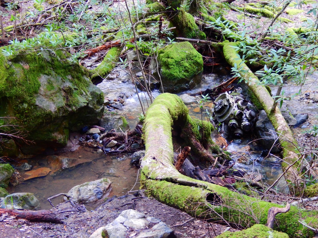
If readers look carefully, you might spot an old Corsair plane engine in the creek in one of the photos. There is more than one plane crash site on Mt. Tam and they are protected and to be respected. One of the plane engines is visible along the creek if you happen to look at the right moment.
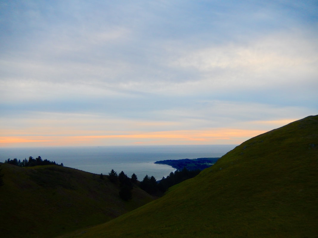
A late afternoon return to the Laurel Dell Trailhead gave us the gift of a sunset glow looking out over the ocean.
(Laurel Dell and Cataract Creek Hike Notes were originally paired with the “The Slippery Slope” Insights post.)
Click Insights/Hike Update News for inspiring reflections. Browse hikes on the main Hikes page or on the Hike Search by Area page. Check out selected articles and interviews under Media. Click World Walks to see or share favorite family-friendly walks! Stay in touch with Lisa Louis and HikingAutism via Contact. See products with inspiring designs that support the efforts of HikingAutism under Support/Shop. The Links page lists a loose collection of helpful information links.
Check the Home page for the broader background story. If you’re not able to take one of these Northern California hikes, hopefully you can enjoy the photo galleries at the bottom of each hike page! Feel free to share and follow on Facebook at HikingAutism, follow on Twitter at @HikingAutism and Instagram at lisalouis777
(scroll to bottom for photo gallery)
Location: Laurel Dell Trailhead, West Ridgecrest Blvd., Stinson Beach, CA
Starting Point: Laurel Dell Trailhead is located on W. Ridgecrest Blvd., about 3 miles northwest of Pantoll Campground (via Pantoll Road and W. Ridgecrest Blvd.) There is a parking pull-off area with a gate and a Mt. Tamalpais Watershed sign at a curve in the road. There’s a glorious view of the ocean across the road from the parking area, and the Laurel Dell trail starts downhill facing inland.
Info links:
For all web links, if a link doesn’t jump directly, copy and paste into browser.
Mt. Tam State Park brochure link (California State Parks):
https://www.parks.ca.gov/pages/471/files/MountTamalpaisSPFinalWebLayout110816.pdf
Mt. Tam Watershed information (Marin Water):
https://www.marinwater.org/mt-tam-watershed
Mt. Tam project and road status info (CA State Parks):
https://www.parks.ca.gov/?page_id=471
Mt. Tam Watershed map (Marin Water):
https://www.marinwater.org/sites/default/files/2020-09/Watershed%20Visitor%20Map.pdf
Distance:
There are multiple hike options starting from Laurel Dell trailhead. This set of notes and photo gallery covers a very short walk on Laurel Dell “Road” (it’s a trail/fire road) (approximately 0.3 miles) down to a short connector trail, the Ray Murphy Trail (which does not show up on many maps) that connects to Cataract Creek and the Cataract Trail. From this junction it’s about 0.5 miles from there to Cataract Falls heading northwest. We, however walked southeast on the Cataract Trail toward Rock Spring for about half a mile and realized we were going in the wrong direction to get to Cataract Falls, so we retraced our steps and then continued on Cataract Trail northwest to Cataract Falls. That added an extra mile to what would otherwise have been a relatively short 1.6 miles round trip to the falls and back.
Considerations:
• The drive is part of the Mt. Tam experience. Our route was Panoramic Highway, Pantoll Road, and W. Ridgecrest Blvd., all of which are scenic but also somewhat narrow and curvy in places. Drive with caution in case of animals, hikers, etc., on the road.
• There is space for several cars at the Laurel Dell Trailhead parking area.
• As is always the case, trailheads are easier to park at on weekdays and earlier in the day rather than on a weekend afternoon.
• There is a pit toilet near the Laurel Dell picnic area, but not at the trailhead (0.7 miles away from the trailhead if taking Laurel Dell Road/trail, a bit longer if taking Cataract Trail). Bathroom options include making an earlier stop at Pantoll Campground.
• Dressing in layers, using sun protection, and having water are advised for any hike.
• Be aware of poison oak along any trail. Scrubs like Technu are good to have in case of contact.
• Pay attention to health, safety and wildlife notices.
The trail:
The Laurel Dell Trailhead on W. Ridgecrest Blvd. makes for a lovely vista stop even if you’re not hiking. Parking is on the inland side, recognizable by the gate and Mt. Tamalpais Watershed sign. Across the road on the ocean side, the gently rolling hills frame the ocean, with the tip of Bolinas jutting out in the distance.
Laurel Dell fire road itself is a smooth, welcoming path that winds gently down from the open hills into wet, woodsy creek terrain. Instead of continuing northwest on Laurel Dell fire road, we left that and took the short connector trail, the Ray Murphy Trail. This trail is not marked on many maps. The trails and creek at this juncture are a bit scattered even on the maps. The deep, woodsy paths in this area featured moss, ferns, wet rock steps and wooden footbridges.
Though we’d originally intended to head northwest to visit Cataract Falls, we ended up heading southwest on Cataract Trail, where the forest cover eventually opened up a bit and we saw more hikers heading in the direction of Rock Springs.
We could have just enjoyed continuing in this unintended but still pleasant direction, but the falls called to us and we turned around and walked the half mile back past our original trail juncture and made our way north along Cataract Trail to Cataract Falls, where we had visited from other trailheads in the past. (See Cataract Trail to Cataract Falls for another hike to the falls.)
We enjoyed the damp, mossy trails, sometimes with slippery rocks, until we came to the Laurel Dell picnic area, where there is a vault toilet available. Wooden fences indicating a more civilized (and frequently used) trail brought us to Cataract Falls, always a great spot for a break. (We’ve only been on weekdays, so have not had to endure weekend crowds.)
If readers look carefully, you might spot an old Corsair plane engine in the creek in one of the photos. There is more than one plane crash site on Mt. Tam and they are protected and to be respected. One of the plane engines is visible along the creek if you happen to look at the right moment.
A late afternoon return to the Laurel Dell Trailhead gave us the gift of a sunset glow looking out over the ocean.
(Laurel Dell and Cataract Creek Hike Notes were originally paired with the “The Slippery Slope” Insights post.)
Click Insights/Hike Update News for inspiring reflections. Browse hikes on the main Hikes page or on the Hike Search by Area page. Check out selected articles and interviews under Media. Click World Walks to see or share favorite family-friendly walks! Stay in touch with Lisa Louis and HikingAutism via Contact. See products with inspiring designs that support the efforts of HikingAutism under Support/Shop. The Links page lists a loose collection of helpful information links.
Check the Home page for the broader background story. If you’re not able to take one of these Northern California hikes, hopefully you can enjoy the photo galleries at the bottom of each hike page! Feel free to share and follow on Facebook at HikingAutism, follow on Twitter at @HikingAutism and Instagram at lisalouis777