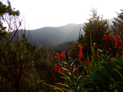
Fern Creek Trail - Muir Woods
(scroll to bottom for photo gallery)
Starting Point: Parking area across the road near Mountain Home Inn, 810 Panoramic Hwy, Mill Valley, CA 94941
Location: The ridge top parking areas near Mountain Home Inn are the starting point for numerous hikes. To get to Mountain Home Inn, from US-101, Exit 445B connects to CA-1 N, which then connects to Panoramic Highway. Watch for the signs where Shoreline Highway (1) and Panoramic Highway split off. Panoramic Highway turns right up the hill, curving along a beautiful stretch of mountain ridges.
Mountain Home Inn is on the uphill side of the road, and the parking areas are across the road along the ridge edge leading downhill. If you find yourself at the Throckmorton Fire Station, you’ve overshot Mountain Home Inn and trailhead parking.
Mount Tamalpais State Park info link (if a link doesn’t jump directly, copy and paste into browser) (Information links are sometimes changed at the source unexpectedly. We do our best to update.):
https://www.parks.ca.gov/pages/471/files/MountTamalpaisSPFinalWebLayout110816.pdf
Maps with trails:
(if a link doesn’t jump directly, copy and paste into browser)
http://www.friendsofmttam.org/wp-content/uploads/map-Mt-Tam-topo-600.png
http://www.onetam.org/map-and-trails
(The following link is the same link as the info link above: scroll to the bottom for a trail map.)
https://www.parks.ca.gov/pages/471/files/MountTamalpaisSPFinalWebLayout110816.pdf
Other good resources:
Mount Tamalpais Trails by Barry Spitz, a book including a description of every trail on Mt. Tam.
A good old fashioned paper map of Marin and Mt. Tam that includes trail names and distances. I have multiple Mt. Tam maps and switch between different versions depending on the hike.
Distance:
There are countless options for hiking down into Muir Woods on the various trails that start near Mountain Home Inn. The hike depicted in this post’s photos specifically lead through the Panoramic-Lost Trail-Fern Creek trail connections that ultimately lead down to the paved pathways within Muir Woods. It is a little over a mile of trail to get down to the Muir Woods paths, but remember these are steep, winding trails. Starting out downhill means returning to the trailhead with a steep uphill climb part of the way. The Panoramic-Lost Trail-Fern Creek trail combination down to the junction with the Muir Woods path and back is probably about 2.5 miles. Once down into the Muir Woods pathway proper, hikers have the option of turning right which leads toward Bridge 4, or heading left which leads toward Bridge 3 and the gift shop and visitor center.
Note in light of Muir Woods parking restrictions: I think of hiking the trails along this ridge down into Muir Woods as a stealth mission. Muir Woods parking now requires reservations at all times. Rather than battle with logistics to get into Muir Woods from the visitor parking lot, I’d rather hike in from the ridge above and avoid the crowds. These trails and hikes have always been available, but I appreciate the mountainside access more now.
Considerations:
• Maps, both for the roads and the hiking trails, are highly recommended for any Mt. Tam hikes. Hikers can get lost, and trails are steep. Rangers will search for a lost hiker if they know someone is missing, but lone hikers don’t have a way of letting someone know if they’ve slipped down a steep ridge or ravine.
• There is often little or no cell phone service in this area.
• The trailhead parking areas are in close access to multiple trail starts. I have been thrown off more than once starting this hike because I forget you have to walk about 0.2 miles on the road, backtracking south from the parking area. Keep an eye out along the right side of the road as you walk south on the shoulder of the road for some wooden structures that mark the start of the zigzag connection starting this hike.
• There are rustic toilet facilities at the trailhead parking areas.
• Mt. Tam is a popular spot for hikers. Trailhead parking is typically easier on weekdays or by getting an earlier start on weekends.
The trail:
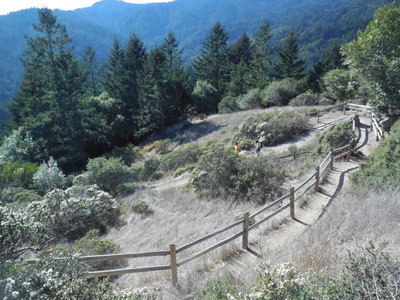
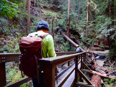
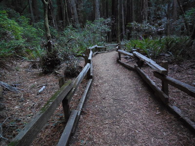
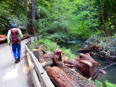
From the parking area near Mountain Home Inn, turn back facing south and walk along the road shoulder. Keep an eye out along the right side of the road for a short downward trail with some wooden structures that mark the start of the zigzag connection starting this hike. Refer to trail signs as well as maps. The wood fence switchback section leads from the Panoramic Trail start to the Canopy View Trail (listed as Ocean View Trail on some maps, a point which has thrown me off more than once) to Lost Trail, which is a right turn away from Canopy View/Ocean View Trail. Lost Trail connects to Fern Creek Trail. Turn left onto Fern Creek Trail to make your way down to the Kent Memorial space which then connects onto the main pathway in Muir Woods. There is a metal/wood bridge structure over a fallen tree leading to this section. At this connector point you are near Bridge 4 with a short walk to the right, or Bridge 3, Cathedral Grove and Bohemian Grove with a short walk to the left.
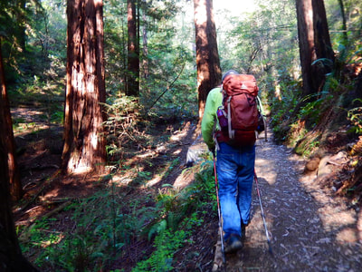
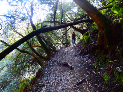
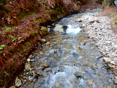
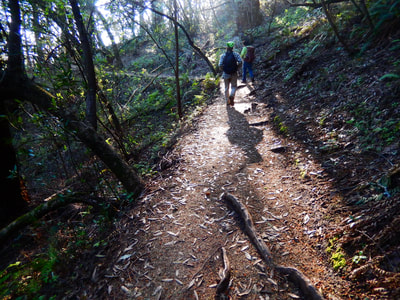
There are so many trails cutting up, down, and sideways through Mt. Tam. I love the roots jutting out of the trail, patchy shadows of leaves, deep green moss and ferns, fallen trees, babbling creeks, steep ravines along narrow pathways, sharp turns in the trail, and then the occasional sudden open spaces. Starting at the top of the ridge you are under bright open sky, but as you get down deeper into the woods, sunlight has a harder time making its way past the dense canopy of redwoods and other trees. It’s always a surprise to hike back up to the top of a ridge and realize that it’s been sunny and bright all along.
Wear sturdy shoes, have your map along, and if you happen to get from point A to point B by connecting with a different trail combination than the trails listed here, you’ll still have had some magical time on Mt. Tam.
(Fern Creek Trail - Muir Woods Hike Notes were originally paired with the “Stealth Mission” Insights post.)
Click Insights/Hike Update News for inspiring reflections. Browse hikes on the main Hikes page or on the Hike Search by Area page. Check out selected articles and interviews under Media. Click World Walks to see or share favorite family-friendly walks! Stay in touch with Lisa Louis and HikingAutism via Contact. See products with inspiring designs that support the efforts of HikingAutism under Support/Shop. The Links page lists a loose collection of helpful information links.
Check the Home page for the broader background story. If you’re not able to take one of these Northern California hikes, hopefully you can enjoy the photo galleries at the bottom of each hike page! Feel free to share and follow on Facebook at HikingAutism, follow on Twitter at @HikingAutism and Instagram at lisalouis777
