Nora Trail-West Point Inn Connector
(scroll to bottom for photo gallery)
Location: The loop hike that includes the Nora Trail as one segment described in this post starts at: Bootjack Campground parking area, Mount Tamalpais State Park, to West Point Inn, 100 Old Railroad Grade, Mill Valley, CA 94941
Starting Point: Bootjack parking area, 895 Panoramic Highway, Mill Valley, CA 94941
Info links:
For all web links, if a link doesn’t jump directly, copy and paste into browser.
For online map application searches, input “Bootjack Campground Parking”
Mount Tamalpais State Park info link (CA State Parks):
https://www.parks.ca.gov/?page_id=471
Muir Woods and Vicinity Trail Map (National Park Service):
https://www.nps.gov/goga/planyourvisit/upload/map-muwo-trail-2019-small.pdf
Mount Tamalpais brochure with map (California State Parks):
https://www.parks.ca.gov/pages/471/files/MountTamalpaisSPFinalWebLayout110816.pdf
Distance:
The gallery and description in this post cover the Nora Trail connector trail segment of a loop hike which starts with a short steep walk up from the Bootjack parking area through the campsites to the trail junction of Bootjack Trail and the Matt Davis Trail. We took the 0.2 mile section of Bootjack Trail to connect with Old Stage Road, and then hiked 1.4 miles to West Point Inn. Our return was 0.5 miles from West Point Inn on the Nora Trail (covered in this post) until we reached the Matt Davis Trail and headed southwest for 1.3 miles to return to the original trail junction at the top of the campsites above the Bootjack Campground parking area. The total hike was around 3.6 miles but hills might make that feel a bit longer.
Considerations:
• The Bootjack parking area is fairly large, but as is the case at many trailheads, it gets more crowded on weekends.
• There are toilets at the Bootjack trailhead parking area, and also at West Point Inn.
• Follow health, safety, and wildlife information signs.
• Having a poison oak scrub like Technu is handy for any trail.
• As with any Bay Area outing, bring layers. You may be hot in the sun one moment and shivering under fog and a chilly breeze the next.
• Maps are important, whether paper or a downloaded image. Cell service is not always reliable, so downloading an image ahead of time helps. Not all trails are marked clearly or accurately on all maps, and trail signs aren’t always as clear cut as expected, so keeping a sense of bearings is important.
The trail:
Readers can read about the ascending leg of this hike in the Old Stage Road to West Point Inn Hike Notes. The last leg is described in the Matt Davis Trail-West Point Inn to Bootjack Hike Notes.
Some may find it odd to use a full post just on a half mile connector trail, but I feel like that handy little Nora Trail merits its own photo gallery and description!
Years ago I hiked to West Point Inn starting from the fire station on Hog Back Road, then took the Matt Davis Trail until we hit the Nora Trail, which was a half mile of switchbacks, making the final uphill climb to West Point Inn. I remember liking the ambience of the Nora Trail, but didn’t get good photos on that hike.
I hiked a different route for the hike described in this series of Hike Notes, taking the gradually ascending Old Stage Road from Bootjack, which takes hikers to West Point Inn with little steep climbing. It was a pleasant climb up, with the treat of hanging out at the West Point Inn, which can be reached from multiple directions.
I liked the feel of the Nora Trail when I climbed it years earlier, but this time I got to see the trail on the descending leg of the hike. It certainly was an easier half mile going down compared to climbing up.
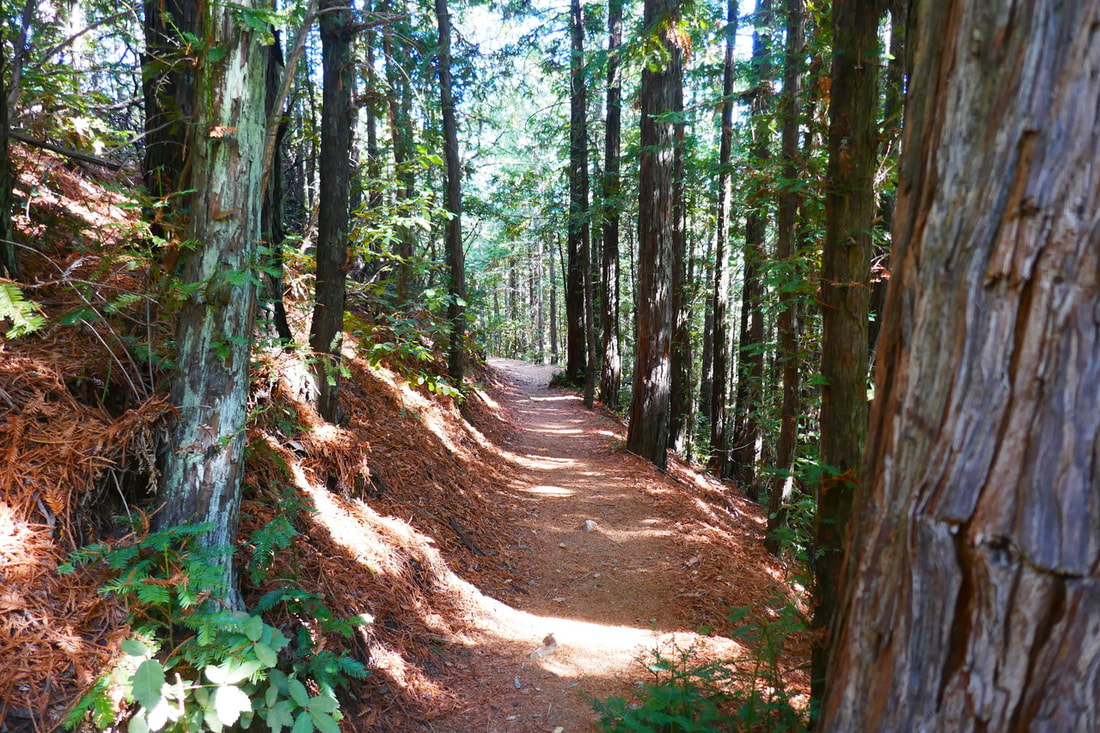
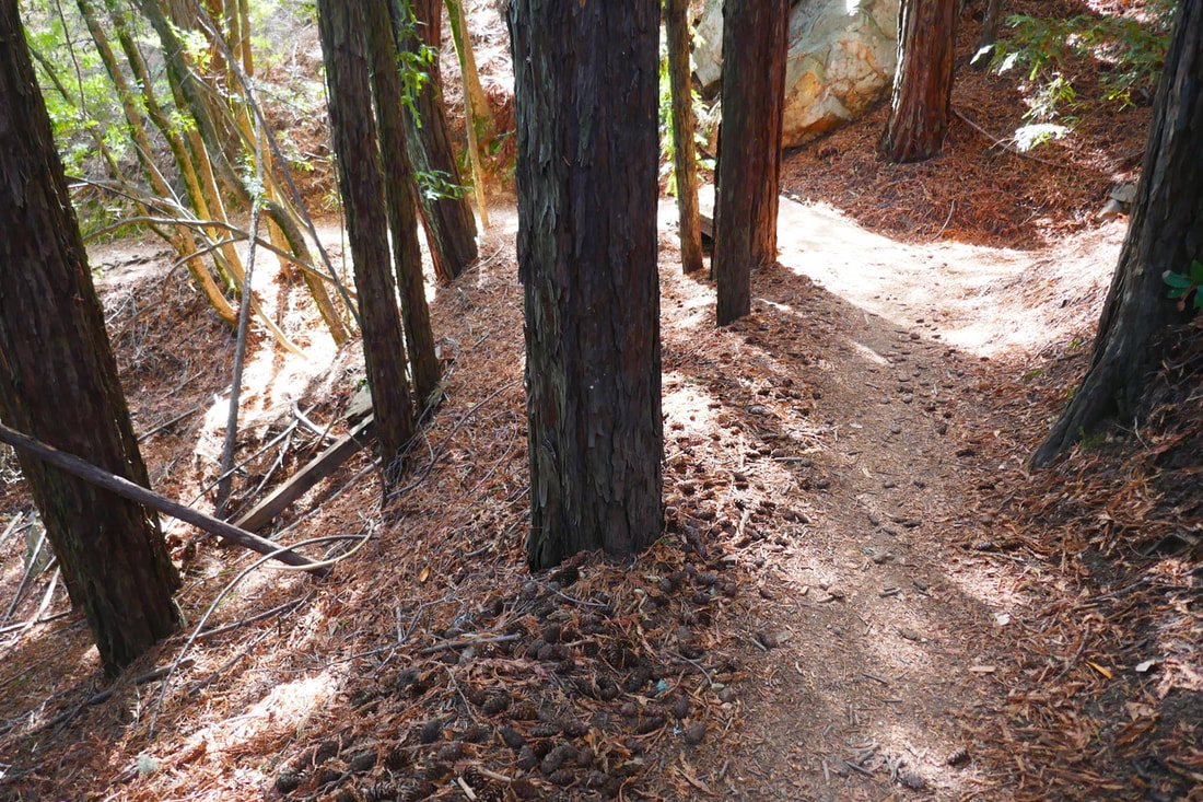
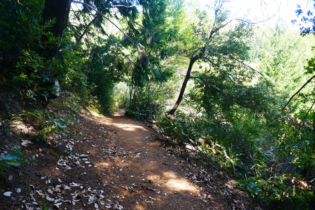
The thing I like about the Nora Trail is in such a short distance, it includes a variety of my favorite things on Mt. Tam. There are smooth stretches of trail made soft underfoot by evergreen needle and leaf debris. There’s a light, airy feeling in those brief stretches that remind me of some old Adirondack trails from my childhood.
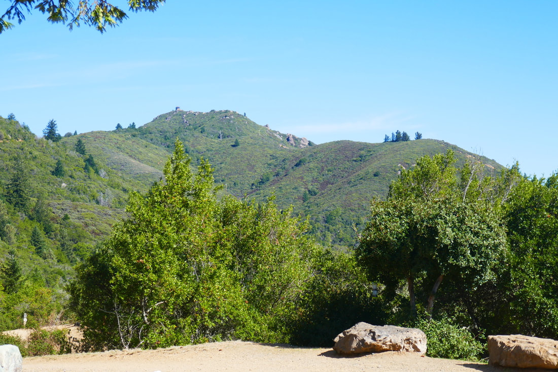
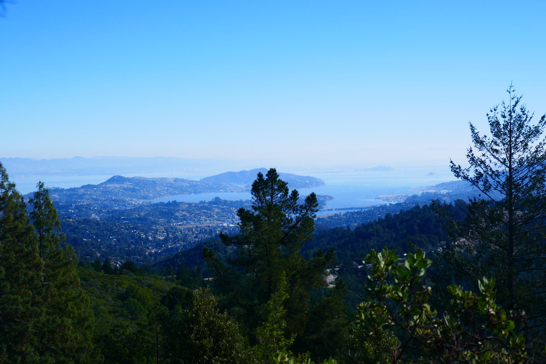
Starting from the top, though, there are bay, ocean and mountain ridge views facing away from the West Point Inn, the East Peak of Mt. Tam looming up to one side. The low chapparal brush at the top end of the Nora Trail allows for these broad views.
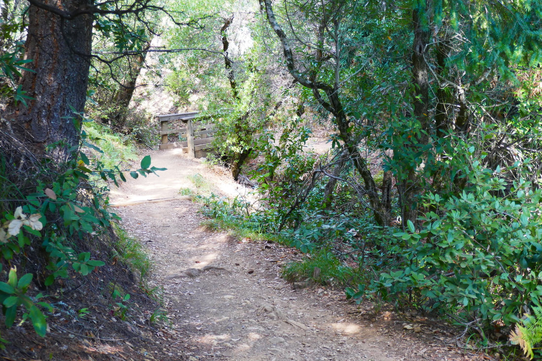
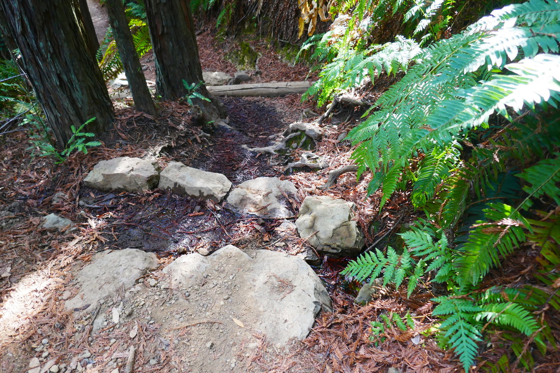
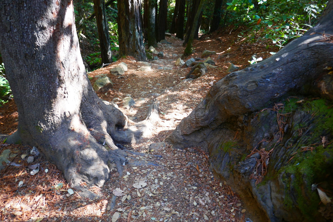
A smooth, open view start on the Nora Trail from the front of the West Point Inn soon descends into tree cover, starting with deciduous trees and shifting to redwood groves, another hallmark of many Mt. Tam trails. Wooden footbridges dot the way, and smooth trail turns to rocks and tree roots requiring more care with footing.
The view opens up again at points to reveal the East Peak and ocean views over mountain ridges, then hikers are back under the tree canopy where they may see live oak, bay and madrone trees. Damp creek areas, rocky stretches requiring more attention to the trail, and more wooden footbridges lead hikers down toward the trail junction with the Matt Davis Trail.
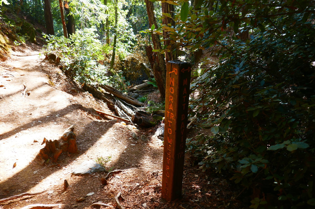
The last stretch of the Nora Trail has the lovely, woodsy redwood feel that highlights many parts of Mt. Tam. Once at the trail junction with the Matt Davis Trail, an old wood post trail sign marks the Matt Davis Trail, with an option to go in two directions. Just a reminder to hikers that maps (paper and/or a downloaded image of a map, since cell service isn’t always reliable out on a trail), compasses, and double-checking your location as you go along is a good idea even for experienced hikers. On this hike, we bumped into a couple of hikers who were halfway to Bootjack on the Matt Davis Trail when they realized they thought they were hiking in the other direction, and had to backtrack quite a way.
The final leg of this loop hike will be covered in the next Hike Notes. Enjoy the Nora Trail, whether climbing up or down!
(Nora Trail-West Point Inn Connector Hike Notes were originally paired with the “Grateful” Insights post.)
Check the Home page for the broader background story. Click Insights/Hike Update News for inspiring reflections. Browse hikes on the main Hikes page or on the Hike Search by Area page, and scroll to the bottom of each hike page to see full photo galleries.
If you’d like to support HikingAutism, check out the Support/Shop page! Check out selected articles and interviews under Media. Click World Walks to see or share favorite family-friendly walks! Stay in touch with Lisa Louis and HikingAutism via Contact. The Links page lists a loose collection of helpful information links. Feel free to share and follow on Facebook at HikingAutism, follow on Twitter at @HikingAutism and Instagram at lisalouis777
(scroll to bottom for photo gallery)
Location: The loop hike that includes the Nora Trail as one segment described in this post starts at: Bootjack Campground parking area, Mount Tamalpais State Park, to West Point Inn, 100 Old Railroad Grade, Mill Valley, CA 94941
Starting Point: Bootjack parking area, 895 Panoramic Highway, Mill Valley, CA 94941
Info links:
For all web links, if a link doesn’t jump directly, copy and paste into browser.
For online map application searches, input “Bootjack Campground Parking”
Mount Tamalpais State Park info link (CA State Parks):
https://www.parks.ca.gov/?page_id=471
Muir Woods and Vicinity Trail Map (National Park Service):
https://www.nps.gov/goga/planyourvisit/upload/map-muwo-trail-2019-small.pdf
Mount Tamalpais brochure with map (California State Parks):
https://www.parks.ca.gov/pages/471/files/MountTamalpaisSPFinalWebLayout110816.pdf
Distance:
The gallery and description in this post cover the Nora Trail connector trail segment of a loop hike which starts with a short steep walk up from the Bootjack parking area through the campsites to the trail junction of Bootjack Trail and the Matt Davis Trail. We took the 0.2 mile section of Bootjack Trail to connect with Old Stage Road, and then hiked 1.4 miles to West Point Inn. Our return was 0.5 miles from West Point Inn on the Nora Trail (covered in this post) until we reached the Matt Davis Trail and headed southwest for 1.3 miles to return to the original trail junction at the top of the campsites above the Bootjack Campground parking area. The total hike was around 3.6 miles but hills might make that feel a bit longer.
Considerations:
• The Bootjack parking area is fairly large, but as is the case at many trailheads, it gets more crowded on weekends.
• There are toilets at the Bootjack trailhead parking area, and also at West Point Inn.
• Follow health, safety, and wildlife information signs.
• Having a poison oak scrub like Technu is handy for any trail.
• As with any Bay Area outing, bring layers. You may be hot in the sun one moment and shivering under fog and a chilly breeze the next.
• Maps are important, whether paper or a downloaded image. Cell service is not always reliable, so downloading an image ahead of time helps. Not all trails are marked clearly or accurately on all maps, and trail signs aren’t always as clear cut as expected, so keeping a sense of bearings is important.
The trail:
Readers can read about the ascending leg of this hike in the Old Stage Road to West Point Inn Hike Notes. The last leg is described in the Matt Davis Trail-West Point Inn to Bootjack Hike Notes.
Some may find it odd to use a full post just on a half mile connector trail, but I feel like that handy little Nora Trail merits its own photo gallery and description!
Years ago I hiked to West Point Inn starting from the fire station on Hog Back Road, then took the Matt Davis Trail until we hit the Nora Trail, which was a half mile of switchbacks, making the final uphill climb to West Point Inn. I remember liking the ambience of the Nora Trail, but didn’t get good photos on that hike.
I hiked a different route for the hike described in this series of Hike Notes, taking the gradually ascending Old Stage Road from Bootjack, which takes hikers to West Point Inn with little steep climbing. It was a pleasant climb up, with the treat of hanging out at the West Point Inn, which can be reached from multiple directions.
I liked the feel of the Nora Trail when I climbed it years earlier, but this time I got to see the trail on the descending leg of the hike. It certainly was an easier half mile going down compared to climbing up.
The thing I like about the Nora Trail is in such a short distance, it includes a variety of my favorite things on Mt. Tam. There are smooth stretches of trail made soft underfoot by evergreen needle and leaf debris. There’s a light, airy feeling in those brief stretches that remind me of some old Adirondack trails from my childhood.
Starting from the top, though, there are bay, ocean and mountain ridge views facing away from the West Point Inn, the East Peak of Mt. Tam looming up to one side. The low chapparal brush at the top end of the Nora Trail allows for these broad views.
A smooth, open view start on the Nora Trail from the front of the West Point Inn soon descends into tree cover, starting with deciduous trees and shifting to redwood groves, another hallmark of many Mt. Tam trails. Wooden footbridges dot the way, and smooth trail turns to rocks and tree roots requiring more care with footing.
The view opens up again at points to reveal the East Peak and ocean views over mountain ridges, then hikers are back under the tree canopy where they may see live oak, bay and madrone trees. Damp creek areas, rocky stretches requiring more attention to the trail, and more wooden footbridges lead hikers down toward the trail junction with the Matt Davis Trail.
The last stretch of the Nora Trail has the lovely, woodsy redwood feel that highlights many parts of Mt. Tam. Once at the trail junction with the Matt Davis Trail, an old wood post trail sign marks the Matt Davis Trail, with an option to go in two directions. Just a reminder to hikers that maps (paper and/or a downloaded image of a map, since cell service isn’t always reliable out on a trail), compasses, and double-checking your location as you go along is a good idea even for experienced hikers. On this hike, we bumped into a couple of hikers who were halfway to Bootjack on the Matt Davis Trail when they realized they thought they were hiking in the other direction, and had to backtrack quite a way.
The final leg of this loop hike will be covered in the next Hike Notes. Enjoy the Nora Trail, whether climbing up or down!
(Nora Trail-West Point Inn Connector Hike Notes were originally paired with the “Grateful” Insights post.)
Check the Home page for the broader background story. Click Insights/Hike Update News for inspiring reflections. Browse hikes on the main Hikes page or on the Hike Search by Area page, and scroll to the bottom of each hike page to see full photo galleries.
If you’d like to support HikingAutism, check out the Support/Shop page! Check out selected articles and interviews under Media. Click World Walks to see or share favorite family-friendly walks! Stay in touch with Lisa Louis and HikingAutism via Contact. The Links page lists a loose collection of helpful information links. Feel free to share and follow on Facebook at HikingAutism, follow on Twitter at @HikingAutism and Instagram at lisalouis777