Pedro Point South Ridge Trail
(scroll to bottom for photo gallery)
Location: Trailhead near Devil’s Slide North Parking Lot, Cabrillo Hwy/Rte. 1, Pacifica
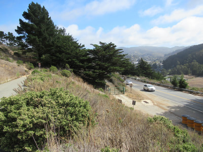
Starting Point: Park in the north parking lot for Devil’s Slide, at the northern end of the Tom Lantos Tunnels. Walk from the parking lot toward Rte. 1 and turn left. Take the paved walkway up the hill (rather than the roadway toward the green gate). A short walk will get you to the information sign where the South Ridge and Arroyo trails start.
Info links:
For all web links, if a link doesn’t jump directly, copy and paste into browser.
Pedro Point Headlands info link (Visit Pacifica):
https://visitpacifica.com/pedro-point-headlands/
Pedro Point Headlands info link (Pacifica Land Trust):
https://www.pacifica-land-trust.org/project/pedro-point-headlands/
Pedro Point Headlands trail map link (California Beaches):
https://www.californiabeaches.com/attraction/pedro-point-headlands-trails/
Distance:
There is an information sign at the South Ridge Trailhead with the same trail map as the pdf link noted above. The trail sign markers list the South Ridge Trail as 0.6 miles (a sometimes steep 0.6 miles), the Arroyo Trail as 0.6 miles (less steep, more tree cover), the Bluff Trail as 0.5 miles, and the Middle Ridge Trail as 0.3 miles. What is noted as the Green Gate Trail is really the access pathway from the road/parking, but count that as another 1/3 mile or so from the north parking lot.
Considerations:
• Skip the green gate: The info link above states that it is possible to park in front of the green gate and enter from there, HOWEVER, on our recent visit parking was not allowed, and there was a sign prohibiting pedestrians from walking along the road to the green gate. For safety, park in the North Parking Lot for Devil’s Slide, just before the Tom Lantos Tunnel from the north. Walk up the paved walkway that is parallel and above the roadside strip to the green gate (which appeared to be closed/locked on our visit anyway).
• Weekdays and mornings are a better bet for parking. Having said that, we parked easily midday on a beautiful Saturday.
• There are bathroom facilities a short way up the Devil’s Slide trail from the parking spaces. It means backtracking a bit when you head back toward the Pedro Point trail entrance, but good to have the option. There was one port-a-potty at the South Ridge Trail start when we visited.
• Info link says mountain bikes and equestrians not allowed at this time, though we saw signs on the trail saying equestrians “not recommended.”
• It can get very gusty and windy at the high end of the bluffs. Use caution on the narrow trail sections along the cliffs on the Bluff Trail.
The trail:
It is a short uphill walk left out of the Devil’s Slide North Parking Lot up the paved walkway that leads up to the main trail start. There is a trail information sign, a port-a-potty, and a handful of other structural items in a clearing.
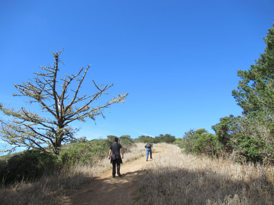
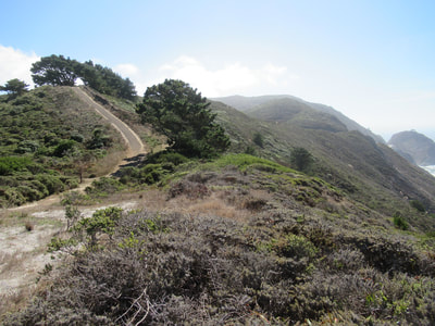
The South Ridge Trail sign is easy to find, and you will easily see the trail leading up hill. (Arroyo Trail start is harder to find: see future post.)
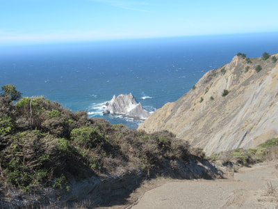
The trail sign says 0.6 miles to connect to the Bluff Trail (which is the trail leading to the best views of the unique geological structure of Pedro Point).
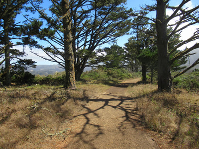
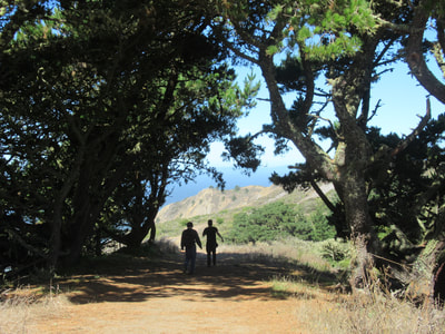
This 0.6 miles has some steep stretches, but every step is worth it. The trail ambience changes as you rise up, with a bit of an alpine feeling reminiscent of other regions.
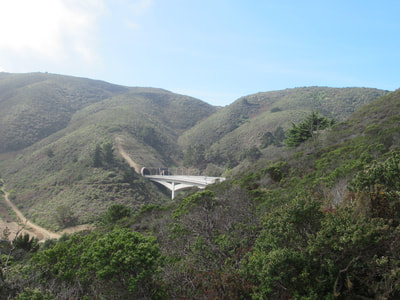
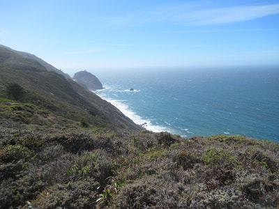
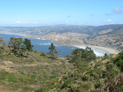
There are great views from above, with a look toward the tunnels cutting through Devil’s Slide to the south, the vast Pacific to the west, and a great shoreline view of Pacifica to the north. The mountain views to the east are also dramatic.
When you finish rising up (you’ll think you’re done and then realize the trail rises again), the views are great but the wind may pick up.
There is a trail sign where the South Ridge Trail, the Bluff Trail, and the Arroyo Trail meet. (The Arroyo Trail will be covered in a future post, but if you decide to take it back down for a loop hike: When you get toward the end and have to decide “Left or right?” to get back to the parking lot, turn right!)
The Bluff Trail is noted as 0.5 miles, and is the stretch that leads up and over to the crest above the iconic Pedro Point rock. It is a trail of sharp dips and rises.
We stopped partway along the Bluff Trail at a view point where we could see the rock and avoided the top crest due to wind. The short Middle Ridge Trail, which connects midway along the Bluff Trail, is a short little jog inland, offering surrounding hill views.
You can make your return trip back by the South Ridge Trail, which makes for dramatic views in the reverse direction. We took the Arroyo Trail back, which is an animal of a different nature (watch for future post).
It’s hard to beat the Pedro Point Headlands for stunning views over a short trail distance, but be prepared for some uphill trail sections.
(Pedro Point South Ridge Trail Hike Notes were originally paired with the "Mind-Reading Through Pictures” Insights post.)
Click Insights/Hike Update News for inspiring reflections. Browse hikes on the main Hikes page or on the Hike Search by Area page. Check out selected articles and interviews under Media. Click World Walks to see or share favorite family-friendly walks! Stay in touch with Lisa Louis and HikingAutism via Contact. See products with inspiring designs that support the efforts of HikingAutism under Support/Shop. The Links page lists a loose collection of helpful information links.
Check the Home page for the broader background story. If you’re not able to take one of these Northern California hikes, hopefully you can enjoy the photo galleries at the bottom of each hike page! Feel free to share and follow on Facebook at HikingAutism, follow on Twitter at @HikingAutism and Instagram at lisalouis777
