Julian Trail - Marin Headlands, Sausalito, CA
(scroll to bottom for photo gallery)
Location: Julian Trail trailhead at roundabout parking lot and restroom at intersection of Conzelman Road and McCullough Road.
Starting Point: Follow the Marin Headlands signs just north of the Golden Gate Bridge to drive up Conzelman Road to the roundabout, which connects with McCullough Road. This appears as “Coastal Trail Parking and Restroom” on Google maps. The Julian Trail and Slacker Trail are both noted as “Coastal Trail” on some maps since technically they are part of the Coastal Trail. The Julian Trail starts on the same side of the road as the parking lot/bathroom facility.
Info links:
For all web links, if a link doesn’t jump directly, copy and paste into browser.
Julian Trail Info link (Parks Conservancy):
https://www.parksconservancy.org/trails/julian-trail
Marin Headlands Trail Map link (National Park Service):
https://www.nps.gov/goga/planyourvisit/upload/map_mahe_150429_508_2021.pdf
Map link (Suisun Wildlife) showing the Julian trail in parentheses as “Julian Fire Road” (under “Coastal Trail”):
http://www.suisunwildlife.org/Marin%20Headlands.pdf
Distance:
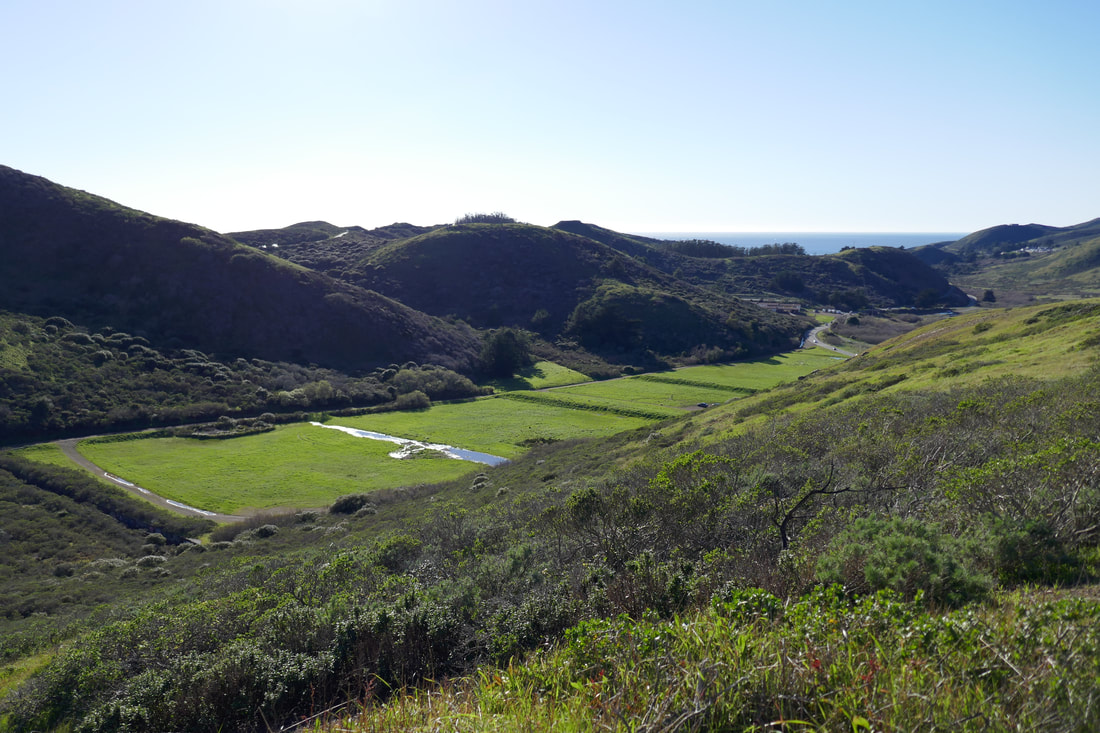
The Julian Trail, technically part of the Coastal Trail, is a 1.6 mile long trail segment that connects from the Slacker Trail trailhead (at the roundabout at Conzelman Road and McCollough Road) down toward Rodeo Beach Lagoon where it picks up the Coastal Trail with one segment leading toward Black Sands Beach, and another leading down to Bunker Road and paths leading to Rodeo Beach.
Considerations:
• The roundabout parking lot for this trailhead has a toilet facility.
• This is a fairly wide fire road type trail, with no tree coverage. Sun protection is in order.
• The winds can be strong, with almost no trees to block the wind.
• Mountain bikes whiz by at a fast clip sometimes. Keep an eye out on curves.
• This is a gradually descending trail that ends in a valley. Remember it is 1.6 miles uphill to return.
• As with any trailhead on weekends, parking spots are often easier to come by in the morning than the afternoon.
The trail:
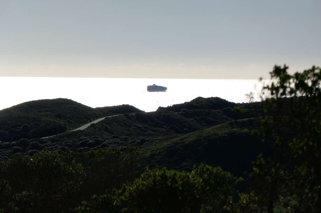
This is a handy starting spot for a trail as the parking lot and bathroom facility are right there by the trailhead. The tip of the Golden Gate Bridge is visible from the parking lot looking southeast. It’s an easy walk across the road from the parking lot to enjoy the Golden Gate Bridge and San Francisco view before or after a hike. It’s a great spot to catch the sunset.
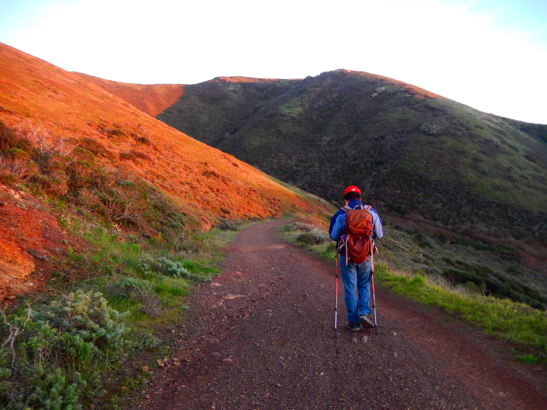
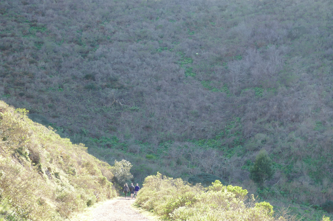
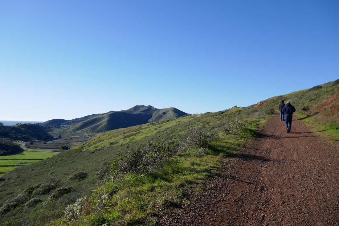
The trailhead itself starts right from the parking lot. Much of this trail feels like a hill is guiding walkers on the left with broad views opening to the right until reaching the sharp turn for the final descent into the valley.
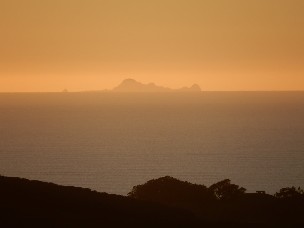
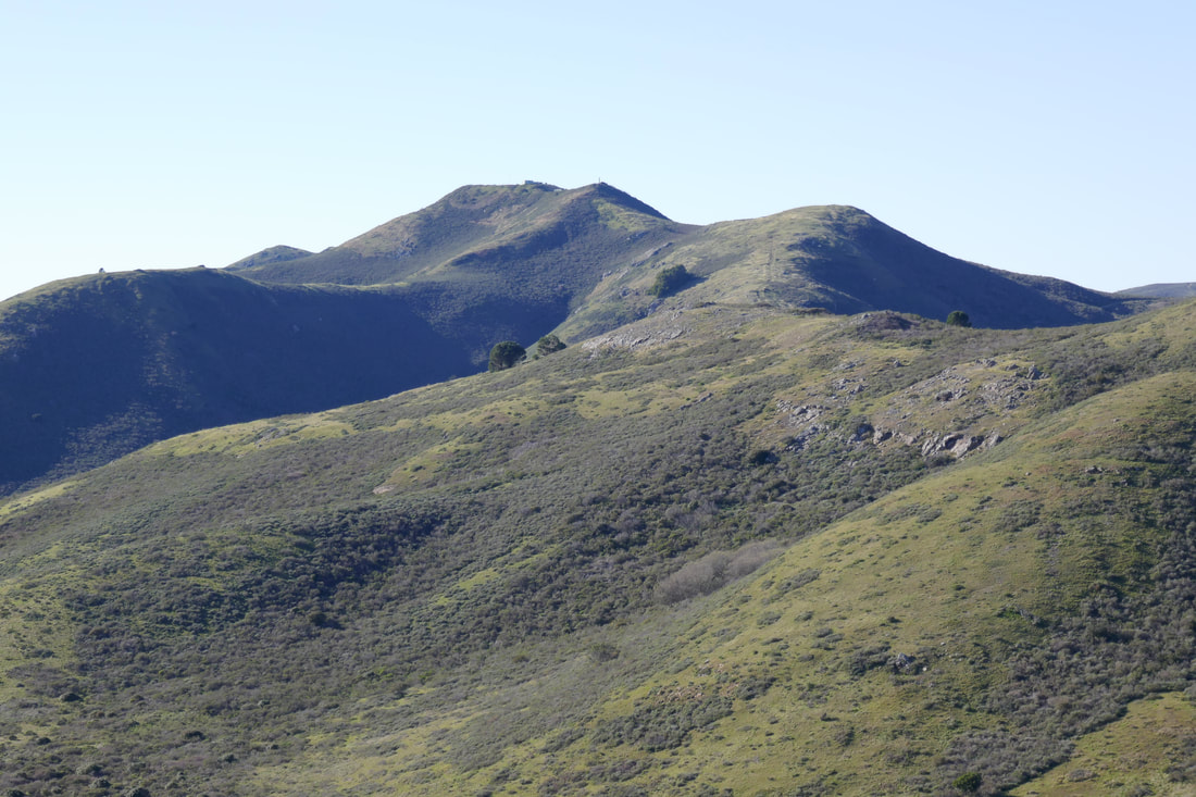
On a reasonably clear day, the view of the Farallon Islands can be stunning.
Midday light dampens some of the dramatic shadows of the rolling hills of the headlands, but there is still a visual effect that looks to me like thick icing flowing on an amorphous cake. Early morning or late afternoon offer great shadow effects.
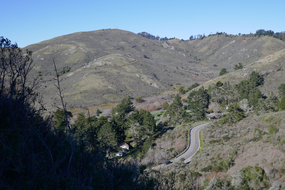
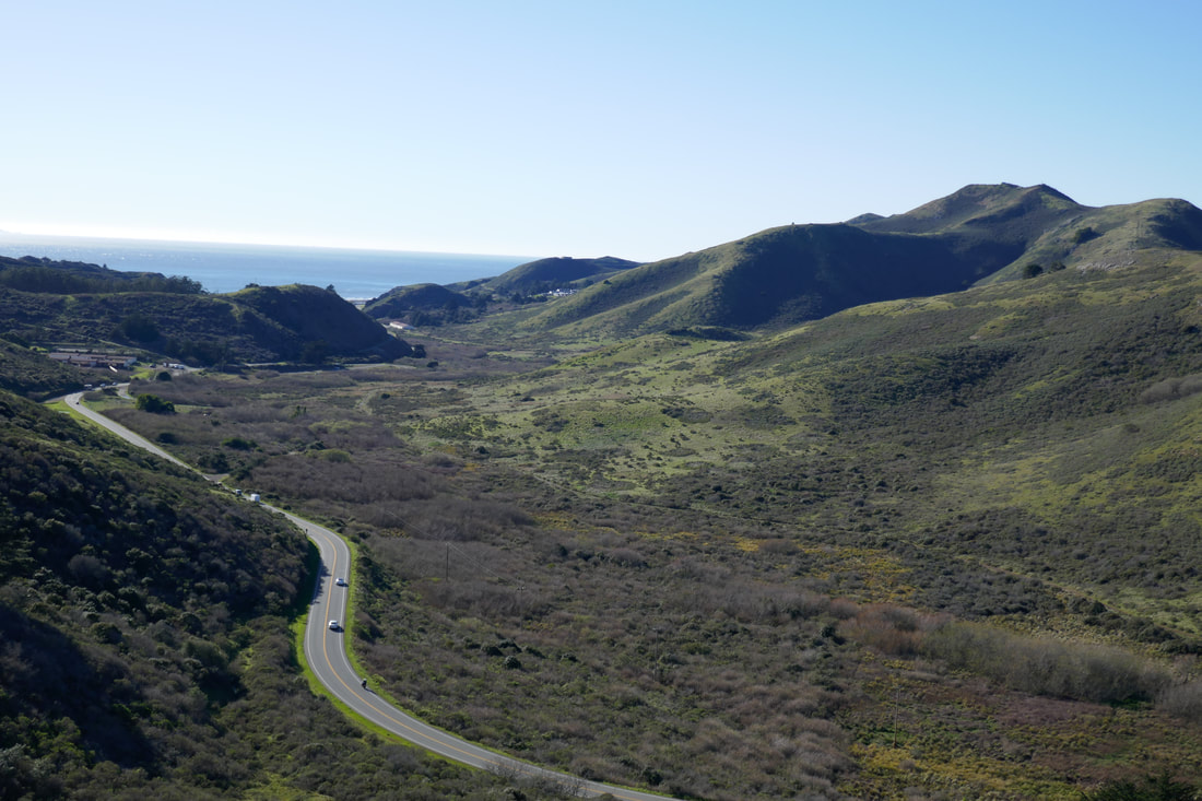
Turns in the trail offer different views down the valley toward Rodeo Beach, but the view on this particular walk is less varied than on trails with a mix of tree coverage and open space. Our hike stopped before the final stretch down into the valley, so the photo gallery does not include shots from the farthest points below.
This is a wide, clear trail, listed as “Julian Fire Road” on some maps (overlapping with its true identity as part of the Coastal Trail), but that means hikers also have to keep a heads up for speedy mountain bikers.
A quick step across the road from the roundabout offers nice end-of-the-hike bridge and city views for those who have a little time to spare.
(Julian Trail – Marin Headlands Hike Notes were originally paired with the “Looming Shadows” Insights post.)
Click Insights/Hike Update News for inspiring reflections. Browse hikes on the main Hikes page or on the Hike Search by Area page. Check out selected articles and interviews under Media. Click World Walks to see or share favorite family-friendly walks! Stay in touch with Lisa Louis and HikingAutism via Contact. See products with inspiring designs that support the efforts of HikingAutism under Support/Shop. The Links page lists a loose collection of helpful information links.
Check the Home page for the broader background story. If you’re not able to take one of these Northern California hikes, hopefully you can enjoy the photo galleries at the bottom of each hike page! Feel free to share and follow on Facebook at HikingAutism, follow on Twitter at @HikingAutism and Instagram at lisalouis777
(scroll to bottom for photo gallery)
Location: Julian Trail trailhead at roundabout parking lot and restroom at intersection of Conzelman Road and McCullough Road.
Starting Point: Follow the Marin Headlands signs just north of the Golden Gate Bridge to drive up Conzelman Road to the roundabout, which connects with McCullough Road. This appears as “Coastal Trail Parking and Restroom” on Google maps. The Julian Trail and Slacker Trail are both noted as “Coastal Trail” on some maps since technically they are part of the Coastal Trail. The Julian Trail starts on the same side of the road as the parking lot/bathroom facility.
Info links:
For all web links, if a link doesn’t jump directly, copy and paste into browser.
Julian Trail Info link (Parks Conservancy):
https://www.parksconservancy.org/trails/julian-trail
Marin Headlands Trail Map link (National Park Service):
https://www.nps.gov/goga/planyourvisit/upload/map_mahe_150429_508_2021.pdf
Map link (Suisun Wildlife) showing the Julian trail in parentheses as “Julian Fire Road” (under “Coastal Trail”):
http://www.suisunwildlife.org/Marin%20Headlands.pdf
Distance:
The Julian Trail, technically part of the Coastal Trail, is a 1.6 mile long trail segment that connects from the Slacker Trail trailhead (at the roundabout at Conzelman Road and McCollough Road) down toward Rodeo Beach Lagoon where it picks up the Coastal Trail with one segment leading toward Black Sands Beach, and another leading down to Bunker Road and paths leading to Rodeo Beach.
Considerations:
• The roundabout parking lot for this trailhead has a toilet facility.
• This is a fairly wide fire road type trail, with no tree coverage. Sun protection is in order.
• The winds can be strong, with almost no trees to block the wind.
• Mountain bikes whiz by at a fast clip sometimes. Keep an eye out on curves.
• This is a gradually descending trail that ends in a valley. Remember it is 1.6 miles uphill to return.
• As with any trailhead on weekends, parking spots are often easier to come by in the morning than the afternoon.
The trail:
This is a handy starting spot for a trail as the parking lot and bathroom facility are right there by the trailhead. The tip of the Golden Gate Bridge is visible from the parking lot looking southeast. It’s an easy walk across the road from the parking lot to enjoy the Golden Gate Bridge and San Francisco view before or after a hike. It’s a great spot to catch the sunset.
The trailhead itself starts right from the parking lot. Much of this trail feels like a hill is guiding walkers on the left with broad views opening to the right until reaching the sharp turn for the final descent into the valley.
On a reasonably clear day, the view of the Farallon Islands can be stunning.
Midday light dampens some of the dramatic shadows of the rolling hills of the headlands, but there is still a visual effect that looks to me like thick icing flowing on an amorphous cake. Early morning or late afternoon offer great shadow effects.
Turns in the trail offer different views down the valley toward Rodeo Beach, but the view on this particular walk is less varied than on trails with a mix of tree coverage and open space. Our hike stopped before the final stretch down into the valley, so the photo gallery does not include shots from the farthest points below.
This is a wide, clear trail, listed as “Julian Fire Road” on some maps (overlapping with its true identity as part of the Coastal Trail), but that means hikers also have to keep a heads up for speedy mountain bikers.
A quick step across the road from the roundabout offers nice end-of-the-hike bridge and city views for those who have a little time to spare.
(Julian Trail – Marin Headlands Hike Notes were originally paired with the “Looming Shadows” Insights post.)
Click Insights/Hike Update News for inspiring reflections. Browse hikes on the main Hikes page or on the Hike Search by Area page. Check out selected articles and interviews under Media. Click World Walks to see or share favorite family-friendly walks! Stay in touch with Lisa Louis and HikingAutism via Contact. See products with inspiring designs that support the efforts of HikingAutism under Support/Shop. The Links page lists a loose collection of helpful information links.
Check the Home page for the broader background story. If you’re not able to take one of these Northern California hikes, hopefully you can enjoy the photo galleries at the bottom of each hike page! Feel free to share and follow on Facebook at HikingAutism, follow on Twitter at @HikingAutism and Instagram at lisalouis777