Azalea Hill and Alpine Lake Trail
(scroll to bottom for photo gallery)
Location:Parking lot for Azalea Hill Trailhead on Bolinas/Bolinas-Fairfax Road, Fairfax, CA, Marin Watershed
Getting to the Starting Spot: Alpine Lake is one of five lakes in the Marin Watershed (Marin Municipal Water District). For those on US Rte. 101, get onto Sir Francis Drake Blvd, which runs through a large section of Marin County, including Fairfax. In downtown Fairfax, from Sir Francis Drake, get onto Bolinas Road (Bolinas-Fairfax Road on some maps). This requires a tricky extra link via Pacheco or Claus and Broadway/Center Blvd., depending on which direction one is driving from. (This is what maps are made for). Follow Bolinas Road as it goes past Deer Park. Stay on Bolinas Road past Sky Oaks Road, and continue driving past smaller connector roads as Bolinas Road curves left (south) past the Meadow Club Golf Course. Just past the Pine Mountain Fire Road (on the right), there is a parking area on the left which is the start of the Azalea Hill Trail. Google Maps shows this spot fairly clearly.
Info links:
For all web links, if a link doesn’t jump directly, copy and paste into browser.
Mt. Tam Watershed information (Marin Water):
https://www.marinwater.org/mt-tam-watershed
Mt. Tam project and road status info (CA State Parks):
https://www.parks.ca.gov/?page_id=471
Mt. Tam Watershed map (Marin Water):
https://www.marinwater.org/sites/default/files/2020-09/Watershed%20Visitor%20Map.pdf
Maps in general: I suggest using Google maps or another GPS/satellite map for extra reference for this hike. The info on several maps I’ve looked at is all slightly different.
Distance:
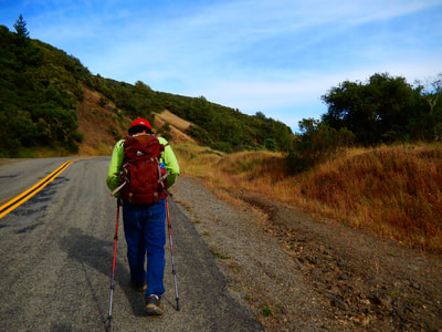
One source notes this as a 2.8 mile loop trail. Slightly under one mile of that is the Azalea Hill Trail leading to the northwest side of Alpine Lake, at it’s narrow northern end. Most of the rest of the hike is along a path (that does not show up on many of the maps, but it’s there) along the north side of Alpine Lake. About 1.6 miles of the hike (I’m seeing mixed numbers on varying maps) follows along the north side of Alpine Lake, which is a fairly flat walk. When the lakeside path turns northwest at the upper sharp jutting point on the west side of Alpine Lake, it starts going uphill and gets a bit rocky. This leads up to Fairfax-Bolinas Road. From there, turn right to walk along the road to get back to the trailhead parking lot.
Considerations:
• There were no toilet facilities (including portable toilets) when I visited the Azalea Hill Trail parking lot. For those who like to make a restroom stop, one option is to make a short side trip down Sky Oaks Road and use the parking pay station toilets before continuing on Bolinas/Bolinas-Fairfax Road to the Azalea Hill Trail parking area.
• Parking fee is not required for the Azalea Hill trailhead parking lot, but is required for the Bon Tempe Lake and Lake Lagunitas parking areas.
• Parking is allowed from sunrise to sunset. Yes, it is possible to get a ticket for parking too far after sunset.
• It’s always good to check the road closure updates link noted above. Various factors cause some of the roads to be closed for months at a time.
• The Azalea Hill Trail and the trail along the north edge of Alpine Lake are mostly single track paths that are not always clearly shown on maps. The AllTrails hike web site has a map that shows the general loop, and Google Maps shows a good general image, but information varies between the varying map sources I have. The basic loop takes you from the parking area to the northern, narrow top end of Alpine Lake, and then follows that curve until it becomes a narrow point again curving west. That’s when you climb the trail up to Bolina-Fairfax Road and turn right to walk a short distance back to the parking area.
The trail:
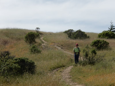
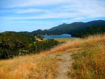
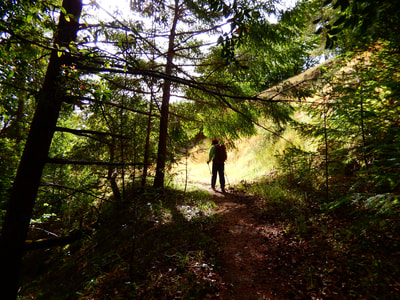
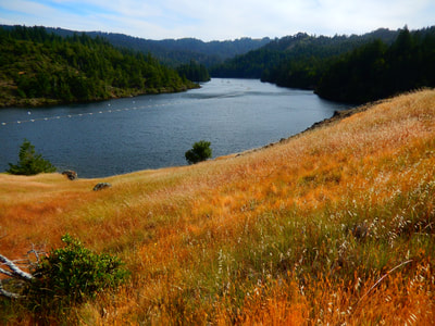
There is a wide open space that rises up and then drops down again from the trailhead, which starts right from the parking area. You can see Alpine Lake, which is the destination for a major section of the walk. The Azalea Hill Trail is not a straight shot to the lake, however, and gets a little sketchy in spots, as it drops through some tree sections with rocky parts of the trail, and then goes through open meadow and more trees to eventually reach the lake.
Once down closer to the edge of Alpine Lake, there are some rocky patches that make for a good break spot for a rest and snack. This is a very peaceful place, with fewer hikers on the trail than many other Watershed or Mount Tam trails. On a weekday, you might very well have the entire loop to yourself.
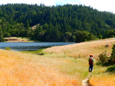
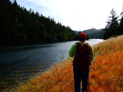
Walk along the single path trail that follows the edge of the lake, with the water at your left and hills to your right. There will be little stretches with tree cover, but mostly there are grassy open areas along the lake.
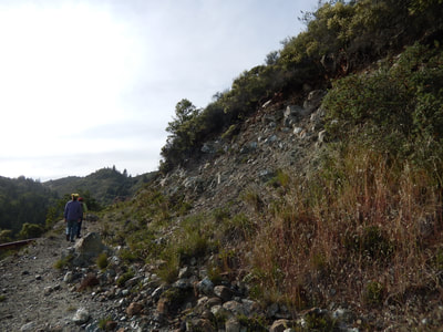
When the trail veers to the right to follow the sharp curve of the lake, this is your indication to watch for the rocky uphill climb to start as you follow the narrow point of that section of Alpine lake, and continue straight on up to the roadway.
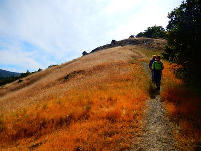
It gets rockier and hillier for this stretch, and the road is not easily visible as you are rising from below it. You can see the narrow point of Alpine Lake down to your left, which means you’re on the right track to just head upward to the road.
You will be back on Bolinas-Fairfax Road. Turn right and walk the short distance back to the trailhead parking area.
(Azalea Hill and Alpine Lake Trail Hike Notes originally paired with Insights post Man Down.)
Click Insights/Hike Update News for inspiring reflections. Browse hikes on the main Hikes page or on the Hike Search by Area page. Check out selected articles and interviews under Media. Click World Walks to see or share favorite family-friendly walks! Stay in touch with Lisa Louis and HikingAutism via Contact. See products with inspiring designs that support the efforts of HikingAutism under Support/Shop. The Links page lists a loose collection of helpful information links.
Check the Home page for the broader background story. If you’re not able to take one of these Northern California hikes, hopefully you can enjoy the photo galleries at the bottom of each hike page! Feel free to share and follow on Facebook at HikingAutism, follow on Twitter at @HikingAutism and Instagram at lisalouis777
