Tennessee Valley, Mill Valley, Marin County, California
(scroll to bottom for photo gallery)
Location: From Route 101 (north of the Golden Gate Bridge), take Mill Valley/Stinson Beach/Hwy. 1 exit. Follow the Shoreline Highway until you see the Tennessee Valley Rd. sign, take the left turn, and follow the winding road until you reach the parking area.
(Information links are sometimes changed at the source unexpectedly. We do our best to update.)
Tennessee Valley information:
https://www.nps.gov/goga/planyourvisit/tennessee_valley.htm
Tennessee Valley Disability Accessibility information (scroll down):
https://www.nps.gov/goga/planyourvisit/tennessee-valley-accessibility.htm
Maps with trails (Marin Headlands, includes Tennessee Valley trails):
https://www.nps.gov/goga/planyourvisit/upload/map-mahe-4c-2022-01-22_web.pdf
Distance: The Tennessee Valley Trail is 1.7 miles from the parking lot to Tennessee Beach, rounded up to about 3.5 miles round trip if you consider ambling around on the beach a bit.
Considerations: When at the beach: Do not turn your back on the ocean. A waterline that is twenty feet away one moment can be a sneaker wave knocking you over or sweeping away your gear 30 seconds later.
This is a popular hike because the trails are not steep and it is very family friendly. Parking is always easier on weekdays or when arriving early on weekends.
Restrooms are available at the parking area.
The trail:
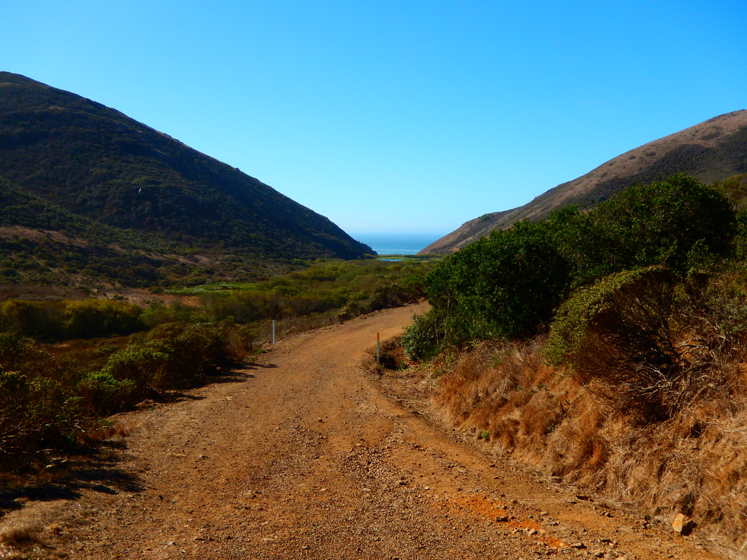
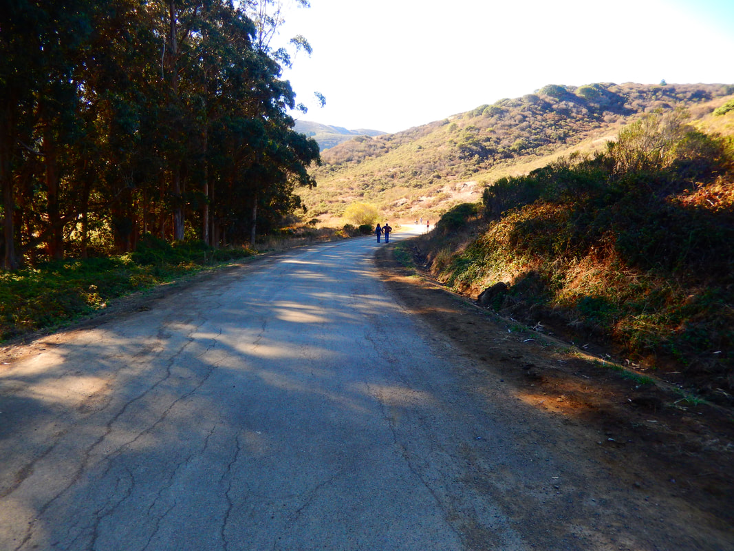
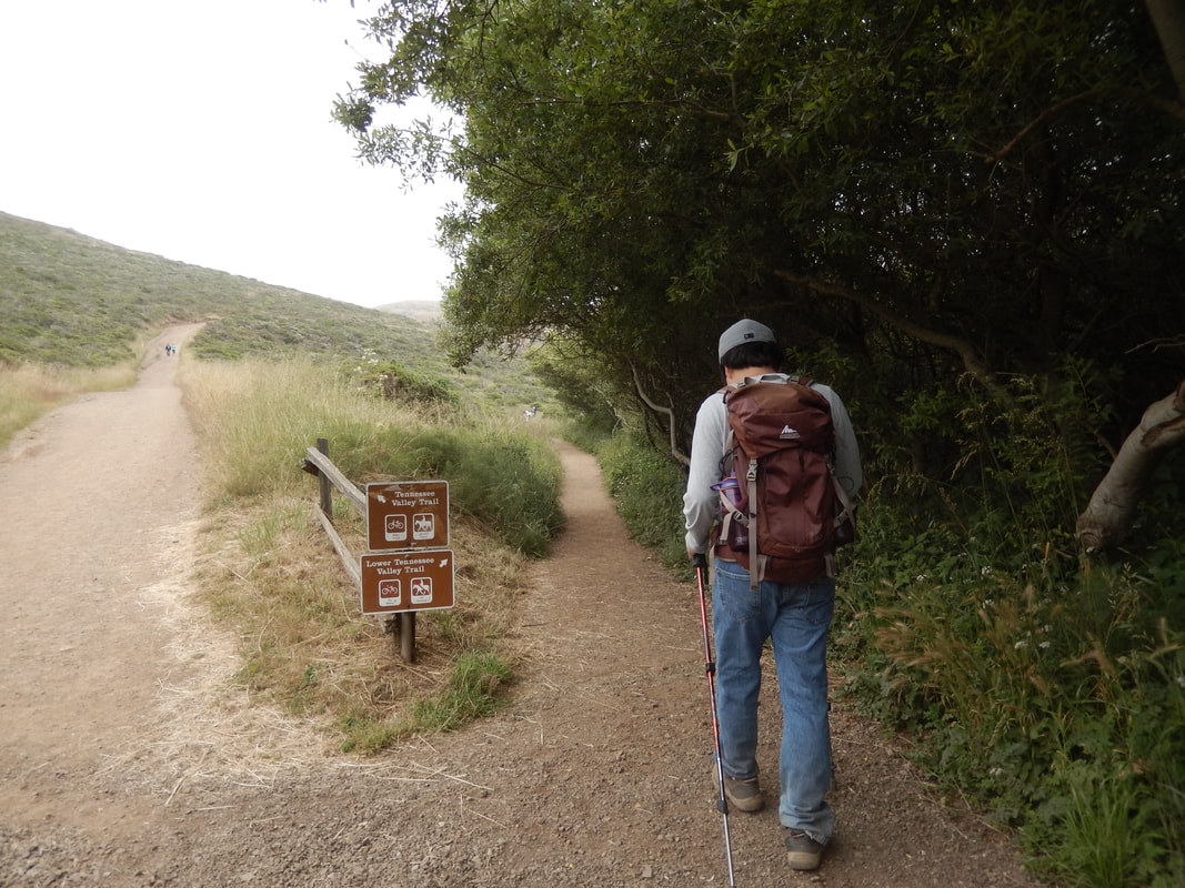
From the parking area, continue along the paved roadway that passes eucalyptus trees and horse stables on the left and a path to Haypress Campground on the right. The paved path becomes a broad, fairly smooth dirt pathway that wends its way to Tennessee Beach.
Tennessee Valley Trail is the upper trail hugging the hills on the right, which we always enjoy walking on the way out to the beach.
On the way back from the beach, we often take the right fork in the path marked as the Lower Tennessee Valley Trail, which ambles through a low chaparral area that is flatter but has a wider variety of flowers and plants to look at.
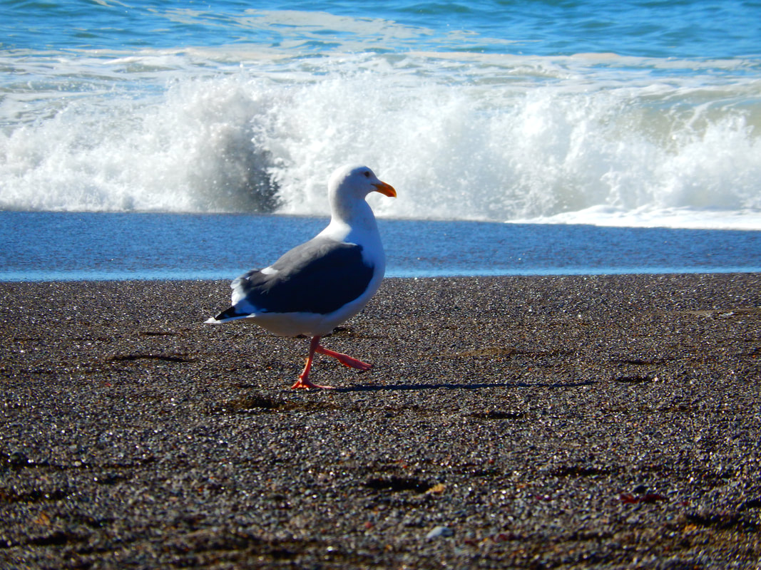
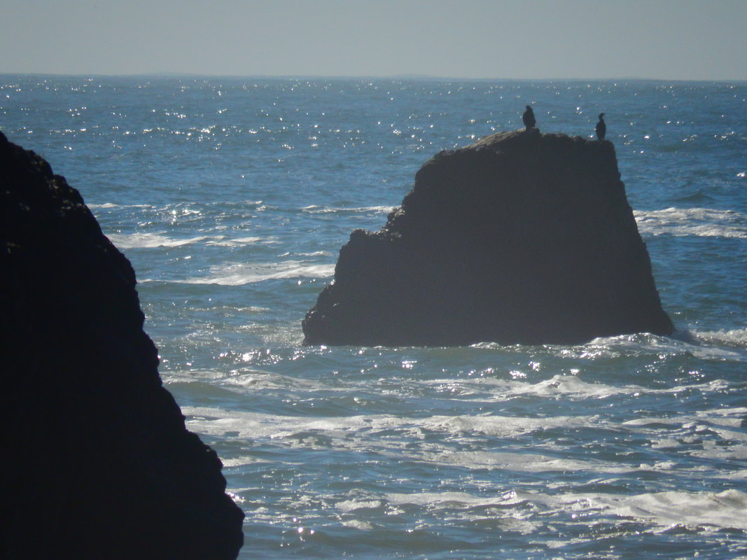
There are raptors flying over the trail and seabirds at the beach. Larger local mammals include deer, coyote, bobcats, and reports of mountain lion sightings.
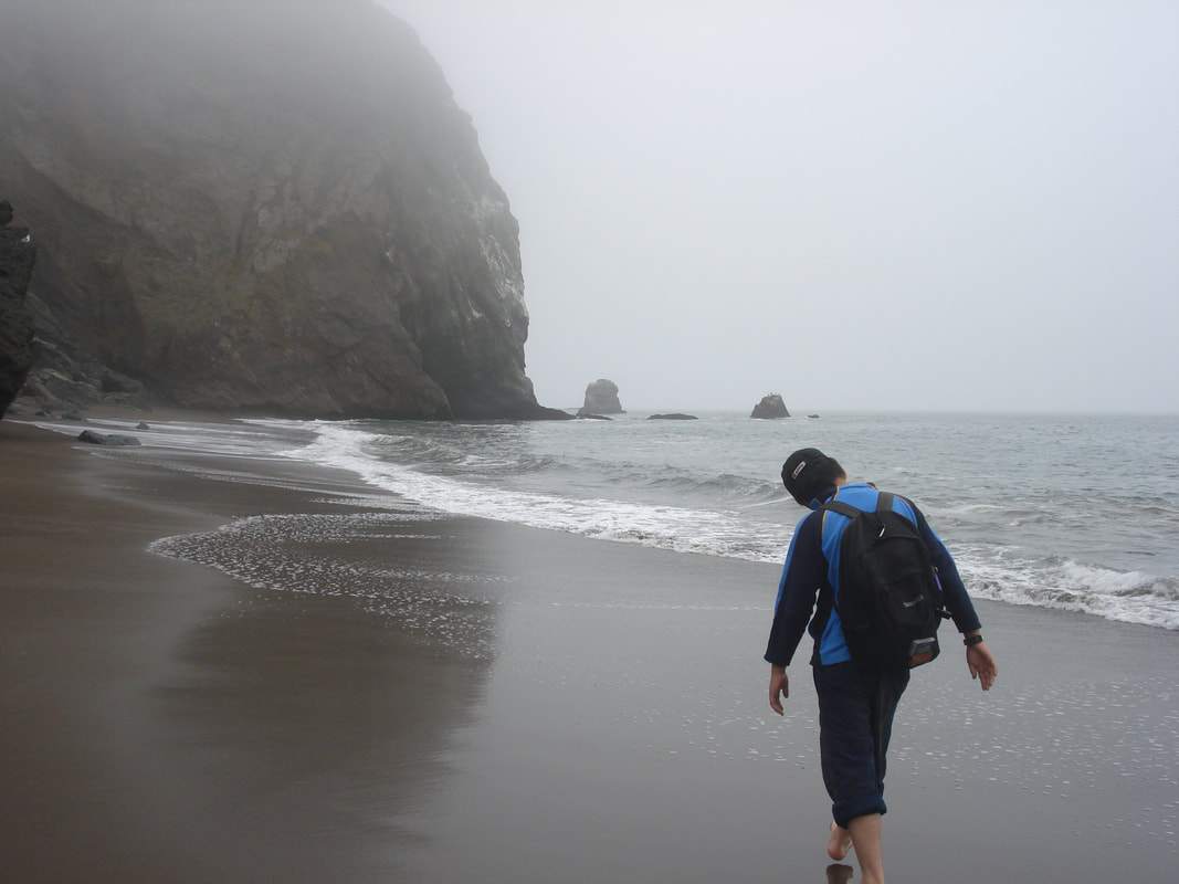
The geological formations at Tennessee Beach are fascinating. Much information can be found online, including a report of the collapse of the iconic rock arch that was there the first time I visited in 2012 but crumbled away in 2013.
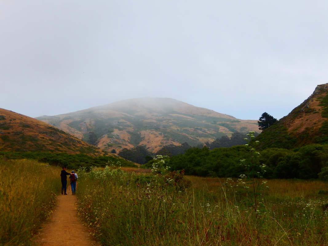
Overall, this is a family friendly hike that does not require steep climbs, making it a popular place not only for this main trail, but for the numerous trails that branch off for more challenging hikes. Photos include sunny days and overcast, crowded days and beach-to-ourselves days, to get an overall sense.
(Tennessee Valley Hike Notes were originally paired with the “Help! (to the tune of the Beatles classic)” Insights post.)
Click Insights/Hike Update News for inspiring reflections. Browse hikes on the main Hikes page or on the Hike Search by Area page. Check out selected articles and interviews under Media. Click World Walks to see or share favorite family-friendly walks! Stay in touch with Lisa Louis and HikingAutism via Contact. See products with inspiring designs that support the efforts of HikingAutism under Support/Shop. The Links page lists a loose collection of helpful information links.
Check the Home page for the broader background story. If you’re not able to take one of these Northern California hikes, hopefully you can enjoy the photo galleries at the bottom of each hike page! Feel free to share and follow on Facebook at HikingAutism, follow on Twitter at @HikingAutism and Instagram at lisalouis777
(scroll to bottom for photo gallery)
Location: From Route 101 (north of the Golden Gate Bridge), take Mill Valley/Stinson Beach/Hwy. 1 exit. Follow the Shoreline Highway until you see the Tennessee Valley Rd. sign, take the left turn, and follow the winding road until you reach the parking area.
(Information links are sometimes changed at the source unexpectedly. We do our best to update.)
Tennessee Valley information:
https://www.nps.gov/goga/planyourvisit/tennessee_valley.htm
Tennessee Valley Disability Accessibility information (scroll down):
https://www.nps.gov/goga/planyourvisit/tennessee-valley-accessibility.htm
Maps with trails (Marin Headlands, includes Tennessee Valley trails):
https://www.nps.gov/goga/planyourvisit/upload/map-mahe-4c-2022-01-22_web.pdf
Distance: The Tennessee Valley Trail is 1.7 miles from the parking lot to Tennessee Beach, rounded up to about 3.5 miles round trip if you consider ambling around on the beach a bit.
Considerations: When at the beach: Do not turn your back on the ocean. A waterline that is twenty feet away one moment can be a sneaker wave knocking you over or sweeping away your gear 30 seconds later.
This is a popular hike because the trails are not steep and it is very family friendly. Parking is always easier on weekdays or when arriving early on weekends.
Restrooms are available at the parking area.
The trail:
From the parking area, continue along the paved roadway that passes eucalyptus trees and horse stables on the left and a path to Haypress Campground on the right. The paved path becomes a broad, fairly smooth dirt pathway that wends its way to Tennessee Beach.
Tennessee Valley Trail is the upper trail hugging the hills on the right, which we always enjoy walking on the way out to the beach.
On the way back from the beach, we often take the right fork in the path marked as the Lower Tennessee Valley Trail, which ambles through a low chaparral area that is flatter but has a wider variety of flowers and plants to look at.
There are raptors flying over the trail and seabirds at the beach. Larger local mammals include deer, coyote, bobcats, and reports of mountain lion sightings.
The geological formations at Tennessee Beach are fascinating. Much information can be found online, including a report of the collapse of the iconic rock arch that was there the first time I visited in 2012 but crumbled away in 2013.
Overall, this is a family friendly hike that does not require steep climbs, making it a popular place not only for this main trail, but for the numerous trails that branch off for more challenging hikes. Photos include sunny days and overcast, crowded days and beach-to-ourselves days, to get an overall sense.
(Tennessee Valley Hike Notes were originally paired with the “Help! (to the tune of the Beatles classic)” Insights post.)
Click Insights/Hike Update News for inspiring reflections. Browse hikes on the main Hikes page or on the Hike Search by Area page. Check out selected articles and interviews under Media. Click World Walks to see or share favorite family-friendly walks! Stay in touch with Lisa Louis and HikingAutism via Contact. See products with inspiring designs that support the efforts of HikingAutism under Support/Shop. The Links page lists a loose collection of helpful information links.
Check the Home page for the broader background story. If you’re not able to take one of these Northern California hikes, hopefully you can enjoy the photo galleries at the bottom of each hike page! Feel free to share and follow on Facebook at HikingAutism, follow on Twitter at @HikingAutism and Instagram at lisalouis777