Mount Davidson
(scroll to bottom for photo gallery)
Location:
Mount Davidson’s main trailhead access is close to an intersection of several streets: Myra, Sherwood, Lansdale, and Dalewood.
Mount Davidson
(scroll to bottom for photo gallery)
Location:
Mount Davidson’s main trailhead access is close to an intersection of several streets: Myra, Sherwood, Lansdale, and Dalewood.
Starting Point:
The official trailhead address is 39 Dalewood Way. There is a gate blocking vehicle entrance to a wide dirt fire road, which walkers can easily enter. Our preferred starting point is the narrower trail just up Dalewood with a bus stop near the entrance, near the intersection of Myra, Sherwood, Lansdale, and Dalewood. Walkers can also drive around the perimeter of Mount Davidson and search for paths and stairs for an added adventure exploring, but this is the main trailhead.
Info links:
For all web links, if a link doesn’t jump directly, copy and paste into browser.
Mount Davidson information and trail map link (Mount Davidson Cross):
https://www.mountdavidsoncross.org/visit
Mount Davidson information link (SF Rec and Park):
https://sfrecpark.org/Facilities/Facility/Details/Mt-Davidson-Park-190
Another suggested resource:
Mount Davidson information link (MtDavidson.org):
https://mtdavidson.org/mount-davidson-park/
Distance:
The distance from the main trailhead along the fire road to the open vista space at the top is only a quarter of a mile. This is more of a walk than a hike. Having said that, Mount Davidson covers 40 acres, and has many narrower paths and old stone stairs to explore, so visitors can make a much longer walk out of this if they wish.
Considerations:
• Street parking is along relatively narrow residential streets surrounding Mount Davidson. Check parking signs carefully, and be sure not to block driveways.
• The top of Mount Davidson is the highest point in San Francisco (variously noted as 927 to 938 feet). Some trails are steeper than others, and the main fire road is a relatively gentle incline.
• Poison oak: Steer clear, and keep a scrub like Technu handy.
• Pay attention to wildlife postings, particularly coyote updates.
• No toilet facilities available.
• The top of Mount Davidson is famous for its large concrete cross. The city sold the land in 1997 to avoid legal issues regarding church versus state.
The trail:
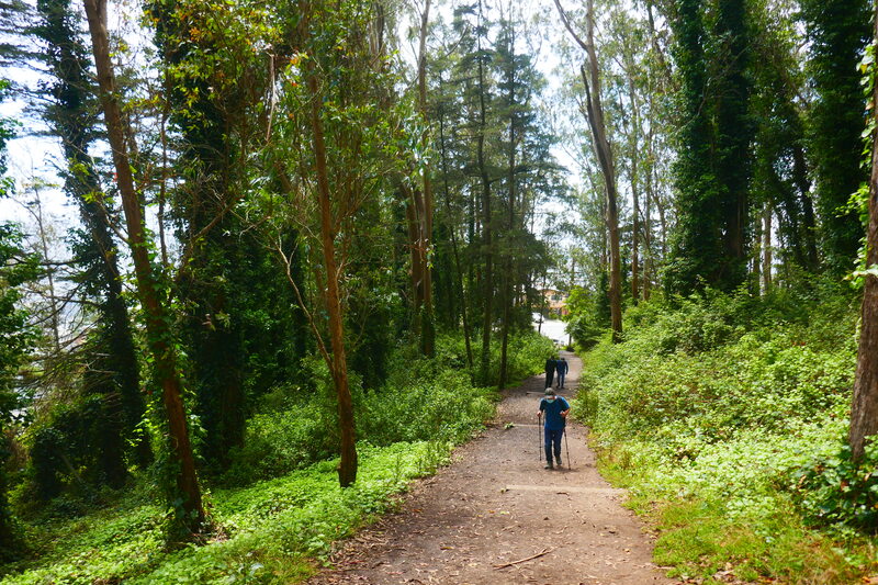
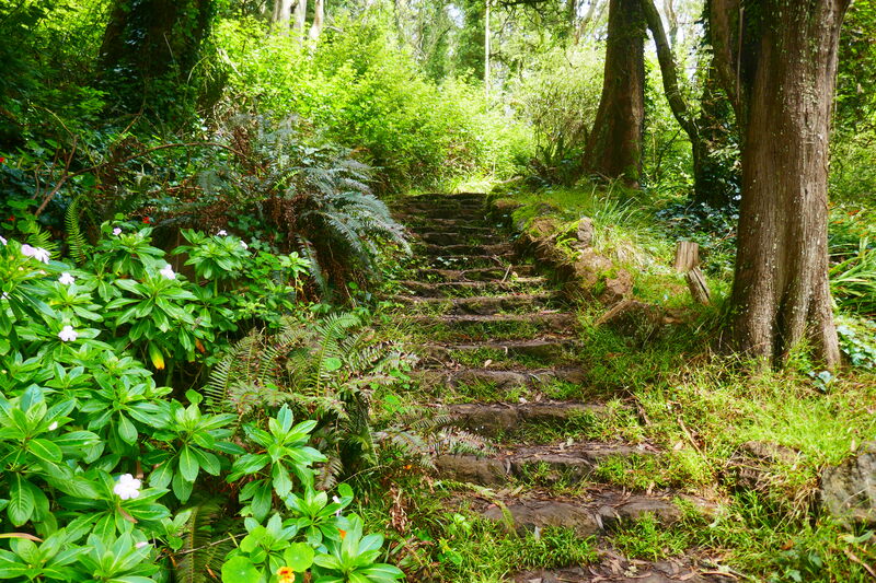
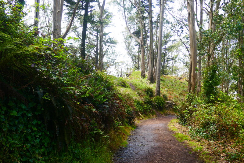
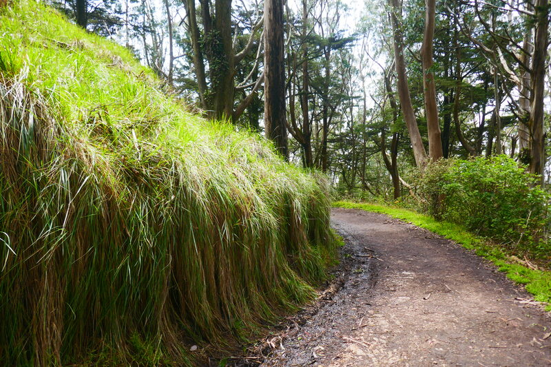
Our preference is to ascend Mount Davidson from the narrower trail that starts near the bus stop. Mount Davidson is host to a wide variety of plant life, from eucalyptus trees and coyote brush to long grasses which line the earthy, damp stretch descending back toward the main trailhead. Blackberry bushes, a variety of flowers, and rich green grasses line areas of old stone steps which beckon walkers to explore side paths.
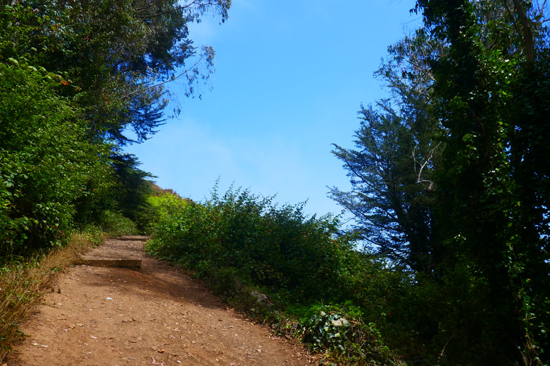
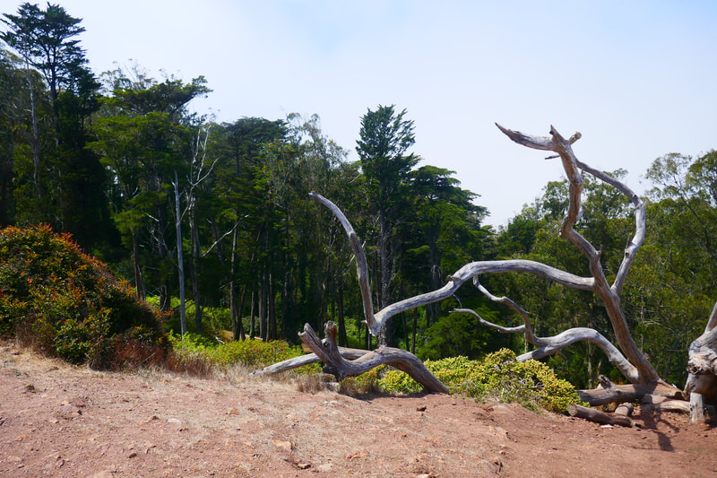
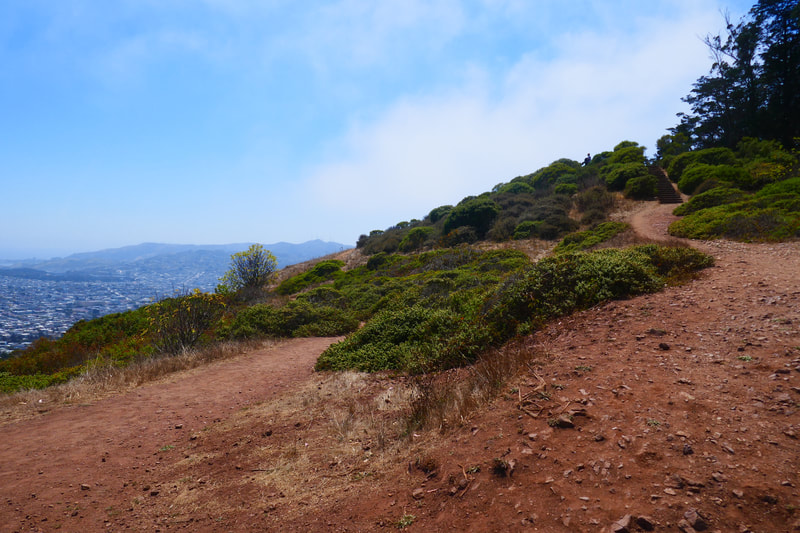
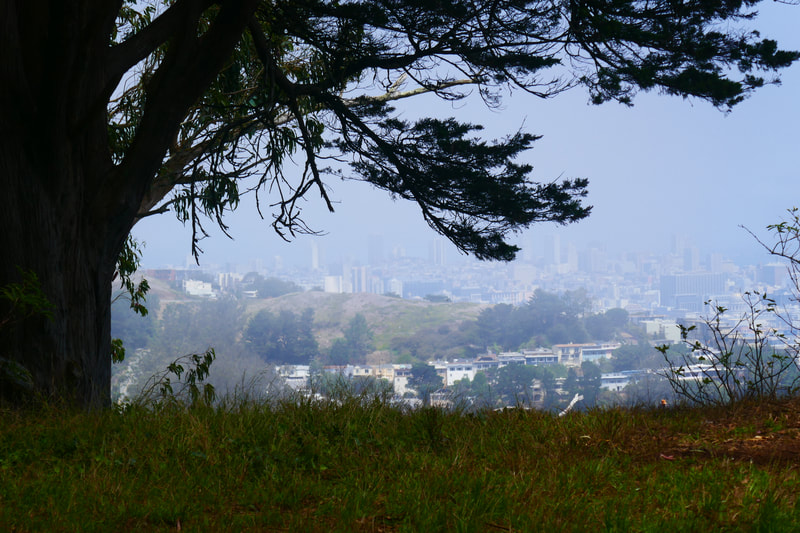
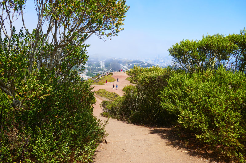
Climbing from the bus stop trailhead, walkers make their way up through a forested area, which eventually opens up into a cityscape view. The wide vista area near the top is marked by a photogenic downed tree, which offers a resting spot for looking at the views.
Looking to the next level up, a red earth path leads walkers to a scenic set of stairs. The view from this top level is soon covered by trees again. Look through the trees to spot the huge cross that is such a big part of Mount Davidson’s history. The concrete cross was built during the Depression in 1934, and has long been known as an Easter sunrise celebration spot. In 1997, the land was sold to a private organization to avoid conflicts with separation of church and state laws, allowing the cross to stay.
Facing the cross, but standing back a fair distance away, there are trails on the right side that lead downward. These trails take visitors through the damper “rain forest” section of Mount Davidson, with surprisingly green, damp trails that are sometimes muddy even during San Francisco’s drier seasons. The wider dirt path leads past numerous enticing side paths and charming stone stairways, which walkers could explore. Stay on this main trail to return to the fire road gate on Dalewood. From this gate, it is a short distance back to the bus stop trail start.
Visitors can try various entry and exit points to sample the various trails and mysterious stairways of Mount Davidson, making it a popular place for locals to take neighborhood walks.
(Mount Davidson Hike Notes were originally paired with the “Hidden Oasis” Insights post.)
Click Insights/Hike Update News for inspiring reflections. Browse hikes on the main Hikes page or on the Hike Search by Area page. Check out selected articles and interviews under Media. Click World Walks to see or share favorite family-friendly walks! Stay in touch with Lisa Louis and HikingAutism via Contact. See products with inspiring designs that support the efforts of HikingAutism under Support/Shop. The Links page lists a loose collection of helpful information links.
Check the Home page for the broader background story. If you’re not able to take one of these Northern California hikes, hopefully you can enjoy the photo galleries at the bottom of each hike page! Feel free to share and follow on Facebook at HikingAutism, follow on Twitter at @HikingAutism and Instagram at lisalouis777
(scroll to bottom for photo gallery)
Location:
Mount Davidson’s main trailhead access is close to an intersection of several streets: Myra, Sherwood, Lansdale, and Dalewood.
Mount Davidson
(scroll to bottom for photo gallery)
Location:
Mount Davidson’s main trailhead access is close to an intersection of several streets: Myra, Sherwood, Lansdale, and Dalewood.
Starting Point:
The official trailhead address is 39 Dalewood Way. There is a gate blocking vehicle entrance to a wide dirt fire road, which walkers can easily enter. Our preferred starting point is the narrower trail just up Dalewood with a bus stop near the entrance, near the intersection of Myra, Sherwood, Lansdale, and Dalewood. Walkers can also drive around the perimeter of Mount Davidson and search for paths and stairs for an added adventure exploring, but this is the main trailhead.
Info links:
For all web links, if a link doesn’t jump directly, copy and paste into browser.
Mount Davidson information and trail map link (Mount Davidson Cross):
https://www.mountdavidsoncross.org/visit
Mount Davidson information link (SF Rec and Park):
https://sfrecpark.org/Facilities/Facility/Details/Mt-Davidson-Park-190
Another suggested resource:
Mount Davidson information link (MtDavidson.org):
https://mtdavidson.org/mount-davidson-park/
Distance:
The distance from the main trailhead along the fire road to the open vista space at the top is only a quarter of a mile. This is more of a walk than a hike. Having said that, Mount Davidson covers 40 acres, and has many narrower paths and old stone stairs to explore, so visitors can make a much longer walk out of this if they wish.
Considerations:
• Street parking is along relatively narrow residential streets surrounding Mount Davidson. Check parking signs carefully, and be sure not to block driveways.
• The top of Mount Davidson is the highest point in San Francisco (variously noted as 927 to 938 feet). Some trails are steeper than others, and the main fire road is a relatively gentle incline.
• Poison oak: Steer clear, and keep a scrub like Technu handy.
• Pay attention to wildlife postings, particularly coyote updates.
• No toilet facilities available.
• The top of Mount Davidson is famous for its large concrete cross. The city sold the land in 1997 to avoid legal issues regarding church versus state.
The trail:
Our preference is to ascend Mount Davidson from the narrower trail that starts near the bus stop. Mount Davidson is host to a wide variety of plant life, from eucalyptus trees and coyote brush to long grasses which line the earthy, damp stretch descending back toward the main trailhead. Blackberry bushes, a variety of flowers, and rich green grasses line areas of old stone steps which beckon walkers to explore side paths.
Climbing from the bus stop trailhead, walkers make their way up through a forested area, which eventually opens up into a cityscape view. The wide vista area near the top is marked by a photogenic downed tree, which offers a resting spot for looking at the views.
Looking to the next level up, a red earth path leads walkers to a scenic set of stairs. The view from this top level is soon covered by trees again. Look through the trees to spot the huge cross that is such a big part of Mount Davidson’s history. The concrete cross was built during the Depression in 1934, and has long been known as an Easter sunrise celebration spot. In 1997, the land was sold to a private organization to avoid conflicts with separation of church and state laws, allowing the cross to stay.
Facing the cross, but standing back a fair distance away, there are trails on the right side that lead downward. These trails take visitors through the damper “rain forest” section of Mount Davidson, with surprisingly green, damp trails that are sometimes muddy even during San Francisco’s drier seasons. The wider dirt path leads past numerous enticing side paths and charming stone stairways, which walkers could explore. Stay on this main trail to return to the fire road gate on Dalewood. From this gate, it is a short distance back to the bus stop trail start.
Visitors can try various entry and exit points to sample the various trails and mysterious stairways of Mount Davidson, making it a popular place for locals to take neighborhood walks.
(Mount Davidson Hike Notes were originally paired with the “Hidden Oasis” Insights post.)
Click Insights/Hike Update News for inspiring reflections. Browse hikes on the main Hikes page or on the Hike Search by Area page. Check out selected articles and interviews under Media. Click World Walks to see or share favorite family-friendly walks! Stay in touch with Lisa Louis and HikingAutism via Contact. See products with inspiring designs that support the efforts of HikingAutism under Support/Shop. The Links page lists a loose collection of helpful information links.
Check the Home page for the broader background story. If you’re not able to take one of these Northern California hikes, hopefully you can enjoy the photo galleries at the bottom of each hike page! Feel free to share and follow on Facebook at HikingAutism, follow on Twitter at @HikingAutism and Instagram at lisalouis777
