Mori Point, Mori Point Road, Pacifica, CA 94044
(scroll to bottom for photo gallery)
Location:
Pacifica, Mori Point Road intersecting with Route 1, just south of Sharp Park Road
Park on Mori Point Road or Bradford Way
The Mori Point sign on the west side of Route 1 is very easy to miss. Northbound on Route 1, it is shortly past the Reina Del Mar intersection and the Pacifica Police Department. Southbound on Route 1, it is just past Sharp Park Road.
(Information links are sometimes changed at the source unexpectedly. We do our best to update.)
Mori Point information:
http://www.parksconservancy.org/visit/park-sites/mori-point.html
Mori Point Accessibility information:
From the parking area to the beach along Old Mori Trail/Road is quite flat, including a wooden bridge/walkway over a marshy part of the habitat restoration area. This makes for a fairly smooth path to the ocean.
Map with trails:
http://www.parksconservancy.org/assets/visit-your-parks/pdfs/mori-point-trail-map.pdf
Distance: You can make this a half mile stroll or add some steep challenging sections to do a 1.5 mile hike to the Mori Point headlands area and back.
Considerations: As noted above, the Mori Point sign is easy to pass by. It is between Sharp Park Road and Reina Del Mar Ave.
Mori Point Road itself, which is mainly used for trailhead parking, is a short road. Bradford Way is a good parking backup.
Getting on and off Route 1 involves calculating fast traffic. Heading back north the west side of Route 1 often involves heading south first, and making a left to turn back north from the east side.
Cliffs can be unstable. Use caution in steep areas.
Mori Point now has a toilet facility near the trailhead.
The trail:
If you want an easy stroll, walk past the toilet facility onto Old Mori Trail/Road which borders houses for a stretch, then opens into an open area that then connects with the Coastal Trail to the ocean. There is a pretty little wooden walkway area over a marshy habitat restoration area.
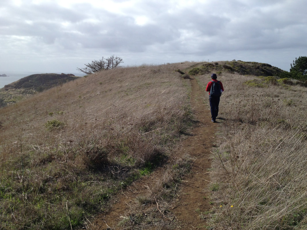
We like a little more rugged hike most days. Where Bradford Way almost connects to Route 1, walking away from the trailhead bathroom facility toward the main road, there are trail openings leading upward to the right.
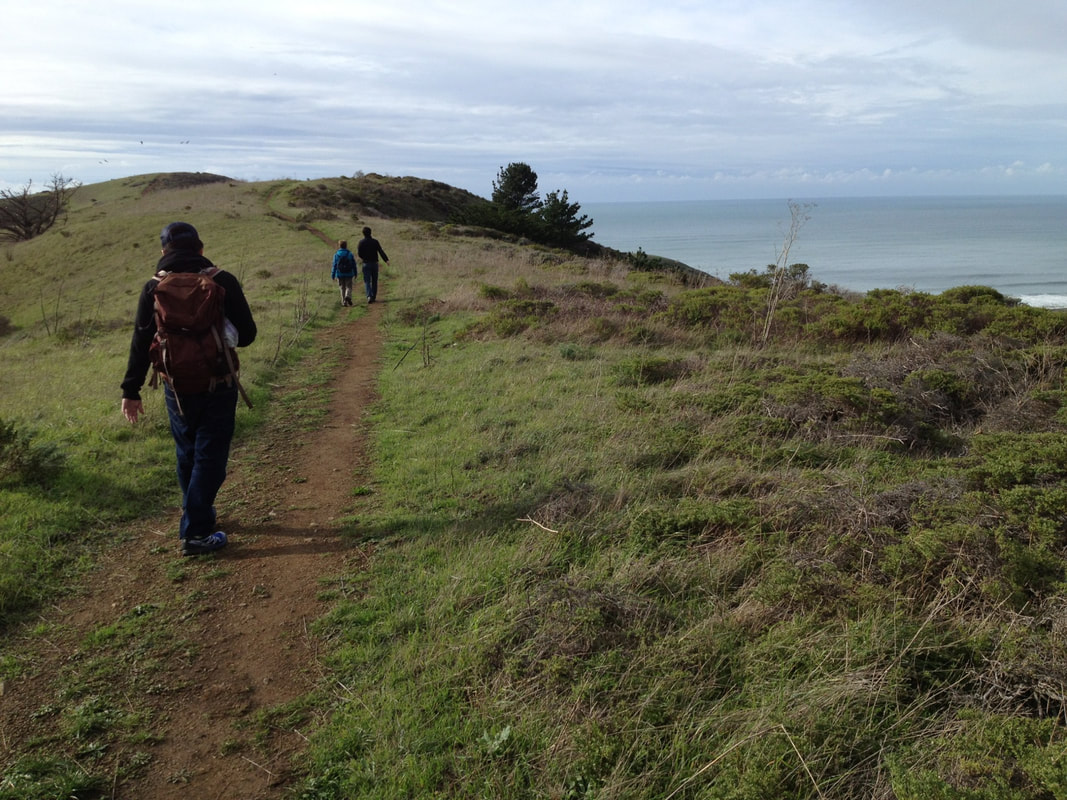
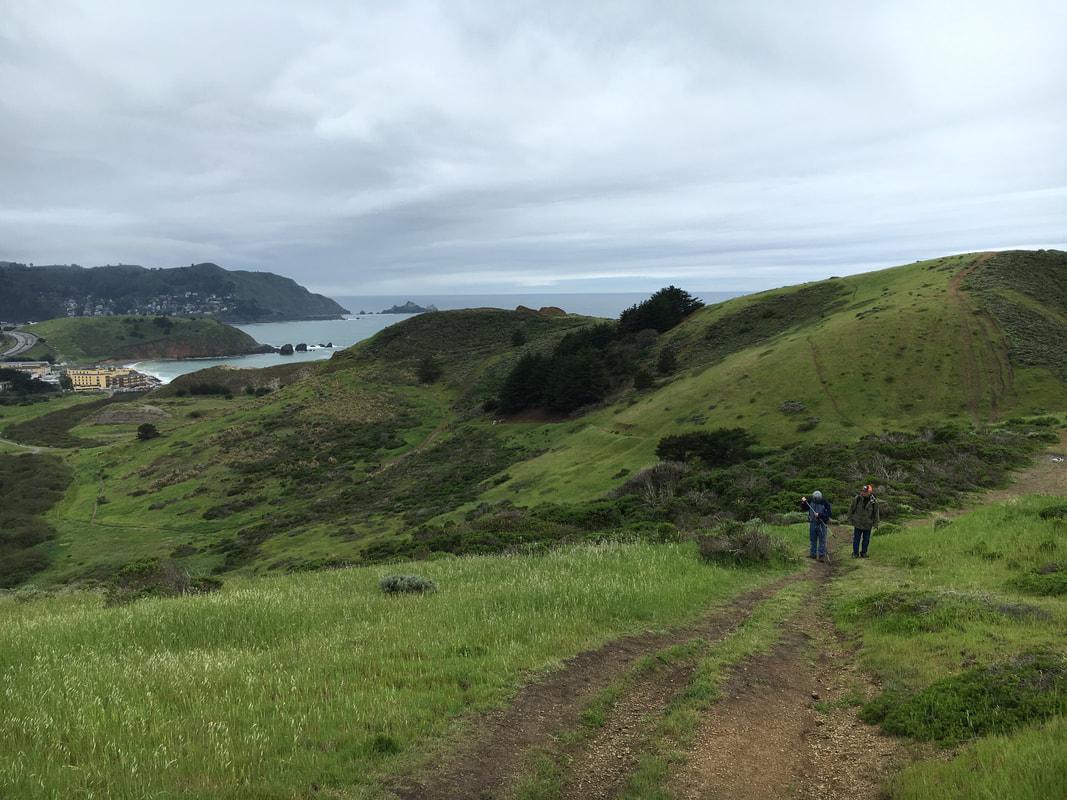
Go up the steep hill on Upper Mori Trail/Road, paralleling the road below to the right. This trail veers to the left to become what is called Lishumsha Trail on the Parks Conservancy map (link above), and then connects to the Coastal Trail.
Our favorite walk is to keep on this high trail heading the middle route straight toward the coast.
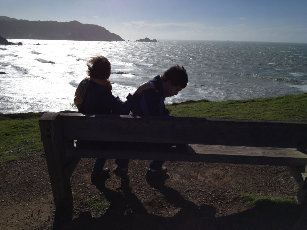
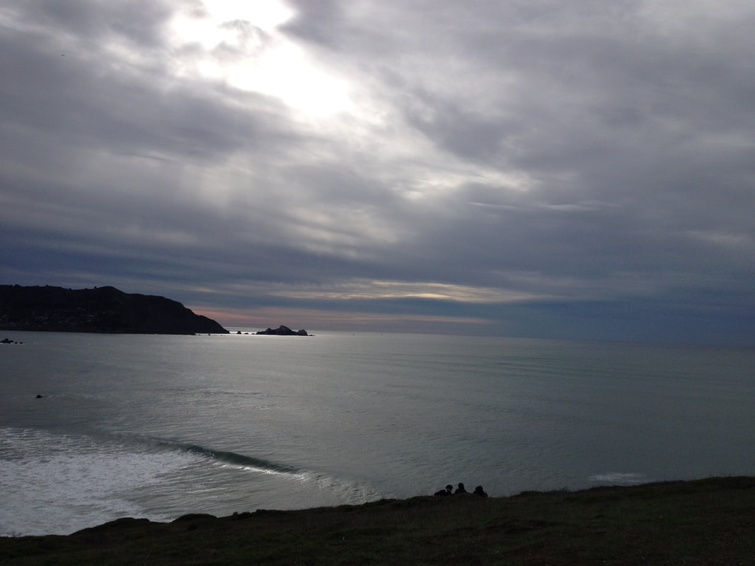
The Mori headlands area that juts out high above the sea is a great place for whale watching, catching the sunset, or having a snack break on a bench.
We love taking the Bootlegger’s Steps (yes, from Prohibition era deliveries by sea) back down the hill, and turning back to the parking area on Old Mori Trail for an easy close to a pretty loop.
Future posts will cover other Mori Point hike options.
As usual, the photo gallery here includes images from both blue sky days and overcast days. It’s beautiful either way.
(Mori Point Hike Notes were originally paired with the “Maintaining the Bright Spots” Insights post.)
Click Insights/Hike Update News for inspiring reflections. Browse hikes on the main Hikes page or on the Hike Search by Area page. Check out selected articles and interviews under Media. Click World Walks to see or share favorite family-friendly walks! Stay in touch with Lisa Louis and HikingAutism via Contact. See products with inspiring designs that support the efforts of HikingAutism under Support/Shop. The Links page lists a loose collection of helpful information links.
Check the Home page for the broader background story. If you’re not able to take one of these Northern California hikes, hopefully you can enjoy the photo galleries at the bottom of each hike page! Feel free to share and follow on Facebook at HikingAutism, follow on Twitter at @HikingAutism and Instagram at lisalouis777
(scroll to bottom for photo gallery)
Location:
Pacifica, Mori Point Road intersecting with Route 1, just south of Sharp Park Road
Park on Mori Point Road or Bradford Way
The Mori Point sign on the west side of Route 1 is very easy to miss. Northbound on Route 1, it is shortly past the Reina Del Mar intersection and the Pacifica Police Department. Southbound on Route 1, it is just past Sharp Park Road.
(Information links are sometimes changed at the source unexpectedly. We do our best to update.)
Mori Point information:
http://www.parksconservancy.org/visit/park-sites/mori-point.html
Mori Point Accessibility information:
From the parking area to the beach along Old Mori Trail/Road is quite flat, including a wooden bridge/walkway over a marshy part of the habitat restoration area. This makes for a fairly smooth path to the ocean.
Map with trails:
http://www.parksconservancy.org/assets/visit-your-parks/pdfs/mori-point-trail-map.pdf
Distance: You can make this a half mile stroll or add some steep challenging sections to do a 1.5 mile hike to the Mori Point headlands area and back.
Considerations: As noted above, the Mori Point sign is easy to pass by. It is between Sharp Park Road and Reina Del Mar Ave.
Mori Point Road itself, which is mainly used for trailhead parking, is a short road. Bradford Way is a good parking backup.
Getting on and off Route 1 involves calculating fast traffic. Heading back north the west side of Route 1 often involves heading south first, and making a left to turn back north from the east side.
Cliffs can be unstable. Use caution in steep areas.
Mori Point now has a toilet facility near the trailhead.
The trail:
If you want an easy stroll, walk past the toilet facility onto Old Mori Trail/Road which borders houses for a stretch, then opens into an open area that then connects with the Coastal Trail to the ocean. There is a pretty little wooden walkway area over a marshy habitat restoration area.
We like a little more rugged hike most days. Where Bradford Way almost connects to Route 1, walking away from the trailhead bathroom facility toward the main road, there are trail openings leading upward to the right.
Go up the steep hill on Upper Mori Trail/Road, paralleling the road below to the right. This trail veers to the left to become what is called Lishumsha Trail on the Parks Conservancy map (link above), and then connects to the Coastal Trail.
Our favorite walk is to keep on this high trail heading the middle route straight toward the coast.
The Mori headlands area that juts out high above the sea is a great place for whale watching, catching the sunset, or having a snack break on a bench.
We love taking the Bootlegger’s Steps (yes, from Prohibition era deliveries by sea) back down the hill, and turning back to the parking area on Old Mori Trail for an easy close to a pretty loop.
Future posts will cover other Mori Point hike options.
As usual, the photo gallery here includes images from both blue sky days and overcast days. It’s beautiful either way.
(Mori Point Hike Notes were originally paired with the “Maintaining the Bright Spots” Insights post.)
Click Insights/Hike Update News for inspiring reflections. Browse hikes on the main Hikes page or on the Hike Search by Area page. Check out selected articles and interviews under Media. Click World Walks to see or share favorite family-friendly walks! Stay in touch with Lisa Louis and HikingAutism via Contact. See products with inspiring designs that support the efforts of HikingAutism under Support/Shop. The Links page lists a loose collection of helpful information links.
Check the Home page for the broader background story. If you’re not able to take one of these Northern California hikes, hopefully you can enjoy the photo galleries at the bottom of each hike page! Feel free to share and follow on Facebook at HikingAutism, follow on Twitter at @HikingAutism and Instagram at lisalouis777