Devil’s Slide Trail
(scroll to bottom for photo gallery)
Location: Devil’s Slide Trail at Highway 1, Pacifica, CA 94044
Between Pacifica and Montara, San Mateo County, CA (about 15 miles south of San Francisco)
(Information links are sometimes changed at the source unexpectedly. We do our best to update.)
Devil’s Slide Trail information:
https://parks.smcgov.org/locations/visiting-devils-slide-trail
Maps with trails:
https://parks.smcgov.org/sites/parks.smcgov.org/files/DSTrailBrochure-Nov2016.pdf
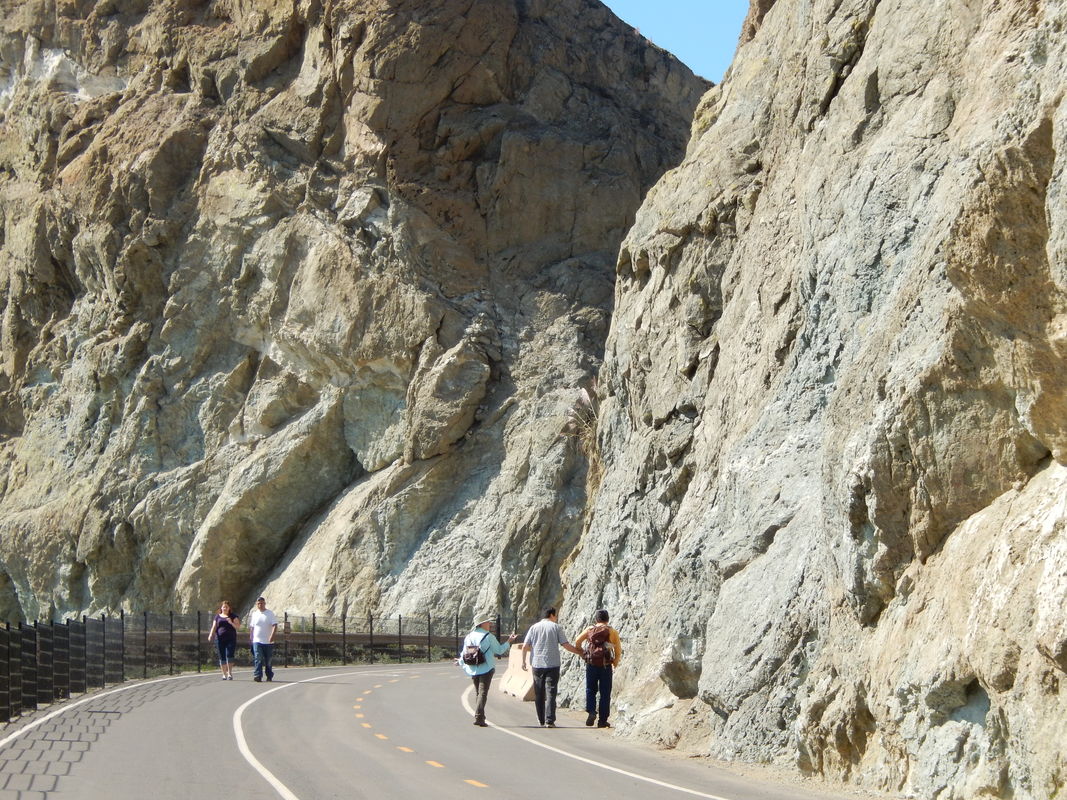
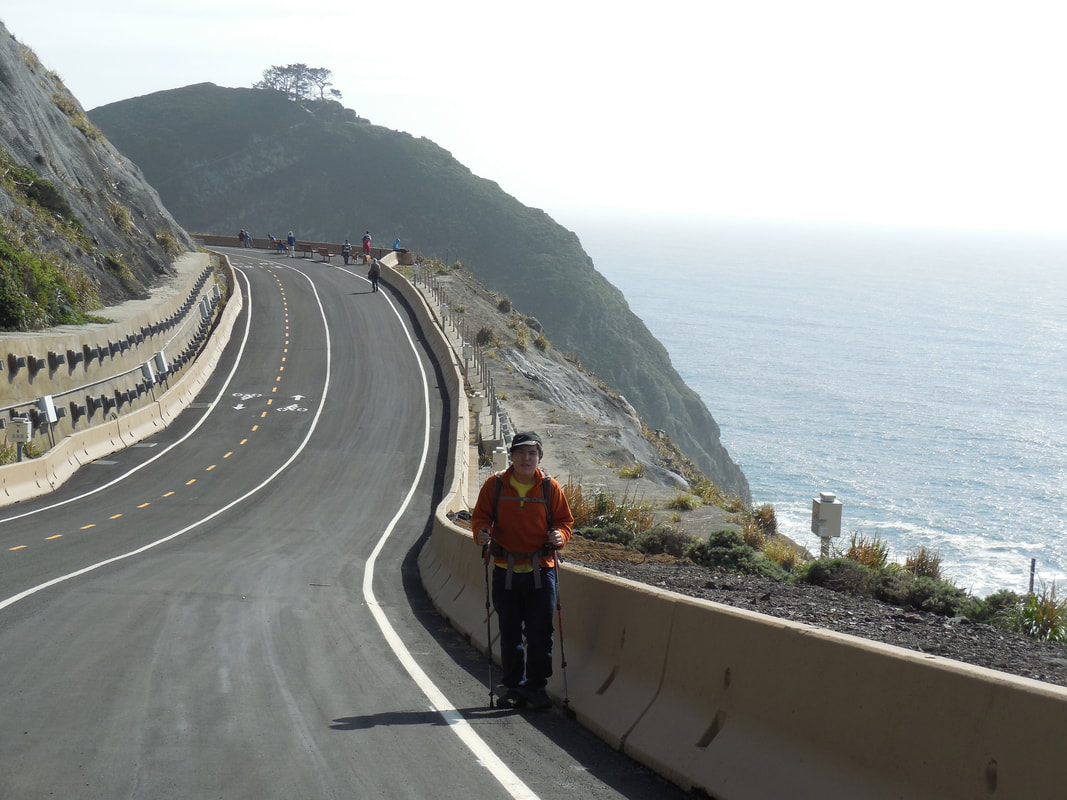
Distance: The trail is 1.3 miles, between the north and south parking lots on either side of the Tom Lantos Tunnels, 2.6 miles round trip.
Considerations: The path is a smoothly paved road, allowing hikers as well as people on bikes and scooters. Parking is limited, especially on weekends. The smaller parking lot on the north side is only accessible as you drive south on Highway 1. The larger parking lot on the south side of the tunnels is accessible whether driving northbound or southbound on Highway 1.
Restrooms are available at both parking lots.
The trail:
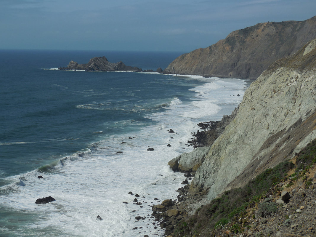
Devil’s Slide was one of the most stunning stretches of road on the California coast, but for years, local traffic reports mentioned fatal crashes off the cliffs of Devil’s Slide, or landslides closing Highway 1 for months at a time.
The opening of Tom Lantos Tunnels in 2013 bypassed the most dangerous section of road. It was a treat to walk the converted Devil’s Slide Trail on opening day in 2014.
The paved surface of the road-turned hiking path makes for smooth walking, but remember there are some steep dips and rises. The scenery makes for a great break at any point for those who need to stop and catch their breath. Take your time, climb those hills, and soak up the stunning views!
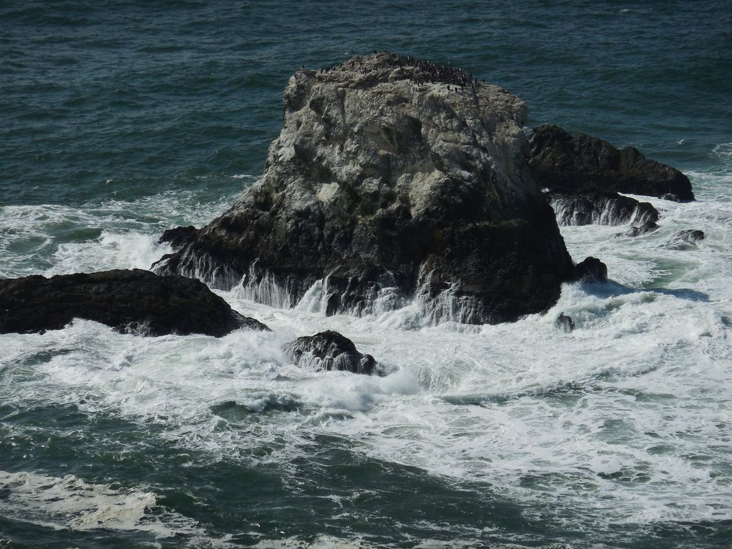
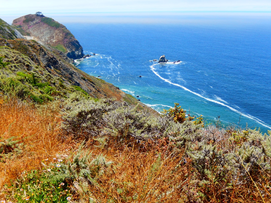
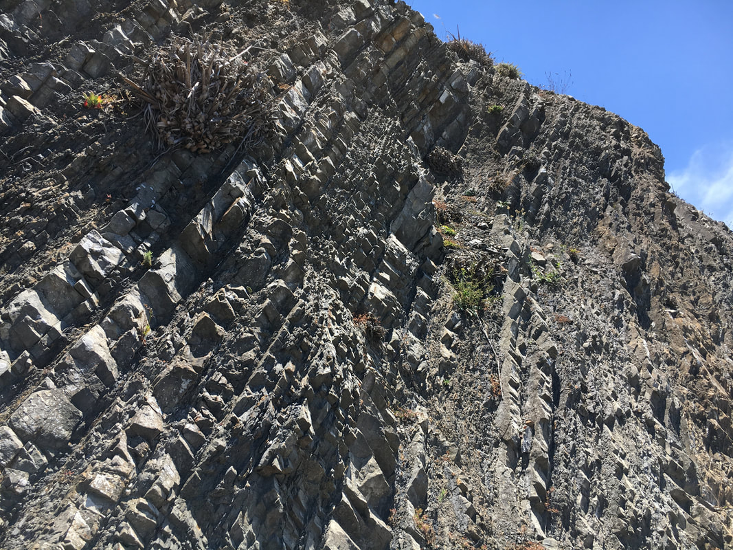
Geological formations are fascinating, whether the sometimes vertical and sometimes spiraling rock layers jutting up along the trail, or the parallel striations of San Pedro Rock jutting out from Pedro Point Headlands facing north.
Check path signs for wildlife information. A variety of raptors fly overhead, with seabirds below. Bring binoculars to catch sight of sea mammals offshore.
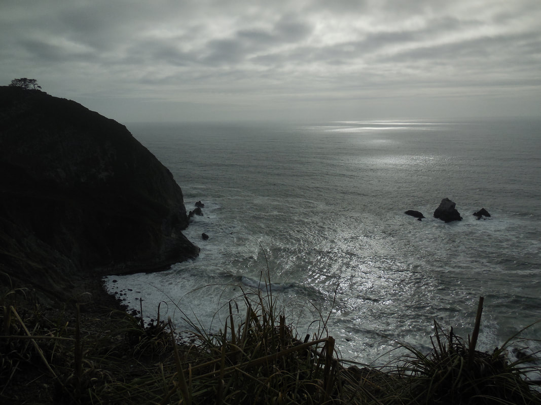
As seen in the photo gallery, the scenery is glorious whether the sky is sunny or overcast.
(Devil's Slide Hike Notes were originally paired with the “Not Just a Label” Insights post.)
Click Insights/Hike Update News for inspiring reflections. Browse hikes on the main Hikes page or on the Hike Search by Area page. Check out selected articles and interviews under Media. Click World Walks to see or share favorite family-friendly walks! Stay in touch with Lisa Louis and HikingAutism via Contact. See products with inspiring designs that support the efforts of HikingAutism under Support/Shop. The Links page lists a loose collection of helpful information links.
Check the Home page for the broader background story. If you’re not able to take one of these Northern California hikes, hopefully you can enjoy the photo galleries at the bottom of each hike page! Feel free to share and follow on Facebook at HikingAutism, follow on Twitter at @HikingAutism and Instagram at lisalouis777
(scroll to bottom for photo gallery)
Location: Devil’s Slide Trail at Highway 1, Pacifica, CA 94044
Between Pacifica and Montara, San Mateo County, CA (about 15 miles south of San Francisco)
(Information links are sometimes changed at the source unexpectedly. We do our best to update.)
Devil’s Slide Trail information:
https://parks.smcgov.org/locations/visiting-devils-slide-trail
Maps with trails:
https://parks.smcgov.org/sites/parks.smcgov.org/files/DSTrailBrochure-Nov2016.pdf
Distance: The trail is 1.3 miles, between the north and south parking lots on either side of the Tom Lantos Tunnels, 2.6 miles round trip.
Considerations: The path is a smoothly paved road, allowing hikers as well as people on bikes and scooters. Parking is limited, especially on weekends. The smaller parking lot on the north side is only accessible as you drive south on Highway 1. The larger parking lot on the south side of the tunnels is accessible whether driving northbound or southbound on Highway 1.
Restrooms are available at both parking lots.
The trail:
Devil’s Slide was one of the most stunning stretches of road on the California coast, but for years, local traffic reports mentioned fatal crashes off the cliffs of Devil’s Slide, or landslides closing Highway 1 for months at a time.
The opening of Tom Lantos Tunnels in 2013 bypassed the most dangerous section of road. It was a treat to walk the converted Devil’s Slide Trail on opening day in 2014.
The paved surface of the road-turned hiking path makes for smooth walking, but remember there are some steep dips and rises. The scenery makes for a great break at any point for those who need to stop and catch their breath. Take your time, climb those hills, and soak up the stunning views!
Geological formations are fascinating, whether the sometimes vertical and sometimes spiraling rock layers jutting up along the trail, or the parallel striations of San Pedro Rock jutting out from Pedro Point Headlands facing north.
Check path signs for wildlife information. A variety of raptors fly overhead, with seabirds below. Bring binoculars to catch sight of sea mammals offshore.
As seen in the photo gallery, the scenery is glorious whether the sky is sunny or overcast.
(Devil's Slide Hike Notes were originally paired with the “Not Just a Label” Insights post.)
Click Insights/Hike Update News for inspiring reflections. Browse hikes on the main Hikes page or on the Hike Search by Area page. Check out selected articles and interviews under Media. Click World Walks to see or share favorite family-friendly walks! Stay in touch with Lisa Louis and HikingAutism via Contact. See products with inspiring designs that support the efforts of HikingAutism under Support/Shop. The Links page lists a loose collection of helpful information links.
Check the Home page for the broader background story. If you’re not able to take one of these Northern California hikes, hopefully you can enjoy the photo galleries at the bottom of each hike page! Feel free to share and follow on Facebook at HikingAutism, follow on Twitter at @HikingAutism and Instagram at lisalouis777