Bootjack Trail-Mountain Theater to Bootjack Campground
(scroll to bottom for photo gallery)
Location: Mount Tamalpais State Park: Hikers can start from Mountain Theater and go down, or start from Bootjack Campground parking area and go up.
Starting Point: Parking to start from Mountain Theater is available at the Quarry Parking Lot off E. Ridgecrest Blvd., and to start from Bootjack Campground is from Bootjack parking area, 895 Panoramic Highway, Mill Valley, CA 94941
Info links:
For all web links, if a link doesn’t jump directly, copy and paste into browser.
For online map application searches, input “Mt. Tam” “Mountain Theater,” “Quarry Parking Lot,” or “Bootjack Campground Parking”
Mount Tamalpais State Park info link (CA State Parks):
https://www.parks.ca.gov/?page_id=471
Muir Woods and Vicinity Trail Map (National Park Service):
https://www.nps.gov/goga/planyourvisit/upload/map-muwo-trail-2019-small.pdf
Mount Tamalpais brochure with map (California State Parks):
https://www.parks.ca.gov/pages/471/files/MountTamalpaisSPFinalWebLayout110816.pdf
Distance:
The distance for Bootjack Trail between the Bootjack Campground and the Mountain Theater is noted as 0.8 miles. We did that section as a descending return segment that started with an off-trail hike to ascend (see Mountain Theater from Bootjack Campground). Going up and back from the Campground on the same trail would make a round trip of 1.6 miles. For those who wish to start from the top, add a bit more distance from the Quarry Parking Lot to the Mountain Theater where the Bootjack Trail starts. It’s easier going down than coming back up, so we started our hike from the bottom and ended by going down! The other major trail that could make this a loop hike is the Easy Grade Trail.
Considerations:
(We started from the bottom at Bootjack Campground parking lot, so this information applies to that trailhead start)
• The parking area is fairly large, but as is the case at many trailheads, it gets more crowded on weekends.
• There are toilets at the trailhead parking area.
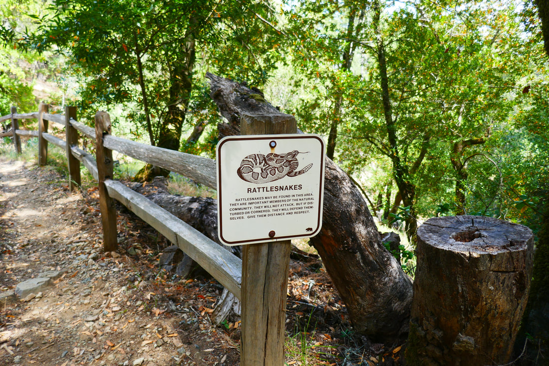
• Follow health, safety signs, and wildlife information signs.
• Having a poison oak scrub like Technu is handy for any trail.
• As with any Bay Area outing, bring layers. You may be hot in the sun one moment and shivering under fog and a chilly breeze the next.
The trail:
This is basically a companion piece to previous Hike Notes, Mountain Theater from Bootjack Campground, in which we accidentally went off trail straight up the mountain and then made our way back down along Bootjack Trail. The photo gallery and description here are the descent from the theater to the Bootjack parking area.
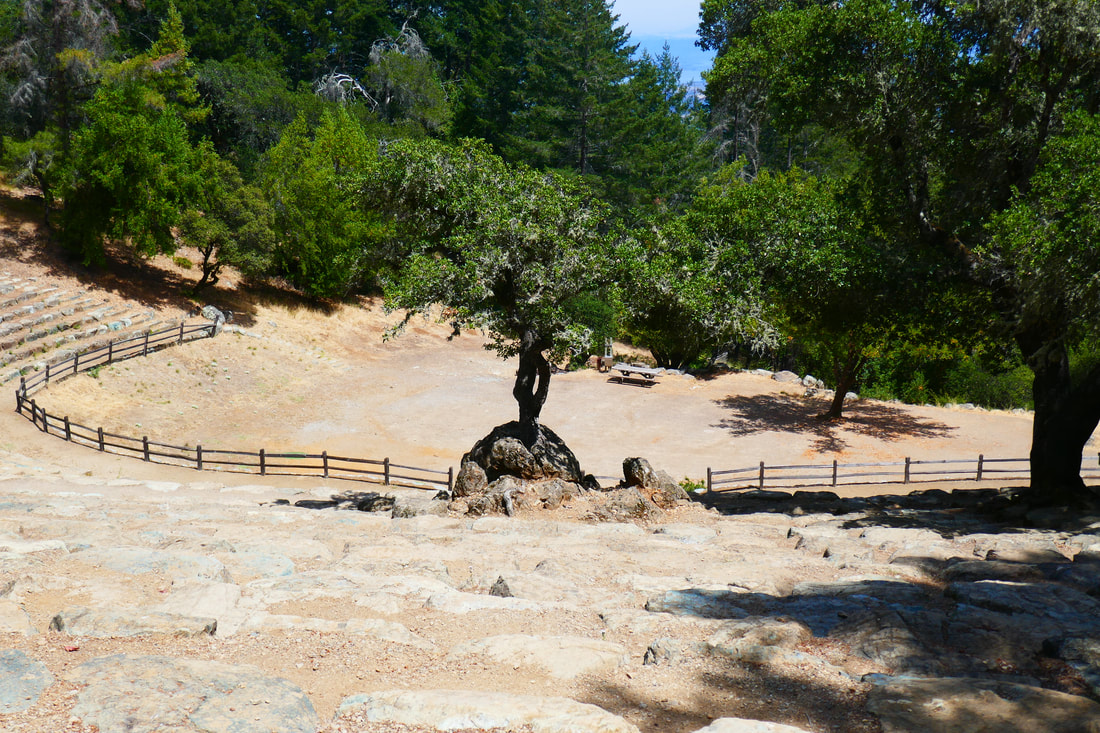
The Mountain Theater is a junction area for trails in various directions. Though we’d reached the Mountain Theater mostly via an unmarked trail, we easily found signs that led us to the theater, and once there, we saw trail signs for Bootjack Trail to head back down.
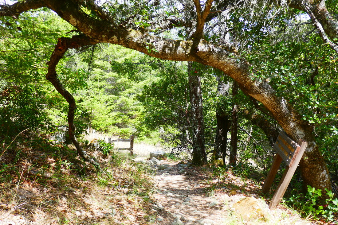
I was reminded to be cautious when we saw a wildlife sign about rattlesnakes. Though we did not encounter any rattlesnakes, we did see some lizards.
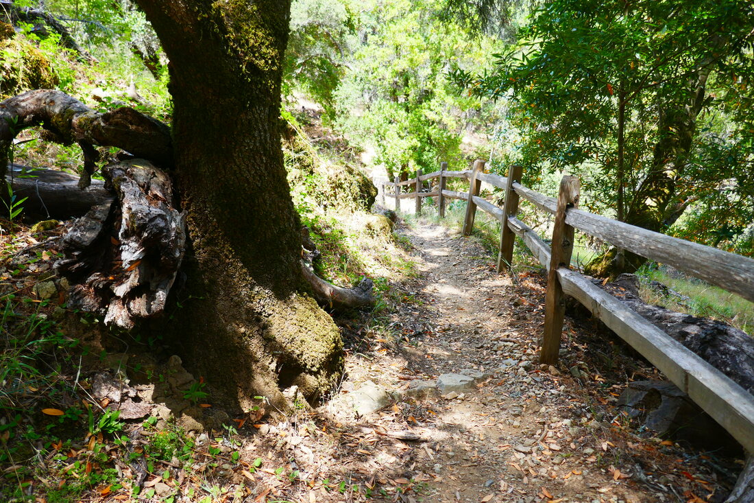
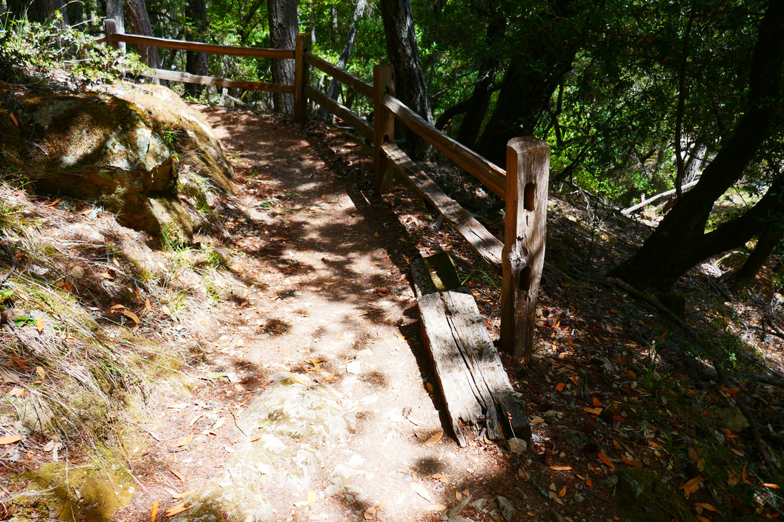
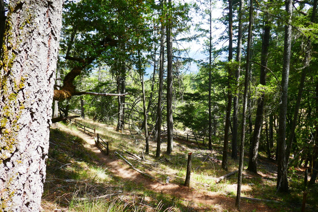
I wanted to try this section of the Bootjack Trail because it looked like a sharp zigzag switchback trail on the map, which I always enjoy hiking on. After our barely-there trail ascending, it was a big change to not only have a well-marked trail, but to have wooden fencing along much of it.
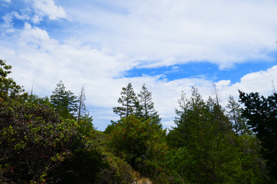
This section of the Bootjack Trail (the full trail continues all the way to Bridge 4 in Muir Woods) is only 0.8 miles, but offers a mixture of open sky, deciduous trees, and darker forest stretches.
I love steps in the middle of a forest hike, and Bootjack started at the top with some stone steps and offered wooden steps when approaching the campground parking area.
The creek bed where Bootjack Creek runs in non-drought years was visible on some parts of the trail, but the creek was dry during our hike.
As anticipated, there were plenty of switchback turns along the dirt path, often adorned by scattered leaves and shadows. This was an easy 0.8 miles because we took the trail downhill. Having said that, switchbacks in trails are designed to make ascents less steep, so this would have been an easier climb than the straight-up trail we took ascending.
It was enjoyable seeing this part of Bootjack Trail, and I look forward to trying the section between Bootjack Campground and Muir Woods one day.
(Bootjack Trail-Mountain Theater to Bootjack Campground Hike Notes were originally paired with the “Finding Our Feet” Insights post.)
Click Insights/Hike Update News for inspiring reflections. Browse hikes on the main Hikes page or on the Hike Search by Area page. Check out selected articles and interviews under Media. Click World Walks to see or share favorite family-friendly walks! Stay in touch with Lisa Louis and HikingAutism via Contact. See products with inspiring designs that support the efforts of HikingAutism under Support/Shop. The Links page lists a loose collection of helpful information links.
Check the Home page for the broader background story. If you’re not able to take one of these Northern California hikes, hopefully you can enjoy the photo galleries at the bottom of each hike page! Feel free to share and follow on Facebook at HikingAutism, follow on Twitter at @HikingAutism and Instagram at lisalouis777
(scroll to bottom for photo gallery)
Location: Mount Tamalpais State Park: Hikers can start from Mountain Theater and go down, or start from Bootjack Campground parking area and go up.
Starting Point: Parking to start from Mountain Theater is available at the Quarry Parking Lot off E. Ridgecrest Blvd., and to start from Bootjack Campground is from Bootjack parking area, 895 Panoramic Highway, Mill Valley, CA 94941
Info links:
For all web links, if a link doesn’t jump directly, copy and paste into browser.
For online map application searches, input “Mt. Tam” “Mountain Theater,” “Quarry Parking Lot,” or “Bootjack Campground Parking”
Mount Tamalpais State Park info link (CA State Parks):
https://www.parks.ca.gov/?page_id=471
Muir Woods and Vicinity Trail Map (National Park Service):
https://www.nps.gov/goga/planyourvisit/upload/map-muwo-trail-2019-small.pdf
Mount Tamalpais brochure with map (California State Parks):
https://www.parks.ca.gov/pages/471/files/MountTamalpaisSPFinalWebLayout110816.pdf
Distance:
The distance for Bootjack Trail between the Bootjack Campground and the Mountain Theater is noted as 0.8 miles. We did that section as a descending return segment that started with an off-trail hike to ascend (see Mountain Theater from Bootjack Campground). Going up and back from the Campground on the same trail would make a round trip of 1.6 miles. For those who wish to start from the top, add a bit more distance from the Quarry Parking Lot to the Mountain Theater where the Bootjack Trail starts. It’s easier going down than coming back up, so we started our hike from the bottom and ended by going down! The other major trail that could make this a loop hike is the Easy Grade Trail.
Considerations:
(We started from the bottom at Bootjack Campground parking lot, so this information applies to that trailhead start)
• The parking area is fairly large, but as is the case at many trailheads, it gets more crowded on weekends.
• There are toilets at the trailhead parking area.
• Follow health, safety signs, and wildlife information signs.
• Having a poison oak scrub like Technu is handy for any trail.
• As with any Bay Area outing, bring layers. You may be hot in the sun one moment and shivering under fog and a chilly breeze the next.
The trail:
This is basically a companion piece to previous Hike Notes, Mountain Theater from Bootjack Campground, in which we accidentally went off trail straight up the mountain and then made our way back down along Bootjack Trail. The photo gallery and description here are the descent from the theater to the Bootjack parking area.
The Mountain Theater is a junction area for trails in various directions. Though we’d reached the Mountain Theater mostly via an unmarked trail, we easily found signs that led us to the theater, and once there, we saw trail signs for Bootjack Trail to head back down.
I was reminded to be cautious when we saw a wildlife sign about rattlesnakes. Though we did not encounter any rattlesnakes, we did see some lizards.
I wanted to try this section of the Bootjack Trail because it looked like a sharp zigzag switchback trail on the map, which I always enjoy hiking on. After our barely-there trail ascending, it was a big change to not only have a well-marked trail, but to have wooden fencing along much of it.
This section of the Bootjack Trail (the full trail continues all the way to Bridge 4 in Muir Woods) is only 0.8 miles, but offers a mixture of open sky, deciduous trees, and darker forest stretches.
I love steps in the middle of a forest hike, and Bootjack started at the top with some stone steps and offered wooden steps when approaching the campground parking area.
The creek bed where Bootjack Creek runs in non-drought years was visible on some parts of the trail, but the creek was dry during our hike.
As anticipated, there were plenty of switchback turns along the dirt path, often adorned by scattered leaves and shadows. This was an easy 0.8 miles because we took the trail downhill. Having said that, switchbacks in trails are designed to make ascents less steep, so this would have been an easier climb than the straight-up trail we took ascending.
It was enjoyable seeing this part of Bootjack Trail, and I look forward to trying the section between Bootjack Campground and Muir Woods one day.
(Bootjack Trail-Mountain Theater to Bootjack Campground Hike Notes were originally paired with the “Finding Our Feet” Insights post.)
Click Insights/Hike Update News for inspiring reflections. Browse hikes on the main Hikes page or on the Hike Search by Area page. Check out selected articles and interviews under Media. Click World Walks to see or share favorite family-friendly walks! Stay in touch with Lisa Louis and HikingAutism via Contact. See products with inspiring designs that support the efforts of HikingAutism under Support/Shop. The Links page lists a loose collection of helpful information links.
Check the Home page for the broader background story. If you’re not able to take one of these Northern California hikes, hopefully you can enjoy the photo galleries at the bottom of each hike page! Feel free to share and follow on Facebook at HikingAutism, follow on Twitter at @HikingAutism and Instagram at lisalouis777