Ring Mountain-Tiburon
(scroll to bottom for photo gallery)
Location: Loop Trail, Corte Madera, CA 94925 (officially Corte Madera but on the Tiburon Peninsula)
Directions: This is a fairly quick jaunt north of the Golden Gate Bridge in Marin County. There are multiple entries to this round-peaked destination. Directions below are courtesy of the Marin County Parks link for Ring Mountain Open Space Preserve:
• North access: from Hwy 101 in Corte Madera, take the exit for Tamalpais Dr east. Go straight onto San Clemente, which merges into Paradise Dr after 0.4 miles. Follow Paradise Dr approximately 1 mile (go past Westward Dr). The gate is on the right.
• South access: from Hwy 101 in Mill Valley, take the exiit for East Blithedale Ave. Go east on Tiburon Blvd and turn left at Reed Ranch Rd. MCOSD gate is at the end.
• East access: from Hwy 101 in Corte Madera, take the exit for Tamalpais Dr east. Go straight onto San Clemente, which merges into Paradise Dr after 0.4 miles. Follow Paradise Dr approximately 1.7 miles, turn right onto Taylor Rd, and follow to end (dead end).
Info/Links:
For all web links, if a link doesn’t jump directly, copy and paste into browser. (Information links are sometimes changed at the source unexpectedly. We do our best to update.)
Ring Mountain Open Space Preserve info link:
https://www.marincountyparks.org/depts/pk/divisions/open-space/ring-mountain
Ring Mountain Open Space Preserve map:
https://www.marincountyparks.org/~/media/f544bdff419b400896064894625983a8.ashx
Distance:
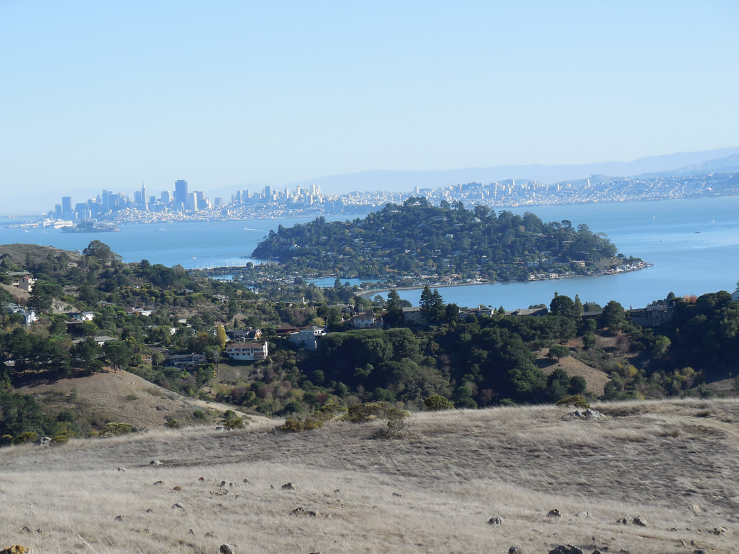
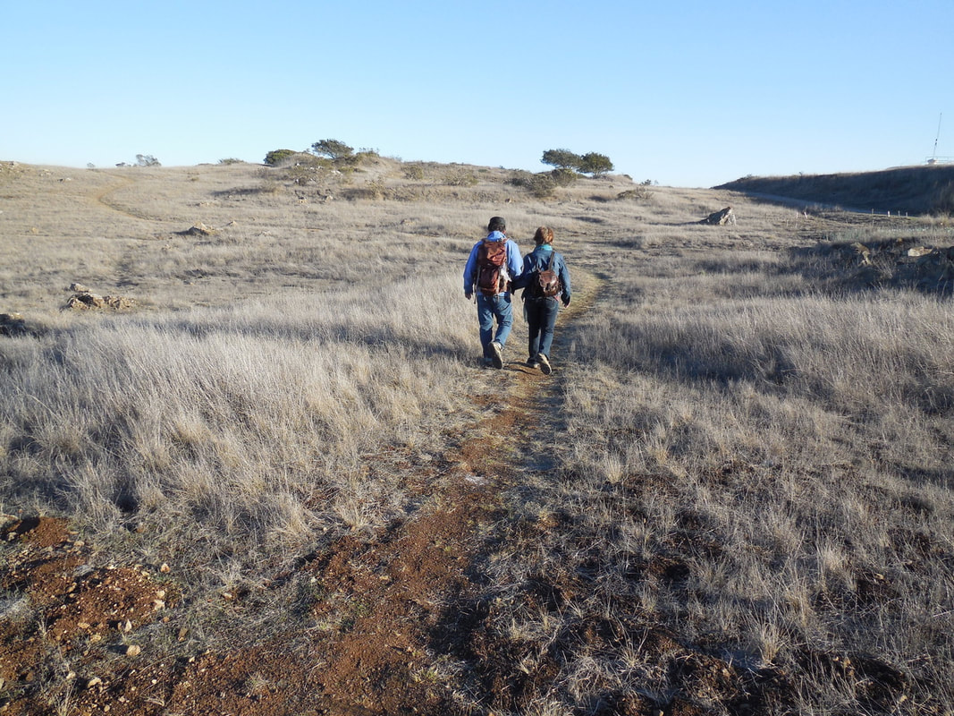
You can make an outing to Ring Mountain as long or short as you want. If you start from the north on Paradise Drive and hike up along the Phyllis Ellman Trail, you could stretch the up and back trail and some wandering around the top to see various rock formations into a two mile hike. Starting from the east on Taylor Road or from the south from Reed Ranch Road makes it possible to take shorter walk options near popular features like Turtle Rock.
Considerations:
• Hiking, biking, horse riding allowed.
• Dogs on leash only.
• No toilet facilities.
• Limited parking, though there are three main starting point options as noted above under directions.
• This is a popular rock climbing site. Have fun, but use caution.
The trail:
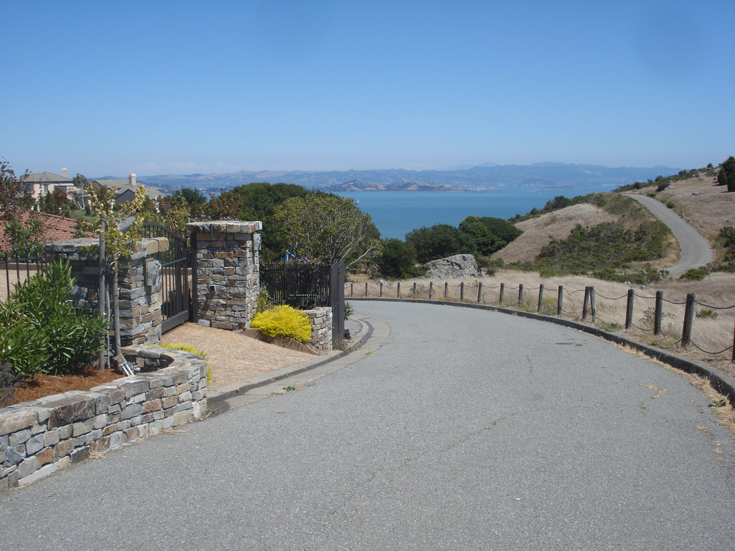
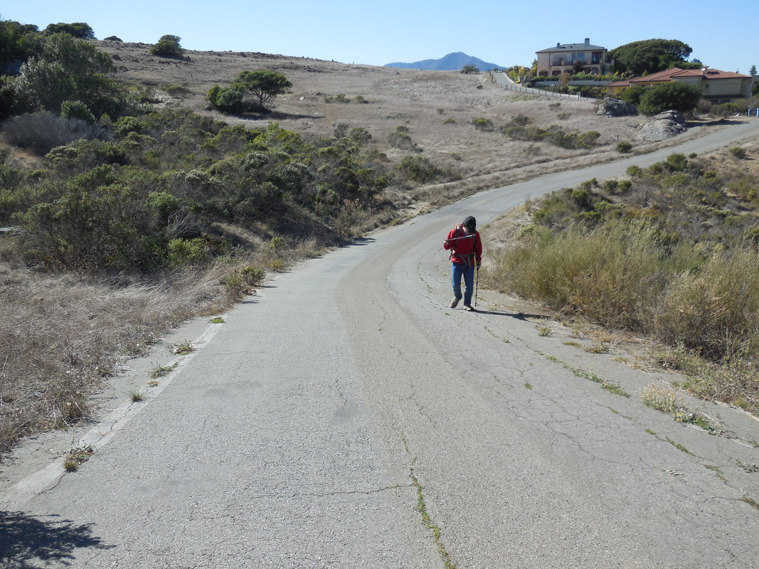
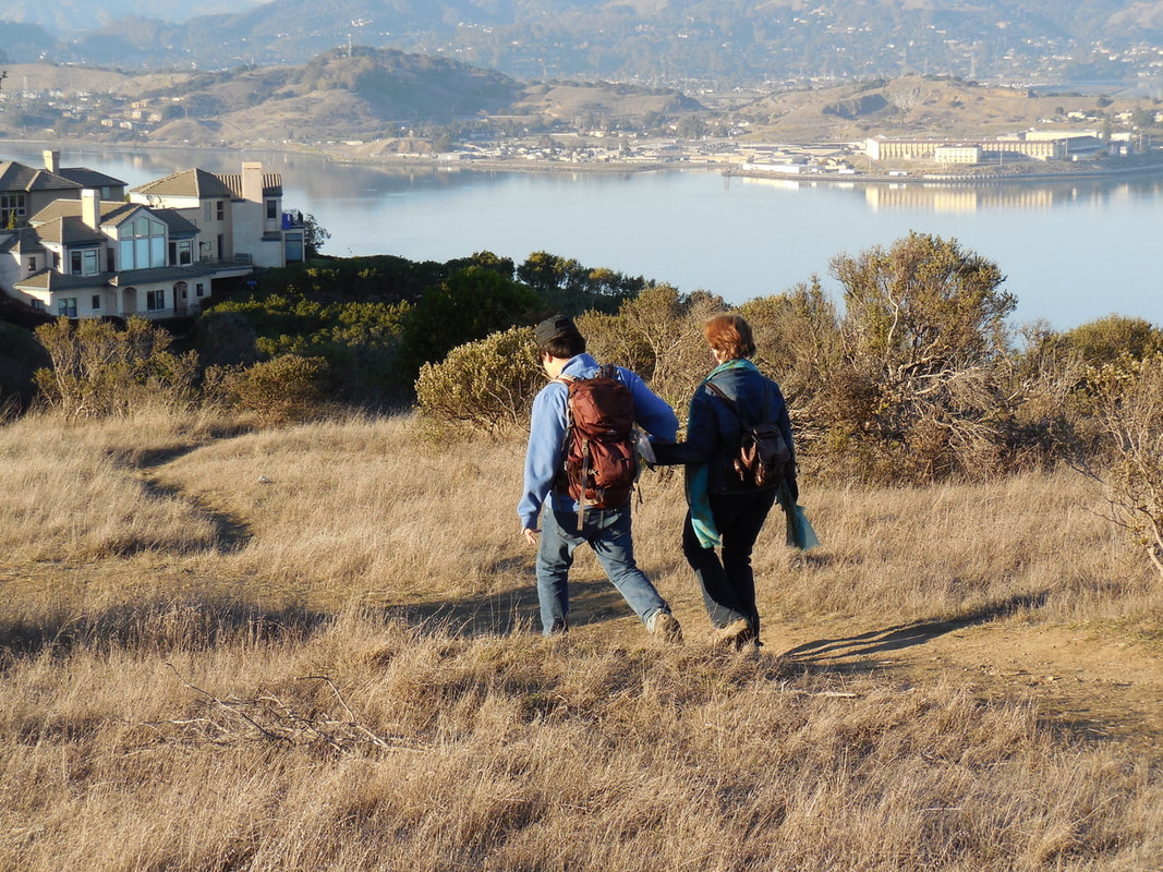
Most of the photos in the photo gallery here are starting from the Taylor Road entrance, as illustrated by the house and gate near the entrance to the preserve. The Phyliis Ellman Trail offers other pretty views.
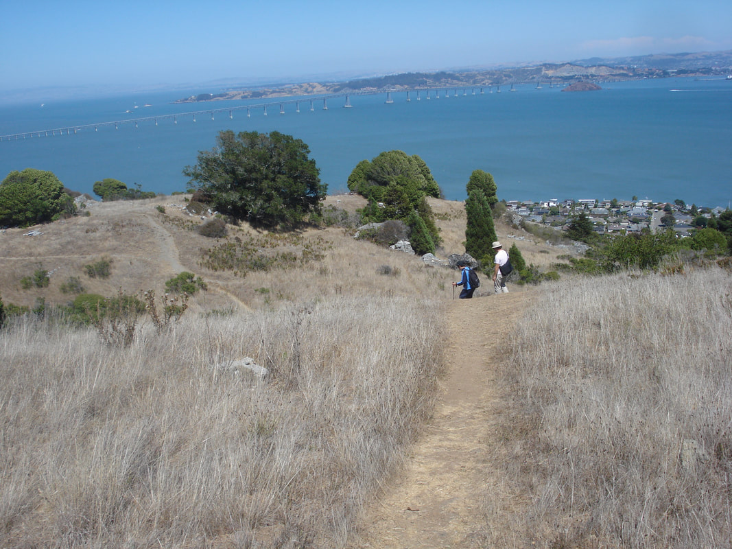
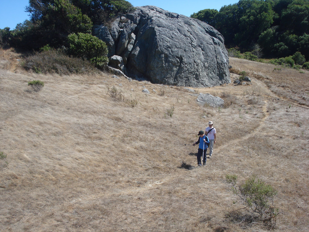
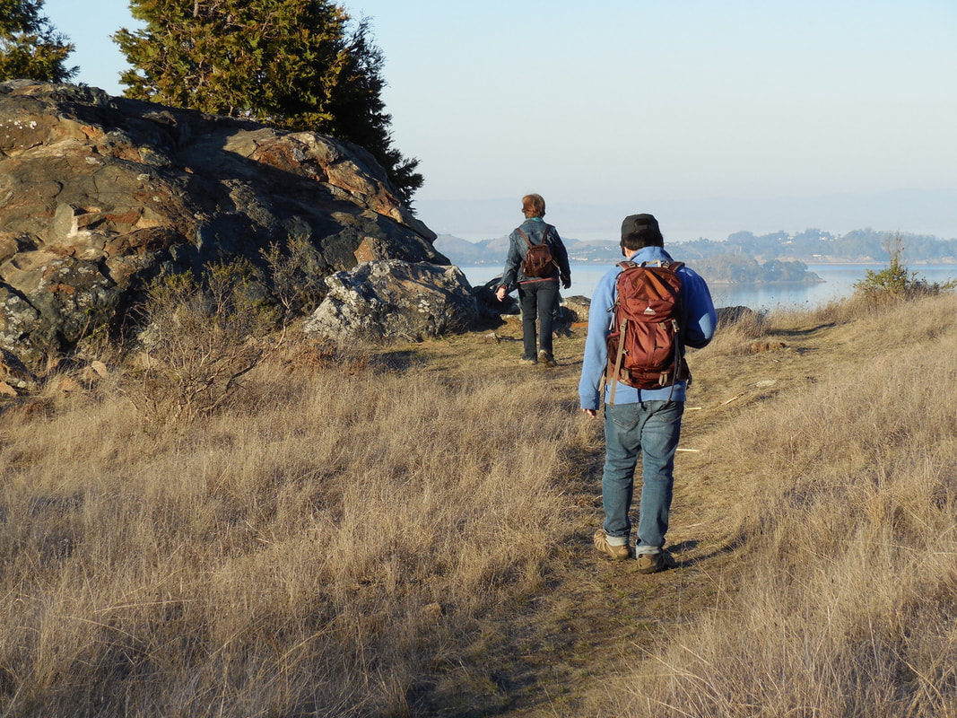
You can combine the trails and fire roads marked on the Ring Mountain Open Space Preserve map in any way you wish, or just wander back and forth between the popular rock formations such as Turtle Rock. The large rock with the split is fun to climb inside as well as on top of.
There are petroglyphs marked on some of the boulders. Mortar holes and other artifacts reflecting Coast Miwok Indian activities have been dated at almost 2,400 years old.
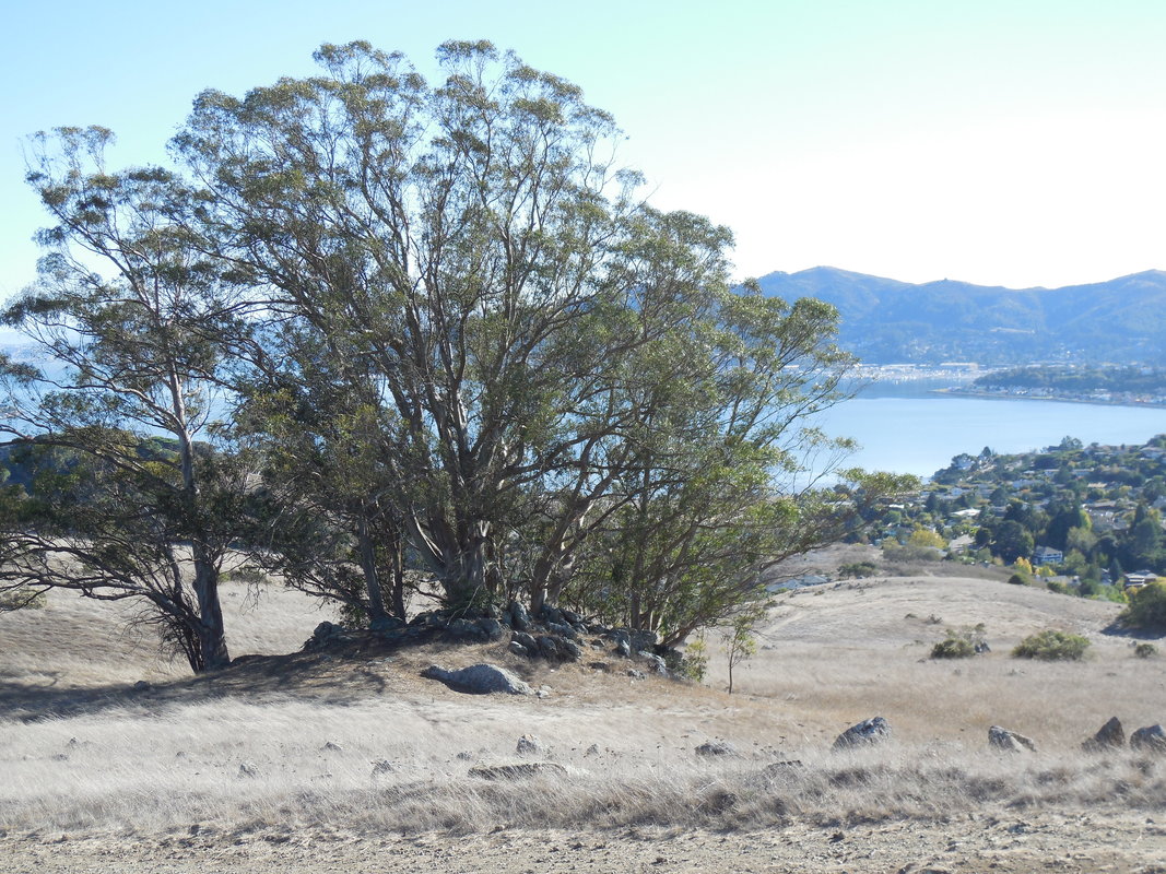
Ring Mountain is also the site of some rare plants. This serpentinite-rich area makes for a poor plant growing environment. The soils contains a lot of magnesium, nickel, cobalt, and chromium, which are also not plant friendly. The plants that do thrive here, however, include the Tiburon mariposa lily, which can be found only here. Though Ring Mountain looks quite barren at a glance, there are actually quite a few wildflowers that grow here in addition to the mariposa lily.
For a slightly other-worldly feel with the visual delights of unusual rock formations, wildflowers in the spring, and great views year round, Ring Mountain is a great spot to visit.
(Ring Mountain-Tiburon Hike Notes were originally paired with the “On Another Planet” Insights post.)
Click Insights/Hike Update News for inspiring reflections. Browse hikes on the main Hikes page or on the Hike Search by Area page. Check out selected articles and interviews under Media. Click World Walks to see or share favorite family-friendly walks! Stay in touch with Lisa Louis and HikingAutism via Contact. See products with inspiring designs that support the efforts of HikingAutism under Support/Shop. The Links page lists a loose collection of helpful information links.
Check the Home page for the broader background story. If you’re not able to take one of these Northern California hikes, hopefully you can enjoy the photo galleries at the bottom of each hike page! Feel free to share and follow on Facebook at HikingAutism, follow on Twitter at @HikingAutism and Instagram at lisalouis777
(scroll to bottom for photo gallery)
Location: Loop Trail, Corte Madera, CA 94925 (officially Corte Madera but on the Tiburon Peninsula)
Directions: This is a fairly quick jaunt north of the Golden Gate Bridge in Marin County. There are multiple entries to this round-peaked destination. Directions below are courtesy of the Marin County Parks link for Ring Mountain Open Space Preserve:
• North access: from Hwy 101 in Corte Madera, take the exit for Tamalpais Dr east. Go straight onto San Clemente, which merges into Paradise Dr after 0.4 miles. Follow Paradise Dr approximately 1 mile (go past Westward Dr). The gate is on the right.
• South access: from Hwy 101 in Mill Valley, take the exiit for East Blithedale Ave. Go east on Tiburon Blvd and turn left at Reed Ranch Rd. MCOSD gate is at the end.
• East access: from Hwy 101 in Corte Madera, take the exit for Tamalpais Dr east. Go straight onto San Clemente, which merges into Paradise Dr after 0.4 miles. Follow Paradise Dr approximately 1.7 miles, turn right onto Taylor Rd, and follow to end (dead end).
Info/Links:
For all web links, if a link doesn’t jump directly, copy and paste into browser. (Information links are sometimes changed at the source unexpectedly. We do our best to update.)
Ring Mountain Open Space Preserve info link:
https://www.marincountyparks.org/depts/pk/divisions/open-space/ring-mountain
Ring Mountain Open Space Preserve map:
https://www.marincountyparks.org/~/media/f544bdff419b400896064894625983a8.ashx
Distance:
You can make an outing to Ring Mountain as long or short as you want. If you start from the north on Paradise Drive and hike up along the Phyllis Ellman Trail, you could stretch the up and back trail and some wandering around the top to see various rock formations into a two mile hike. Starting from the east on Taylor Road or from the south from Reed Ranch Road makes it possible to take shorter walk options near popular features like Turtle Rock.
Considerations:
• Hiking, biking, horse riding allowed.
• Dogs on leash only.
• No toilet facilities.
• Limited parking, though there are three main starting point options as noted above under directions.
• This is a popular rock climbing site. Have fun, but use caution.
The trail:
Most of the photos in the photo gallery here are starting from the Taylor Road entrance, as illustrated by the house and gate near the entrance to the preserve. The Phyliis Ellman Trail offers other pretty views.
You can combine the trails and fire roads marked on the Ring Mountain Open Space Preserve map in any way you wish, or just wander back and forth between the popular rock formations such as Turtle Rock. The large rock with the split is fun to climb inside as well as on top of.
There are petroglyphs marked on some of the boulders. Mortar holes and other artifacts reflecting Coast Miwok Indian activities have been dated at almost 2,400 years old.
Ring Mountain is also the site of some rare plants. This serpentinite-rich area makes for a poor plant growing environment. The soils contains a lot of magnesium, nickel, cobalt, and chromium, which are also not plant friendly. The plants that do thrive here, however, include the Tiburon mariposa lily, which can be found only here. Though Ring Mountain looks quite barren at a glance, there are actually quite a few wildflowers that grow here in addition to the mariposa lily.
For a slightly other-worldly feel with the visual delights of unusual rock formations, wildflowers in the spring, and great views year round, Ring Mountain is a great spot to visit.
(Ring Mountain-Tiburon Hike Notes were originally paired with the “On Another Planet” Insights post.)
Click Insights/Hike Update News for inspiring reflections. Browse hikes on the main Hikes page or on the Hike Search by Area page. Check out selected articles and interviews under Media. Click World Walks to see or share favorite family-friendly walks! Stay in touch with Lisa Louis and HikingAutism via Contact. See products with inspiring designs that support the efforts of HikingAutism under Support/Shop. The Links page lists a loose collection of helpful information links.
Check the Home page for the broader background story. If you’re not able to take one of these Northern California hikes, hopefully you can enjoy the photo galleries at the bottom of each hike page! Feel free to share and follow on Facebook at HikingAutism, follow on Twitter at @HikingAutism and Instagram at lisalouis777