China Camp Campsite to Chicken Coop Hill, San Rafael, CA
(scroll to bottom for photo gallery)
Location: N. San Pedro Rd., San Rafael, CA 94901
Starting Point: Trailhead from China Camp Campsite parking lot, San Rafaei, Northwest of McNears Beach, southwest of McInnis County Park
For driving directions, input “China Camp Campsite, San Rafael” into your GPS map system.
Info links:
For all web links, if a link doesn’t jump directly, copy and paste into browser.
China Camp Brochure and Map link (CA State Parks):
https://www.parks.ca.gov/pages/466/files/ChinaCampSPWebLayout2015.pdf
China Camp Info link (Friends of China Camp):
https://friendsofchinacamp.org
China Camp Tick Info link (Friends of China Camp):
https://friendsofchinacamp.org/wp-content/uploads/2018/03/TICK-TALES.pdf
Distance:
With a rough eyeball estimate from the China Camp map in the brochure provided by California State Parks, the Shoreline Trail from the Campsite parking lot to the spot on N San Pedro Road for crossing to climb Chicken Coop Hill is about a mile. The walk up and around Chicken Coop Hill to get the trail back adds a negligible distance but includes a bit of hill climbing.
Considerations:
• There is a modest day use parking fee payable at the China Beach Campsite parking area. There are also other State Park day-fee parking areas along N. San Pedro Road in this area.
• Bathrooms are available at the China Beach Campsite parking area.
• See link above for the brochure info regarding disability accessible features.
• Follow posted signs regarding dogs, horses, cycling, etc.
• Ticks are found in almost all areas covered in hikingautism.com. I included the tick info link above because China Camp is the only place I ever got a tick bite, just luck of the draw, I’m sure!
• Always be aware of poison oak. Technu or another scrub for poison oak, etc. is handy to have along.
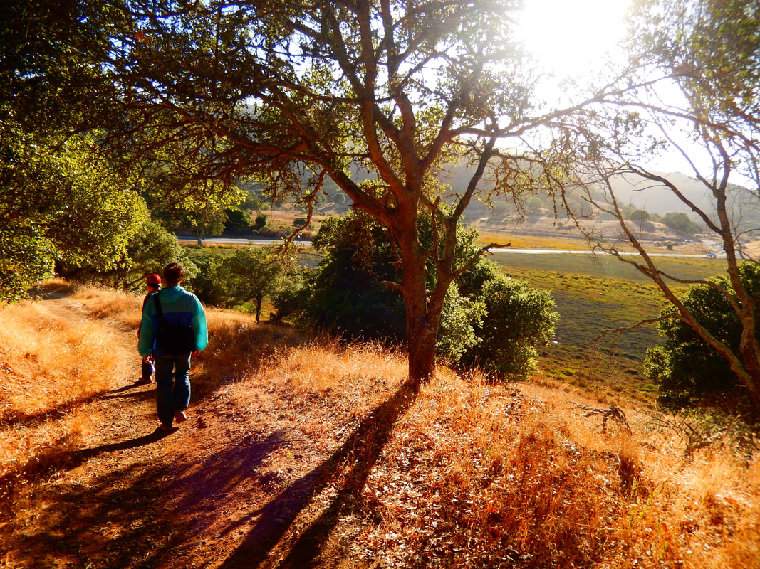
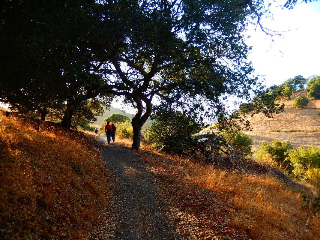
(Note: Title photo image is of a hill west of Chicken Coop Hill on N. San Pedro Road.)
The trail:
The China Camp Campsite parking area can be reached from Route 101 by taking N. San Pedro Rd. off exit 454, but our family usually takes the winding route along San Rafael Bay which melds into San Francisco Bay and then opens up to San Pablo Bay, taking the Central San Rafael exit 452 to 2nd Street which morphs into 3rdStreet and Point San Pedro Rd. to curve around the point by McNears Beach, after which we follow the curve westward, enjoying the bay view through China Camp State Park.
See the brochure link for information on the local history of indigenous Coast Miwok people and the historic population of Chinese shrimp fishermen.
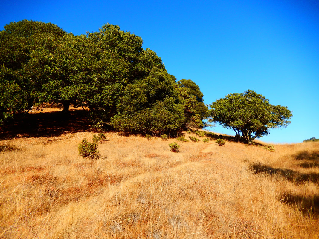
China Camp offers a variety of hiking options, but this post covers a walk along the Shoreline Trail starting from the China Cam Campsite parking lot. The hike starts out with some grassy hills and oak, Manzanita and madrone trees, and winds its way in and out of more woodsy areas.
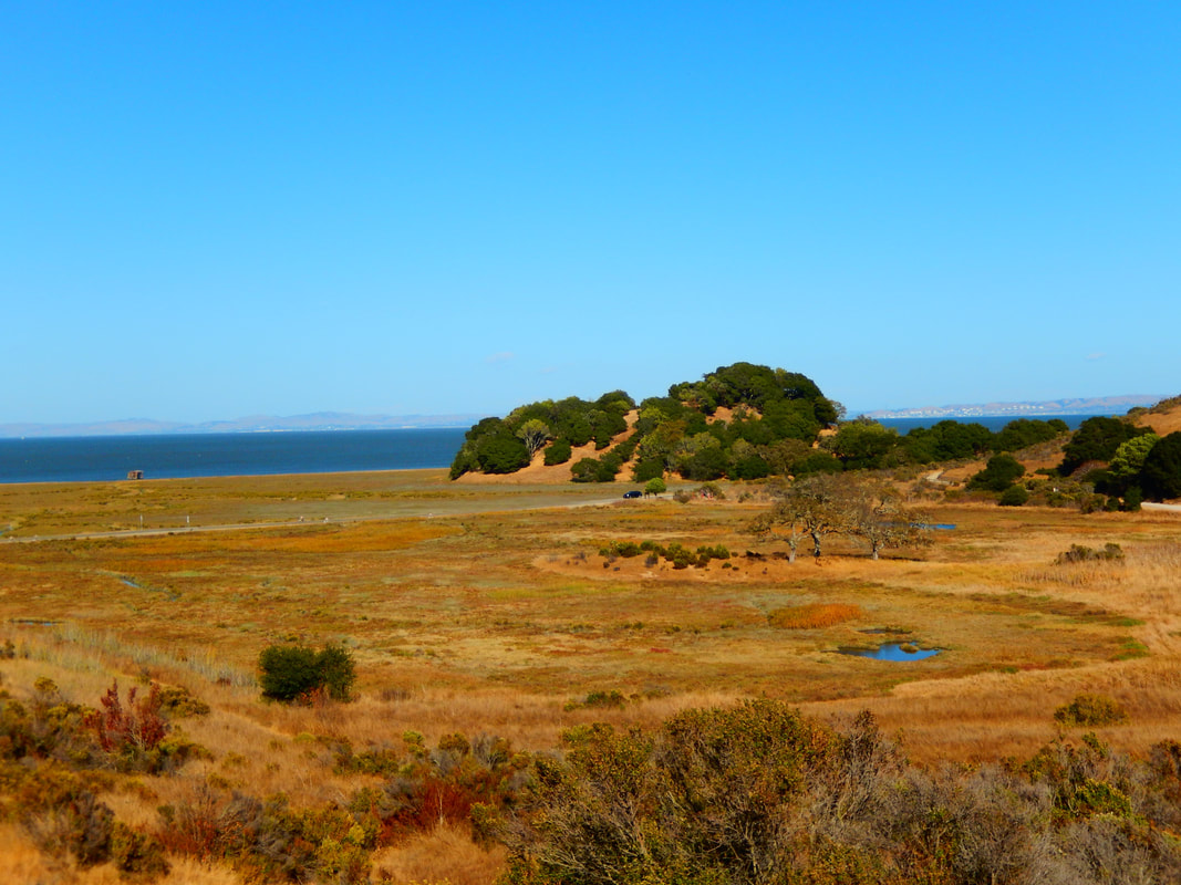
The Shoreline Trail wends its way toward the bay, back inland, then out again. The first hill looking toward the bay is Turtle Back Hill, followed by Bullet Hill, which can be reached by a less traveled trail called Bullet Hill Trail that goes along the upper side of a marsh-like valley. For this hike, we continue past the Bullet Hill Trail turnoff and stay on Shoreline Trail.
There is a Miwok Meadows Day-Use Area with picnic tables and some signs with natural history information on the last stretch facing north toward Chicken Coop Hill.
Shortly after that, Shoreline Trail runs right next to North San Pedro Road facing east. We like to walk until we’re positioned on the east side of Chicken Coop Hill, and can see a gently curved trail up the hill across the road. Cars can move pretty quickly around the curves here, so use caution crossing to the trail.
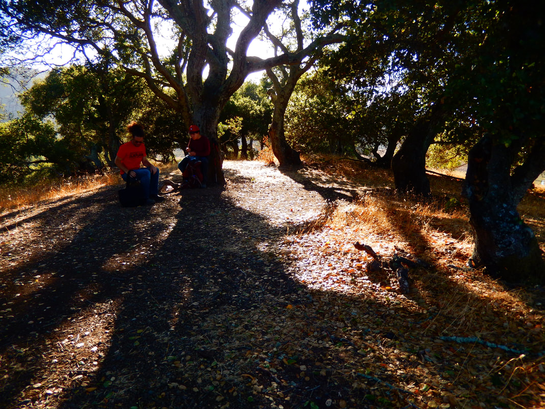
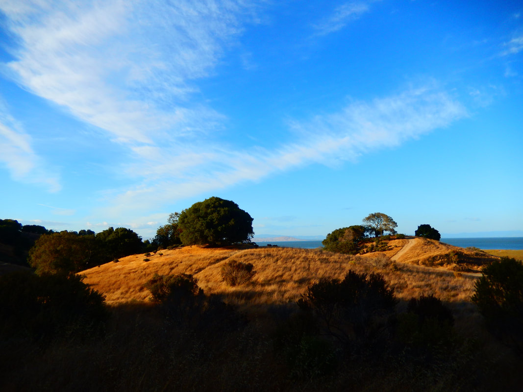
After walking up the lovely curved path to the top of the hill, we come to a plateau. There is a beautiful patch of shady trees at the top of the hill which makes for a perfect spot for a snack break. There is always a magical little forest feeling under those trees after walking in open space for much of this hike. After our break, we continue along the trail that curves around the bay side of the hill (west and then south), leading back to a road crossing on the west side of Chicken Coop Hill, a little further back from where we first crossed.
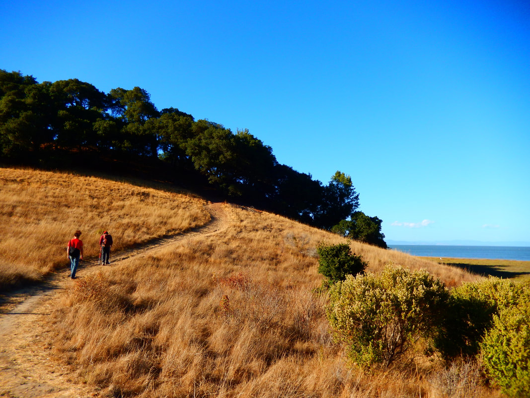
The return trip along Shoreline Trail has a different visual sense, and is just as enjoyable as the outward bound walk.
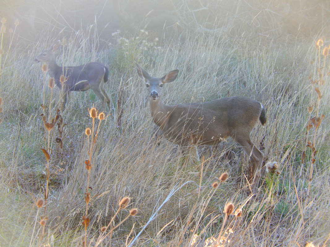
We’ve seen various birds in the area, as well as plentiful deer, both in the woods next to meadow areas and also on the hills leading down to the marsh area.
(China Camp Campsite to Chicken Coop Hill Hike Notes were originally paired with the “Maxfield Parrish Moments” Insights post.)
Click Insights/Hike Update News for inspiring reflections. Browse hikes on the main Hikes page or on the Hike Search by Area page. Check out selected articles and interviews under Media. Click World Walks to see or share favorite family-friendly walks! Stay in touch with Lisa Louis and HikingAutism via Contact. See products with inspiring designs that support the efforts of HikingAutism under Support/Shop. The Links page lists a loose collection of helpful information links.
Check the Home page for the broader background story. If you’re not able to take one of these Northern California hikes, hopefully you can enjoy the photo galleries at the bottom of each hike page! Feel free to share and follow on Facebook at HikingAutism, follow on Twitter at @HikingAutism and Instagram at lisalouis777
(scroll to bottom for photo gallery)
Location: N. San Pedro Rd., San Rafael, CA 94901
Starting Point: Trailhead from China Camp Campsite parking lot, San Rafaei, Northwest of McNears Beach, southwest of McInnis County Park
For driving directions, input “China Camp Campsite, San Rafael” into your GPS map system.
Info links:
For all web links, if a link doesn’t jump directly, copy and paste into browser.
China Camp Brochure and Map link (CA State Parks):
https://www.parks.ca.gov/pages/466/files/ChinaCampSPWebLayout2015.pdf
China Camp Info link (Friends of China Camp):
https://friendsofchinacamp.org
China Camp Tick Info link (Friends of China Camp):
https://friendsofchinacamp.org/wp-content/uploads/2018/03/TICK-TALES.pdf
Distance:
With a rough eyeball estimate from the China Camp map in the brochure provided by California State Parks, the Shoreline Trail from the Campsite parking lot to the spot on N San Pedro Road for crossing to climb Chicken Coop Hill is about a mile. The walk up and around Chicken Coop Hill to get the trail back adds a negligible distance but includes a bit of hill climbing.
Considerations:
• There is a modest day use parking fee payable at the China Beach Campsite parking area. There are also other State Park day-fee parking areas along N. San Pedro Road in this area.
• Bathrooms are available at the China Beach Campsite parking area.
• See link above for the brochure info regarding disability accessible features.
• Follow posted signs regarding dogs, horses, cycling, etc.
• Ticks are found in almost all areas covered in hikingautism.com. I included the tick info link above because China Camp is the only place I ever got a tick bite, just luck of the draw, I’m sure!
• Always be aware of poison oak. Technu or another scrub for poison oak, etc. is handy to have along.
(Note: Title photo image is of a hill west of Chicken Coop Hill on N. San Pedro Road.)
The trail:
The China Camp Campsite parking area can be reached from Route 101 by taking N. San Pedro Rd. off exit 454, but our family usually takes the winding route along San Rafael Bay which melds into San Francisco Bay and then opens up to San Pablo Bay, taking the Central San Rafael exit 452 to 2nd Street which morphs into 3rdStreet and Point San Pedro Rd. to curve around the point by McNears Beach, after which we follow the curve westward, enjoying the bay view through China Camp State Park.
See the brochure link for information on the local history of indigenous Coast Miwok people and the historic population of Chinese shrimp fishermen.
China Camp offers a variety of hiking options, but this post covers a walk along the Shoreline Trail starting from the China Cam Campsite parking lot. The hike starts out with some grassy hills and oak, Manzanita and madrone trees, and winds its way in and out of more woodsy areas.
The Shoreline Trail wends its way toward the bay, back inland, then out again. The first hill looking toward the bay is Turtle Back Hill, followed by Bullet Hill, which can be reached by a less traveled trail called Bullet Hill Trail that goes along the upper side of a marsh-like valley. For this hike, we continue past the Bullet Hill Trail turnoff and stay on Shoreline Trail.
There is a Miwok Meadows Day-Use Area with picnic tables and some signs with natural history information on the last stretch facing north toward Chicken Coop Hill.
Shortly after that, Shoreline Trail runs right next to North San Pedro Road facing east. We like to walk until we’re positioned on the east side of Chicken Coop Hill, and can see a gently curved trail up the hill across the road. Cars can move pretty quickly around the curves here, so use caution crossing to the trail.
After walking up the lovely curved path to the top of the hill, we come to a plateau. There is a beautiful patch of shady trees at the top of the hill which makes for a perfect spot for a snack break. There is always a magical little forest feeling under those trees after walking in open space for much of this hike. After our break, we continue along the trail that curves around the bay side of the hill (west and then south), leading back to a road crossing on the west side of Chicken Coop Hill, a little further back from where we first crossed.
The return trip along Shoreline Trail has a different visual sense, and is just as enjoyable as the outward bound walk.
We’ve seen various birds in the area, as well as plentiful deer, both in the woods next to meadow areas and also on the hills leading down to the marsh area.
(China Camp Campsite to Chicken Coop Hill Hike Notes were originally paired with the “Maxfield Parrish Moments” Insights post.)
Click Insights/Hike Update News for inspiring reflections. Browse hikes on the main Hikes page or on the Hike Search by Area page. Check out selected articles and interviews under Media. Click World Walks to see or share favorite family-friendly walks! Stay in touch with Lisa Louis and HikingAutism via Contact. See products with inspiring designs that support the efforts of HikingAutism under Support/Shop. The Links page lists a loose collection of helpful information links.
Check the Home page for the broader background story. If you’re not able to take one of these Northern California hikes, hopefully you can enjoy the photo galleries at the bottom of each hike page! Feel free to share and follow on Facebook at HikingAutism, follow on Twitter at @HikingAutism and Instagram at lisalouis777