Huckleberry Trail
(scroll to bottom for photo gallery)
Location: Near Sunrise Lane, Larkspur, 94939, Marin County, CA (west of Corte Madera by a glance of the map)
Starting Point: The trailhead is a short way up the Southern Marin Line Fire Road from its start at the connection with Sunrise Lane. The Huckleberry Trail is marked by an MCOSD (Marin County Open Space District) sign.
Info links:
For all web links, if a link doesn’t jump directly, copy and paste into browser.
Marin County Parks Open Space info link:
https://www.marincountyparks.org/depts/pk/divisions/open-space
Marin County Parks Open Space maps list link:
https://www.marincountyparks.org/depts/pk/divisions/open-space/main/preservemaps
Blithedale Summit map link (specifically showing the Huckleberry Trail):
https://www.marincountyparks.org/-/media/images/departments/pk/open-space/blithedale-summit/map_blithedalebaltimorekingcamino_20180914.pdf
Distance:
The Huckleberry Trail is a short but quite steep connector trail between the Southern Marin Line Fire Road and the Corte Madera Ridge Fire Road in the Blithedale Summit Preserve. I’ve seen various distances noted for this trail, but I place my faith in Barry Spitz, author of Mount Tamalpais Trails. He notes 0.61 miles for the Huckleberry Trail proper. It may feel longer because it is very steep in parts. There is also a short walk along the Southern Marin Line Fire Road from the end of Sunrise Lane to get to the start of the Huckleberry Trail.
Considerations:
• This is not an easy trail. Not easy to park. Not easy to climb in some steep parts.
• Have a map, whether electronically or on paper. For this hike, a street map is almost as necessary for finding your way through the maze of small streets to Sunrise Lane as a trail map is for checking the trail and fire road connections.
• Being able to park on Sunrise Lane to get to the trailhead is a roll of the dice. Have a backup hike plan nearby on the chance that you can’t park, and keep trying until you get lucky.
• No bathroom facilities provided at either end of the Huckleberry Trail.
• According to the MCOSD sign, bikes are not allowed, but dogs are allowed on leash.
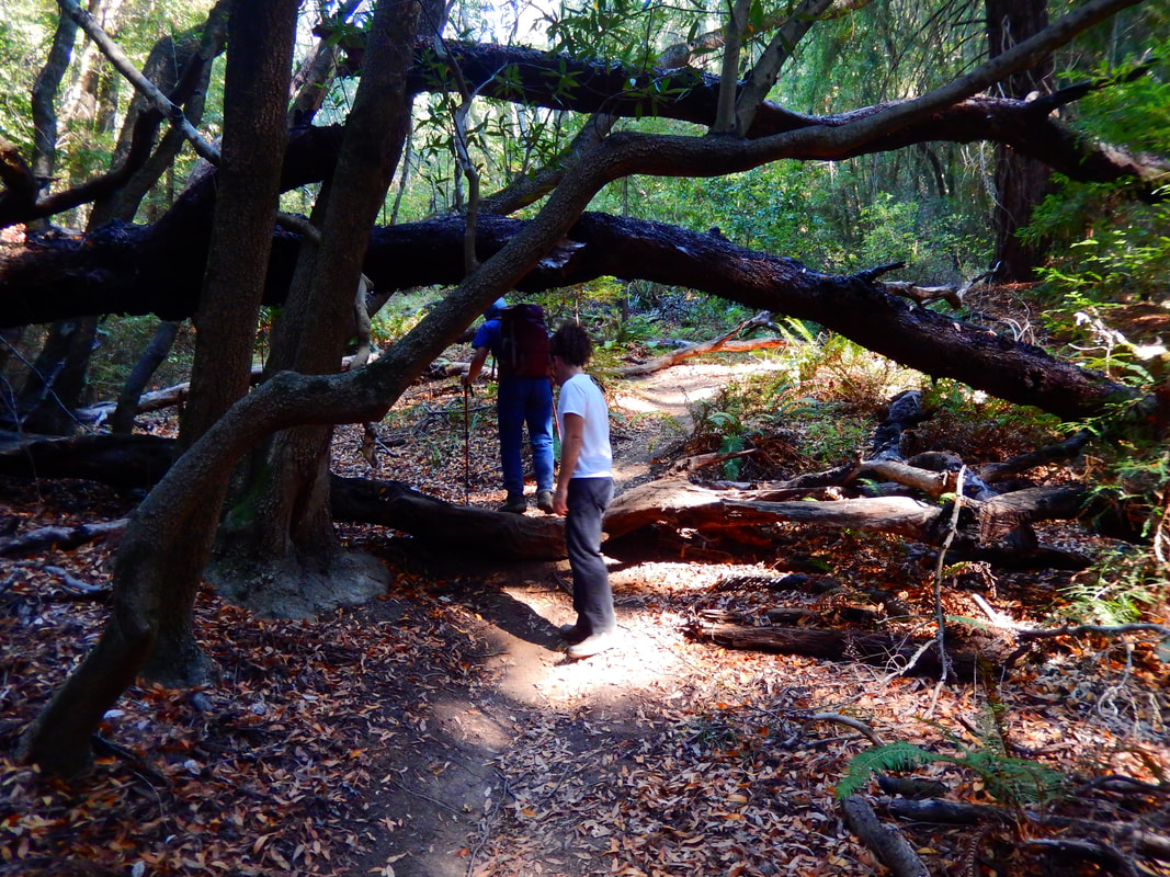
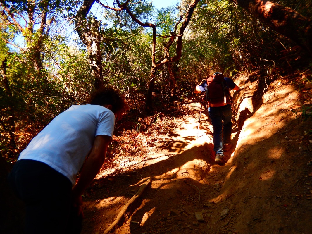
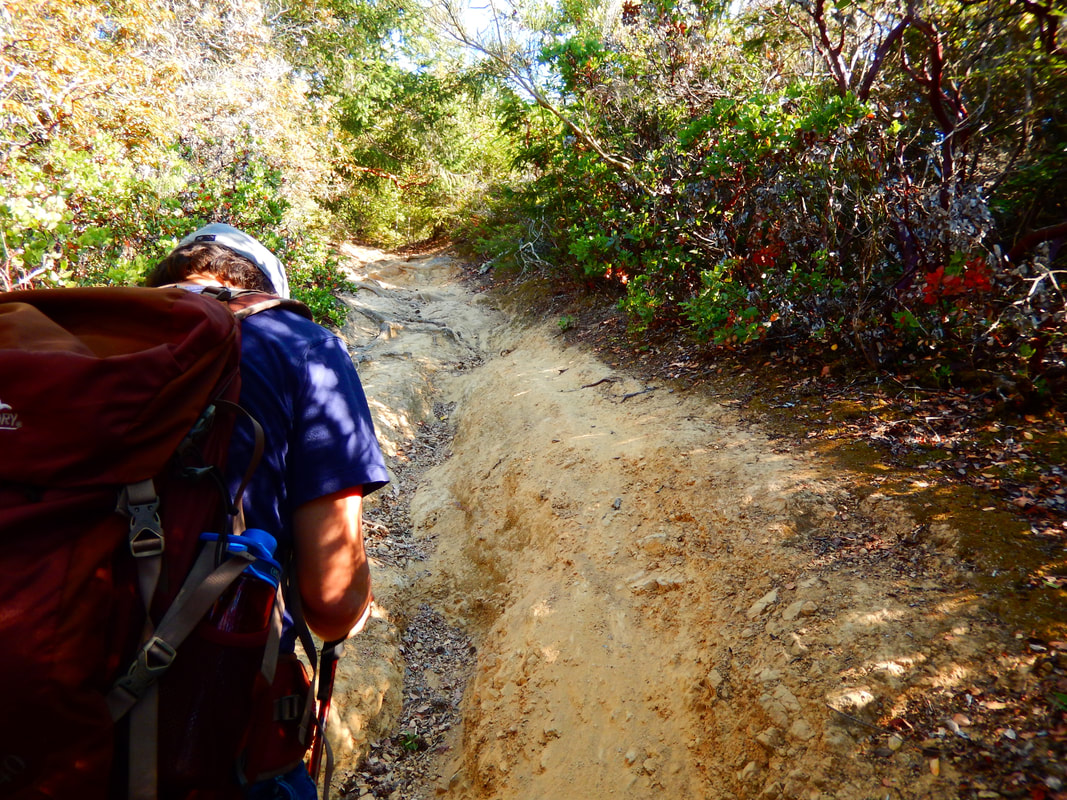
• There are some very steep sections, especially at the bottom end of the trail.
The trail:
If you’ve had the luck to find parking, from Sunrise Lane, make your way to the connection with the southern end of the Southern Marin Line Fire Road. There is a gate.
The MCOSD sign for the Huckleberry Trail is really only a few hundred feet in from the Sunrise Lane/Southern Marin Line Fire Road connection.
As noted above, though the trail is only about 0.6 miles, it is quite steep in parts, especially starting out climbing from the southeast end.
The Huckleberry Trail has a rapid elevation rise from 480 to 860 feet.
As the name suggests, there are huckleberry bushes along the trail.
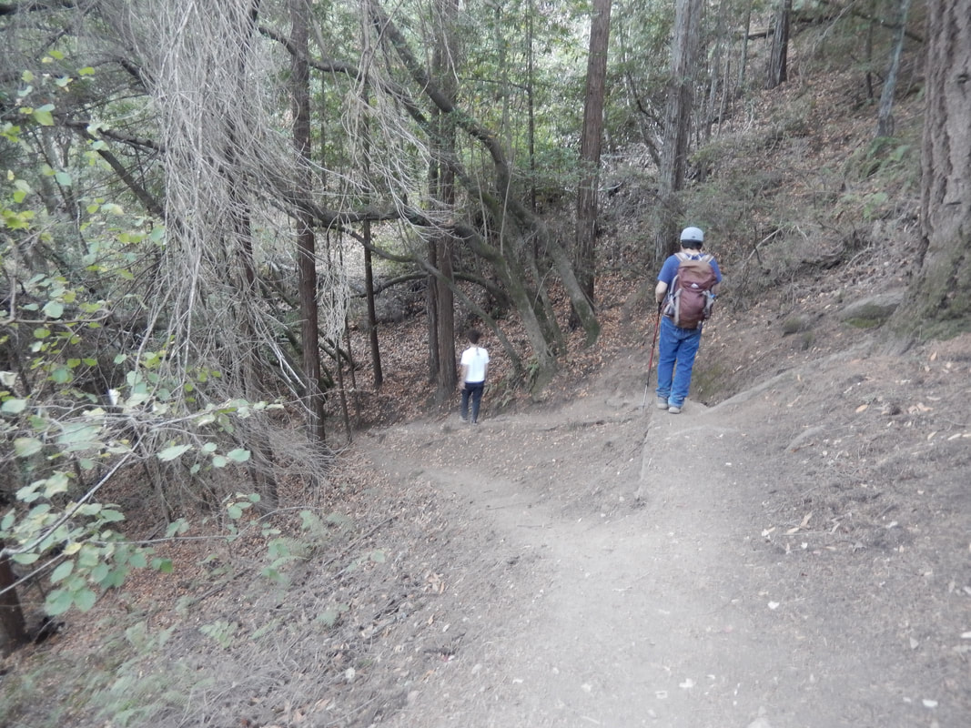
There are some stretches with redwoods, and as the trail rises, Manzanita trees become more prominent.
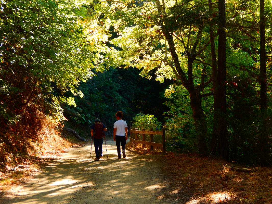
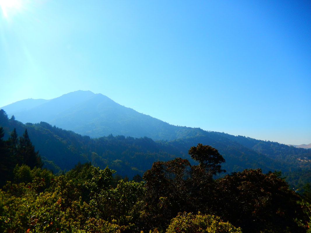
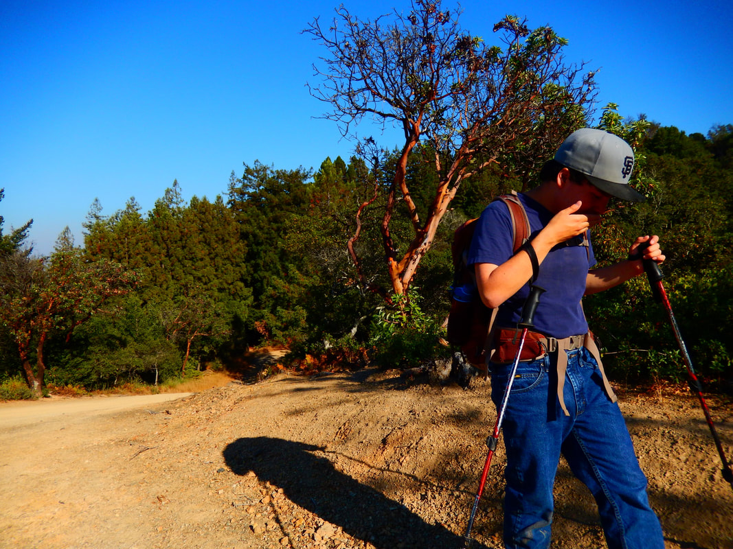
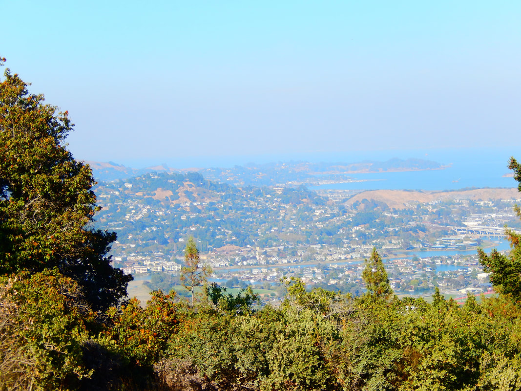
Though there is more of an “in the woods” narrow-path feel closer to the bottom, the trail opens up in patches, offering views of Mount Tam and the bay even before reaching the peak.
The steep climb pays off at the top when you reach a four way junction. The Huckleberry Trail connects to the Corte Madera Ridge Fire Road. Take Corte Madera Ridge Fire Road to the left and you go southeast toward Summit Drive on Corte Madera Ridge. Take Corte Madera Ridge Fire Road to the right and you will head west, further into Blithedale Ridge. Cut straight across and you will be on Glen Fire Road, which curves southwest and then south.
To round off Huckleberry Trail as your main hike, turn right at the intersection and climb a few yards higher to get a view of Mount Tam. You can always find a rock, tree stump, or relatively smooth patch of dirt to sit on for a snack break.
Soak in the view once more before descending back down into the darker sections of trail to return to Southern Marin Line Fire Road and Sunrise Lane.
(Huckleberry Trail Hike Notes originally paired with Insights post Hansel and Gretel Trails.)
Click Insights/Hike Update News for inspiring reflections. Browse hikes on the main Hikes page or on the Hike Search by Area page. Check out selected articles and interviews under Media. Click World Walks to see or share favorite family-friendly walks! Stay in touch with Lisa Louis and HikingAutism via Contact. See products with inspiring designs that support the efforts of HikingAutism under Support/Shop. The Links page lists a loose collection of helpful information links.
Check the Home page for the broader background story. If you’re not able to take one of these Northern California hikes, hopefully you can enjoy the photo galleries at the bottom of each hike page! Feel free to share and follow on Facebook at HikingAutism, follow on Twitter at @HikingAutism and Instagram at lisalouis777
(scroll to bottom for photo gallery)
Location: Near Sunrise Lane, Larkspur, 94939, Marin County, CA (west of Corte Madera by a glance of the map)
Starting Point: The trailhead is a short way up the Southern Marin Line Fire Road from its start at the connection with Sunrise Lane. The Huckleberry Trail is marked by an MCOSD (Marin County Open Space District) sign.
Info links:
For all web links, if a link doesn’t jump directly, copy and paste into browser.
Marin County Parks Open Space info link:
https://www.marincountyparks.org/depts/pk/divisions/open-space
Marin County Parks Open Space maps list link:
https://www.marincountyparks.org/depts/pk/divisions/open-space/main/preservemaps
Blithedale Summit map link (specifically showing the Huckleberry Trail):
https://www.marincountyparks.org/-/media/images/departments/pk/open-space/blithedale-summit/map_blithedalebaltimorekingcamino_20180914.pdf
Distance:
The Huckleberry Trail is a short but quite steep connector trail between the Southern Marin Line Fire Road and the Corte Madera Ridge Fire Road in the Blithedale Summit Preserve. I’ve seen various distances noted for this trail, but I place my faith in Barry Spitz, author of Mount Tamalpais Trails. He notes 0.61 miles for the Huckleberry Trail proper. It may feel longer because it is very steep in parts. There is also a short walk along the Southern Marin Line Fire Road from the end of Sunrise Lane to get to the start of the Huckleberry Trail.
Considerations:
• This is not an easy trail. Not easy to park. Not easy to climb in some steep parts.
• Have a map, whether electronically or on paper. For this hike, a street map is almost as necessary for finding your way through the maze of small streets to Sunrise Lane as a trail map is for checking the trail and fire road connections.
• Being able to park on Sunrise Lane to get to the trailhead is a roll of the dice. Have a backup hike plan nearby on the chance that you can’t park, and keep trying until you get lucky.
• No bathroom facilities provided at either end of the Huckleberry Trail.
• According to the MCOSD sign, bikes are not allowed, but dogs are allowed on leash.
• There are some very steep sections, especially at the bottom end of the trail.
The trail:
If you’ve had the luck to find parking, from Sunrise Lane, make your way to the connection with the southern end of the Southern Marin Line Fire Road. There is a gate.
The MCOSD sign for the Huckleberry Trail is really only a few hundred feet in from the Sunrise Lane/Southern Marin Line Fire Road connection.
As noted above, though the trail is only about 0.6 miles, it is quite steep in parts, especially starting out climbing from the southeast end.
The Huckleberry Trail has a rapid elevation rise from 480 to 860 feet.
As the name suggests, there are huckleberry bushes along the trail.
There are some stretches with redwoods, and as the trail rises, Manzanita trees become more prominent.
Though there is more of an “in the woods” narrow-path feel closer to the bottom, the trail opens up in patches, offering views of Mount Tam and the bay even before reaching the peak.
The steep climb pays off at the top when you reach a four way junction. The Huckleberry Trail connects to the Corte Madera Ridge Fire Road. Take Corte Madera Ridge Fire Road to the left and you go southeast toward Summit Drive on Corte Madera Ridge. Take Corte Madera Ridge Fire Road to the right and you will head west, further into Blithedale Ridge. Cut straight across and you will be on Glen Fire Road, which curves southwest and then south.
To round off Huckleberry Trail as your main hike, turn right at the intersection and climb a few yards higher to get a view of Mount Tam. You can always find a rock, tree stump, or relatively smooth patch of dirt to sit on for a snack break.
Soak in the view once more before descending back down into the darker sections of trail to return to Southern Marin Line Fire Road and Sunrise Lane.
(Huckleberry Trail Hike Notes originally paired with Insights post Hansel and Gretel Trails.)
Click Insights/Hike Update News for inspiring reflections. Browse hikes on the main Hikes page or on the Hike Search by Area page. Check out selected articles and interviews under Media. Click World Walks to see or share favorite family-friendly walks! Stay in touch with Lisa Louis and HikingAutism via Contact. See products with inspiring designs that support the efforts of HikingAutism under Support/Shop. The Links page lists a loose collection of helpful information links.
Check the Home page for the broader background story. If you’re not able to take one of these Northern California hikes, hopefully you can enjoy the photo galleries at the bottom of each hike page! Feel free to share and follow on Facebook at HikingAutism, follow on Twitter at @HikingAutism and Instagram at lisalouis777