Fort Baker
(scroll to bottom for photo gallery)
Location: Sausalito, CA 94965. From US-101, take Alexander Ave. exit to Bunker Road, turn right on the hairpin turn on Bunker Road before the signal light tunnel, and follow Bunker Road down the hill toward Fort Baker and Horseshoe Bay
Starting Point: Once down the hill along Bunker Road, take Moore Road which continues toward the waterfront. There is roadside parking along Moore Road near the fishing pier and line of port-a-potties, but even more parking space is available along Sommerville Road which runs along Horseshoe Bay.
Info links:
For all web links, if a link doesn’t jump directly, copy and paste into browser.
Fort Baker information link (National Park Service):
https://www.nps.gov/goga/planyourvisit/fort-baker.htm
Fort Baker map link (scroll to bottom for Fort Baker expanded map) (National Park Service):
https://www.nps.gov/goga/planyourvisit/upload/map_mahe_150429_508_2021.pdf
Fort Baker accessibility link (National Park Service):
https://www.nps.gov/goga/planyourvisit/fort-baker-accessibility.htm
Fort Baker info and map link (Golden Gate National Parks Conservancy):
https://www.parksconservancy.org/parks/fort-baker
Distance:
It is approximately 0.7 miles from Moore Road Pier around Horseshoe Bay to the Satterlee Breakwater on the east side off Marina Road. Visitors can add more of a walk by taking the steps leading up from Satterlee Road and exploring around Battery Yates. Battery Yates Trail, Fort Baker Bay Trail, Drown Road Trail, and Chapel Steps Trail are small trails noted on the Fort Baker map in the National Park Service map of the area, all of which are relatively short but can add to a hike for those wishing to do more than walk along the waterfront.
Considerations:
• There is roadside parking along Moore Road, but this is a narrow stretch that gets crowded. There is a bigger parking area along Sommerville Road.
• There is a line of port-a-potties on Moore Road near the Coast Guard station and fishing pier.
• Golden Gate Bridge traffic and traffic off the Alexander Ave. exit to Bunker Road can get heavy, especially on weekends. As always weekdays or early starts on weekends typically mean less traffic and fewer crowds.
• As with any Bay Area outing, bring layers. You may be hot in the sun one moment and shivering under fog and a chilly breeze the next.
The trail:
We started our visit from Moore Road, thinking that toilet facilities (a line of port-a-potties in this case) are always a good trail start and end. This also means starting the walk from the west side and walking all along Horseshoe Bay. Since Moore Road is fairly narrow and has a lot of fishing pier visitors parking there, we would park along the more open Sommerville Road parking area next visit.
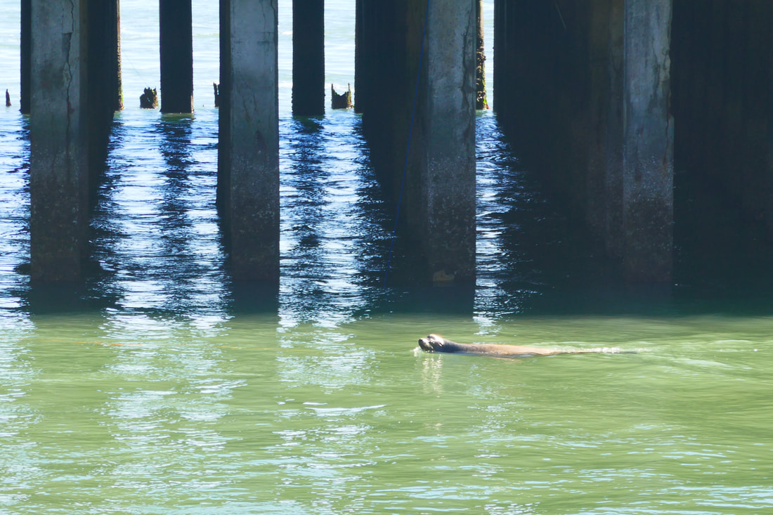
The fishing pier juts out in picturesque fashion with the San Francisco skyline looming beyond it. Even more entertaining at the front side of the pier was the sea lion that playfully swam between the shoreline and the pier posts.
We walked toward the bridge along Moore Road to where it connects with a section of Conzelman Road that is closed to regular traffic. We saw hikers and cyclists making their way up Conzelman from under the bridge/freeway structure near this intersection. Next time we may try hiking up that scenic stretch of road.
We turned back along Moore Road and walked back past the fishing pier toward the US Coast Guard Station where Moore meets Sommerville Road. There are little patches of beach to walk on along this stretch.
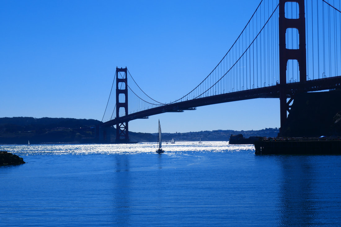
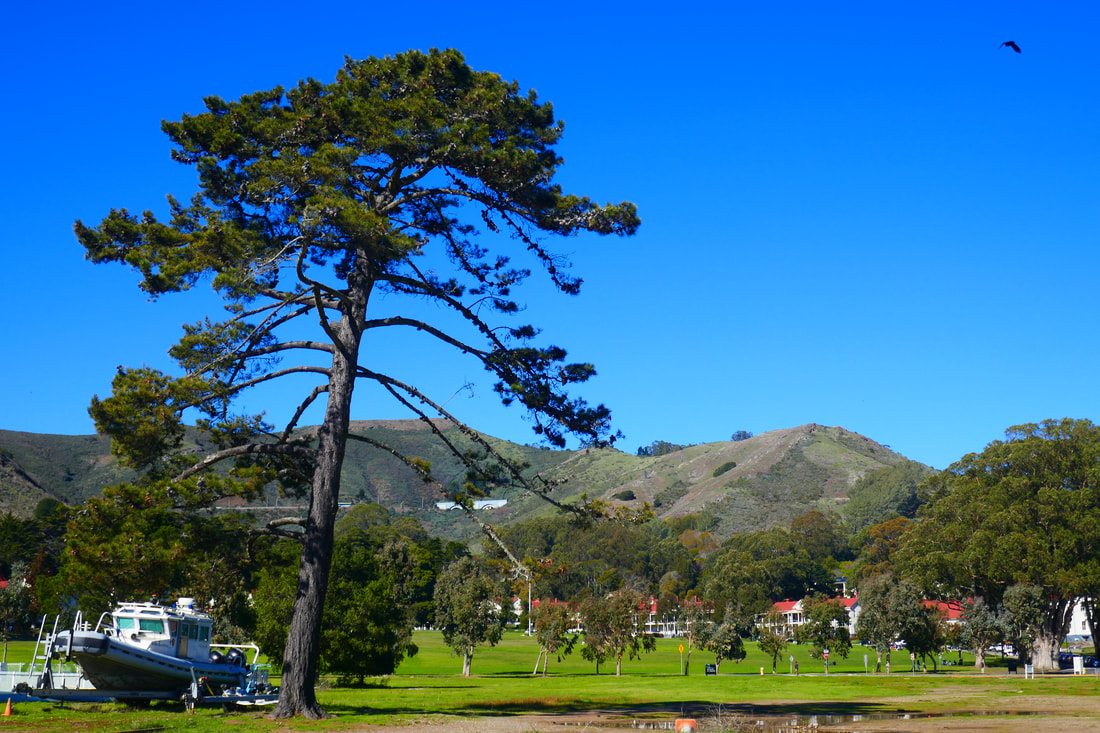
The rolling Marin Headlands are in view facing inland, and a great view of San Francisco is visible all along this walk. The dominant visible force is undoubtedly the Golden Gate Bridge looming to the south. It was dramatic in high contrast shadow on our sunny day, and would be equally dramatic on a typical foggy day.
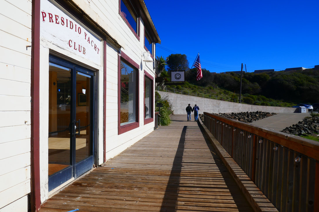
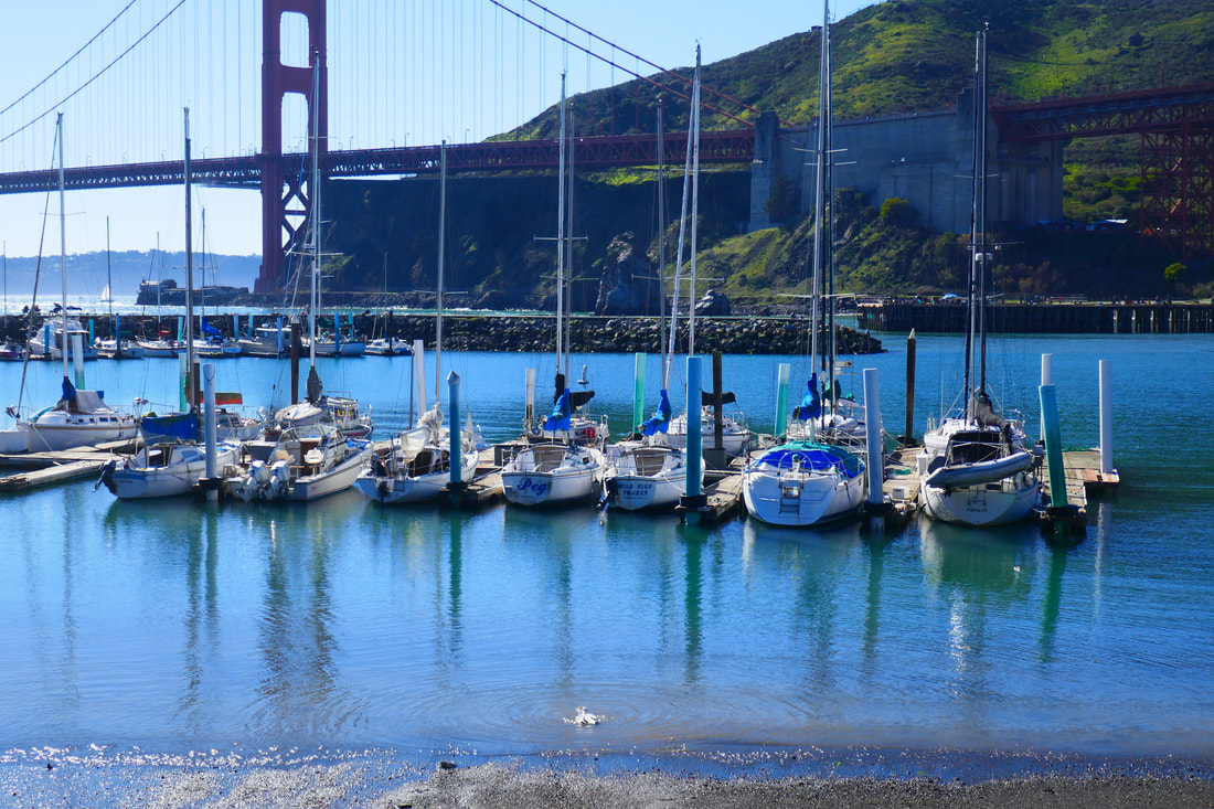
We enjoyed the walk along Horseshoe Bay, then walked the wooden boardwalk past the Presidio Yacht Club and enjoyed the marina view from benches along Marina Road. Next time we’ll try walking along the Satterlee Breakwater that starts from Marina and Satterleee at Point Cavallo.
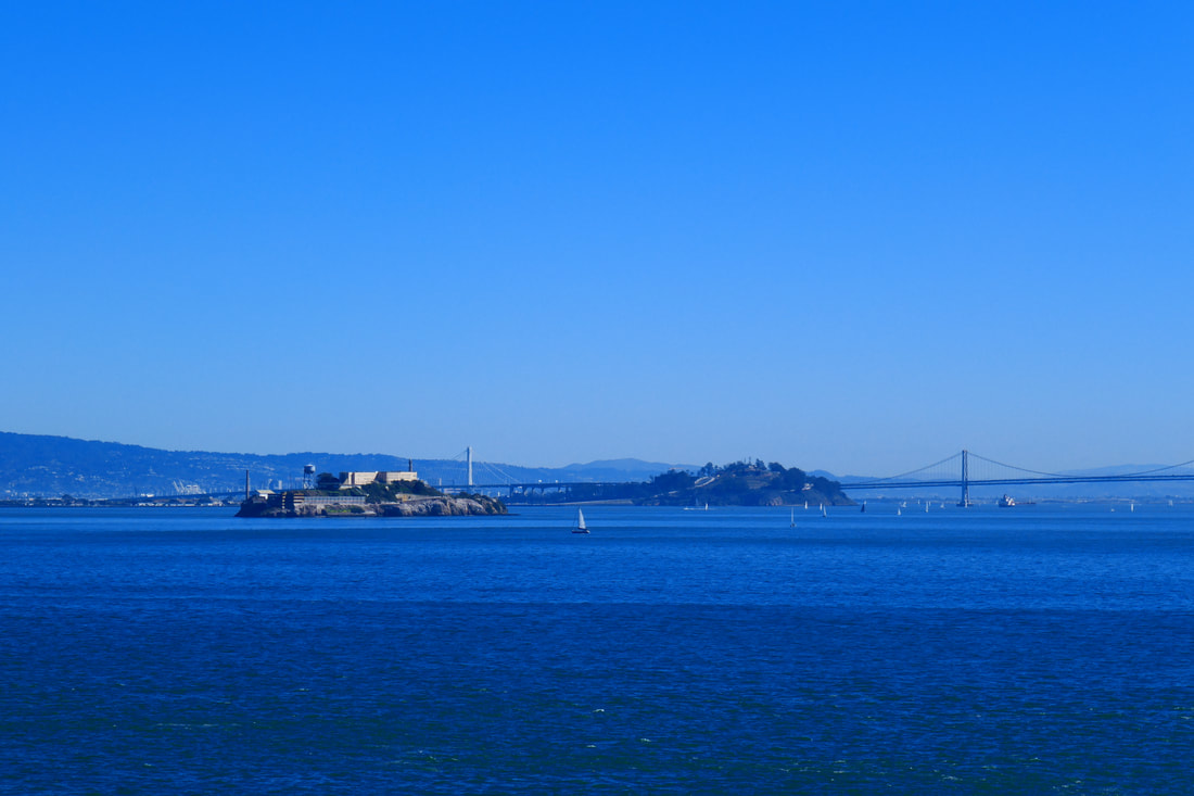
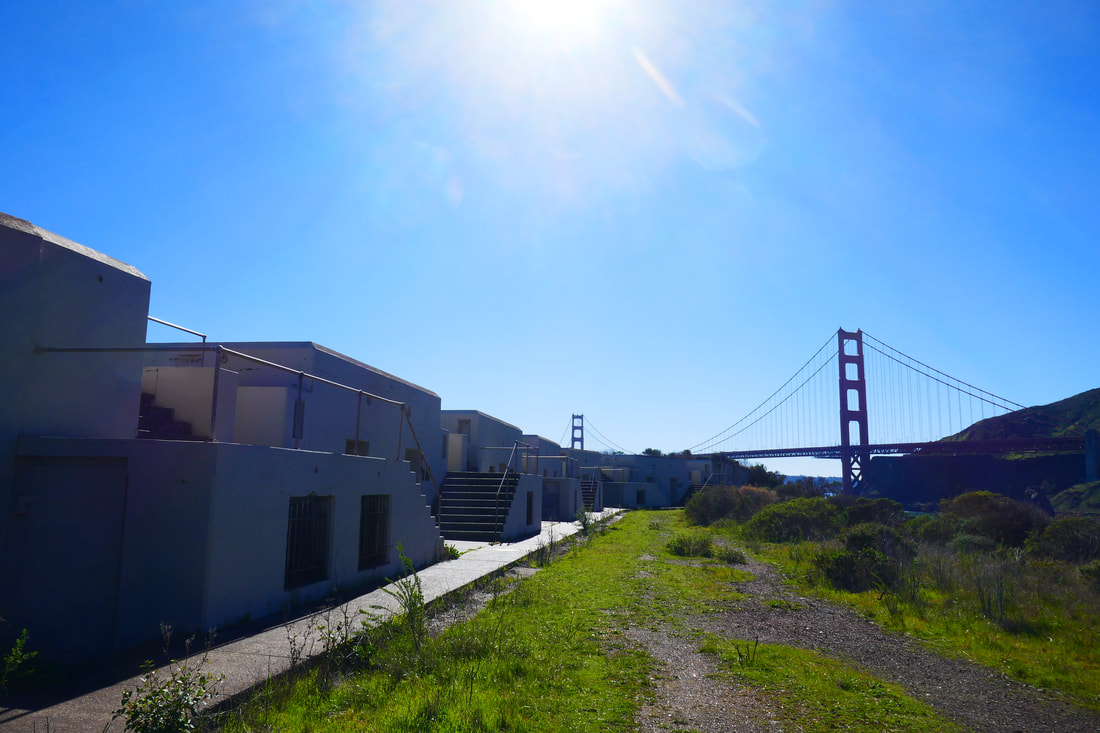
For this visit, we decided to take the stairs up the hill from the curve in Satterlee Road. We could see Angel Island, Alcatraz, and the Bay Bridge in the distance. From here we took a dirt path that led around to Battery Yates, one of many historic military sites dotted around the Bay Area. We made our way back along the Horseshoe Bay waterfront for what may not have added up to a full two mile walk. This would make a nice spot to take visitors for an easy walk with great views from the Marin side of the Golden Gate Bridge.
(Fort Baker Hike Notes were originally paired with the “So Close and Yet So Far” Insights post.)
Click Insights/Hike Update News for inspiring reflections. Browse hikes on the main Hikes page or on the Hike Search by Area page. Check out selected articles and interviews under Media. Click World Walks to see or share favorite family-friendly walks! Stay in touch with Lisa Louis and HikingAutism via Contact. See products with inspiring designs that support the efforts of HikingAutism under Support/Shop. The Links page lists a loose collection of helpful information links.
Check the Home page for the broader background story. If you’re not able to take one of these Northern California hikes, hopefully you can enjoy the photo galleries at the bottom of each hike page! Feel free to share and follow on Facebook at HikingAutism, follow on Twitter at @HikingAutism and Instagram at lisalouis777
(scroll to bottom for photo gallery)
Location: Sausalito, CA 94965. From US-101, take Alexander Ave. exit to Bunker Road, turn right on the hairpin turn on Bunker Road before the signal light tunnel, and follow Bunker Road down the hill toward Fort Baker and Horseshoe Bay
Starting Point: Once down the hill along Bunker Road, take Moore Road which continues toward the waterfront. There is roadside parking along Moore Road near the fishing pier and line of port-a-potties, but even more parking space is available along Sommerville Road which runs along Horseshoe Bay.
Info links:
For all web links, if a link doesn’t jump directly, copy and paste into browser.
Fort Baker information link (National Park Service):
https://www.nps.gov/goga/planyourvisit/fort-baker.htm
Fort Baker map link (scroll to bottom for Fort Baker expanded map) (National Park Service):
https://www.nps.gov/goga/planyourvisit/upload/map_mahe_150429_508_2021.pdf
Fort Baker accessibility link (National Park Service):
https://www.nps.gov/goga/planyourvisit/fort-baker-accessibility.htm
Fort Baker info and map link (Golden Gate National Parks Conservancy):
https://www.parksconservancy.org/parks/fort-baker
Distance:
It is approximately 0.7 miles from Moore Road Pier around Horseshoe Bay to the Satterlee Breakwater on the east side off Marina Road. Visitors can add more of a walk by taking the steps leading up from Satterlee Road and exploring around Battery Yates. Battery Yates Trail, Fort Baker Bay Trail, Drown Road Trail, and Chapel Steps Trail are small trails noted on the Fort Baker map in the National Park Service map of the area, all of which are relatively short but can add to a hike for those wishing to do more than walk along the waterfront.
Considerations:
• There is roadside parking along Moore Road, but this is a narrow stretch that gets crowded. There is a bigger parking area along Sommerville Road.
• There is a line of port-a-potties on Moore Road near the Coast Guard station and fishing pier.
• Golden Gate Bridge traffic and traffic off the Alexander Ave. exit to Bunker Road can get heavy, especially on weekends. As always weekdays or early starts on weekends typically mean less traffic and fewer crowds.
• As with any Bay Area outing, bring layers. You may be hot in the sun one moment and shivering under fog and a chilly breeze the next.
The trail:
We started our visit from Moore Road, thinking that toilet facilities (a line of port-a-potties in this case) are always a good trail start and end. This also means starting the walk from the west side and walking all along Horseshoe Bay. Since Moore Road is fairly narrow and has a lot of fishing pier visitors parking there, we would park along the more open Sommerville Road parking area next visit.
The fishing pier juts out in picturesque fashion with the San Francisco skyline looming beyond it. Even more entertaining at the front side of the pier was the sea lion that playfully swam between the shoreline and the pier posts.
We walked toward the bridge along Moore Road to where it connects with a section of Conzelman Road that is closed to regular traffic. We saw hikers and cyclists making their way up Conzelman from under the bridge/freeway structure near this intersection. Next time we may try hiking up that scenic stretch of road.
We turned back along Moore Road and walked back past the fishing pier toward the US Coast Guard Station where Moore meets Sommerville Road. There are little patches of beach to walk on along this stretch.
The rolling Marin Headlands are in view facing inland, and a great view of San Francisco is visible all along this walk. The dominant visible force is undoubtedly the Golden Gate Bridge looming to the south. It was dramatic in high contrast shadow on our sunny day, and would be equally dramatic on a typical foggy day.
We enjoyed the walk along Horseshoe Bay, then walked the wooden boardwalk past the Presidio Yacht Club and enjoyed the marina view from benches along Marina Road. Next time we’ll try walking along the Satterlee Breakwater that starts from Marina and Satterleee at Point Cavallo.
For this visit, we decided to take the stairs up the hill from the curve in Satterlee Road. We could see Angel Island, Alcatraz, and the Bay Bridge in the distance. From here we took a dirt path that led around to Battery Yates, one of many historic military sites dotted around the Bay Area. We made our way back along the Horseshoe Bay waterfront for what may not have added up to a full two mile walk. This would make a nice spot to take visitors for an easy walk with great views from the Marin side of the Golden Gate Bridge.
(Fort Baker Hike Notes were originally paired with the “So Close and Yet So Far” Insights post.)
Click Insights/Hike Update News for inspiring reflections. Browse hikes on the main Hikes page or on the Hike Search by Area page. Check out selected articles and interviews under Media. Click World Walks to see or share favorite family-friendly walks! Stay in touch with Lisa Louis and HikingAutism via Contact. See products with inspiring designs that support the efforts of HikingAutism under Support/Shop. The Links page lists a loose collection of helpful information links.
Check the Home page for the broader background story. If you’re not able to take one of these Northern California hikes, hopefully you can enjoy the photo galleries at the bottom of each hike page! Feel free to share and follow on Facebook at HikingAutism, follow on Twitter at @HikingAutism and Instagram at lisalouis777