Tomales Point – Point Reyes
(scroll to bottom for photo gallery)
Starting Point: Tomales Point Trailhead, Pierce Point Ranch, Pierce Point Rd., Inverness, CA 94937
Location: Northern end of Point Reyes National Seashore. From Sir Francis Drake Blvd., the main road connecting other parts of Marin County to Point Reyes, take Pierce Point Road and drive north to Pierce Point Ranch.
General information availability:
The National Park Service offers both printed brochures (Bear Valley Visitor Center is a good place to pick up brochures and maps for Point Reyes) and online links with information for various visiting sites. The Point Reyes “Plan Your Visit” and “Maps” links below are portals to a wealth of more detailed information and specific area maps. I always bring paper trail maps on hikes, but the online maps provided here are very helpful, and are updated more regularly than paper maps.
For all web links, if a link doesn’t jump directly, copy and paste into browser. (Information links are sometimes changed at the source unexpectedly. We do our best to update.)
Point Reyes info links:
https://www.nps.gov/pore/planyourvisit/index.htm
Point Reyes maps links:
https://www.nps.gov/pore/planyourvisit/maps.htm
Point Reyes North District map including Tomales Bay trail:
https://www.nps.gov/pore/planyourvisit/upload/map_trailsnorth.pdf
Point Reyes Trail Guide and Suggested Hikes:
https://www.nps.gov/pore/planyourvisit/hiking_guide.htm
Trail Advisory regarding collapse of bluff near Tomales Point:
https://www.nps.gov/pore/planyourvisit/hiking_trail_advisories.htm#CP_JUMP_5520776
Distance:
Following are the one-way distances noted in the Point Reyes Trail Guide link. You can gauge your round trip distance based on your own ability and by checking the distances noted on the map.
Tomales Point Trailhead to Windy Gap, 2 miles
Tomales Point Trailhead to north tip of Tomales Point, 3.7 miles
Considerations:
• There is parking at Pierce Point Ranch, a beautiful starting point for the Tomales Point Trail.
• The closest restroom facilities are 0.4 miles away at McClures Beach.
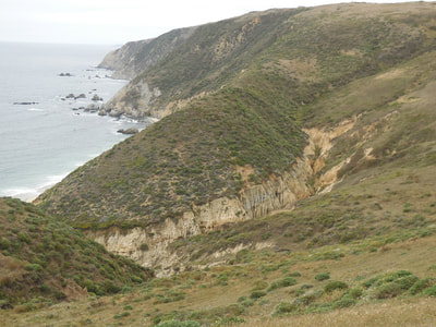
• Check the Trail Advisory link above for trail information. Part of a bluff at Tomales Point has fallen, affecting trail accessibility.
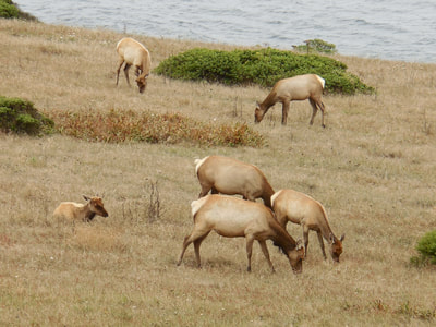
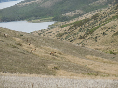
• This trail includes the Tule Elk Reserve. Pay attention to notices regarding wildlife.
• Point Reyes weather can be blustery and chilly, even when surrounding areas are hot and dry. Be prepared with changeable layers of clothing.
The trail:
Part of the treat of visiting Point Reyes is the drive. Be prepared to take your time on roads that are not always smooth, possibly stopping for animals on the road, and enjoy the leisurely pace of getting from one scenic place to the next. It’s actually one long continuum of great scenery.
Point Reyes covers a very large area and offers many hike and beach visiting options. The Tomales Point Trail through the Tule Elk Reserve is pretty much the northernmost option, so involves a longer drive to get to the trailhead.
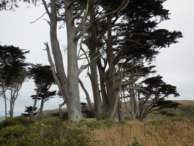
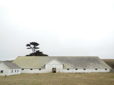
Pierce Point Ranch offers a picturesque old barn, a visually stunning row of trees to start off the trail, and quite a few parking spaces. (This seems like an obvious spot to have toilet facilities, but you have to go 0.4 miles to McClures Beach for the bathroom.)
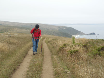
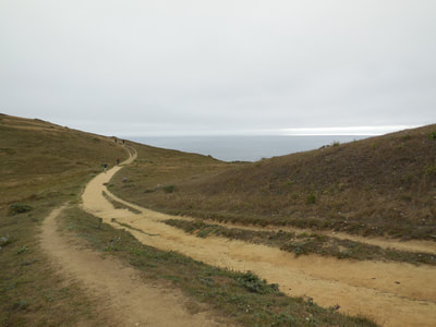
Heading north from Pierce Point Ranch, the Tomales Point hike is pretty much a soft rolling trail, more like a worn old road, leading toward the tip of Tomales Point. The far north end is unmaintained trail, and there is an advisory about crumbling bluffs. All cliff warnings and advisories should be taken seriously. Use your own wits and judgment in addition to posted warnings. California’s coastline is a living, breathing, dynamically changing geological formation, with entire chunks of cliff falling even between hikes I’ve done several months or a year apart at various locations.
Animals moving about (or not) of their own volition, how many tule elk you see, and how closely you see them, will be a matter of luck of the day or season. Binoculars are worth carrying for this hike.
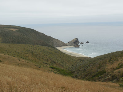
Walking north, if you turn back and look south, you’ll see the curve of McClures Beach behind you.
Facing north, you have the Pacific to your left, and Tomales Bay to your right.
This is not a challenging hike in the sense that it does not have steep sections, although there are rolling hills. The maintained part of the trail is 3 miles out, so you could make a 6 mile round trip hike while staying on fairly easy footing.
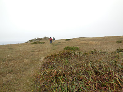
There are patchy rock areas that make for handy break spots. If you sit quietly in an area near the Tule elk, they may wander closer than you expect.
The visual pleasure of this trail has unique subtle features as you make your way back. The changing light over the Pacific is a delight in any direction.
The barn building back at Pierce Point Ranch is also photogenic of its own accord, both inside and out. Walk at your own pace, turn around when you feel you’ve hit halfway, and enjoy the scenic drive back.
(Tomales Point - Point Reyes Hike Notes were originally paired with the “Try a Little Tenderness” Insights post.)
Click Insights/Hike Update News for inspiring reflections. Browse hikes on the main Hikes page or on the Hike Search by Area page. Check out selected articles and interviews under Media. Click World Walks to see or share favorite family-friendly walks! Stay in touch with Lisa Louis and HikingAutism via Contact. See products with inspiring designs that support the efforts of HikingAutism under Support/Shop. The Links page lists a loose collection of helpful information links.
Check the Home page for the broader background story. If you’re not able to take one of these Northern California hikes, hopefully you can enjoy the photo galleries at the bottom of each hike page! Feel free to share and follow on Facebook at HikingAutism, follow on Twitter at @HikingAutism and Instagram at lisalouis777
