Olema Bolinas Ridge Walk, Olema, CA
(scroll to bottom for photo gallery)
Location: Bolinas Ridge Trailhead, on Sir Francis Drake Blvd., midway between Olema, CA and Tocaloma, CA (northwest of Samuel P. Taylor State Park)
Starting Point: There are several ways to connect onto the Bolinas Ridge Trail, but this hike starts from the Bolinas Ridge Trailhead on Sir Francis Drake Blvd.
For driving directions, input “Bolinas Ridge Trailhead, Olema” into your GPS map system.
Info links:
For all web links, if a link doesn’t jump directly, copy and paste into browser.
Olema Valley and Bolinas Ridge link (CA State Parks):
https://www.nps.gov/goga/planyourvisit/bolinas.htm
Bolinas Ridge Info link (Parks Conservancy):
https://www.parksconservancy.org/parks/bolinas-ridge
Bolinas Ridge Trail area map link (National Park Service):
https://www.parksconservancy.org/parks/bolinas-ridge
Bear Valley Visitor Center info link:
https://www.nps.gov/pore/planyourvisit/visitorcenters.htm#CP_JUMP_63132
Distance:
The Bolinas Ridge Trail is a 10.5 mile loop starting in Samuel P. Taylor State Park. Hikers can walk shorter segments from various starting points. This hike description covers the hike starting from the Bolinas Ridge Trailhead on Sir Francis Drake Blvd. We probably covered three or so miles out and back.
Considerations:
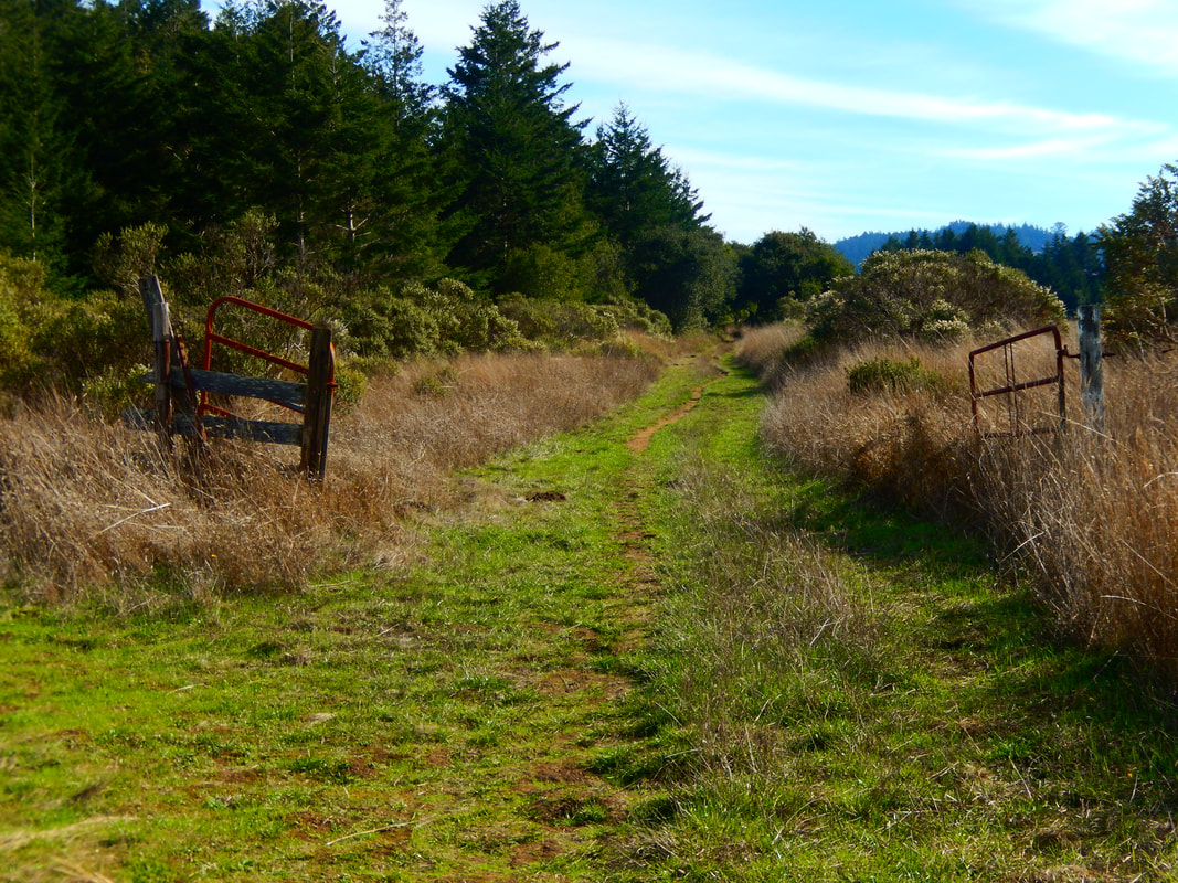
• There are no toilet facilities at this roadside trailhead.
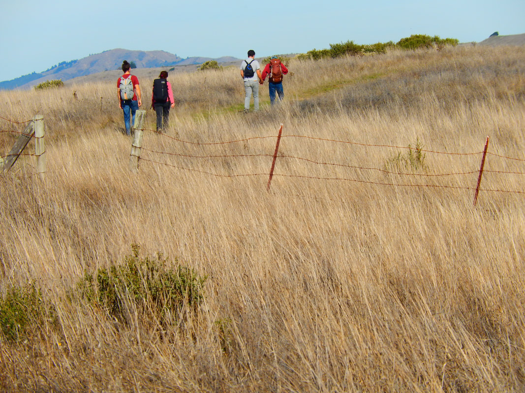
• Keep an eye out for ticks, especially around high grass.
• There is little tree cover for this walk, so sun protection and water bottles are important.
• Follow posted signs regarding dogs, bikes, etc.
• Always check the park service alerts link for storm-related road closures, etc. (https://www.nps.gov/goga/planyourvisit/conditions.htm)
The trail:
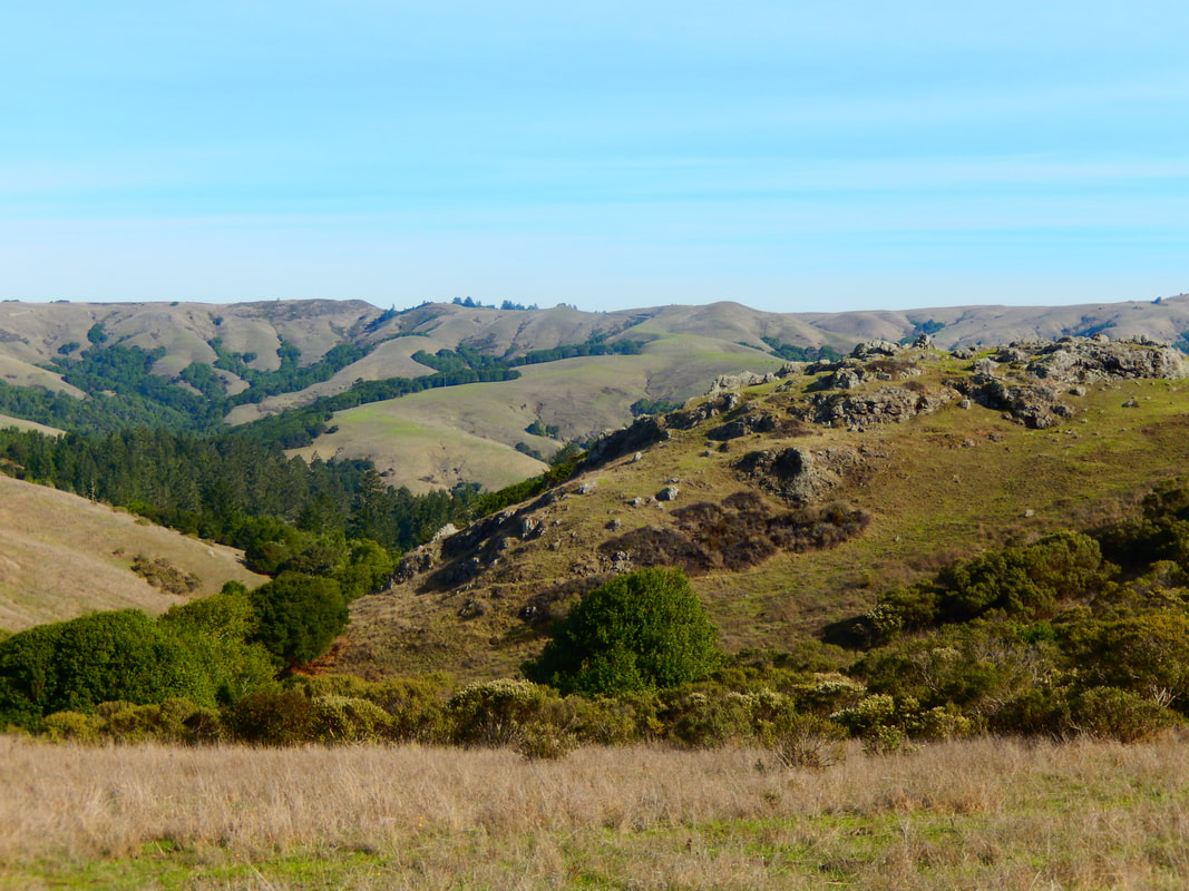
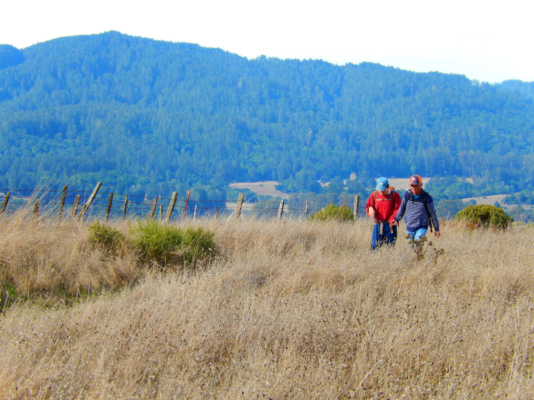
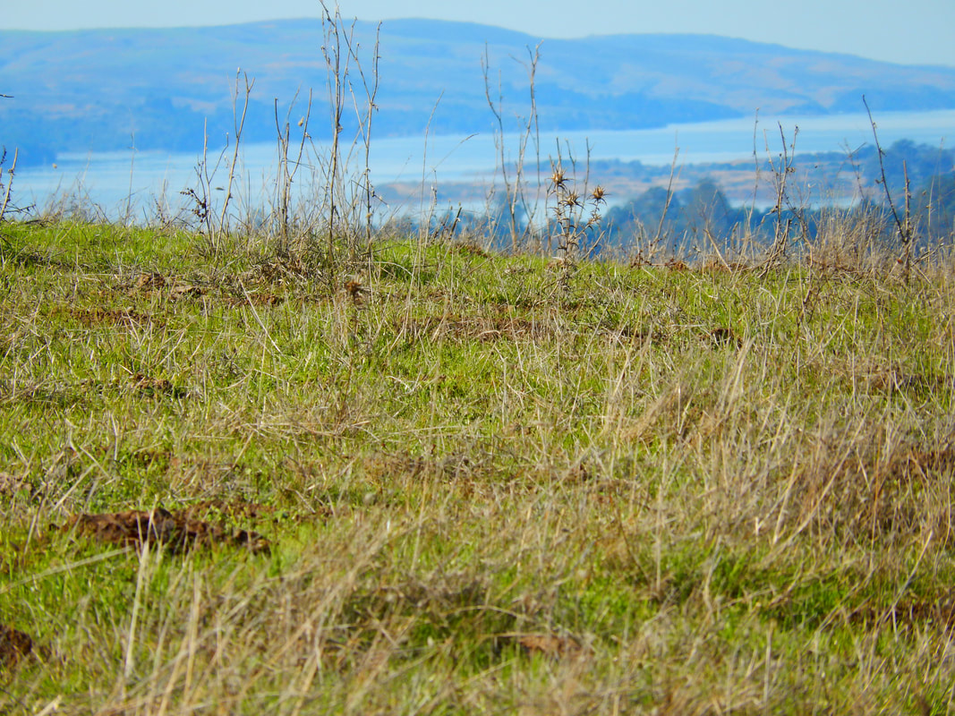
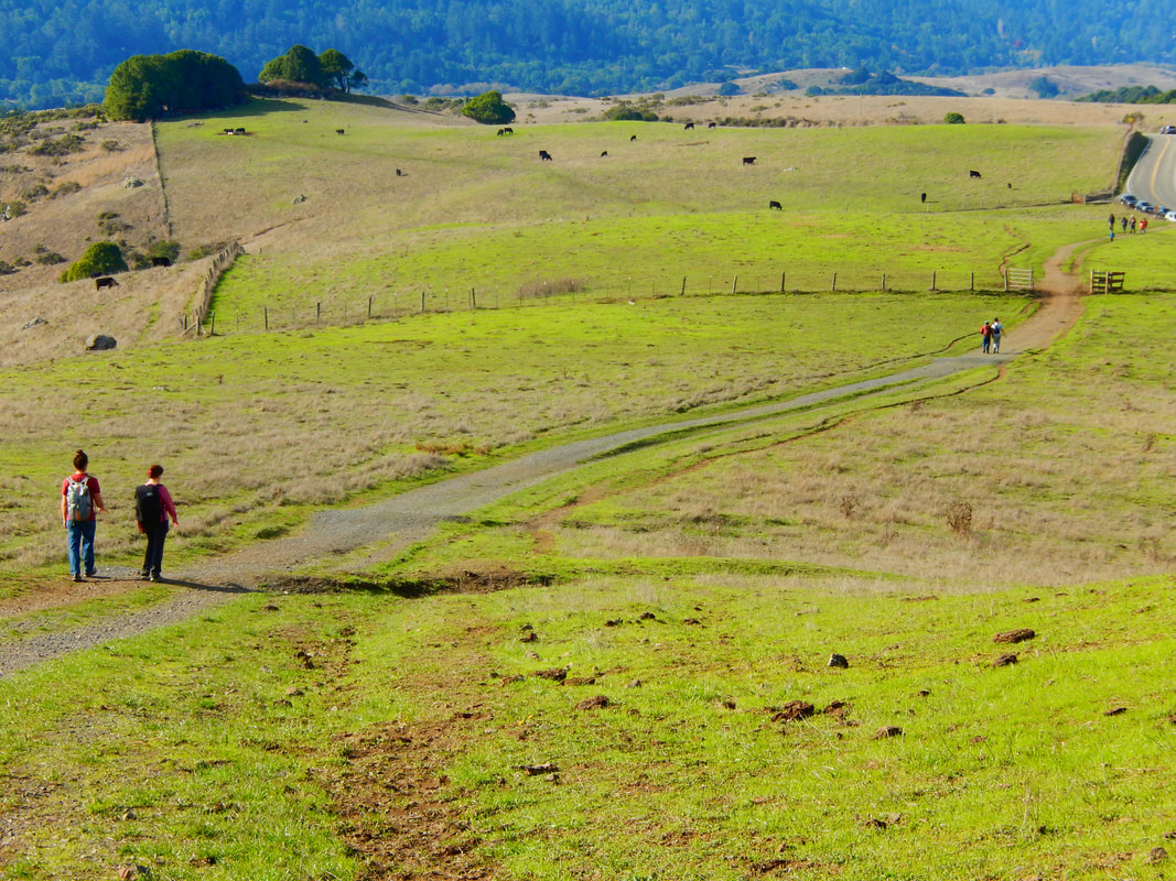
Starting by the cattle gate by the trailhead parking on Sir Francis Drake Blvd., Olema Valley has rolling hills that dip up and down along cow fields, with Tomales Bay at one end and Bolinas Lagoon at the other.
This is an iconic pastoral scenery walk past cows in open fields with sporadic rock formations and patchy tree coverage.
Though there are few hills that could be called steep, the rising grade can be pretty long for some stretches.
There is a more forested area further along the Bolinas Ridge Trail, past the connection with the Jewell Trail.
As with most out and back hikes, the visual delights going one direction feel very different facing back for the return trip. Our hike was in the morning, but this would be a wonderful place for viewing the sunset.
(Olema Bolinas Ridge Walk Hike Notes were originally paired with the “Peace in the Fields” Insights post.)
Click Insights/Hike Update News for inspiring reflections. Browse hikes on the main Hikes page or on the Hike Search by Area page. Check out selected articles and interviews under Media. Click World Walks to see or share favorite family-friendly walks! Stay in touch with Lisa Louis and HikingAutism via Contact. See products with inspiring designs that support the efforts of HikingAutism under Support/Shop. The Links page lists a loose collection of helpful information links.
Check the Home page for the broader background story. If you’re not able to take one of these Northern California hikes, hopefully you can enjoy the photo galleries at the bottom of each hike page! Feel free to share and follow on Facebook at HikingAutism, follow on Twitter at @HikingAutism and Instagram at lisalouis777
(scroll to bottom for photo gallery)
Location: Bolinas Ridge Trailhead, on Sir Francis Drake Blvd., midway between Olema, CA and Tocaloma, CA (northwest of Samuel P. Taylor State Park)
Starting Point: There are several ways to connect onto the Bolinas Ridge Trail, but this hike starts from the Bolinas Ridge Trailhead on Sir Francis Drake Blvd.
For driving directions, input “Bolinas Ridge Trailhead, Olema” into your GPS map system.
Info links:
For all web links, if a link doesn’t jump directly, copy and paste into browser.
Olema Valley and Bolinas Ridge link (CA State Parks):
https://www.nps.gov/goga/planyourvisit/bolinas.htm
Bolinas Ridge Info link (Parks Conservancy):
https://www.parksconservancy.org/parks/bolinas-ridge
Bolinas Ridge Trail area map link (National Park Service):
https://www.parksconservancy.org/parks/bolinas-ridge
Bear Valley Visitor Center info link:
https://www.nps.gov/pore/planyourvisit/visitorcenters.htm#CP_JUMP_63132
Distance:
The Bolinas Ridge Trail is a 10.5 mile loop starting in Samuel P. Taylor State Park. Hikers can walk shorter segments from various starting points. This hike description covers the hike starting from the Bolinas Ridge Trailhead on Sir Francis Drake Blvd. We probably covered three or so miles out and back.
Considerations:
• There are no toilet facilities at this roadside trailhead.
• Keep an eye out for ticks, especially around high grass.
• There is little tree cover for this walk, so sun protection and water bottles are important.
• Follow posted signs regarding dogs, bikes, etc.
• Always check the park service alerts link for storm-related road closures, etc. (https://www.nps.gov/goga/planyourvisit/conditions.htm)
The trail:
Starting by the cattle gate by the trailhead parking on Sir Francis Drake Blvd., Olema Valley has rolling hills that dip up and down along cow fields, with Tomales Bay at one end and Bolinas Lagoon at the other.
This is an iconic pastoral scenery walk past cows in open fields with sporadic rock formations and patchy tree coverage.
Though there are few hills that could be called steep, the rising grade can be pretty long for some stretches.
There is a more forested area further along the Bolinas Ridge Trail, past the connection with the Jewell Trail.
As with most out and back hikes, the visual delights going one direction feel very different facing back for the return trip. Our hike was in the morning, but this would be a wonderful place for viewing the sunset.
(Olema Bolinas Ridge Walk Hike Notes were originally paired with the “Peace in the Fields” Insights post.)
Click Insights/Hike Update News for inspiring reflections. Browse hikes on the main Hikes page or on the Hike Search by Area page. Check out selected articles and interviews under Media. Click World Walks to see or share favorite family-friendly walks! Stay in touch with Lisa Louis and HikingAutism via Contact. See products with inspiring designs that support the efforts of HikingAutism under Support/Shop. The Links page lists a loose collection of helpful information links.
Check the Home page for the broader background story. If you’re not able to take one of these Northern California hikes, hopefully you can enjoy the photo galleries at the bottom of each hike page! Feel free to share and follow on Facebook at HikingAutism, follow on Twitter at @HikingAutism and Instagram at lisalouis777