Tennessee Valley Fox Trail, Tennessee Valley, Mill Valley, Marin County, California
(scroll to bottom for photo gallery)
Location: To get to the Tennessee Valley trailhead, from Route 101 (north of the Golden Gate Bridge), take Mill Valley/Stinson Beach/Hwy. 1 exit. Follow the Shoreline Highway until you see the Tennessee Valley Rd. sign, take the left turn, and follow the winding road until you reach the parking area.
Starting Point: Tennessee Valley Trailhead parking lot, walk about 0.3 miles on the Tennessee Valley Road/Trail. Shortly after the trail turnoff to Haypress Camp (see Rhubarb Trail to Haypress Camp), there is a trail marking the start of the Fox Trail on the right.
Info links:
For all web links, if a link doesn’t jump directly, copy and paste into browser.
Tennessee Valley information:
https://www.nps.gov/goga/planyourvisit/tennessee_valley.htm
Tennessee Valley Disability Accessibility information (scroll down):
https://www.nps.gov/goga/planyourvisit/tennessee-valley-accessibility.htm
Maps with trails (Marin Headlands, includes Tennessee Valley trails):
https://www.nps.gov/goga/planyourvisit/upload/map_mahe_150429_508_2021.pdf
Distance:
Tennessee Valley Trailhead to Fox Trail connection: Approx. 0.3 miles
Fox Trail to Coastal Trail and Coyote Ridge Trail crossroads: 1.1 or 1.2 miles, depending on your information source
Coastal Trail (southbound) to Pirates Cove Trail connection: 0.7 miles
Coastal Trail to Tennessee Valley Trail: 0.7 miles
Tennessee Valley Trail to trailhead parking lot: 1.1 miles
Considerations:
• The Tennessee Valley trailhead parking lot is fairly large, but can get full on weekends and holidays, especially in the afternoon.
• Bathrooms are available at the parking lot.
• Cell phone service is spotty in some places and non-existent in others.
The trail:
Those who like hiking in this area at locations such as Tennessee Valley Beach and Haypress Camp (see Hike Notes on Tennessee Valley and Rhubarb Trail to Haypress Camp) will be familiar with the first 0.3 miles along the Tennessee Valley Trail to the Fox Trail turnoff.
On the right side of the Tennessee Valley Trail, just past the Haypress Camp trail connection, is a sign for the Fox Trail.
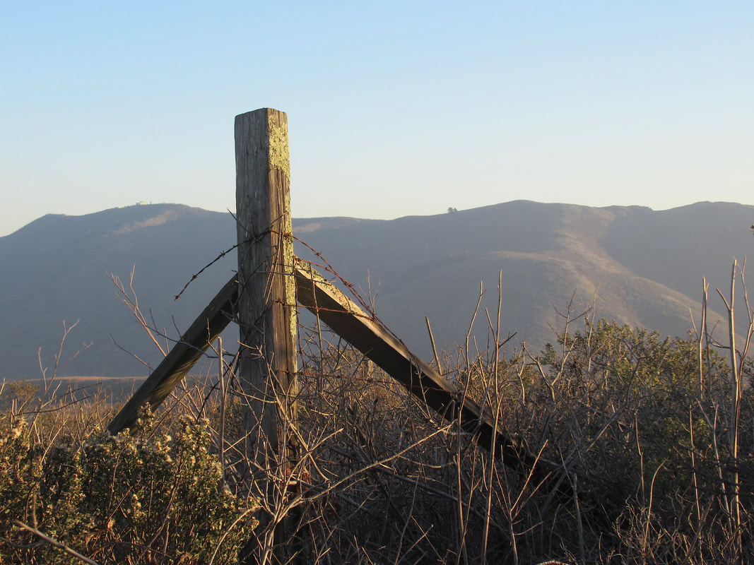
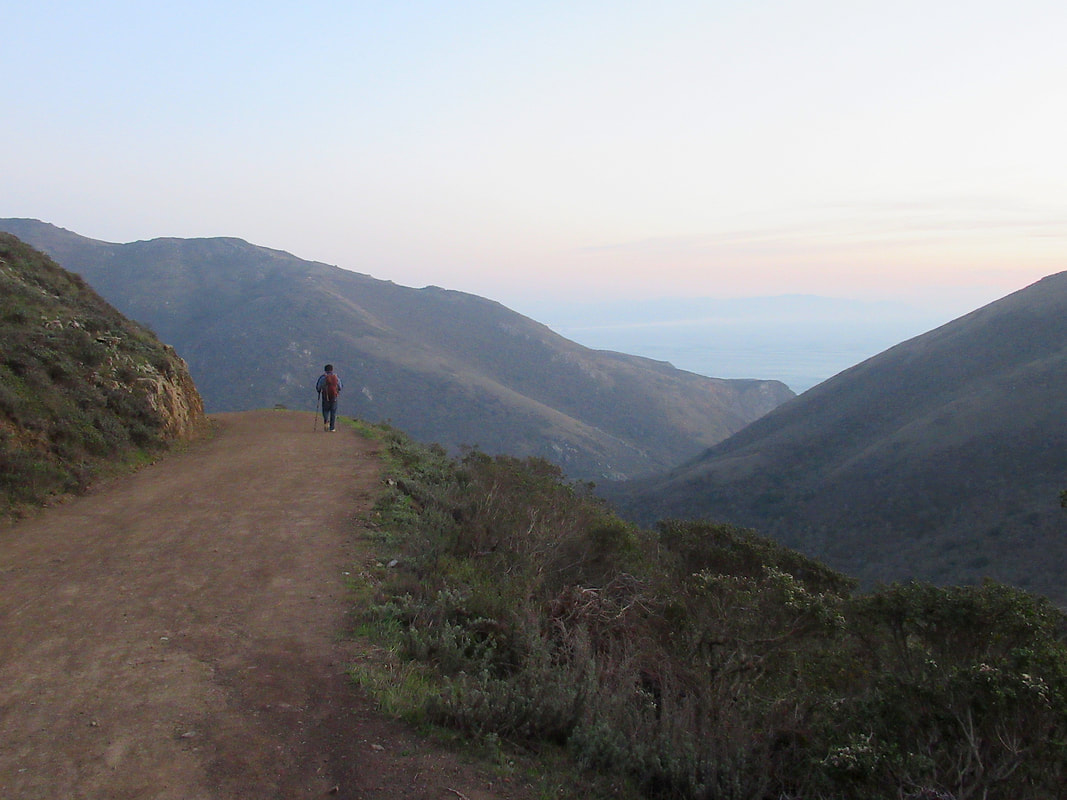
This is open chaparral terrain with coyote brush and other low lying plants along the sides of a wide trail. Though not a steep incline, the upward grade grinds on over a mile, so the sense of effort to climb kicks in at some point.
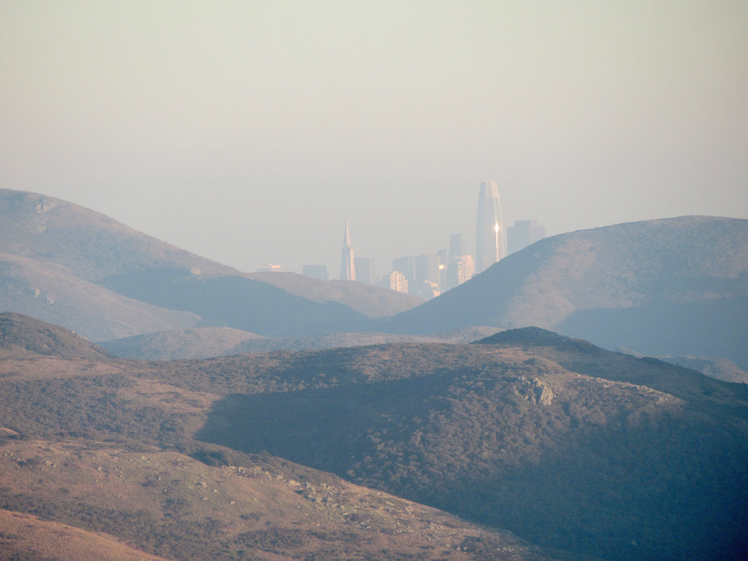
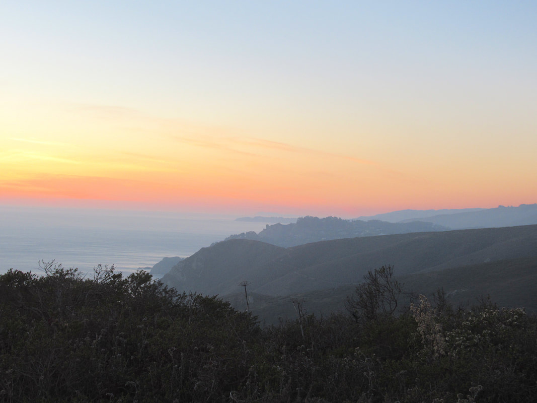
The views include the rolling, soft waves of the Marin Headlands in the midrange view, and bodies of water in the far view. We had a hazy-yet-sparkling view of the San Francisco skyline that looked a lot like Emerald City from the Yellow Brick Road in the Wizard of Oz. Indeed, we were not in Kansas, Dorothy.
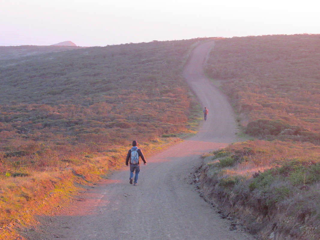
Once at the main trail intersection, we took the Coastal Trail/Coastal Fire Road south toward Tennessee Valley. (The Coastal Trail westward leads toward the north end of the Pirates Cove Trail and Muir Beach.)
This part of the hike makes for a good ridge top stop for a snack looking out at the ocean. Definitely a good spot to check out the sun as it lowers over the ocean, as long as you have a source of light to make your way back. (Residual light after sunset and a bit of moonlight got us back without turning on flashlights.)
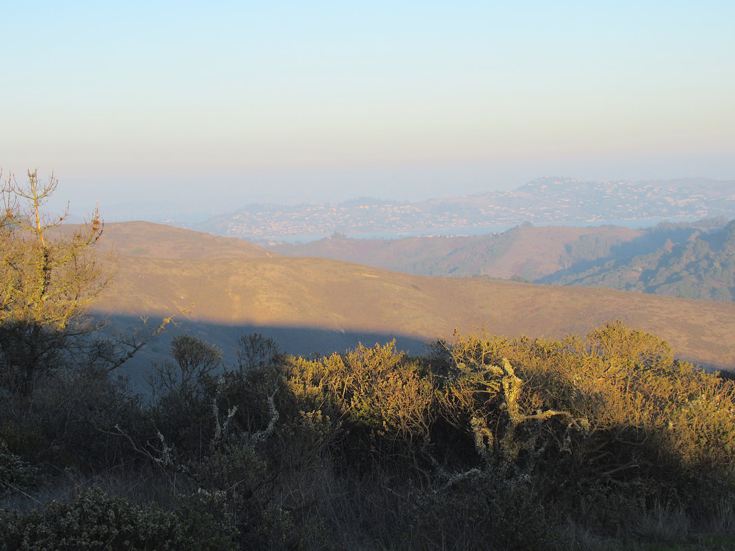
The rises and falls, and broad twists and turns of the Coastal Trail leading back toward Tennessee Valley offer a variety of views, including jutting sections of Point Reyes facing north.
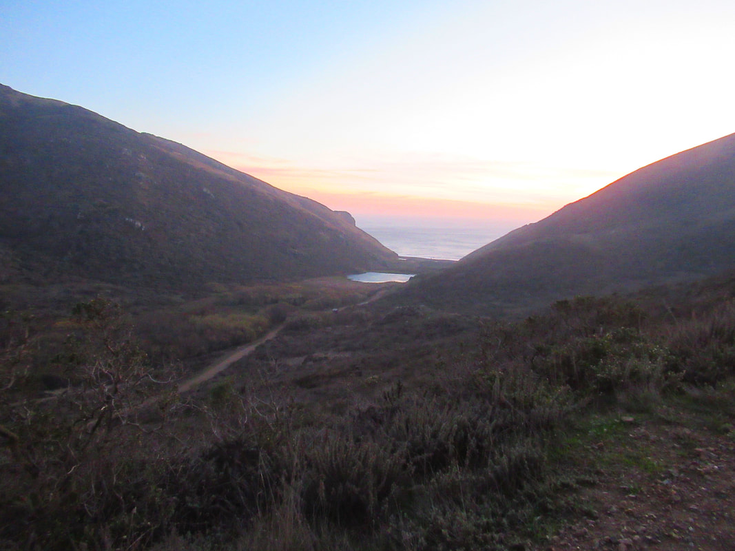
As we got back toward the drop down into Tennessee Valley and its namesake trail back to the trailhead parking area, we saw deer grazing down the hill and a small herd keeping watch from above as well. There were volunteers with binoculars out on the trail earlier on our walk observing bobcat activity. We didn't see any bobcats, or the elusive mountain lions, but it’s good to know they live in the area.
We cut back toward the trailhead parking lot once we connected to the Tennessee Valley Trail, but with extra time and energy, hikers can enjoy a stop at Tennessee Valley Beach before heading back.
(Tennessee Valley Fox Trail Hike Notes were originally paired with the “Winter Light” Insights post.)
Click Insights/Hike Update News for inspiring reflections. Browse hikes on the main Hikes page or on the Hike Search by Area page. Check out selected articles and interviews under Media. Click World Walks to see or share favorite family-friendly walks! Stay in touch with Lisa Louis and HikingAutism via Contact. See products with inspiring designs that support the efforts of HikingAutism under Support/Shop. The Links page lists a loose collection of helpful information links.
Check the Home page for the broader background story. If you’re not able to take one of these Northern California hikes, hopefully you can enjoy the photo galleries at the bottom of each hike page! Feel free to share and follow on Facebook at HikingAutism, follow on Twitter at @HikingAutism and Instagram at lisalouis777
(scroll to bottom for photo gallery)
Location: To get to the Tennessee Valley trailhead, from Route 101 (north of the Golden Gate Bridge), take Mill Valley/Stinson Beach/Hwy. 1 exit. Follow the Shoreline Highway until you see the Tennessee Valley Rd. sign, take the left turn, and follow the winding road until you reach the parking area.
Starting Point: Tennessee Valley Trailhead parking lot, walk about 0.3 miles on the Tennessee Valley Road/Trail. Shortly after the trail turnoff to Haypress Camp (see Rhubarb Trail to Haypress Camp), there is a trail marking the start of the Fox Trail on the right.
Info links:
For all web links, if a link doesn’t jump directly, copy and paste into browser.
Tennessee Valley information:
https://www.nps.gov/goga/planyourvisit/tennessee_valley.htm
Tennessee Valley Disability Accessibility information (scroll down):
https://www.nps.gov/goga/planyourvisit/tennessee-valley-accessibility.htm
Maps with trails (Marin Headlands, includes Tennessee Valley trails):
https://www.nps.gov/goga/planyourvisit/upload/map_mahe_150429_508_2021.pdf
Distance:
Tennessee Valley Trailhead to Fox Trail connection: Approx. 0.3 miles
Fox Trail to Coastal Trail and Coyote Ridge Trail crossroads: 1.1 or 1.2 miles, depending on your information source
Coastal Trail (southbound) to Pirates Cove Trail connection: 0.7 miles
Coastal Trail to Tennessee Valley Trail: 0.7 miles
Tennessee Valley Trail to trailhead parking lot: 1.1 miles
Considerations:
• The Tennessee Valley trailhead parking lot is fairly large, but can get full on weekends and holidays, especially in the afternoon.
• Bathrooms are available at the parking lot.
• Cell phone service is spotty in some places and non-existent in others.
The trail:
Those who like hiking in this area at locations such as Tennessee Valley Beach and Haypress Camp (see Hike Notes on Tennessee Valley and Rhubarb Trail to Haypress Camp) will be familiar with the first 0.3 miles along the Tennessee Valley Trail to the Fox Trail turnoff.
On the right side of the Tennessee Valley Trail, just past the Haypress Camp trail connection, is a sign for the Fox Trail.
This is open chaparral terrain with coyote brush and other low lying plants along the sides of a wide trail. Though not a steep incline, the upward grade grinds on over a mile, so the sense of effort to climb kicks in at some point.
The views include the rolling, soft waves of the Marin Headlands in the midrange view, and bodies of water in the far view. We had a hazy-yet-sparkling view of the San Francisco skyline that looked a lot like Emerald City from the Yellow Brick Road in the Wizard of Oz. Indeed, we were not in Kansas, Dorothy.
Once at the main trail intersection, we took the Coastal Trail/Coastal Fire Road south toward Tennessee Valley. (The Coastal Trail westward leads toward the north end of the Pirates Cove Trail and Muir Beach.)
This part of the hike makes for a good ridge top stop for a snack looking out at the ocean. Definitely a good spot to check out the sun as it lowers over the ocean, as long as you have a source of light to make your way back. (Residual light after sunset and a bit of moonlight got us back without turning on flashlights.)
The rises and falls, and broad twists and turns of the Coastal Trail leading back toward Tennessee Valley offer a variety of views, including jutting sections of Point Reyes facing north.
As we got back toward the drop down into Tennessee Valley and its namesake trail back to the trailhead parking area, we saw deer grazing down the hill and a small herd keeping watch from above as well. There were volunteers with binoculars out on the trail earlier on our walk observing bobcat activity. We didn't see any bobcats, or the elusive mountain lions, but it’s good to know they live in the area.
We cut back toward the trailhead parking lot once we connected to the Tennessee Valley Trail, but with extra time and energy, hikers can enjoy a stop at Tennessee Valley Beach before heading back.
(Tennessee Valley Fox Trail Hike Notes were originally paired with the “Winter Light” Insights post.)
Click Insights/Hike Update News for inspiring reflections. Browse hikes on the main Hikes page or on the Hike Search by Area page. Check out selected articles and interviews under Media. Click World Walks to see or share favorite family-friendly walks! Stay in touch with Lisa Louis and HikingAutism via Contact. See products with inspiring designs that support the efforts of HikingAutism under Support/Shop. The Links page lists a loose collection of helpful information links.
Check the Home page for the broader background story. If you’re not able to take one of these Northern California hikes, hopefully you can enjoy the photo galleries at the bottom of each hike page! Feel free to share and follow on Facebook at HikingAutism, follow on Twitter at @HikingAutism and Instagram at lisalouis777