Lagunitas Creek Walk, Samuel P. Taylor State Park, Lagunitas, California
(scroll to bottom for photo gallery)
Location: 8889Sir Francis Drake Blvd., Lagunitas, CA 94938
Starting Point: Samuel P. Taylor State Park day pass parking area, Sir Francis Drake Blvd., Lagunitas
Info links:
For all web links, if a link doesn’t jump directly, copy and paste into browser.
Marin Watershed Fish Viewing information link (National Park Service):
https://www.nps.gov/pore/planyourvisit/wildlife_viewing_cohosalmon.htm
Marin Watershed Map link:
https://www.marinwater.org/sites/default/files/2020-09/Watershed%20Visitor%20Map.pdf
Samuel P. Taylor State Park information link:
http://www.parks.ca.gov/?page_id=469
Samuel P. Taylor State Park Brochure and Map link:
https://www.parks.ca.gov/pages/469/files/SamuelPTaylorFinalWebLayout072715.pdf
Distance:
The walk illustrated in this photo gallery was about 1 mile out and back for a round trip of about 2 miles, from the Samuel P. Taylor State Park parking area along Lagunitas Creek northwest to the bridge where Taylor Park Rd. crosses from the Cross Marin Trail side of Lagunitas Creek to Sir Francis Drake Blvd.
Considerations:
• Parking in the Samuel P. Taylor State Park parking area requires a small day pass fee.
• Bathrooms are available as part of the Samuel P. Taylor State Park facilities.
• Best luck for salmon viewing is from around November to February, but the trails are beautiful any time of year.
• For those wishing to visit the popular, official fish viewing spot, see link above for Leo T. Cronin Fish Viewing Area for directions.
• Pay attention to wildlife notices such as for mountain lions. We saw bobcat tracks by the creek during our visit.
• Be aware of the poison oak in any hiking area. Technu or another poison oak scrub comes in handy tubes.
The trail:
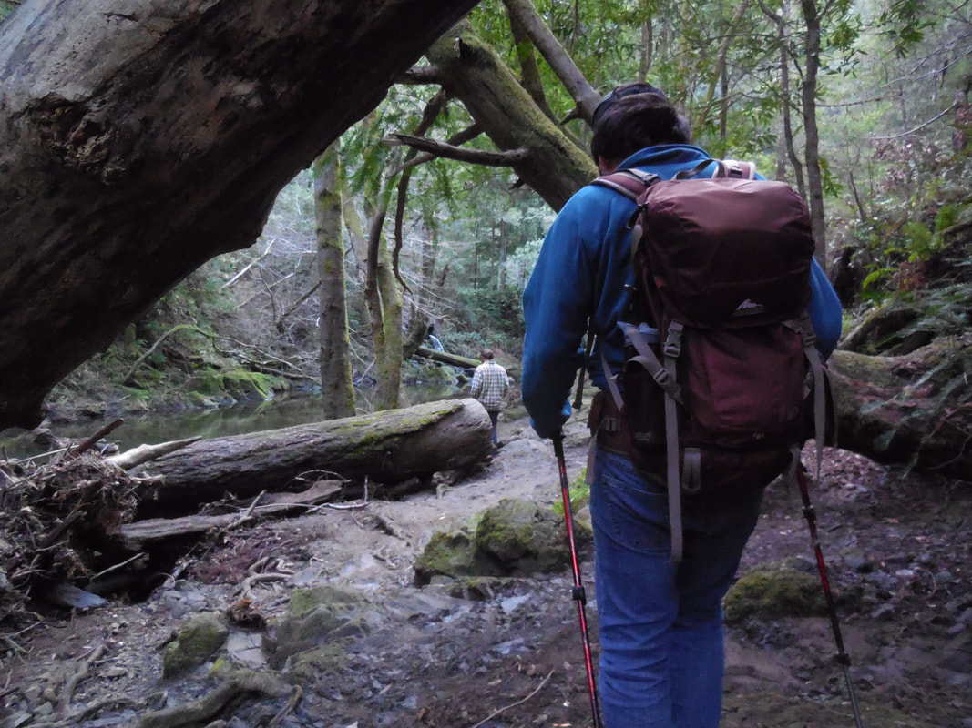
There are other options for hikes along Lagunitas Creek near Samuel P. Taylor State Park, whether during salmon viewing season or not. A popular walk would be to head east on the Cross Marin Trail and go to Shafter Bridge. This photo gallery covers the opposite direction, an easy 2 mile round trip walk heading west from the Samuel P. Taylor State Park parking area and turning around at the small bridge where Taylor Park Rd. crosses the creek to join Sir Francis Drake Blvd.
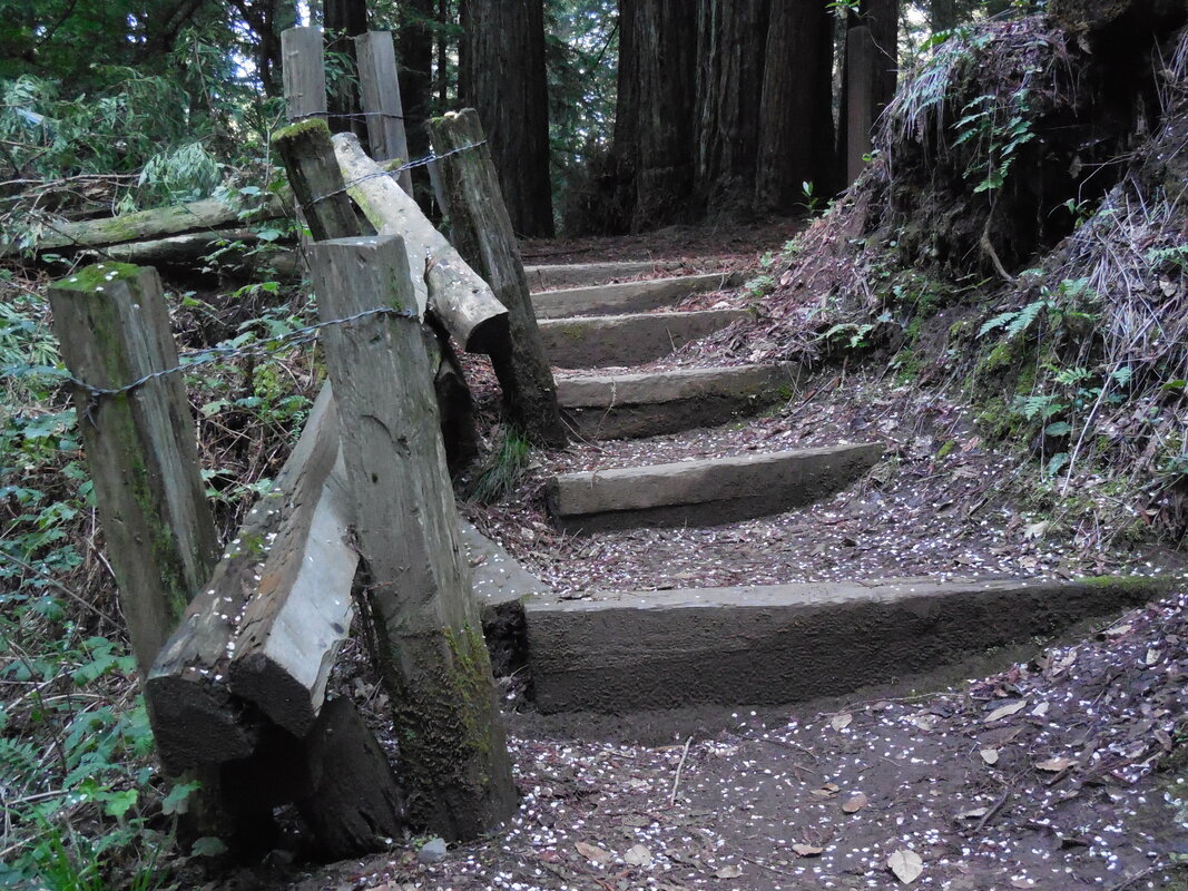
Walkers can enjoy getting a feel for the campsites available at Samuel P. Taylor State park as they walk northwest past the campsite areas along the Cross Marin Trail along Lagunitas Creek, with the Ox Trail as an option part of the way.
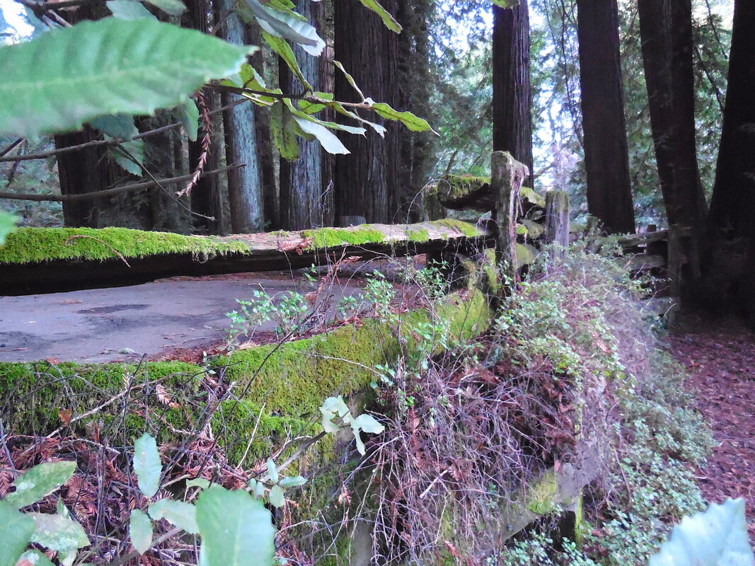
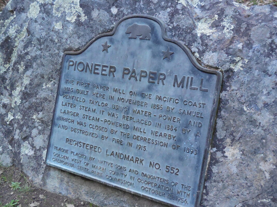
There are information signs along the way, including one about the old railroad crossing, and another about the paper mill built in the area in 1856.
This is a fairly flat path which is also bike friendly. Campers with kids and bikes might be seen riding back and forth along this stretch. Horses are also allowed on the Cross Marin Trail.
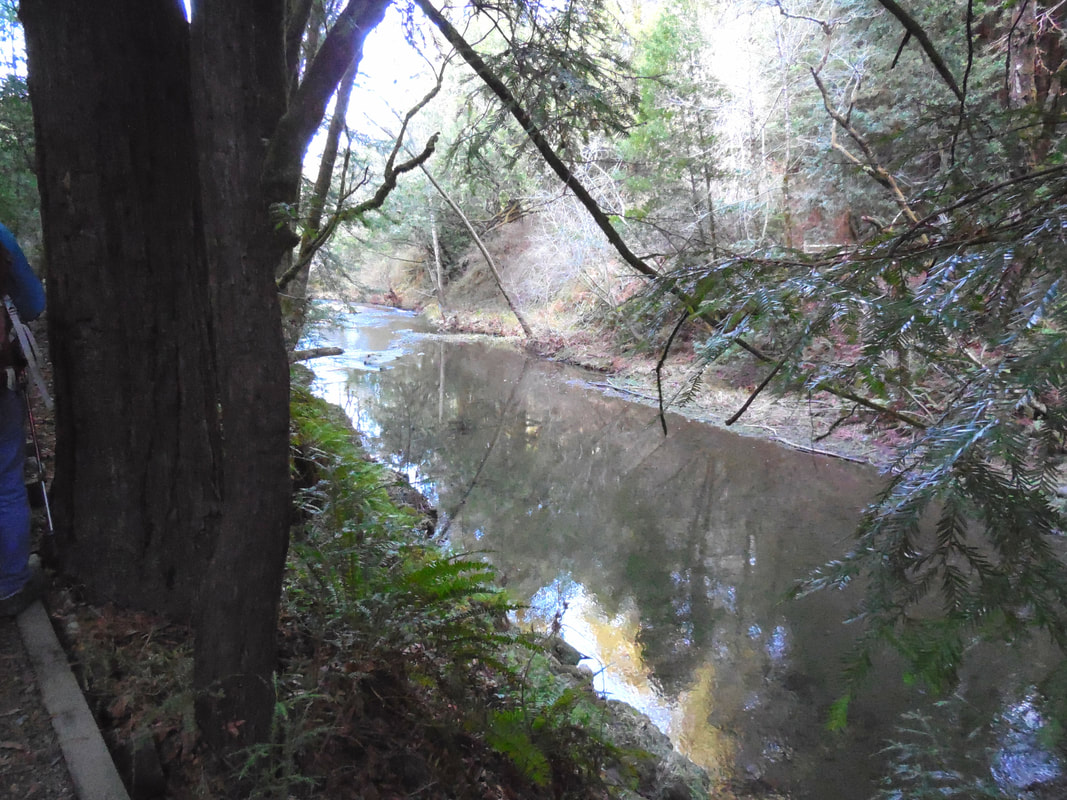
We managed to be down by the creek’s edge at certain points of our walk, and spotted bobcat paw prints.
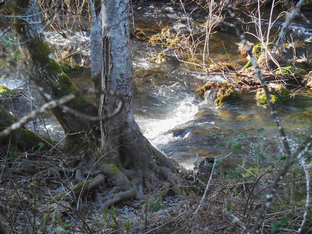
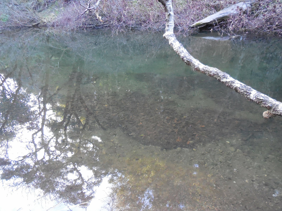
Even on a sunny day, the shady tree cover and mossy surfaces make this a cool, mystical place to take a walk.
Our visit was when water and salmon count were both low, but we did manage to spot salmon swimming. See if you can make out the vague salmon shape in one of the gallery photos. Fish viewing conditions vary from year to year, but the walk is pretty in any season.
(Lagunitas Creek Walk Hike Notes were originally paired with the “Swimming Upstream” Insights post.)
Click Insights/Hike Update News for inspiring reflections. Browse hikes on the main Hikes page or on the Hike Search by Area page. Check out selected articles and interviews under Media. Click World Walks to see or share favorite family-friendly walks! Stay in touch with Lisa Louis and HikingAutism via Contact. See products with inspiring designs that support the efforts of HikingAutism under Support/Shop. The Links page lists a loose collection of helpful information links.
Check the Home page for the broader background story. If you’re not able to take one of these Northern California hikes, hopefully you can enjoy the photo galleries at the bottom of each hike page! Feel free to share and follow on Facebook at HikingAutism, follow on Twitter at @HikingAutism and Instagram at lisalouis777
(scroll to bottom for photo gallery)
Location: 8889Sir Francis Drake Blvd., Lagunitas, CA 94938
Starting Point: Samuel P. Taylor State Park day pass parking area, Sir Francis Drake Blvd., Lagunitas
Info links:
For all web links, if a link doesn’t jump directly, copy and paste into browser.
Marin Watershed Fish Viewing information link (National Park Service):
https://www.nps.gov/pore/planyourvisit/wildlife_viewing_cohosalmon.htm
Marin Watershed Map link:
https://www.marinwater.org/sites/default/files/2020-09/Watershed%20Visitor%20Map.pdf
Samuel P. Taylor State Park information link:
http://www.parks.ca.gov/?page_id=469
Samuel P. Taylor State Park Brochure and Map link:
https://www.parks.ca.gov/pages/469/files/SamuelPTaylorFinalWebLayout072715.pdf
Distance:
The walk illustrated in this photo gallery was about 1 mile out and back for a round trip of about 2 miles, from the Samuel P. Taylor State Park parking area along Lagunitas Creek northwest to the bridge where Taylor Park Rd. crosses from the Cross Marin Trail side of Lagunitas Creek to Sir Francis Drake Blvd.
Considerations:
• Parking in the Samuel P. Taylor State Park parking area requires a small day pass fee.
• Bathrooms are available as part of the Samuel P. Taylor State Park facilities.
• Best luck for salmon viewing is from around November to February, but the trails are beautiful any time of year.
• For those wishing to visit the popular, official fish viewing spot, see link above for Leo T. Cronin Fish Viewing Area for directions.
• Pay attention to wildlife notices such as for mountain lions. We saw bobcat tracks by the creek during our visit.
• Be aware of the poison oak in any hiking area. Technu or another poison oak scrub comes in handy tubes.
The trail:
There are other options for hikes along Lagunitas Creek near Samuel P. Taylor State Park, whether during salmon viewing season or not. A popular walk would be to head east on the Cross Marin Trail and go to Shafter Bridge. This photo gallery covers the opposite direction, an easy 2 mile round trip walk heading west from the Samuel P. Taylor State Park parking area and turning around at the small bridge where Taylor Park Rd. crosses the creek to join Sir Francis Drake Blvd.
Walkers can enjoy getting a feel for the campsites available at Samuel P. Taylor State park as they walk northwest past the campsite areas along the Cross Marin Trail along Lagunitas Creek, with the Ox Trail as an option part of the way.
There are information signs along the way, including one about the old railroad crossing, and another about the paper mill built in the area in 1856.
This is a fairly flat path which is also bike friendly. Campers with kids and bikes might be seen riding back and forth along this stretch. Horses are also allowed on the Cross Marin Trail.
We managed to be down by the creek’s edge at certain points of our walk, and spotted bobcat paw prints.
Even on a sunny day, the shady tree cover and mossy surfaces make this a cool, mystical place to take a walk.
Our visit was when water and salmon count were both low, but we did manage to spot salmon swimming. See if you can make out the vague salmon shape in one of the gallery photos. Fish viewing conditions vary from year to year, but the walk is pretty in any season.
(Lagunitas Creek Walk Hike Notes were originally paired with the “Swimming Upstream” Insights post.)
Click Insights/Hike Update News for inspiring reflections. Browse hikes on the main Hikes page or on the Hike Search by Area page. Check out selected articles and interviews under Media. Click World Walks to see or share favorite family-friendly walks! Stay in touch with Lisa Louis and HikingAutism via Contact. See products with inspiring designs that support the efforts of HikingAutism under Support/Shop. The Links page lists a loose collection of helpful information links.
Check the Home page for the broader background story. If you’re not able to take one of these Northern California hikes, hopefully you can enjoy the photo galleries at the bottom of each hike page! Feel free to share and follow on Facebook at HikingAutism, follow on Twitter at @HikingAutism and Instagram at lisalouis777