Bothin Marsh
(scroll to bottom for photo gallery)
Location:Bothin Marsh Preserve, Mill Valley, CA
Starting Point:Pohono St. Park and Ride parking area, Pohono St., Mill Valley, CA (alternative starting point noted in Directions link below)
Info/Links:
For all web links, if a link doesn’t jump directly, copy and paste into browser.
Bothin Marsh Preserve info link (Marin County Parks):
https://www.marincountyparks.org/parkspreserves/preserves/bothin-marsh
Trail Map link (Marin County Parks):
https://www.parks.marincounty.org/-/media/files/sites/marin-county-parks/parks-and-preserves/maps/map_bothin_061221.pdf
Directions (Marin County Parks):
https://www.marincountyparks.org/parkspreserves/preserves/bothin-marsh?tabnum=2
Mill Valley/Sausalito Pathway (Marin County Parks):
https://www.marincountyparks.org/parkspreserves/parks/mill-valley-sausalito-pathway
Distance:
From the Pohono St. parking area to the north end of the Marsh near Sycamore Ave. near Mill Valley Middle School looks to be about one mile, with a walk out and back making for a two mile round trip, not including excursions down side paths.
Considerations:
• We enjoy starting this walk from before the Highway 101 overpass, walking from the Pohono St. park and ride area and crossing the bridge over Coyote Creek to reach Bothin Marsh itself, but Miller Ave. is noted as another popular starting spot for visiting Bothin Marsh Preserve.
• There are port-a-potties available at the Pohono St. parking lot in the Muir Woods Shuttle area.
• This is an open path with no shade. Sun protection is in order for sunny days, and layers with wind protection for cold, windy days.
• Mud and deep puddles can be an issue during rainy season.
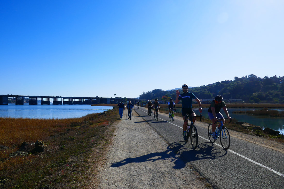
• This trail is popular with bikers, sometimes in large groups going fast. Keep your walking group on one side of the trail or the other and be aware of fast bikes passing by, particularly on narrow bridges.
The trail:
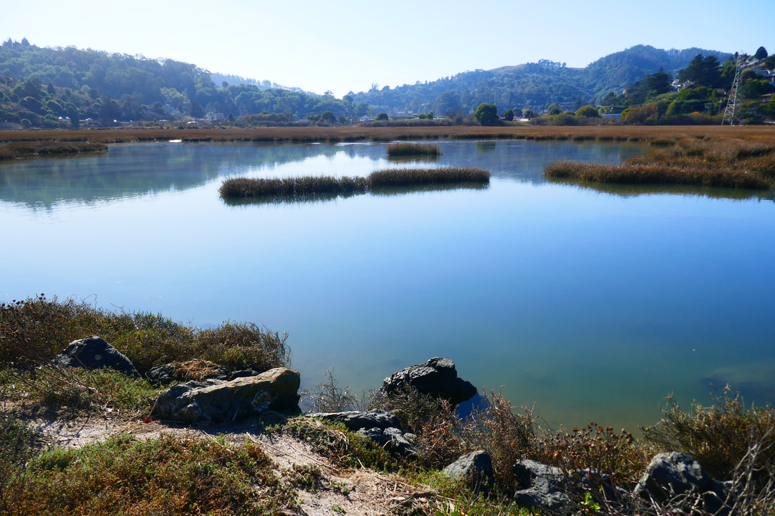
Just a short distance north of the Golden Gate Bridge, visiting the Bothin Marsh Preserve makes for an easy, flat walk among countless migratory birds under the watch of Mt. Tam, without ever really leaving urban conveniences.
Exit 445B from US-101 allows visitors to start from our favored spot, the Pohono St. Park and Ride, or to start from Miller Ave. via Altamont Blvd. off CA-1.
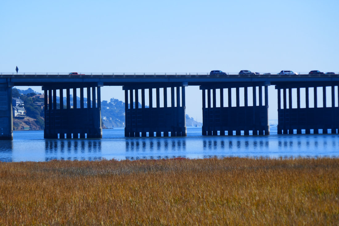
Our walk in this photo gallery started from the Pohono St. parking area. Before walkers even get to the freeway overpass, which is a dramatic structure to walk under, you may see a variety of birds, and perhaps kayakers having a paddle in Richardson Bay.
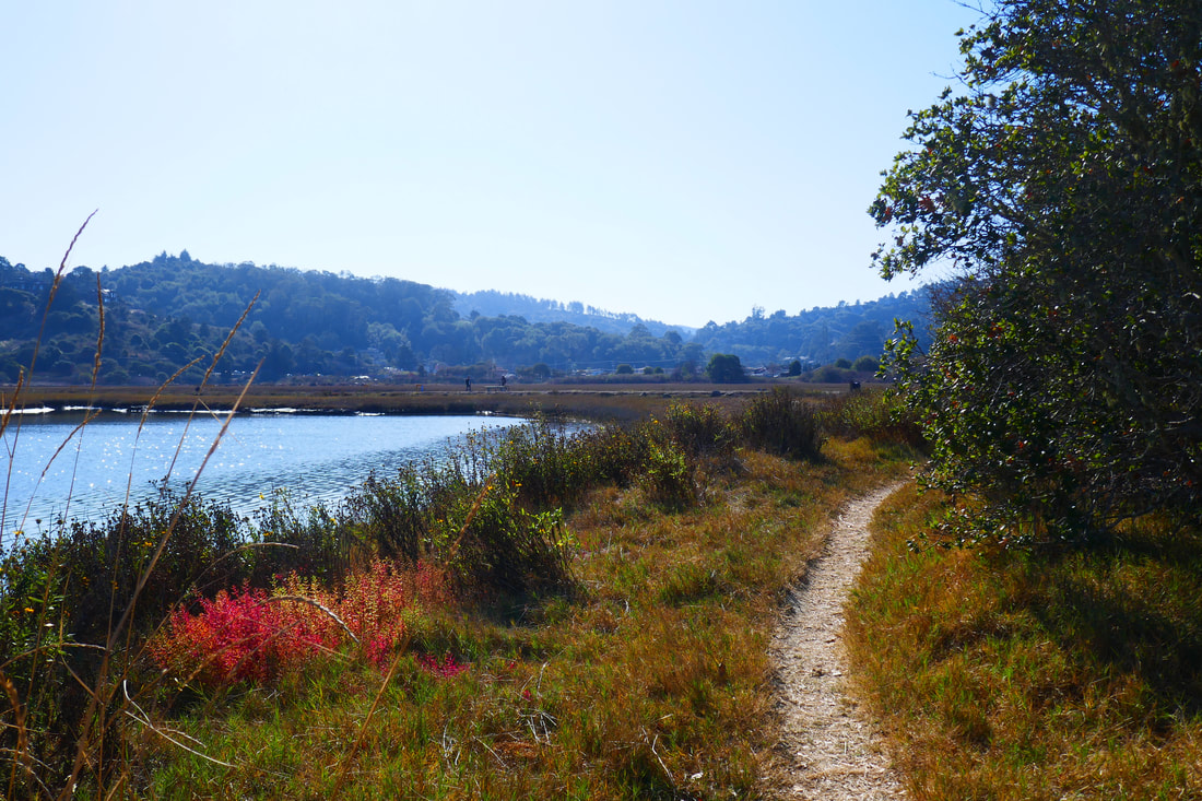
Once past the overpass, the trail passes over Coyote Creek by a small bridge. There’s a wooden boardwalk trail that goes along the side of Coyote Creek which makes for a nice little addition to the walk, or visitors can just continue straight on the Mill Valley/Sausalito Path/Bay Trail that leads north through Bothin Marsh Preserve.
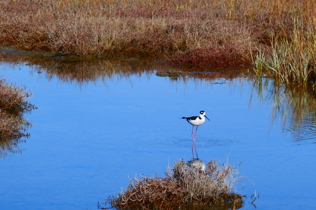
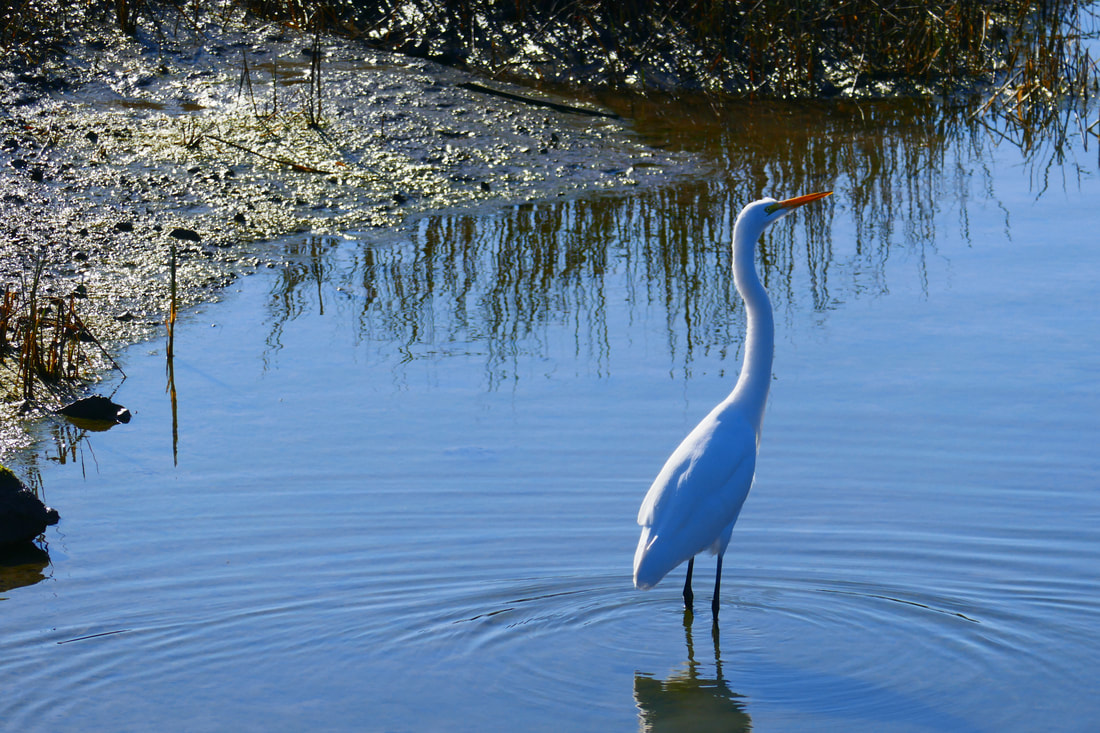
Bikes make their way at fast speeds, sometimes in groups, so keep an eye out in front and behind, and make space on the trail. There are many interesting birds to see, some of which we were not able to identify.
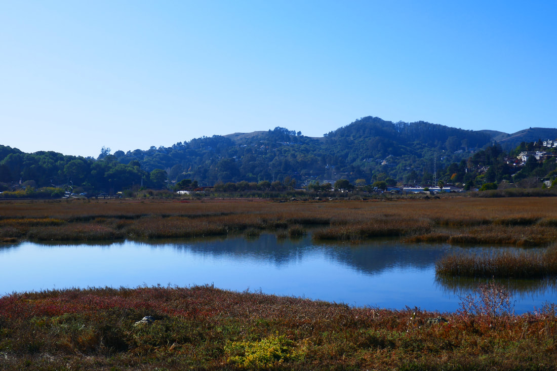
Mt. Tam looms to the north, reflecting in the marsh waters when the light is right. Sunshine brings entrancing sparkle patterns between clumps of marsh grass.
There is a pretty little side path facing the bay that takes walkers out to a grassy outcropping with some trees, which has a bit more of an off the trail feel than the main path. Walkers can continue on to a dog run and park toward the northern end. Though we didn’t go that far, a bridge also crosses over to Hauke Park, at the northeast end of the waterway that the marsh borders.
The flat path makes this walk more accessible for those in wheelchairs as well, though rainy season can make for mud and sometimes deep puddles. For easy access to amazing migratory bird viewing, this is a great choice.
(Bothin Marsh Hike Notes were originally paired with the “Nature Through an Urban Frame” Insights post.)
Click Insights/Hike Update News for inspiring reflections. Browse hikes on the main Hikes page or on the Hike Search by Area page. Check out selected articles and interviews under Media. Click World Walks to see or share favorite family-friendly walks! Stay in touch with Lisa Louis and HikingAutism via Contact. See products with inspiring designs that support the efforts of HikingAutism under Support/Shop. The Links page lists a loose collection of helpful information links.
Check the Home page for the broader background story. If you’re not able to take one of these Northern California hikes, hopefully you can enjoy the photo galleries at the bottom of each hike page! Feel free to share and follow on Facebook at HikingAutism, follow on Twitter at @HikingAutism and Instagram at lisalouis777
(scroll to bottom for photo gallery)
Location:Bothin Marsh Preserve, Mill Valley, CA
Starting Point:Pohono St. Park and Ride parking area, Pohono St., Mill Valley, CA (alternative starting point noted in Directions link below)
Info/Links:
For all web links, if a link doesn’t jump directly, copy and paste into browser.
Bothin Marsh Preserve info link (Marin County Parks):
https://www.marincountyparks.org/parkspreserves/preserves/bothin-marsh
Trail Map link (Marin County Parks):
https://www.parks.marincounty.org/-/media/files/sites/marin-county-parks/parks-and-preserves/maps/map_bothin_061221.pdf
Directions (Marin County Parks):
https://www.marincountyparks.org/parkspreserves/preserves/bothin-marsh?tabnum=2
Mill Valley/Sausalito Pathway (Marin County Parks):
https://www.marincountyparks.org/parkspreserves/parks/mill-valley-sausalito-pathway
Distance:
From the Pohono St. parking area to the north end of the Marsh near Sycamore Ave. near Mill Valley Middle School looks to be about one mile, with a walk out and back making for a two mile round trip, not including excursions down side paths.
Considerations:
• We enjoy starting this walk from before the Highway 101 overpass, walking from the Pohono St. park and ride area and crossing the bridge over Coyote Creek to reach Bothin Marsh itself, but Miller Ave. is noted as another popular starting spot for visiting Bothin Marsh Preserve.
• There are port-a-potties available at the Pohono St. parking lot in the Muir Woods Shuttle area.
• This is an open path with no shade. Sun protection is in order for sunny days, and layers with wind protection for cold, windy days.
• Mud and deep puddles can be an issue during rainy season.
• This trail is popular with bikers, sometimes in large groups going fast. Keep your walking group on one side of the trail or the other and be aware of fast bikes passing by, particularly on narrow bridges.
The trail:
Just a short distance north of the Golden Gate Bridge, visiting the Bothin Marsh Preserve makes for an easy, flat walk among countless migratory birds under the watch of Mt. Tam, without ever really leaving urban conveniences.
Exit 445B from US-101 allows visitors to start from our favored spot, the Pohono St. Park and Ride, or to start from Miller Ave. via Altamont Blvd. off CA-1.
Our walk in this photo gallery started from the Pohono St. parking area. Before walkers even get to the freeway overpass, which is a dramatic structure to walk under, you may see a variety of birds, and perhaps kayakers having a paddle in Richardson Bay.
Once past the overpass, the trail passes over Coyote Creek by a small bridge. There’s a wooden boardwalk trail that goes along the side of Coyote Creek which makes for a nice little addition to the walk, or visitors can just continue straight on the Mill Valley/Sausalito Path/Bay Trail that leads north through Bothin Marsh Preserve.
Bikes make their way at fast speeds, sometimes in groups, so keep an eye out in front and behind, and make space on the trail. There are many interesting birds to see, some of which we were not able to identify.
Mt. Tam looms to the north, reflecting in the marsh waters when the light is right. Sunshine brings entrancing sparkle patterns between clumps of marsh grass.
There is a pretty little side path facing the bay that takes walkers out to a grassy outcropping with some trees, which has a bit more of an off the trail feel than the main path. Walkers can continue on to a dog run and park toward the northern end. Though we didn’t go that far, a bridge also crosses over to Hauke Park, at the northeast end of the waterway that the marsh borders.
The flat path makes this walk more accessible for those in wheelchairs as well, though rainy season can make for mud and sometimes deep puddles. For easy access to amazing migratory bird viewing, this is a great choice.
(Bothin Marsh Hike Notes were originally paired with the “Nature Through an Urban Frame” Insights post.)
Click Insights/Hike Update News for inspiring reflections. Browse hikes on the main Hikes page or on the Hike Search by Area page. Check out selected articles and interviews under Media. Click World Walks to see or share favorite family-friendly walks! Stay in touch with Lisa Louis and HikingAutism via Contact. See products with inspiring designs that support the efforts of HikingAutism under Support/Shop. The Links page lists a loose collection of helpful information links.
Check the Home page for the broader background story. If you’re not able to take one of these Northern California hikes, hopefully you can enjoy the photo galleries at the bottom of each hike page! Feel free to share and follow on Facebook at HikingAutism, follow on Twitter at @HikingAutism and Instagram at lisalouis777