Phoenix Lake
(scroll to bottom for photo gallery)
Location:Phoenix Lake in the Marin Watershed
Starting Point:Park in the parking area at Natalie Coffin Greene Park, Ross, CA, in the Marin Watershed. From Sir Francis Drake Blvd. in Ross, turn down Lagunitas Road across from the Marin Art & Garden Center, and follow Lagunitas Road (name changes to Dibblee Road at the end on Google Maps) to its end in Natalie Coffin Greene Park.
Info/Links:
For all web links, if a link doesn’t jump directly, copy and paste into browser.
Mt. Tam Watershed information (Marin Water):
https://www.marinwater.org/mt-tam-watershed
Mt. Tam project and road status info (CA State Parks):
https://www.parks.ca.gov/?page_id=471
Mt. Tam Watershed map (Marin Water):
https://www.marinwater.org/sites/default/files/2020-09/Watershed%20Visitor%20Map.pdf
Under Google Maps, key names to input include: Natalie Coffin Greene Park, Phoenix Lake
Distance:
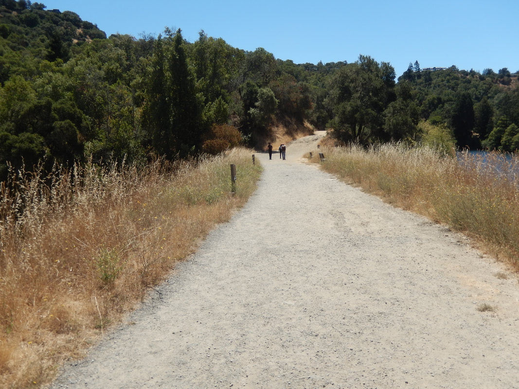
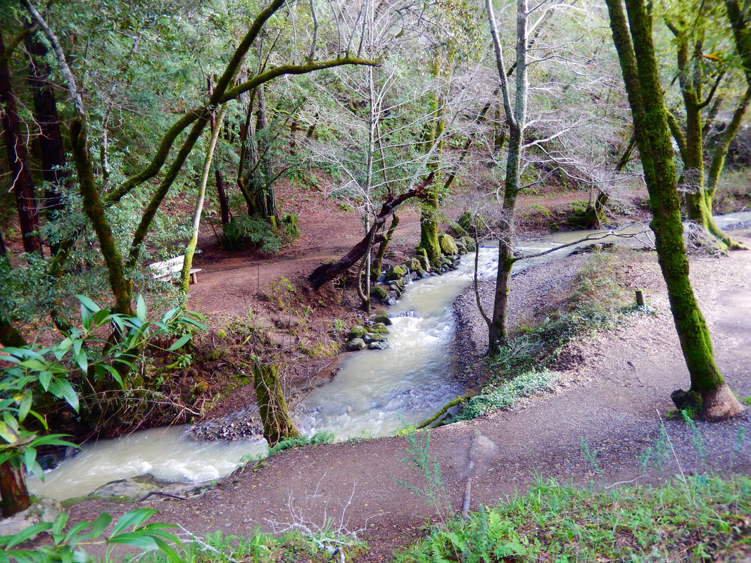
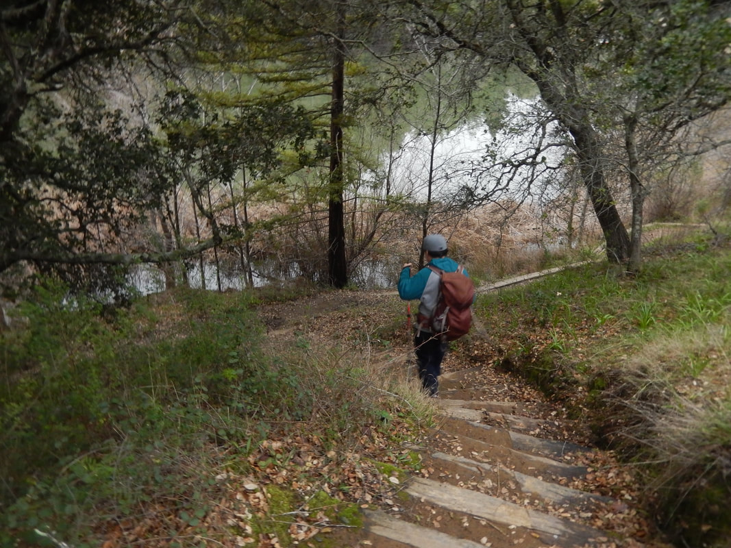
From the Natalie Coffin Greene Park parking area to Phoenix Lake is 0.2 miles. There is a little creek area with a bench down low, a stairway rise along the water release structure up to the lake edge, and benches to sit and view the lake from if you just want to enjoy the drive and a short walk to have a quiet view of the lake.
Beyond that, hikers can make as long or short a hike as they wish from this point. Phoenix Lake is the starting point for many a trail, which can be combined in pretty much any series of segments and distances you wish. Look at the trail map link above, or check out any of the several good paper maps available, and you’ll see what a network of connecting trails there are in the area.
Considerations:
• For those planning to hike from Phoenix Lake, bring a paper map or multiple paper maps. Some trails get a little fuzzy in places. The maps don’t always match exactly, either. There are multiple map options for Mt. Tam and the Marin Watershed.
• Parking is limited at Natalie Coffin Greene Park. The lot is used by short term dog walkers as well as long term hiking visitors, so follow the polite protocol of waiting at the parking area entrance with engine off until someone leaves. As always, weekend and afternoon parking is typically harder. Go on a weekday if possible or go early.
• There are port-a-potties at the parking area.
• Pay attention to trail signs regarding plant and animal life, including any cautions regarding mountain lion sightings.
• Always watch for poison oak. A poison oak scrub like Technu is handy to have along.
• Check for ticks after any outing.
The trail:
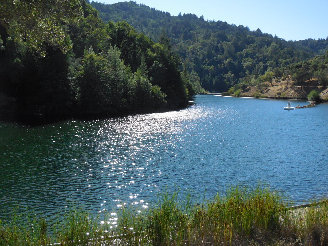
Phoenix Lake, accessed from Natalie Coffin Greene Park, makes for a pretty spot to just soak up some fresh air and pretty scenery, even if you’re not up for a big hike. There are shady areas in the lower area of the park, and things are more open and brighter after climbing up to the edge of the lake. It’s beautifully moody on an overcast winter day, and sparkles in bright summer sun.
There are places to sit and take in a view from below or above. If not taking any of the countless trail combination hikes that can start from Phoenix Lake, it’s possible to just walk along the perimeter and enjoy the changing view. There are several stairways along the perimeter trail that lead down to the water’s edge, making for scenic stopping spots closer to the water.
An outing doesn’t always have to be a big, long hike. A drive, some time to view a pretty scene and perhaps contemplate a future hike is sometimes just the thing! Phoenix Lake is great as a destination in and of itself, as well as a launching spot for many different hikes.
(Phoenix Lake Hike Notes were originally paired with the “A Quiet Place” Insights post.)
Click Insights/Hike Update News for inspiring reflections. Browse hikes on the main Hikes page or on the Hike Search by Area page. Check out selected articles and interviews under Media. Click World Walks to see or share favorite family-friendly walks! Stay in touch with Lisa Louis and HikingAutism via Contact. See products with inspiring designs that support the efforts of HikingAutism under Support/Shop. The Links page lists a loose collection of helpful information links.
Check the Home page for the broader background story. If you’re not able to take one of these Northern California hikes, hopefully you can enjoy the photo galleries at the bottom of each hike page! Feel free to share and follow on Facebook at HikingAutism, follow on Twitter at @HikingAutism and Instagram at lisalouis777
(scroll to bottom for photo gallery)
Location:Phoenix Lake in the Marin Watershed
Starting Point:Park in the parking area at Natalie Coffin Greene Park, Ross, CA, in the Marin Watershed. From Sir Francis Drake Blvd. in Ross, turn down Lagunitas Road across from the Marin Art & Garden Center, and follow Lagunitas Road (name changes to Dibblee Road at the end on Google Maps) to its end in Natalie Coffin Greene Park.
Info/Links:
For all web links, if a link doesn’t jump directly, copy and paste into browser.
Mt. Tam Watershed information (Marin Water):
https://www.marinwater.org/mt-tam-watershed
Mt. Tam project and road status info (CA State Parks):
https://www.parks.ca.gov/?page_id=471
Mt. Tam Watershed map (Marin Water):
https://www.marinwater.org/sites/default/files/2020-09/Watershed%20Visitor%20Map.pdf
Under Google Maps, key names to input include: Natalie Coffin Greene Park, Phoenix Lake
Distance:
From the Natalie Coffin Greene Park parking area to Phoenix Lake is 0.2 miles. There is a little creek area with a bench down low, a stairway rise along the water release structure up to the lake edge, and benches to sit and view the lake from if you just want to enjoy the drive and a short walk to have a quiet view of the lake.
Beyond that, hikers can make as long or short a hike as they wish from this point. Phoenix Lake is the starting point for many a trail, which can be combined in pretty much any series of segments and distances you wish. Look at the trail map link above, or check out any of the several good paper maps available, and you’ll see what a network of connecting trails there are in the area.
Considerations:
• For those planning to hike from Phoenix Lake, bring a paper map or multiple paper maps. Some trails get a little fuzzy in places. The maps don’t always match exactly, either. There are multiple map options for Mt. Tam and the Marin Watershed.
• Parking is limited at Natalie Coffin Greene Park. The lot is used by short term dog walkers as well as long term hiking visitors, so follow the polite protocol of waiting at the parking area entrance with engine off until someone leaves. As always, weekend and afternoon parking is typically harder. Go on a weekday if possible or go early.
• There are port-a-potties at the parking area.
• Pay attention to trail signs regarding plant and animal life, including any cautions regarding mountain lion sightings.
• Always watch for poison oak. A poison oak scrub like Technu is handy to have along.
• Check for ticks after any outing.
The trail:
Phoenix Lake, accessed from Natalie Coffin Greene Park, makes for a pretty spot to just soak up some fresh air and pretty scenery, even if you’re not up for a big hike. There are shady areas in the lower area of the park, and things are more open and brighter after climbing up to the edge of the lake. It’s beautifully moody on an overcast winter day, and sparkles in bright summer sun.
There are places to sit and take in a view from below or above. If not taking any of the countless trail combination hikes that can start from Phoenix Lake, it’s possible to just walk along the perimeter and enjoy the changing view. There are several stairways along the perimeter trail that lead down to the water’s edge, making for scenic stopping spots closer to the water.
An outing doesn’t always have to be a big, long hike. A drive, some time to view a pretty scene and perhaps contemplate a future hike is sometimes just the thing! Phoenix Lake is great as a destination in and of itself, as well as a launching spot for many different hikes.
(Phoenix Lake Hike Notes were originally paired with the “A Quiet Place” Insights post.)
Click Insights/Hike Update News for inspiring reflections. Browse hikes on the main Hikes page or on the Hike Search by Area page. Check out selected articles and interviews under Media. Click World Walks to see or share favorite family-friendly walks! Stay in touch with Lisa Louis and HikingAutism via Contact. See products with inspiring designs that support the efforts of HikingAutism under Support/Shop. The Links page lists a loose collection of helpful information links.
Check the Home page for the broader background story. If you’re not able to take one of these Northern California hikes, hopefully you can enjoy the photo galleries at the bottom of each hike page! Feel free to share and follow on Facebook at HikingAutism, follow on Twitter at @HikingAutism and Instagram at lisalouis777