Fort Funston Upper Trails
(scroll to bottom for photo gallery)
(Much of the information in this post overlaps with a previous related post, Fort Funston Beach Walk.)
Fort Funston, Fort Funston Road, San Francisco, CA 94132
Location: Fort Funston is at the far southwest corner of San Francisco, a short distance south of the San Francisco Zoo, just past the junction of Great Highway and Skyline Blvd. Turn up the hill from Skyline Blvd. onto Fort Funston Road (right when southbound, left when northbound). If traveling south and you pass the Olympic Club sign on your left, you’ve gone too far.
Fort Funston information:
http://www.parksconservancy.org/visit/park-sites/fort-funston.html
Fort Funston Disability Accessibility information:
The hang gliding viewing deck is wheelchair-accessible. Some of the upper trail areas are smooth enough to be accessible by wheelchair; trails and stairs to the beach are not.
Maps with trails (Fort Funston, each map has its pros and cons, try these or search online for your preferred map, select and paste links if they don’t jump automatically):
https://www.google.com/maps/place/Fort+Funston/@37.7135653,-122.502336,17.55z/data=!4m5!3m4!1s0x0:0x2c5b494bcda94ecc!8m2!3d37.7195436!4d-122.5028052
Distance: You can make a Fort Funston visit as short (just check out the hang gliding viewing deck), or as long (wander around the upper trails and/or make your way down to the beach) as you want. This Fort Funston Upper Trails post covers the trails on the top of the bluff, rather than the lower beach walk noted in Fort Funston Beach Walk. Other sites describe this as about a 2.2 mile out and back hike, but you can wander along various sections of the upper trails, including the Sunset Trail, the Horse Trail, the Chip Trail, Battery Davis Road, and Funston Beach Trail, to add up to a longer walk.
Considerations:
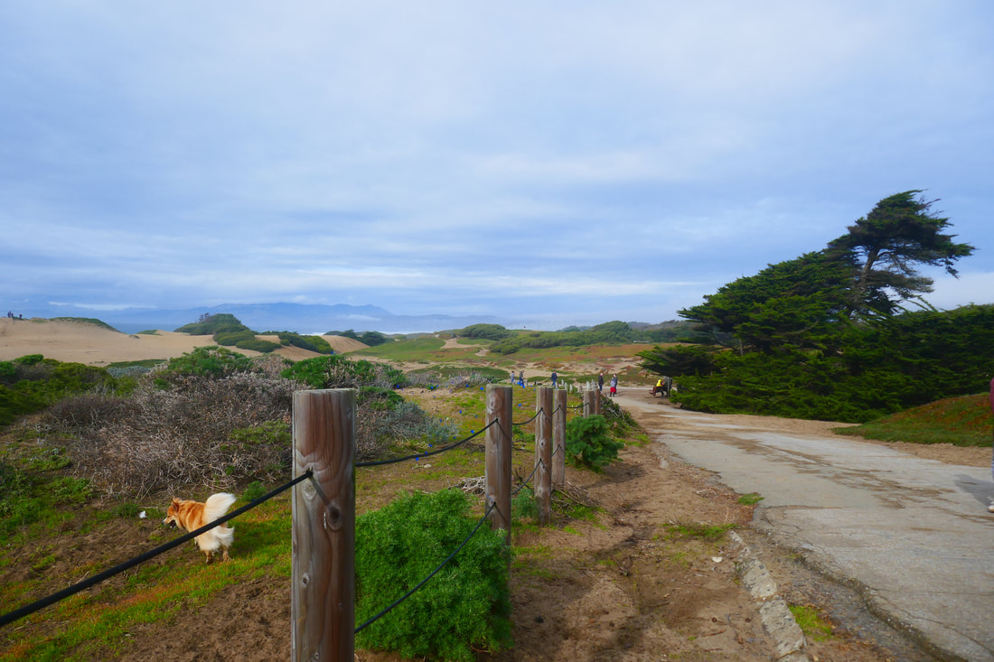
• Dogs are officially allowed off leash here. We have a family member who is very skittish around dogs, but he manages to enjoy walks here despite the numerous dogs.
• Portable toilets are available at the parking area.
• Fort Funston can be very windy.
• The road and pathways are quite weatherworn, with crumbling asphalt in some areas and old paths buried deep under the dunes in others. Heed warnings about dangerous cliffs. Serious injury and death due to crumbling cliffs are part of Fort Funston’s history.
• If going down to the beach: The stairs down to the beach are beautiful but steep. If you choose to return to the parking lot by the same steps, it is a fairly strenuous climb.
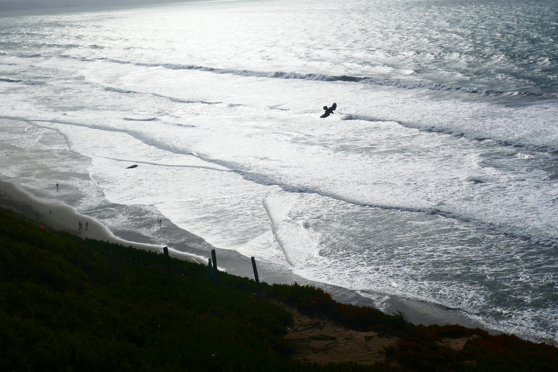
• When at the beach: Do not turn your back on the ocean. Sneaker waves and rip tide warnings apply to all beaches.
The trail:
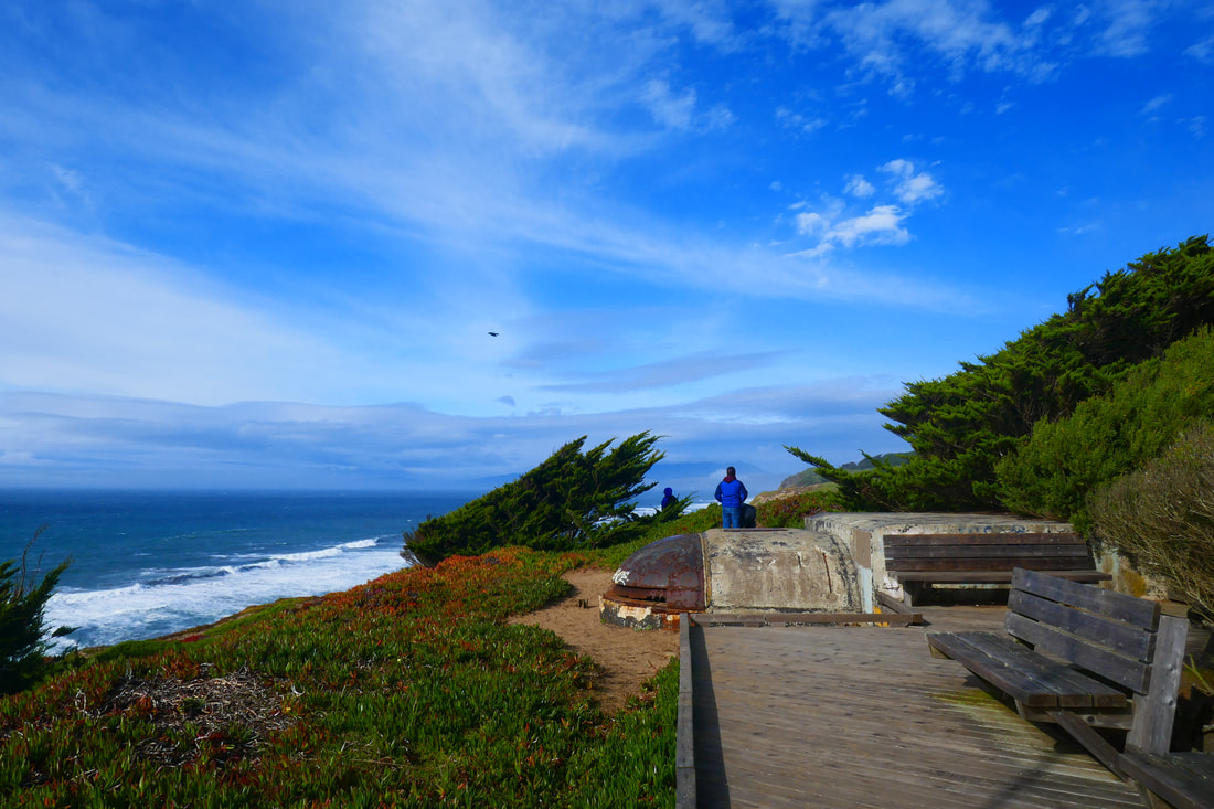
The parking area is large. Facing straight toward the ocean from the parking lot is the short walkway to the hang gliding viewing deck, a great spot for a wide view of the coast, whether hang gliders are flying or not. There is a glorious view facing south that offers dramatic cliff and ocean scenery.
For this Fort Funston Upper Trails post, facing the ocean, turn to the right and find the trail that leads over an old battery structure facing north toward the Marin Headlands, with Mount Tam looming up behind. You can also walk back to the parking area along the wooden deck path and take the Sunset Trail facing north from there.
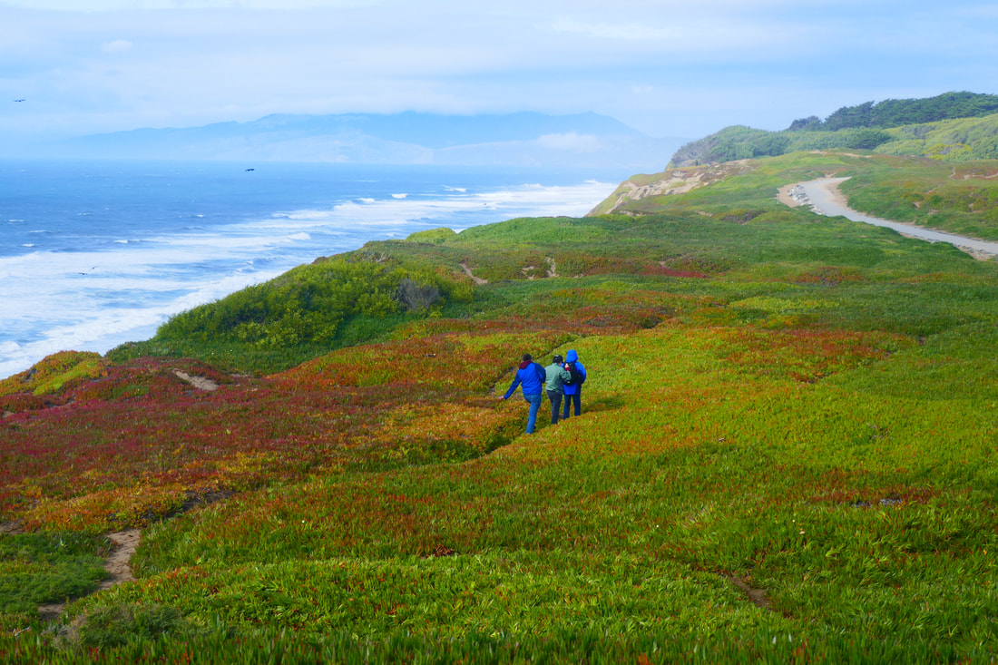
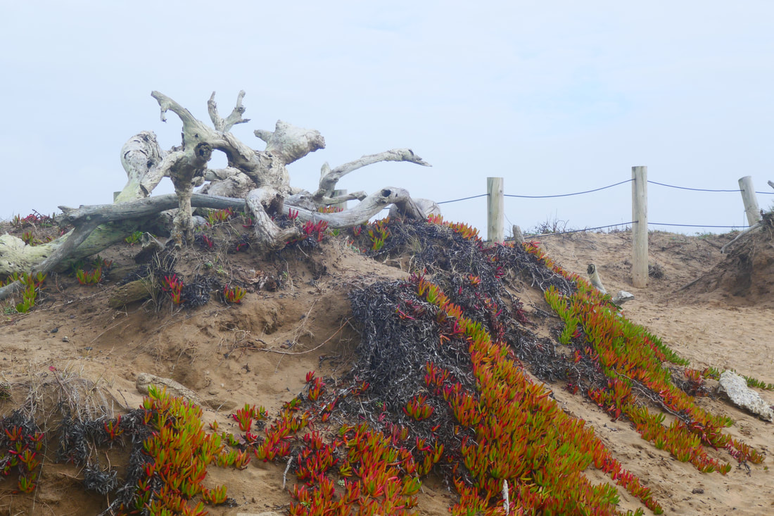
There are unofficial sandy trails through the ice plants that provide much of the sand level plant life in this area. The low plant cover offers an interesting combination of reds and greens. Keep an eye out for wildflowers in spring.
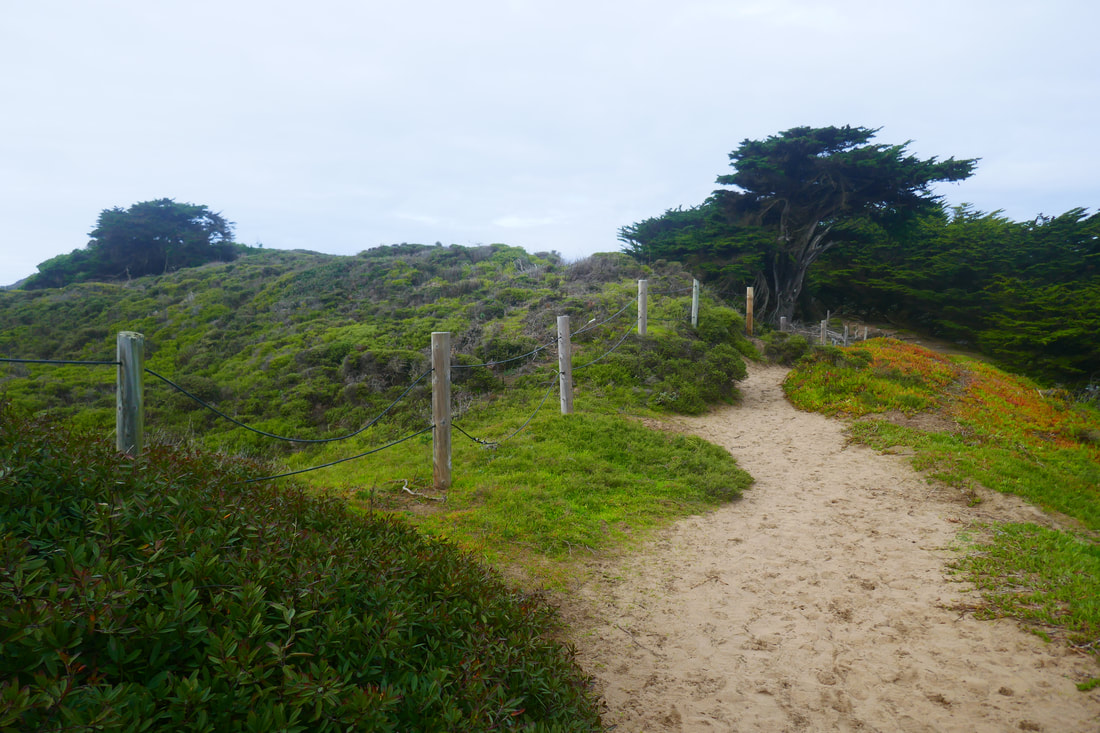
This is a very popular area for dog walking, so to stay on main trails such as the Sunset Trail that runs closest to the ocean, follow the more populated pathways.
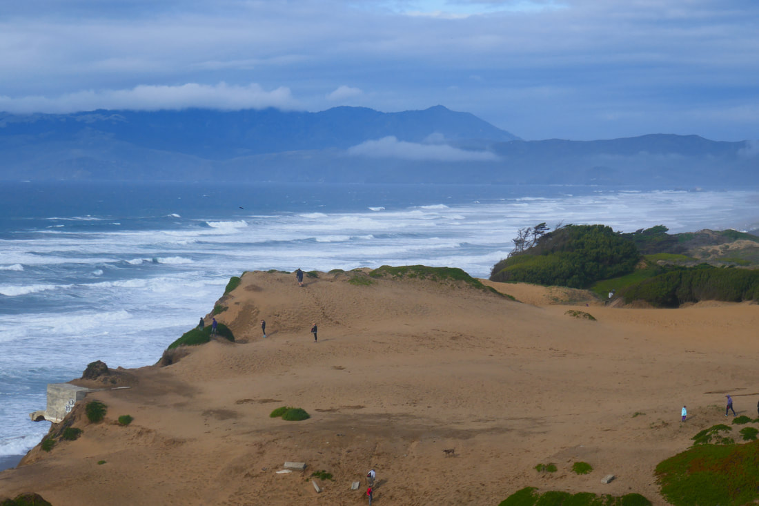
When doing the upper trails rather than the beach at Fort Funston, we often take the Sunset Trail north, enjoying gorgeous views of Marin, walk past historic military structure Battery Davis past the Funston Beach Trail to the beach, and continue toward the end of the Sunset Trail where old pathways are now buried deep in sand.
At the northern end of Fort Funston is a sandy, rocky incline that leads up to an old concrete structure that looks like a UFO. We used to sit on that for snack time but it looks dangerously unstable now.
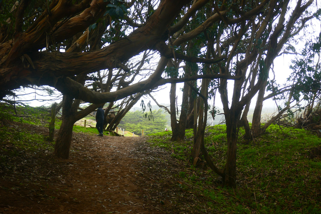
We make a right turn at the north end of the Sunset Trail, where there are trees bordering the trail. At this point the trail becomes the Horse Trail, which leads back through some tree tunnel areas and parallels Skyline Boulevard with a view of Lake Merced.
Once out of the tree tunnel section of trail, walkers can patch together a return to the parking lot via the Horse Trail, Battery Davis Road, and/or the Chip Trail. Head south and you will eventually return to the parking area.
(Fort Funston Upper Trail Hike Notes were originally paired with the “Your Own Shangri-La” Insights post.)
Click Insights/Hike Update News for inspiring reflections. Browse hikes on the main Hikes page or on the Hike Search by Area page. Check out selected articles and interviews under Media. Click World Walks to see or share favorite family-friendly walks! Stay in touch with Lisa Louis and HikingAutism via Contact. See products with inspiring designs that support the efforts of HikingAutism under Support/Shop. The Links page lists a loose collection of helpful information links.
Check the Home page for the broader background story. If you’re not able to take one of these Northern California hikes, hopefully you can enjoy the photo galleries at the bottom of each hike page! Feel free to share and follow on Facebook at HikingAutism, follow on Twitter at @HikingAutism and Instagram at lisalouis777
(scroll to bottom for photo gallery)
(Much of the information in this post overlaps with a previous related post, Fort Funston Beach Walk.)
Fort Funston, Fort Funston Road, San Francisco, CA 94132
Location: Fort Funston is at the far southwest corner of San Francisco, a short distance south of the San Francisco Zoo, just past the junction of Great Highway and Skyline Blvd. Turn up the hill from Skyline Blvd. onto Fort Funston Road (right when southbound, left when northbound). If traveling south and you pass the Olympic Club sign on your left, you’ve gone too far.
Fort Funston information:
http://www.parksconservancy.org/visit/park-sites/fort-funston.html
Fort Funston Disability Accessibility information:
The hang gliding viewing deck is wheelchair-accessible. Some of the upper trail areas are smooth enough to be accessible by wheelchair; trails and stairs to the beach are not.
Maps with trails (Fort Funston, each map has its pros and cons, try these or search online for your preferred map, select and paste links if they don’t jump automatically):
https://www.google.com/maps/place/Fort+Funston/@37.7135653,-122.502336,17.55z/data=!4m5!3m4!1s0x0:0x2c5b494bcda94ecc!8m2!3d37.7195436!4d-122.5028052
Distance: You can make a Fort Funston visit as short (just check out the hang gliding viewing deck), or as long (wander around the upper trails and/or make your way down to the beach) as you want. This Fort Funston Upper Trails post covers the trails on the top of the bluff, rather than the lower beach walk noted in Fort Funston Beach Walk. Other sites describe this as about a 2.2 mile out and back hike, but you can wander along various sections of the upper trails, including the Sunset Trail, the Horse Trail, the Chip Trail, Battery Davis Road, and Funston Beach Trail, to add up to a longer walk.
Considerations:
• Dogs are officially allowed off leash here. We have a family member who is very skittish around dogs, but he manages to enjoy walks here despite the numerous dogs.
• Portable toilets are available at the parking area.
• Fort Funston can be very windy.
• The road and pathways are quite weatherworn, with crumbling asphalt in some areas and old paths buried deep under the dunes in others. Heed warnings about dangerous cliffs. Serious injury and death due to crumbling cliffs are part of Fort Funston’s history.
• If going down to the beach: The stairs down to the beach are beautiful but steep. If you choose to return to the parking lot by the same steps, it is a fairly strenuous climb.
• When at the beach: Do not turn your back on the ocean. Sneaker waves and rip tide warnings apply to all beaches.
The trail:
The parking area is large. Facing straight toward the ocean from the parking lot is the short walkway to the hang gliding viewing deck, a great spot for a wide view of the coast, whether hang gliders are flying or not. There is a glorious view facing south that offers dramatic cliff and ocean scenery.
For this Fort Funston Upper Trails post, facing the ocean, turn to the right and find the trail that leads over an old battery structure facing north toward the Marin Headlands, with Mount Tam looming up behind. You can also walk back to the parking area along the wooden deck path and take the Sunset Trail facing north from there.
There are unofficial sandy trails through the ice plants that provide much of the sand level plant life in this area. The low plant cover offers an interesting combination of reds and greens. Keep an eye out for wildflowers in spring.
This is a very popular area for dog walking, so to stay on main trails such as the Sunset Trail that runs closest to the ocean, follow the more populated pathways.
When doing the upper trails rather than the beach at Fort Funston, we often take the Sunset Trail north, enjoying gorgeous views of Marin, walk past historic military structure Battery Davis past the Funston Beach Trail to the beach, and continue toward the end of the Sunset Trail where old pathways are now buried deep in sand.
At the northern end of Fort Funston is a sandy, rocky incline that leads up to an old concrete structure that looks like a UFO. We used to sit on that for snack time but it looks dangerously unstable now.
We make a right turn at the north end of the Sunset Trail, where there are trees bordering the trail. At this point the trail becomes the Horse Trail, which leads back through some tree tunnel areas and parallels Skyline Boulevard with a view of Lake Merced.
Once out of the tree tunnel section of trail, walkers can patch together a return to the parking lot via the Horse Trail, Battery Davis Road, and/or the Chip Trail. Head south and you will eventually return to the parking area.
(Fort Funston Upper Trail Hike Notes were originally paired with the “Your Own Shangri-La” Insights post.)
Click Insights/Hike Update News for inspiring reflections. Browse hikes on the main Hikes page or on the Hike Search by Area page. Check out selected articles and interviews under Media. Click World Walks to see or share favorite family-friendly walks! Stay in touch with Lisa Louis and HikingAutism via Contact. See products with inspiring designs that support the efforts of HikingAutism under Support/Shop. The Links page lists a loose collection of helpful information links.
Check the Home page for the broader background story. If you’re not able to take one of these Northern California hikes, hopefully you can enjoy the photo galleries at the bottom of each hike page! Feel free to share and follow on Facebook at HikingAutism, follow on Twitter at @HikingAutism and Instagram at lisalouis777