Battery Wallace-Marin Headlands View Path
(scroll to bottom for photo gallery)
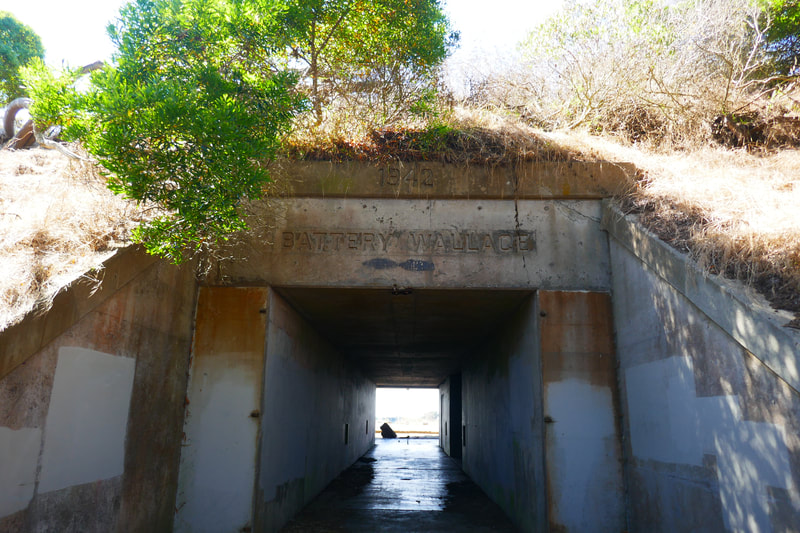
Battery Wallace #2 and trail from parking area across Conzelman Road, Marin Headlands, Mill Valley, CA
Location: Battery Wallace #2 is on Conzelman Road just south of Battery Wallace and the Bicentennial Camp Picnic Area. If you see signs for Old Conzelman Road or Field Road, you’ve passed the parking pull-off.
For all web links, if a link doesn’t jump directly, copy and paste into browser. (Information links may change. We do our best to update.)
Battery Wallace information link (National Park Service):
https://www.nps.gov/places/000/battery-wallace.htm
Marin Headlands information link (National Park Service):
https://www.nps.gov/goga/marin-headlands.htm
Marin Headlands map link (National Park Service):
(Scroll to the lower left map section for the area specifically including Battery Wallace)
https://www.nps.gov/goga/planyourvisit/upload/map_mahe_150429_508_2021.pdf
Distance:
Walking around Battery Wallace #2, crossing the street to the parking pull off area, and then walking down the unmarked trail to where the bluff narrows into a triangle, ending the trail, might be a quarter mile one way, for an easy half mile in and out. There are miles and miles of trails in the Marin Headlands to hike, including with this as a starting point, but the area covered in this description and gallery is a short distance. See Hike Search by Area for many other Marin Headlands hikes to try.
Considerations:
General note: All information is subject to change based on current health and safety guidelines.
• The parking pull off across from Battery Wallace #2 is small, but there is more parking available by the Bicentennial Camp Picnic Area and then down the hill along Field Road.
• There are vault toilets at the Bicentennial Camp Picnic Area and also down the hill at the Point Bonita Lighthouse Parking Area.
• Follow health, safety signs, and wildlife information signs.
• This trail extends along a bluff with steep cliffs. Use caution when walking any cliffside areas.
• Having a poison oak scrub like Technu is handy for any trail. This narrow trail had poison oak along the edges in some stretches.
• As with any Bay Area outing, bring layers. You may be hot in the sun one moment and shivering under fog and a chilly breeze the next.
The trail:
Battery Wallace #2 is one of several historic military structures dotting the Golden Gate National Recreation Area. We had stopped a short distance north of Battery Wallace #2 to explore the Bicentennial Camp and picnic area, and used the vault toilets there. We moved from the roadside parking there to a small parking pull-off diagonally across the road from Battery Wallace #2.
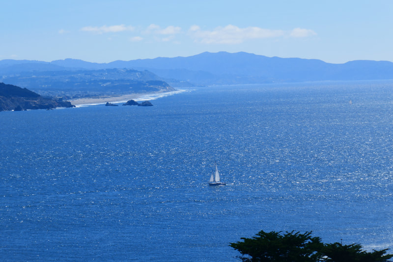
It’s always visually dramatic to walk into a battery entranceway and pass through the tunnel space. You reach the other side of the tunnel usually to have amazing views open before you. Battery Wallace #2 gave us glorious views across the water to San Francisco. We could see a sailboat in the foreground and the stretch of Ocean Beach from our own neighborhood, with Seal Rocks in view as well.
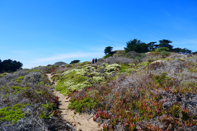
We went back through the battery and over to the small, unmarked parking pull-out area. It took a minute to find the start of the unnamed path I found in online maps. Standing in the rectangular parking area, the path starts from the upper right corner facing the water away from the road.
We noticed poison oak leaves clinging to the inner edges of the narrow path right away. It was easy to spot because it was a seasonal red, but might be harder to notice when in its early green stage.
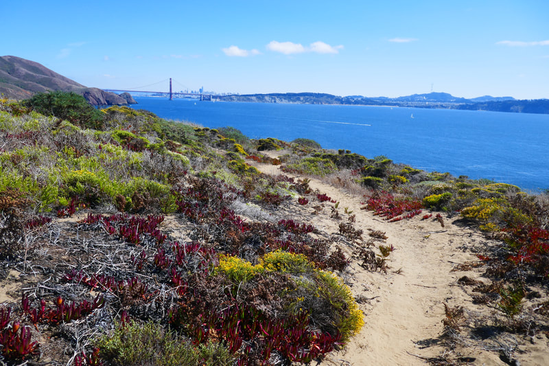
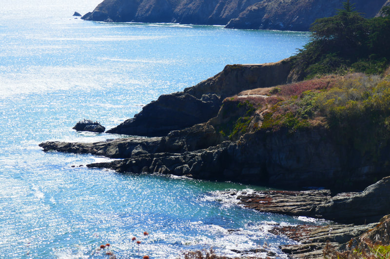
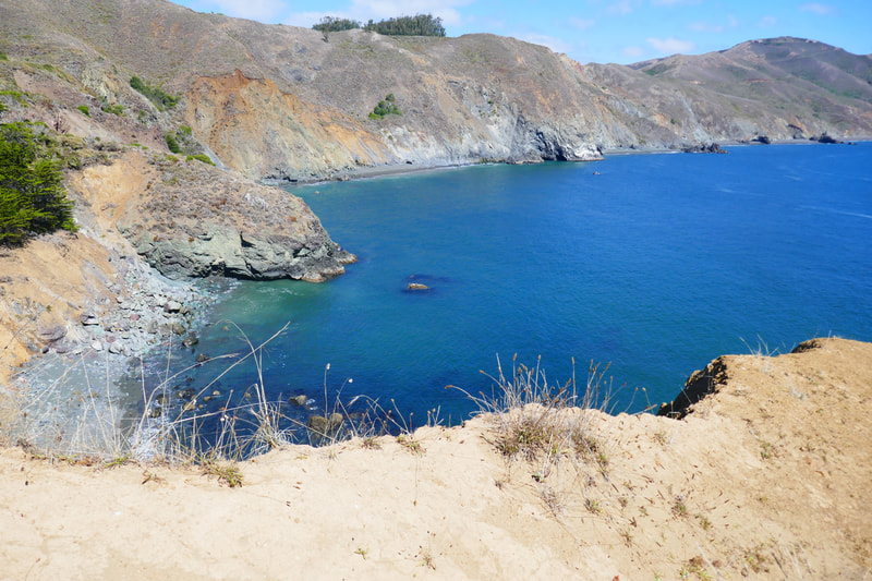
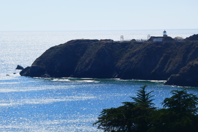
We made our way past an initial clump of trees, pleasantly surprised to see a little bench nestled under the trees facing the water. This bluff juts out offering amazing views. From the left, we saw steep cliffs leading to what is called Jessen’s Beach on the map (though I didn’t see any way to access it down the steep cliffs), then the Golden Gate Bridge, San Francisco, the Golden Gate, and Point Bonita Lighthouse.
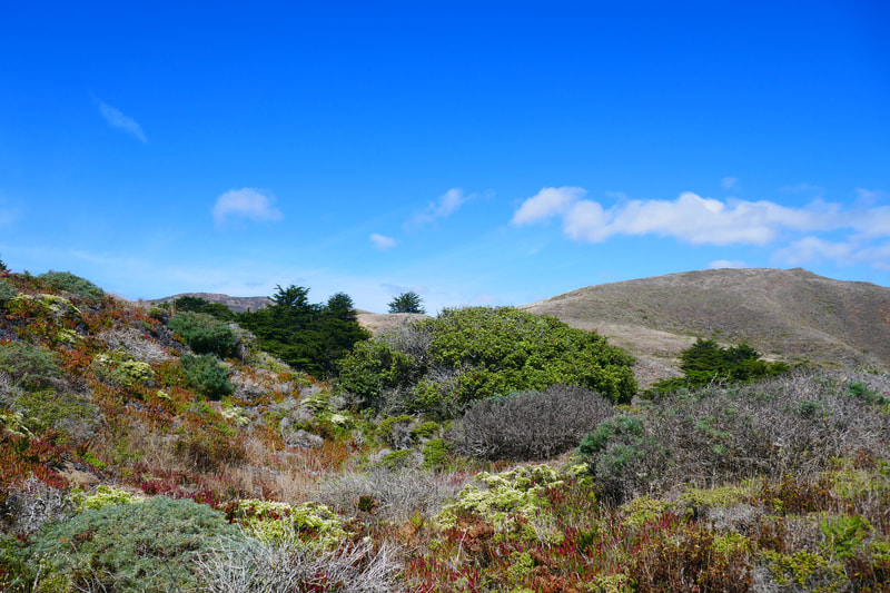
We were fortunate to have amazing visibility which came right after a bad patch of wildfire smoke. The path was sandy, and wound through coyote brush and other low scrub, which gave a nice textured view with yellow and white flowers. Red popped into the palette from ice plants as well as poison oak.
We stepped over a lot of coyote scat, but typically you wouldn’t meet a coyote on the open trail during the day. They clearly hang out here, though.
The trail narrowed to a triangular junction where I was pretty sure the cliff edge started and the trail ended. My “spidey sense” of gravity pulling downward told me I’d hit the end of the trail and should not peek further over the edge. My husband kept our son at a good distance back from the trail end because he tends to move in sudden bursts, which is not safe along cliffs. Same caution for small children, pets, or anyone who may not feel stable on their feet.
Repeating myself: the views here are absolutely stunning. We could see the green serpentinite stone native to the area down along the beach and cliffs to the left. The Golden Gate Bridge and San Francisco were in clear view across sparkling waters with sailboats in the foreground. Large ships came in from behind Point Bonita Lighthouse to the right, and made their way to pass under the Golden Gate Bridge.
This was a very short walk with a very high scenery value. The path does incline downward on the way out, and requires a moderate uphill climb to return, but it’s probably less than a quarter mile each way.
This was an unexpected treat and will make a great bonus stop for us when we’re in the Marin Headlands and want a short walk to catch amazing scenery. Enjoy while using caution with poison oak and cliff edges!
Those who like the hiking in this area might also check out these other Marin Headlands hikes noted under Hike Search by Area.
(Battery Wallace-Marin Headlands View Walk Hike Notes were originally paired with the “Unexpected Paths” Insights post.)
If you’d like to support HikingAutism, check out the new Support/Shop page!
Click Insights/Hike Update News for inspiring reflections. Browse hikes on the main Hikes page or on the Hike Search by Area page. Check out selected articles and interviews under Media. Click World Walks to see or share favorite family-friendly walks! Stay in touch with Lisa Louis and HikingAutism via Contact. See products with inspiring designs that support the efforts of HikingAutism under Support/Shop. The Links page lists a loose collection of helpful information links.
Check the Home page for the broader background story. If you’re not able to take one of these Northern California hikes, hopefully you can enjoy the photo galleries at the bottom of each hike page! Feel free to share and follow on Facebook at HikingAutism, follow on Twitter at @HikingAutism and Instagram at lisalouis777
