Point Lobos State Natural Reserve
(scroll to bottom for photo gallery)
Location:Point Lobos State Natural Reserve, Route 1, Box 62, Carmel, CA 93923
Starting Point: Point Lobos State Natural Reserve is about 4 miles south of Carmel-by-the-Sea on Route 1.
Info links:
For all web links, if a link doesn’t jump directly, copy and paste into browser.
Point Lobos State Natural Reserve info links (California State Parks):
http://www.parks.ca.gov/?page_id=571
Point Lobos State Natural Reserve info links (Point Lobos Foundation):
https://www.pointlobos.org
https://www.pointlobos.org/plan-your-visit
Point Lobos State Natural Reserve trail map:
https://www.pointlobos.org/plan-your-visit/maps
Distance:
There is a very good Point Lobos brochure/map with wildlife information, trail descriptions, and a trail map with distances clearly marked that you can obtain for a small fee on site. There is a mishmash of connecting trails, and you can make your visit as long or short a walk as you’d like. As noted in the brochure map: The perimeter hike is 6 miles, Granite Point to Whalers Cabin loop is 1.1 miles, and every other trail walk/loop is noted as 1 mile or less.
Considerations:
• This is a popular diving/snorkeling spot with both a reservation and walkup system for the Point Lobos State Marine Reserve (https://www.parks.ca.gov/?page_id=27221). Popularity can mean lines and parking issues. As with most places, earlier is better. Check info links above for current operating hours.
• The Point Lobos Foundation (https://www.pointlobos.org) offers not only information and support for the reserve, but also many guided walks (https://www.pointlobos.org/plan-your-visit/guided-tours).
• Bathroom facilities are available near the parking area.
• No dogs, no bikes on trails, no collecting, no smoking or fires, no camping, no drones.
The trail:
As noted under the Distance section above, you could walk, rest, walk again, and lather-rinse-repeat to spend a good part of a day covering the many trails here. You can also have a very satisfying short visit if time is limited.
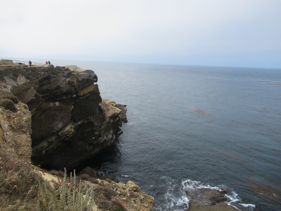
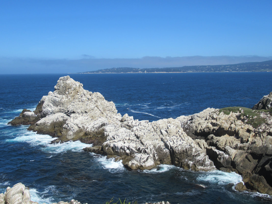
For our visit, we walked from the parking lot along the Sea Lion Point Trail for the view of Sea Lion Rocks, and returned to the parking area via the Sand Hill Trail.
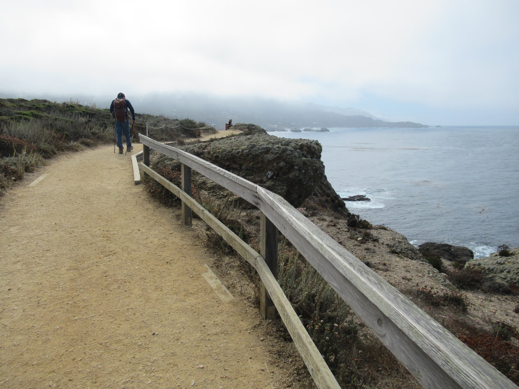
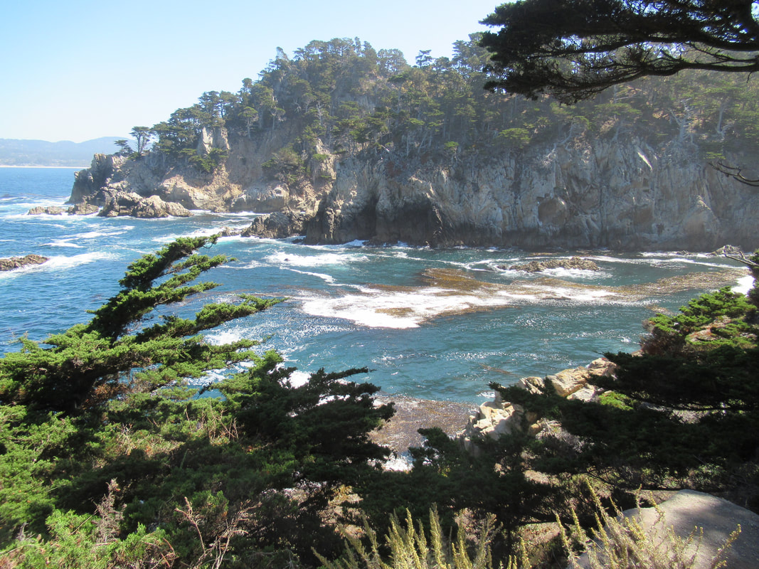
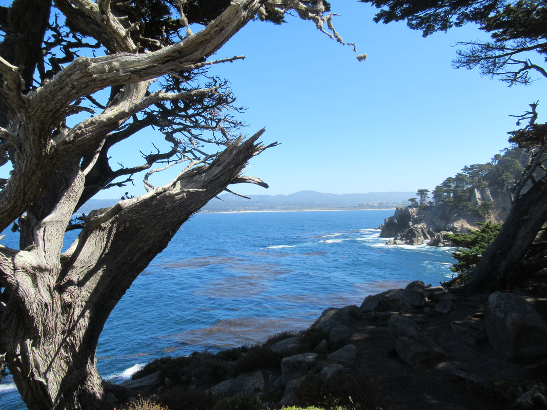
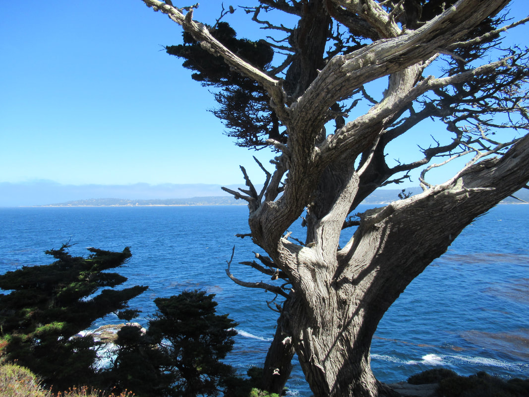
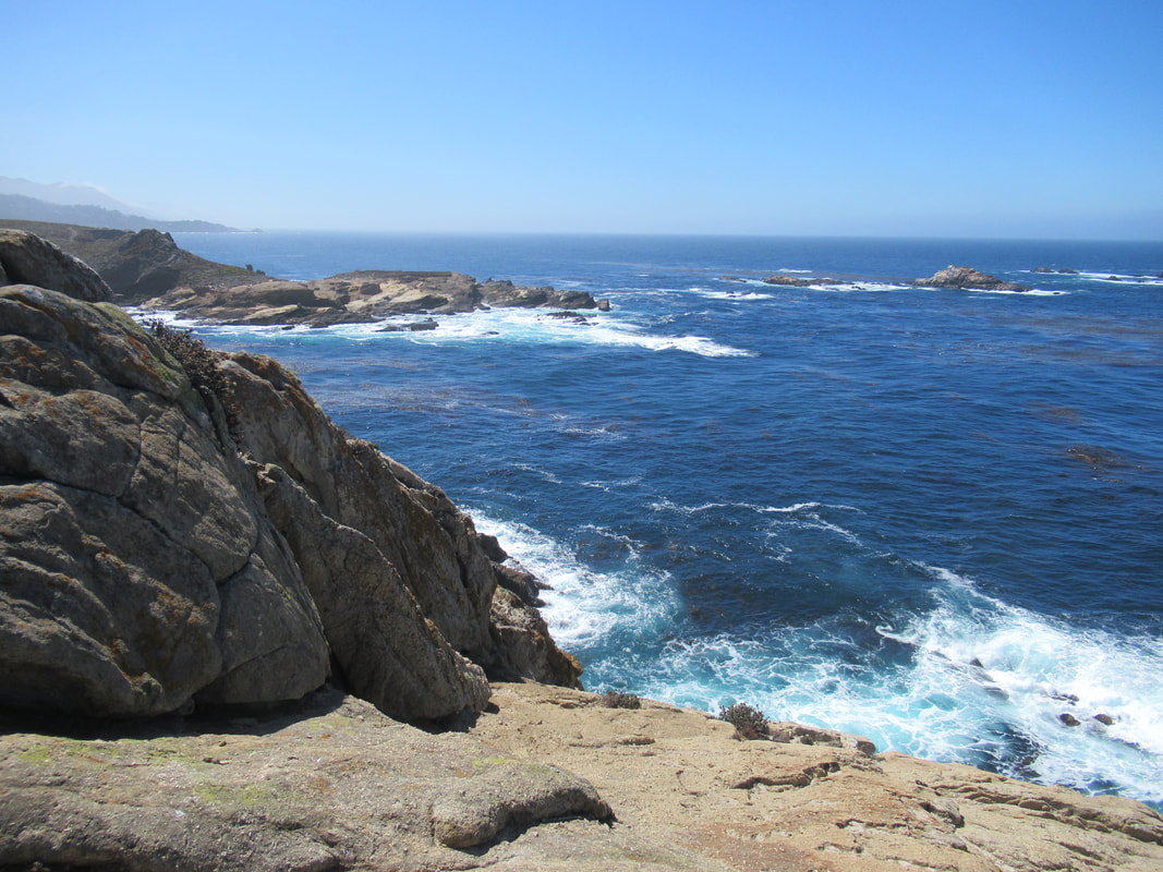
We then walked north on the North Shore Trail, took the left fork on the Old Veteran Trail to a scenic overlook, and then made our way back to the parking lot starting point again. Our last loop was the Cypress Grove Trail that loops out to North Point and the Pinnacle.
This reserve is famous for wildlife as well as plants and geology. We saw harbor seals, sea lions, numerous varieties of birds, and the ever popular sea otters during our brief visit.
There is no such thing as a bad view at Point Lobos. Every turn of the head brings another postcard-perfect view.
We had a limited amount of time, so did not visit the Whalers Cabin and Whaling Station Museum, but will try those on our next visit. Next visit we will also explore the southern section of the reserve, which opens options for longer stretches of trail with a shore view.
For us, this was the tail end of a Big Sur visit, so it felt like a quick stop on our way back north. It makes for a good extension of a visit to Monterey or Carmel, and is only about 9 miles from the Monterey Bay Aquarium, and 4 miles from Carmel-by-the-Sea.
Check ahead on information links for open hours and seasonal restrictions. Blue skies or misty, Point Lobos State Natural Reserve offers visual wonders at every turn.
(Point Lobos State Natural Reserve Hike Notes originally paired with “The "Thank You" We forget” Insights post.)
Click Insights/Hike Update News for inspiring reflections. Browse hikes on the main Hikes page or on the Hike Search by Area page. Check out selected articles and interviews under Media. Click World Walks to see or share favorite family-friendly walks! Stay in touch with Lisa Louis and HikingAutism via Contact. See products with inspiring designs that support the efforts of HikingAutism under Support/Shop. The Links page lists a loose collection of helpful information links.
Check the Home page for the broader background story. If you’re not able to take one of these Northern California hikes, hopefully you can enjoy the photo galleries at the bottom of each hike page! Feel free to share and follow on Facebook at HikingAutism, follow on Twitter at @HikingAutism and Instagram at lisalouis777
(scroll to bottom for photo gallery)
Location:Point Lobos State Natural Reserve, Route 1, Box 62, Carmel, CA 93923
Starting Point: Point Lobos State Natural Reserve is about 4 miles south of Carmel-by-the-Sea on Route 1.
Info links:
For all web links, if a link doesn’t jump directly, copy and paste into browser.
Point Lobos State Natural Reserve info links (California State Parks):
http://www.parks.ca.gov/?page_id=571
Point Lobos State Natural Reserve info links (Point Lobos Foundation):
https://www.pointlobos.org
https://www.pointlobos.org/plan-your-visit
Point Lobos State Natural Reserve trail map:
https://www.pointlobos.org/plan-your-visit/maps
Distance:
There is a very good Point Lobos brochure/map with wildlife information, trail descriptions, and a trail map with distances clearly marked that you can obtain for a small fee on site. There is a mishmash of connecting trails, and you can make your visit as long or short a walk as you’d like. As noted in the brochure map: The perimeter hike is 6 miles, Granite Point to Whalers Cabin loop is 1.1 miles, and every other trail walk/loop is noted as 1 mile or less.
Considerations:
• This is a popular diving/snorkeling spot with both a reservation and walkup system for the Point Lobos State Marine Reserve (https://www.parks.ca.gov/?page_id=27221). Popularity can mean lines and parking issues. As with most places, earlier is better. Check info links above for current operating hours.
• The Point Lobos Foundation (https://www.pointlobos.org) offers not only information and support for the reserve, but also many guided walks (https://www.pointlobos.org/plan-your-visit/guided-tours).
• Bathroom facilities are available near the parking area.
• No dogs, no bikes on trails, no collecting, no smoking or fires, no camping, no drones.
The trail:
As noted under the Distance section above, you could walk, rest, walk again, and lather-rinse-repeat to spend a good part of a day covering the many trails here. You can also have a very satisfying short visit if time is limited.
For our visit, we walked from the parking lot along the Sea Lion Point Trail for the view of Sea Lion Rocks, and returned to the parking area via the Sand Hill Trail.
We then walked north on the North Shore Trail, took the left fork on the Old Veteran Trail to a scenic overlook, and then made our way back to the parking lot starting point again. Our last loop was the Cypress Grove Trail that loops out to North Point and the Pinnacle.
This reserve is famous for wildlife as well as plants and geology. We saw harbor seals, sea lions, numerous varieties of birds, and the ever popular sea otters during our brief visit.
There is no such thing as a bad view at Point Lobos. Every turn of the head brings another postcard-perfect view.
We had a limited amount of time, so did not visit the Whalers Cabin and Whaling Station Museum, but will try those on our next visit. Next visit we will also explore the southern section of the reserve, which opens options for longer stretches of trail with a shore view.
For us, this was the tail end of a Big Sur visit, so it felt like a quick stop on our way back north. It makes for a good extension of a visit to Monterey or Carmel, and is only about 9 miles from the Monterey Bay Aquarium, and 4 miles from Carmel-by-the-Sea.
Check ahead on information links for open hours and seasonal restrictions. Blue skies or misty, Point Lobos State Natural Reserve offers visual wonders at every turn.
(Point Lobos State Natural Reserve Hike Notes originally paired with “The "Thank You" We forget” Insights post.)
Click Insights/Hike Update News for inspiring reflections. Browse hikes on the main Hikes page or on the Hike Search by Area page. Check out selected articles and interviews under Media. Click World Walks to see or share favorite family-friendly walks! Stay in touch with Lisa Louis and HikingAutism via Contact. See products with inspiring designs that support the efforts of HikingAutism under Support/Shop. The Links page lists a loose collection of helpful information links.
Check the Home page for the broader background story. If you’re not able to take one of these Northern California hikes, hopefully you can enjoy the photo galleries at the bottom of each hike page! Feel free to share and follow on Facebook at HikingAutism, follow on Twitter at @HikingAutism and Instagram at lisalouis777