Loma Alta – Smith Ridge
(scroll to bottom for photo gallery)
Location: Loma Alta Open Space Preserve
Directions: From US 101 in Marin, take the exit for Sir Francis Drake/San Anselmo. On Sir Francis Drake as you are driving toward the end of Fairfax, turn right on Glen Drive and park near the Open Space Preserve Gate.
Starting Point: The suggested starting point for hiking at Loma Alta from the southeast is to park on Glen Drive, as noted in the directions above. This starts you on Glen Fire Road to connect to Smith Ridge Fire Road. Other options are to hike Oak Manor Fire Road from near Oak Manor Dr./Manor View Drive, or to start from Dutch Valley Lane in Sleepy Hollow and cut through the short pathway that connects to Smith Ridge Fire Road. Official parking is not as easy to obtain for those spots.
Info links:
Loma Alta Open Space Preserve info link:
https://www.marincountyparks.org/depts/pk/divisions/open-space/loma-alta
Loma Alta Open Space Preserve trail map:
https://www.marincountyparks.org/~/media/684a56dd0769475b94065f38c11f7af2.ashx
(Feel free to do an online search for other trail maps, credited under their respective web sites. Hikingautism.com provides links to maps and info credited to the main organization in charge of a given hiking location.)
Distance:
The Smith Ridge Fire Road segment is noted as 1.3 miles between its junction with Sunrise Fire Road at the top, and junction with Oak Manor Fire Road and Glen Fire Road at the bottom. To get to a higher elevation on the Bay Area Ridge Trail, you have to walk another half mile or so.
Considerations:
• Toilet facilities not available (at least not during our visit).
• Dogs and horses allowed.
• Mountain biking allowed.
• Much of this trail is very open with little tree cover. Sunblock and a hat are important on hot days.
• Bring water.
• Bring a map.
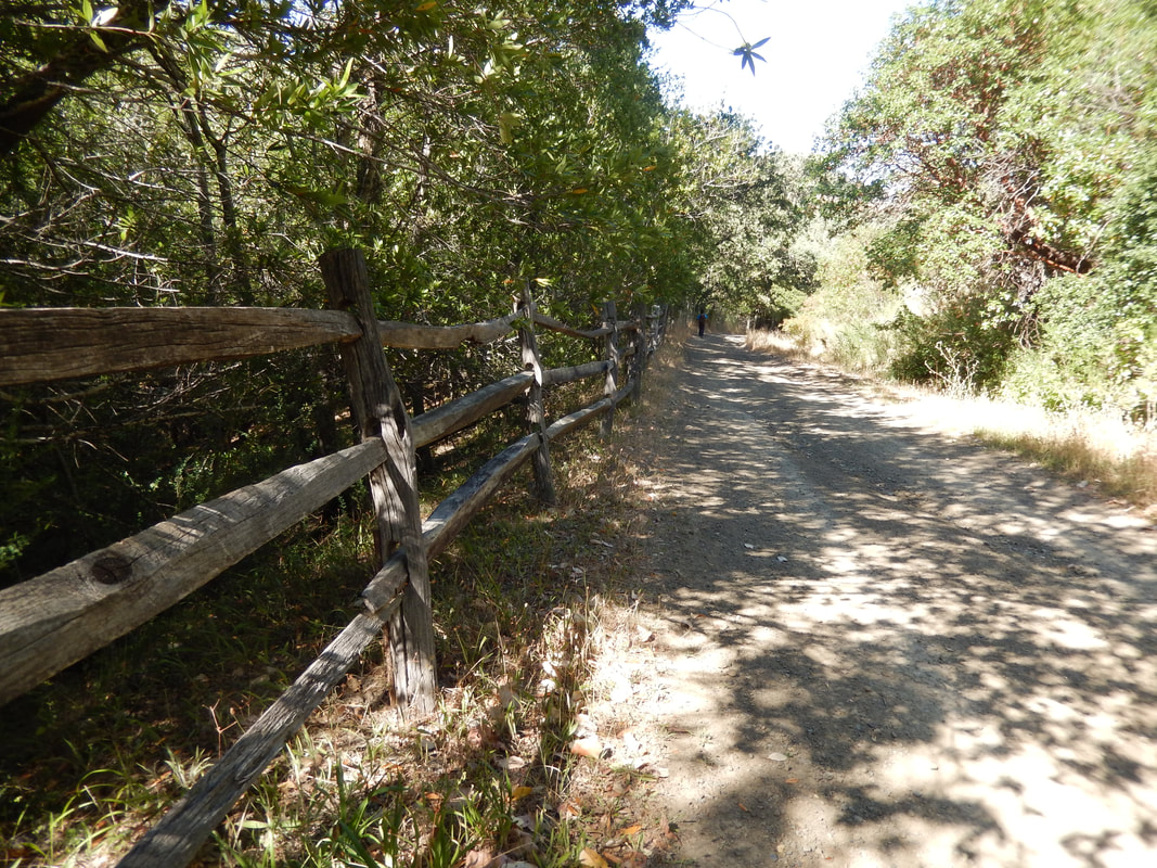
• Parking: Marin does a great job of keeping nature spaces open, but hikers need to figure out public versus private property and parking rules when accessing trails. I am listing only the Glen Drive trailhead parking because it is the official trailhead. (The wooden fence photo in the gallery here is from a different entry point.)
The trail:
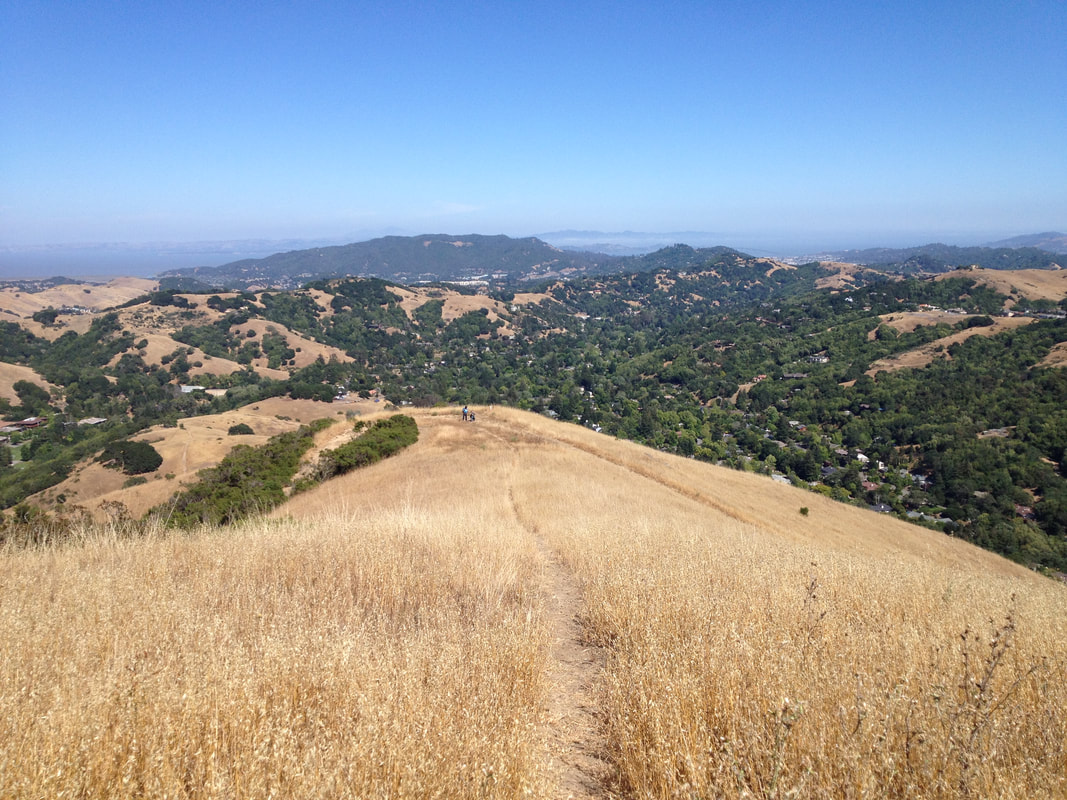
The hallmark of Loma Vista Open Space Preserve is the grand view from the top, reached by climbing Smith Ridge Fire Road. (A steeper hike from the west side, using Sunrise Fire Road, will be covered in a future post.)
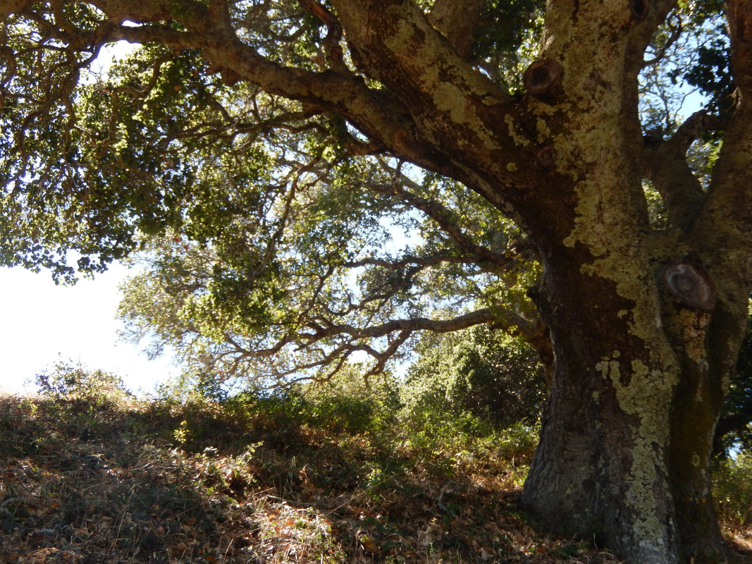
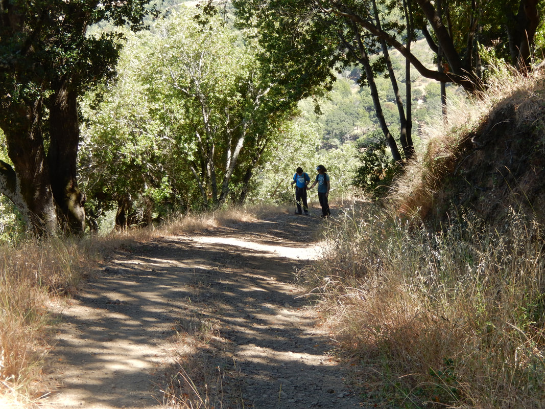
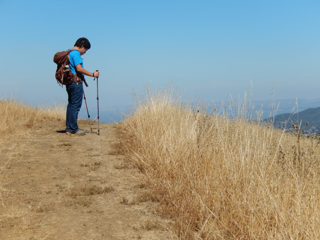
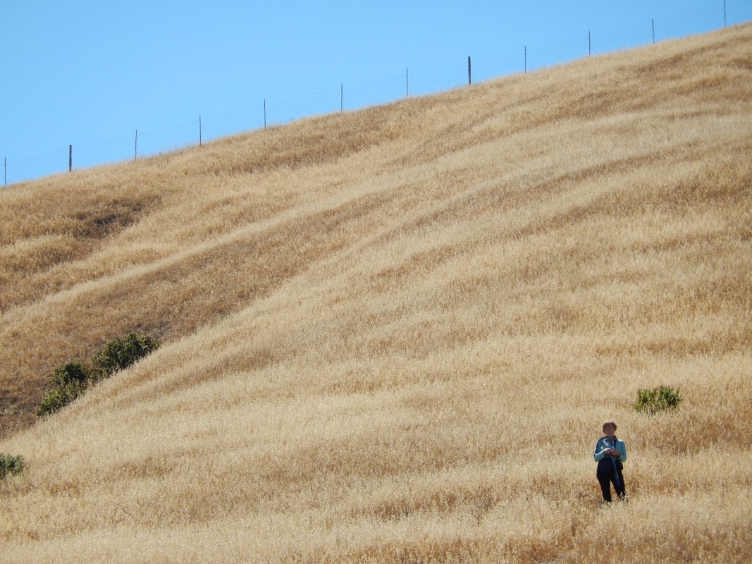
Mileage notations for this area seem to vary, but from the Glen Fire Road trailhead, up along Smith Ridge Fire Road, and then to the 1592 foot altitude noted as the peak after connecting to the Bay Area Ridge Trail adds up to around 2 miles. It can feel longer when climbing up on a hot day from the Oak Manor and Glen Fire Road junction with Smith Ridge Fire Road near the water tanks. This is a pretty steady climb along a twisting trail with only scattered tree cover. The oak trees are lovely, and the cooling shade they provide is more than welcome on a hot day.
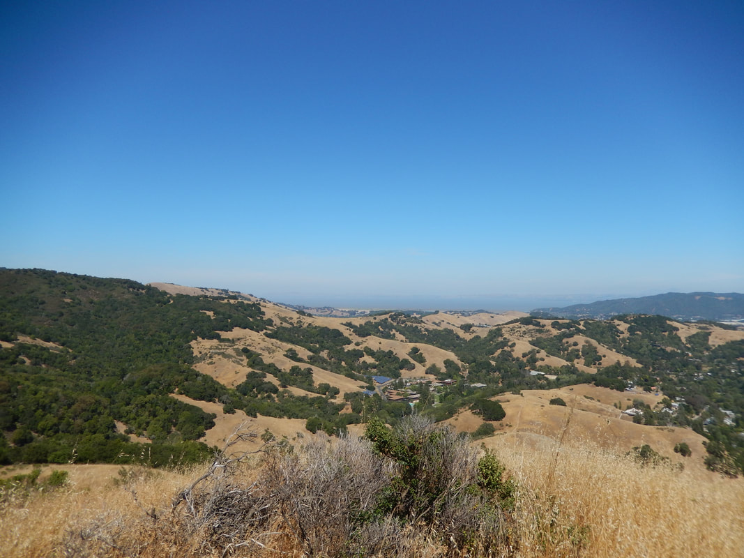
Climb, rest in the shade, and climb again to reach the high viewing area. In clear weather, the views are amazing. Depending on the visibility level and the direction you’re looking, it is possible to see San Francisco and a flash of the Pacific. An extensive part of Marin is visible. On a clear day, you might also see Mt. Diablo and other East Bay landmarks.
Any hike can be as atmospheric and beautiful on a foggy day as on a clear day.
Green hills after the rains are also a comforting sight in light of our frequent droughts.
Having said that, the most striking aspect of Loma Alta when we visited was the stark contrast between the bleached wheat-like grass and the vibrant blue sky. It is a visual stunner during the dry season.
(Loma Alta - Smith Ridge Hike Notes were originally paired with the “The View” Insights post.)
Click Insights/Hike Update News for inspiring reflections. Browse hikes on the main Hikes page or on the Hike Search by Area page. Check out selected articles and interviews under Media. Click World Walks to see or share favorite family-friendly walks! Stay in touch with Lisa Louis and HikingAutism via Contact. See products with inspiring designs that support the efforts of HikingAutism under Support/Shop. The Links page lists a loose collection of helpful information links.
Check the Home page for the broader background story. If you’re not able to take one of these Northern California hikes, hopefully you can enjoy the photo galleries at the bottom of each hike page! Feel free to share and follow on Facebook at HikingAutism, follow on Twitter at @HikingAutism and Instagram at lisalouis777
(scroll to bottom for photo gallery)
Location: Loma Alta Open Space Preserve
Directions: From US 101 in Marin, take the exit for Sir Francis Drake/San Anselmo. On Sir Francis Drake as you are driving toward the end of Fairfax, turn right on Glen Drive and park near the Open Space Preserve Gate.
Starting Point: The suggested starting point for hiking at Loma Alta from the southeast is to park on Glen Drive, as noted in the directions above. This starts you on Glen Fire Road to connect to Smith Ridge Fire Road. Other options are to hike Oak Manor Fire Road from near Oak Manor Dr./Manor View Drive, or to start from Dutch Valley Lane in Sleepy Hollow and cut through the short pathway that connects to Smith Ridge Fire Road. Official parking is not as easy to obtain for those spots.
Info links:
Loma Alta Open Space Preserve info link:
https://www.marincountyparks.org/depts/pk/divisions/open-space/loma-alta
Loma Alta Open Space Preserve trail map:
https://www.marincountyparks.org/~/media/684a56dd0769475b94065f38c11f7af2.ashx
(Feel free to do an online search for other trail maps, credited under their respective web sites. Hikingautism.com provides links to maps and info credited to the main organization in charge of a given hiking location.)
Distance:
The Smith Ridge Fire Road segment is noted as 1.3 miles between its junction with Sunrise Fire Road at the top, and junction with Oak Manor Fire Road and Glen Fire Road at the bottom. To get to a higher elevation on the Bay Area Ridge Trail, you have to walk another half mile or so.
Considerations:
• Toilet facilities not available (at least not during our visit).
• Dogs and horses allowed.
• Mountain biking allowed.
• Much of this trail is very open with little tree cover. Sunblock and a hat are important on hot days.
• Bring water.
• Bring a map.
• Parking: Marin does a great job of keeping nature spaces open, but hikers need to figure out public versus private property and parking rules when accessing trails. I am listing only the Glen Drive trailhead parking because it is the official trailhead. (The wooden fence photo in the gallery here is from a different entry point.)
The trail:
The hallmark of Loma Vista Open Space Preserve is the grand view from the top, reached by climbing Smith Ridge Fire Road. (A steeper hike from the west side, using Sunrise Fire Road, will be covered in a future post.)
Mileage notations for this area seem to vary, but from the Glen Fire Road trailhead, up along Smith Ridge Fire Road, and then to the 1592 foot altitude noted as the peak after connecting to the Bay Area Ridge Trail adds up to around 2 miles. It can feel longer when climbing up on a hot day from the Oak Manor and Glen Fire Road junction with Smith Ridge Fire Road near the water tanks. This is a pretty steady climb along a twisting trail with only scattered tree cover. The oak trees are lovely, and the cooling shade they provide is more than welcome on a hot day.
Climb, rest in the shade, and climb again to reach the high viewing area. In clear weather, the views are amazing. Depending on the visibility level and the direction you’re looking, it is possible to see San Francisco and a flash of the Pacific. An extensive part of Marin is visible. On a clear day, you might also see Mt. Diablo and other East Bay landmarks.
Any hike can be as atmospheric and beautiful on a foggy day as on a clear day.
Green hills after the rains are also a comforting sight in light of our frequent droughts.
Having said that, the most striking aspect of Loma Alta when we visited was the stark contrast between the bleached wheat-like grass and the vibrant blue sky. It is a visual stunner during the dry season.
(Loma Alta - Smith Ridge Hike Notes were originally paired with the “The View” Insights post.)
Click Insights/Hike Update News for inspiring reflections. Browse hikes on the main Hikes page or on the Hike Search by Area page. Check out selected articles and interviews under Media. Click World Walks to see or share favorite family-friendly walks! Stay in touch with Lisa Louis and HikingAutism via Contact. See products with inspiring designs that support the efforts of HikingAutism under Support/Shop. The Links page lists a loose collection of helpful information links.
Check the Home page for the broader background story. If you’re not able to take one of these Northern California hikes, hopefully you can enjoy the photo galleries at the bottom of each hike page! Feel free to share and follow on Facebook at HikingAutism, follow on Twitter at @HikingAutism and Instagram at lisalouis777